IMAGE INDEX
Currently listed: 1,136
Last updated: 04 November 2025

| Preview | Description | Date | Gallery | Source | Copyright | Added | Ref. |
|---|---|---|---|---|---|---|---|
 | Cardiff Royal Infirmary | 1890s | Adamsdown | Auction | Unknown | 2005 | ADA001 |
 | Clifton Street Police Station and Fire Crew | 1910s | Adamsdown | Unknown | Unknown | 2005 | ADA002 |
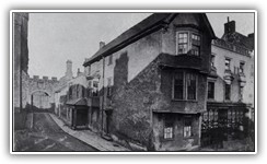
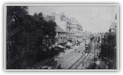
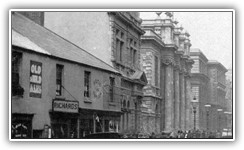
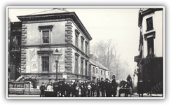
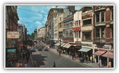
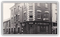
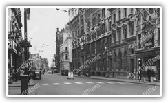
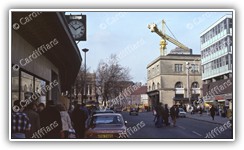
 | Broadway | 1912 | Adamsdown | Unknown | Unknown | 2005 | ADA003 |
 | Adamsdown Labour Party members leaving Moira Terrace on their annual outing | 1920s | Adamsdown | Unknown | Unknown | 2005 | ADA004 |
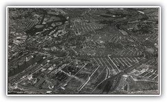
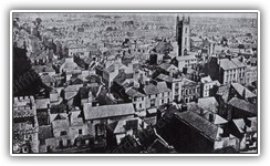
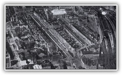
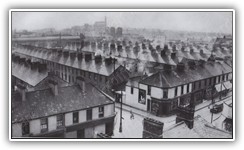
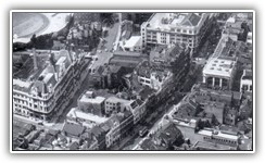
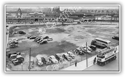
 | Aerial view of Adamsdown, Plasnewydd, the CRI, Newport Road, Glossop Road and City Road | 1940s | Adamsdown | Unknown | Unknown | 2005 | ADA005 |
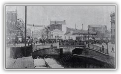
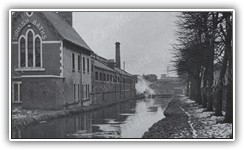
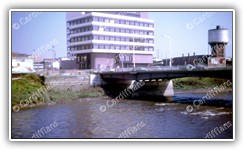
 | View of the Black Bridge from the Railway (looking East) | 1954 | Adamsdown | Unknown | Unknown | 2005 | ADA006 |
 | Black Bridge | 1975 | Adamsdown | Unknown | Unknown | 2005 | ADA007 |
 | Cardiff Central Fire Station - Adam Street (Original building - Control Room) - Demolished 2011 | 1977 | Adamsdown | Unknown | Unknown | 2005 | ADA008 |
 | Cardiff Central Fire Station - Adam Street (Original building - Front View) - Demolished 2011 | 1977 | Adamsdown | Unknown | Unknown | 2005 | ADA009 |
 | Adamsdown Primary School, and the original entrance to Moon Street, which was demolished sometime in the 1950s (off Metal Street) | 2005 | Adamsdown | N/A | M Witty | 2005 | ADA010 |
 | Adamsdown Square, looking down Moira Place | 2005 | Adamsdown | N/A | M Witty | 2005 | ADA011 |
 | Black Bridge, looking towards Adamsdown Square | 2005 | Adamsdown | N/A | M Witty | 2005 | ADA012 |
 | Black Bridge, looking towards Sanquahar Street | 2005 | Adamsdown | N/A | M Witty | 2005 | ADA013 |
 | Clifton Street Police Station and Fire Crew | 2005 | Adamsdown | N/A | M Witty | 2005 | ADA014 |
 | La Gondola Cafe, Clifton Street (Closed in April 2006 after the very popular owner, Tony Leo, passed away) | 2005 | Adamsdown | N/A | M Witty | 2005 | ADA015 |
 | Roath Police Station, Clifton Street | 2005 | Adamsdown | N/A | M Witty | 2005 | ADA016 |
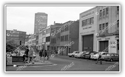
 | SB Motor Factors, Moira Terrace | 1982 | Adamsdown | South Glamorgan County Libraries | Unknown | 2006 | ADA017 |
 | Adamsdown Square | 2005 | Adamsdown | N/A | M Witty | 2006 | ADA018 |
 | Adamsdown Square (Looking towards the Black Bridge) | 2005 | Adamsdown | N/A | M Witty | 2006 | ADA019 |
 | Davies Street, view of the City Centre from the rear of Cardiff Central Fire Station | 2005 | Adamsdown | N/A | M Witty | 2006 | ADA020 |
 | Easterly view of the Great Western Railway from the Black Bridge (before gantries) | 2005 | Adamsdown | N/A | M Witty | 2006 | ADA021 |
 | Sun Street | 2005 | Adamsdown | N/A | M Witty | 2006 | ADA022 |
 | Westerly view of the Great Western Railway from the Black Bridge (before gantries) | 2005 | Adamsdown | N/A | M Witty | 2007 | ADA023 |
 | Lloyd Williams Workwear Shop, Moira Terrace | 1982 | Adamsdown | South Glamorgan County Libraries | Unknown | 2008 | ADA024 |
 | Moira Place and Meteor Street Junction | 1930s | Adamsdown | Unknown | Unknown | 2009 | ADA025 |
 | Great Eastern Hotel (formally Upper Splott Farm), on the junction of Metal Street and Sun Street. (Built 1596, demolished 2009) - Front View | 2009 | Adamsdown | Unknown | Unknown | 2009 | ADA026 |
 | Great Eastern Hotel (formally Upper Splott Farm), on the junction of Metal Street and Sun Street. (Built 1596, demolished 2009) - Side View | 2009 | Adamsdown | N/A | M Witty | 2009 | ADA027 |
 | Wood Yards on Sanquhar Street | 1970s | Adamsdown | Unknown | Unknown | 2010 | ADA028 |
 | Wood Yards on Sanquhar Street, alternate view | 1970s | Adamsdown | Unknown | Unknown | 2010 | ADA029 |
 | Wood Yards, view from Kilcatten Street | 1970s | Adamsdown | Unknown | Unknown | 2010 | ADA030 |
 | Tram on the junction of Planet and Meteor Streets | 1930s | Adamsdown | Unknown | Unknown | 2011 | ADA031 |
 | West Dock, junction of Herbert Street and Bute East Dock (now Lloyd George Avenue) | 1940s | Adamsdown | David Wilton (Ex-Landlord of the Vulcan Hotel) | M Witty | 2011 | ADA032 |
 | Kings Fireplaces (Former Adamsdown Church), Windsor Road | 2005 | Adamsdown | N/A | M Witty | 2015 | ADA033 |
 | Adamsdown, view from the Black Bridge | 2005 | Adamsdown | N/A | M Witty | 2015 | ADA034 |
 | Adamsdown Cemetery Park - Headstones (Anne Gwenllian (d.1868) and William Henry Milner (d.1874)) | 2006 | Adamsdown | N/A | M Witty | 2015 | ADA035 |
 | Adamsdown Cemetery Park - Headstones (Captain J. N. Bradhering - Drowned 1858) | 2006 | Adamsdown | N/A | M Witty | 2015 | ADA036 |
 | Adamsdown Cemetery Park - Headstones (Charles Hurry Riches of the Wharf in this Town (d.1868), also his seventh son, John Alfred Wyndham (d.1880)) | 2006 | Adamsdown | N/A | M Witty | 2015 | ADA037 |
 | Adamsdown Cemetery Park - Headstones (Eliza Bennett (d.1900) and Daniel Bennett (d.1900)) | 2006 | Adamsdown | N/A | M Witty | 2015 | ADA038 |
 | Adamsdown Cemetery Park - Headstones (Elizabeth Kernick - Died 1898) | 2006 | Adamsdown | N/A | M Witty | 2015 | ADA039 |
 | Adamsdown Cemetery Park - Headstones (Emma Smart - Died 1849) | 2006 | Adamsdown | N/A | M Witty | 2015 | ADA040 |
 | Adamsdown Cemetery Park - Headstones (Franklin Hunter Whitney formerly of Topsham Maine and late Commander of the ship Jennie W. Paine of Gardner - Died 1853) | 2006 | Adamsdown | N/A | M Witty | 2015 | ADA041 |
 | Adamsdown Cemetery Park - Headstones (Fredrick Bird (d.1868) and Jenney Bird (d.1870)) | 2006 | Adamsdown | N/A | M Witty | 2015 | ADA042 |
 | Adamsdown Cemetery Park - Headstones (George Clode - Died 1858) | 2006 | Adamsdown | N/A | M Witty | 2015 | ADA043 |
 | Adamsdown Cemetery Park - Headstones (George H Gould - (d.1859), Alfred T Gould (d.1863) Emma F Gould (d.1877) Eliza Gould (d.1881), Thomas Gould (d.1886) | 2006 | Adamsdown | N/A | M Witty | 2015 | ADA044 |
 | Adamsdown Cemetery Park - Headstones (George Johnson (d.1875), Mary Ann Pile (d.1894) and Emmanuel Pile (d.1913)) | 2006 | Adamsdown | N/A | M Witty | 2015 | ADA045 |
 | Adamsdown Cemetery Park - Headstones (George Morgan (d.1848) and Margaret Morgan (d.1860) - Jane Brabyn (d.1870) and Joseph Brabyn (d.1880)) | 2006 | Adamsdown | N/A | M Witty | 2015 | ADA046 |
 | Adamsdown Cemetery Park - Headstones (Henry Stanley - Died 1850) | 2006 | Adamsdown | N/A | M Witty | 2015 | ADA047 |
 | Adamsdown Cemetery Park - Headstones (James Edwards (d.1931), George Edwards (d.1874), Thomas George Edwards (d.1880)) | 2006 | Adamsdown | N/A | M Witty | 2015 | ADA048 |
 | Adamsdown Cemetery Park - Headstones (James John D Wakeham - Died 1857) | 2006 | Adamsdown | N/A | M Witty | 2015 | ADA049 |
 | Adamsdown Cemetery Park - Headstones (Jane Grant - Died 1861) | 2006 | Adamsdown | N/A | M Witty | 2015 | ADA050 |
 | Adamsdown Cemetery Park - Headstones (John Ferrier Williams and Caroline Mary Williams of Cardiff Savings Bank (Also three of his infant children) - Died 1868)) | 2006 | Adamsdown | N/A | M Witty | 2015 | ADA051 |
 | Adamsdown Cemetery Park - Headstones (John Parry and Mary Ann Parry - Emma Smart) | 2006 | Adamsdown | N/A | M Witty | 2015 | ADA052 |
 | Adamsdown Cemetery Park - Headstones (Joseph and Selina Fisher (d.1858), Kate Hunt (d.1858), Robert Thomas Fisher (1864)) | 2006 | Adamsdown | N/A | M Witty | 2015 | ADA053 |
 | Adamsdown Cemetery Park - Headstones (Louisa Dawson of Dewsbury Yorkshire (d.1952), Walter Dawson (d.1861), Ernest Arthur (d,1862)) | 2006 | Adamsdown | N/A | M Witty | 2015 | ADA054 |
 | Adamsdown Cemetery Park - Headstones (Mary Ann Humphries - Died 1869) | 2006 | Adamsdown | N/A | M Witty | 2015 | ADA055 |
 | Adamsdown Cemetery Park - Headstones (Mary Evans - Died 1873) | 2006 | Adamsdown | N/A | M Witty | 2015 | ADA056 |
 | Adamsdown Cemetery Park - Headstones (Misc 01) | 2006 | Adamsdown | N/A | M Witty | 2015 | ADA057 |
 | Adamsdown Cemetery Park - Headstones (Misc 02) | 2006 | Adamsdown | N/A | M Witty | 2015 | ADA058 |
 | Adamsdown Cemetery Park - Headstones (Misc 03) | 2006 | Adamsdown | N/A | M Witty | 2015 | ADA059 |
 | Adamsdown Cemetery Park - Headstones (Misc 04) | 2006 | Adamsdown | N/A | M Witty | 2015 | ADA060 |
 | Adamsdown Cemetery Park - Headstones (Misc 05) | 2006 | Adamsdown | N/A | M Witty | 2015 | ADA061 |
 | Adamsdown Cemetery Park - Headstones (Misc 06) | 2006 | Adamsdown | N/A | M Witty | 2015 | ADA062 |
 | Adamsdown Cemetery Park - Headstones (Misc 07) | 2006 | Adamsdown | N/A | M Witty | 2015 | ADA063 |
 | Adamsdown Cemetery Park - Headstones (Misc 08) | 2006 | Adamsdown | N/A | M Witty | 2015 | ADA064 |
 | Adamsdown Cemetery Park - Headstones (Misc 09) | 2006 | Adamsdown | N/A | M Witty | 2015 | ADA065 |
 | Adamsdown Cemetery Park - Headstones (Misc 10) | 2006 | Adamsdown | N/A | M Witty | 2015 | ADA066 |
 | Adamsdown Cemetery Park - Headstones (Misc 11) | 2006 | Adamsdown | N/A | M Witty | 2015 | ADA067 |
 | Adamsdown Cemetery Park - Headstones (Misc 12) | 2006 | Adamsdown | N/A | M Witty | 2015 | ADA068 |
 | Adamsdown Cemetery Park - Headstones (Misc 13) | 2006 | Adamsdown | N/A | M Witty | 2015 | ADA069 |
 | Adamsdown Cemetery Park - Headstones (Sarah Jane - Died 1852) | 2006 | Adamsdown | N/A | M Witty | 2015 | ADA070 |
 | Adamsdown Cemetery Park - Headstones (Thomas Jones Builder - Died 1860) | 2006 | Adamsdown | N/A | M Witty | 2015 | ADA071 |
 | Adamsdown Cemetery Park - Headstones (William Evans - Died 1874) | 2006 | Adamsdown | N/A | M Witty | 2015 | ADA072 |
 | Adamsdown Cemetery Park - Headstones (William Thompson of Exmouth - Master of the Schooner Jessy of Exeter - Drowned 1835) | 2006 | Adamsdown | N/A | M Witty | 2015 | ADA073 |
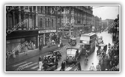
 | Broadway, and the popular musical instrument shop to the left | 2006 | Adamsdown | N/A | M Witty | 2015 | ADA074 |
 | Cardiff Central Fire Station - Davies Street (Original building - Rear View 01 of 02) - Demolished 2011 | 2006 | Adamsdown | N/A | M Witty | 2015 | ADA075 |
 | Cardiff Central Fire Station - Davies Street (Original building - Rear View 02 of 02) - Demolished 2011 | 2006 | Adamsdown | N/A | M Witty | 2015 | ADA076 |
 | The Vulcan Hotel, Adam Street (Dismantled 2012, rebuilt 2024 in St. Fagans) - Car Park | 2006 | Adamsdown | N/A | M Witty | 2015 | ADA077 |
 | The Vulcan Hotel, Adam Street (Dismantled 2012, rebuilt 2024 in St. Fagans) - Front windows | 2006 | Adamsdown | N/A | M Witty | 2015 | ADA078 |
 | The Vulcan Hotel, Adam Street (Dismantled 2012, rebuilt 2024 in St. Fagans) - Hanging Sign | 2006 | Adamsdown | N/A | M Witty | 2015 | ADA079 |
 | The Vulcan Hotel, Adam Street (Dismantled 2012, rebuilt 2024 in St. Fagans) - Side Wall | 2006 | Adamsdown | N/A | M Witty | 2015 | ADA080 |
 | Zion English Baptist Chapel, The Manse, Longcross Street (01) - Closed c1970 - Demolished 2007 | 2006 | Adamsdown | N/A | M Witty | 2015 | ADA081 |
 | Zion English Baptist Chapel, The Manse, Longcross Street (02) - Closed c1970 - Demolished 2007 | 2006 | Adamsdown | N/A | M Witty | 2015 | ADA082 |
 | Roath Youth Amateur Boxing and Athletic Club (Front View) - Demolished 2007 | 2007 | Adamsdown | N/A | M Witty | 2015 | ADA083 |
 | Roath Youth Amateur Boxing and Athletic Club (Rear View) - Demolished 2007 | 2007 | Adamsdown | N/A | M Witty | 2015 | ADA084 |
 | Removed section of Bute Viaduct over Junction Canal to Bute East Dock (Spillers and Bakers on the right) | 1970s | Adamsdown | Gordon W Fox (Donated by Bernard Fox (Son) and Family) | M Witty | 2024 | ADA085 |
 | Steam Engine Works on Tyndall Street, looking towards Bute Viaduct (Spillers and Bakers in background) | 1970s | Adamsdown | Gordon W Fox (Donated by Bernard Fox (Son) and Family) | M Witty | 2024 | ADA086 |
 | Cardiff Central Fire Station, View from Adam Street | 1973 | Adamsdown | Auction | M Witty | 2024 | ADA087 |
 | Casson Studio Theatre, Ruby Street 01 | 1972 | Adamsdown | Auction | M Witty | 2024 | ADA088 |
 | Casson Studio Theatre, Ruby Street 02 | 1972 | Adamsdown | Auction | M Witty | 2024 | ADA089 |
 | Bute Road Station (now Cardiff Bay) - Note the old Platform Two and industrial units where Lloyd George Avenue is now | 1990 | Cardiff Bay | Unknown | Unknown | 2005 | BAY001 |
 | Bute Dock Hotel, West Bute Street | 2005 | Cardiff Bay | N/A | M Witty | 2005 | BAY002 |
 | Disused Platform 2 at Cardiff Bay Train Station | 2005 | Cardiff Bay | N/A | M Witty | 2005 | BAY003 |
 | Bute Street, people queuing for trolleybuses | 1960s | Cardiff Bay | Unknown | Unknown | 2005 | BAY004 |
 | View of the city from Cardiff Bay Railway Station, and special visit from a diesel locomotive. | 2005 | Cardiff Bay | Unknown | Unknown | 2006 | BAY005 |
 | View Of The City Centre - Cardiff Bay Train Station | 2005 | Cardiff Bay | N/A | M Witty | 2006 | BAY006 |
 | Millennium Centre and Water Tower | 2005 | Cardiff Bay | N/A | M Witty | 2006 | BAY007 |
 | Old Taff Vale Railway Office, Bute Street (Refurbished 2019) | 2005 | Cardiff Bay | N/A | M Witty | 2006 | BAY008 |
 | Provision Curers Bonded Store Merchants - Entrance to West Bute Street | 2005 | Cardiff Bay | N/A | M Witty | 2006 | BAY009 |
 | Wide view from office in West Bute Street, with County Hall in background | 2005 | Cardiff Bay | N/A | M Witty | 2006 | BAY010 |
 | Wide view of the City Centre, from offices in Mount Stuart Square | 2005 | Cardiff Bay | N/A | M Witty | 2006 | BAY011 |
 | Hamadryad Hospital Ship, Cardiff Docks | 1890s | Cardiff Bay | Unknown | Unknown | 2006 | BAY012 |
 | Entrance to the Oval Basin (Bute East Dock) | 1910s | Cardiff Bay | Unknown | Unknown | 2006 | BAY013 |
 | C.H. Bailey Ship Repairers - Cardiff Docks | 1960 | Cardiff Bay | Jim Stubbs | M Witty | 2007 | BAY014 |
 | Cardiff Docks | 1960 | Cardiff Bay | Jim Stubbs | M Witty | 2007 | BAY015 |
 | Tugboat 'Lowgarth' bringing in the 'Weirbank' (a cargo ship) to Cardiff Docks | 1974 | Cardiff Bay | Gareth W. Evans | M Witty | 2007 | BAY016 |
 | Norwegian Church | 1990s | Cardiff Bay | Unknown | M Witty | 2009 | BAY017 |
 | Logos Hope - Christian Operation Mobilisation Ship - Aft View | 2009 | Cardiff Bay | N/A | M Witty | 2011 | BAY018 |
 | Logos Hope - Christian Operation Mobilisation Ship - Port View | 2009 | Cardiff Bay | N/A | M Witty | 2011 | BAY019 |
 | Clyde Chancellor Tanker, Mount Stuart Dry Dock | 1963 | Cardiff Bay | Auction | M Witty | 2015 | BAY020 |
 | Water Fountain, West Dock | 1969 | Cardiff Bay | Auction | M Witty | 2015 | BAY021 |
 | Water Fountain, West Dock, Plaque | 1970 | Cardiff Bay | Auction | M Witty | 2015 | BAY022 |
 | Water Fountain, West Dock, Plaque (Close Up) | 1970 | Cardiff Bay | Auction | M Witty | 2015 | BAY023 |
 | SS Britannia - Cardiff Docks (01) | 1977 | Cardiff Bay | Auction | M Witty | 2015 | BAY024 |
 | SS Britannia - Cardiff Docks (02) | 1977 | Cardiff Bay | Auction | M Witty | 2015 | BAY025 |
 | SS Britannia - Cardiff Docks (03) | 1977 | Cardiff Bay | Auction | M Witty | 2015 | BAY026 |
 | SS Britannia - Cardiff Docks (04) | 1977 | Cardiff Bay | Auction | M Witty | 2015 | BAY027 |
 | SS Britannia - Cardiff Docks (05) | 1977 | Cardiff Bay | Auction | M Witty | 2015 | BAY028 |
 | SS Britannia - Cardiff Docks (06) | 1977 | Cardiff Bay | Auction | M Witty | 2015 | BAY029 |
 | SS Britannia - Cardiff Docks (07) | 1977 | Cardiff Bay | Auction | M Witty | 2015 | BAY030 |
 | SS Britannia - Cardiff Docks (08) | 1977 | Cardiff Bay | Auction | M Witty | 2015 | BAY031 |
 | Welsh Industrial and Maritime Museum (01) | 1987 | Cardiff Bay | Auction | M Witty | 2015 | BAY032 |
 | Welsh Industrial and Maritime Museum (02) | 1987 | Cardiff Bay | Auction | M Witty | 2015 | BAY033 |
 | Welsh Industrial and Maritime Museum (03) | 1987 | Cardiff Bay | Auction | M Witty | 2015 | BAY034 |
 | Welsh Industrial and Maritime Museum (04) | 1987 | Cardiff Bay | Auction | M Witty | 2015 | BAY035 |
 | Welsh Industrial and Maritime Museum (05) | 1987 | Cardiff Bay | Auction | M Witty | 2015 | BAY036 |
 | Welsh Industrial and Maritime Museum (06) | 1987 | Cardiff Bay | Auction | M Witty | 2015 | BAY037 |
 | Welsh Industrial and Maritime Museum (07) | 1987 | Cardiff Bay | Auction | M Witty | 2015 | BAY038 |
 | Welsh Industrial and Maritime Museum (08) | 1987 | Cardiff Bay | Auction | M Witty | 2015 | BAY039 |
 | Welsh Industrial and Maritime Museum (09) | 1987 | Cardiff Bay | Auction | M Witty | 2015 | BAY040 |
 | Welsh Industrial and Maritime Museum (10) | 1987 | Cardiff Bay | Auction | M Witty | 2015 | BAY041 |
 | Welsh Industrial and Maritime Museum (11) | 1987 | Cardiff Bay | N/A | M Witty | 2015 | BAY042 |
 | Construction of the Butetown Road Tunnel | 1995 | Cardiff Bay | Unknown | Unknown | 2015 | BAY043 |
 | Construction of the Millennium Centre | 2003 | Cardiff Bay | David Thomas | M Witty | 2015 | BAY044 |
 | Cardiff Bay | 1990s | Cardiff Bay | Andrew Fernandez | M Witty | 2015 | BAY045 |
 | Mount Stuart Dry Docks | 1990s | Cardiff Bay | Andrew Fernandez | M Witty | 2015 | BAY046 |
 | Logos Hope - Christian Operation Mobilisation Ship and Lightship 2000 (Close up) | 2009 | Cardiff Bay | N/A | M Witty | 2018 | BAY047 |
 | Logos Hope - Christian Operation Mobilisation Ship and Lightship 2000 (Panoramic) | 2009 | Cardiff Bay | N/A | M Witty | 2018 | BAY048 |
 | Roath Basin Lock Gates, frozen after a storm. | 2010 | Cardiff Bay | N/A | M Witty | 2018 | BAY049 |
 | Roald Dahl Plass covered in snow after a storm. | 2010 | Cardiff Bay | N/A | M Witty | 2018 | BAY050 |
 | The Dock Keeper's Cottage - Roath Basin - covered in snow after a storm. | 2010 | Cardiff Bay | N/A | M Witty | 2018 | BAY051 |
 | The Dock Keeper's Cottage (Close Up) - Roath Basin - covered in snow after a storm. | 2010 | Cardiff Bay | N/A | M Witty | 2018 | BAY052 |
 | HNLMS Urk M861 (Netherlands) and HNOMS Skudd P962 (Norway) in Roath Basin | 2014 | Cardiff Bay | N/A | M Witty | 2018 | BAY053 |
 | Viesturs M-05 Minehunter (Latvia) in Roath Basin | 2014 | Cardiff Bay | N/A | M Witty | 2018 | BAY054 |
 | La Motte-Picque D645 Frigate (France) in Roath Basin (Panoramic) | 2014 | Cardiff Bay | N/A | M Witty | 2018 | BAY055 |
| Red Arrow XX308 in Cardiff Bay | 2014 | Cardiff Bay | N/A | M Witty | 2018 | BAY056 | |
 | Queue for the HMS Duncan (moored in Roath Basin) | 2014 | Cardiff Bay | N/A | M Witty | 2018 | BAY057 |
 | Police Motorcade parked outside Tŷ Hywel - National Assembly for Wales | 2014 | Cardiff Bay | N/A | M Witty | 2018 | BAY058 |
 | Cardiff Bay and Pierhead Building (Panoramic) | 2014 | Cardiff Bay | N/A | M Witty | 2018 | BAY059 |
 | Cardiff Bay Boardwalk (UEFA Promotion Artwork) | 2017 | Cardiff Bay | N/A | M Witty | 2018 | BAY060 |
 | Floating Football Pitch | 2017 | Cardiff Bay | N/A | M Witty | 2018 | BAY061 |
 | Mount Stuart Dry Docks | 1960s | Cardiff Bay | Auction | M Witty | 2024 | BAY062 |
 | Marion Green Cargo Ship at Cardiff Docks | 2009 | Cardiff Bay | Auction | M Witty | 2024 | BAY063 |
 | The Tube and Lock Keeper Cottages | 2009 | Cardiff Bay | Auction | M Witty | 2024 | BAY064 |
 | Cargo Cranes at Cardiff Docks | 1960 | Cardiff Bay | Auction | M Witty | 2024 | BAY065 |
 | Bomb Damage - Capsized Ship in Bute East Dock (C.H. Bailey Ltd in background) | 1940 | Cardiff Bay | Gordon W Fox (Donated by Bernard Fox (Son) and Family) | M Witty | 2024 | BAY066 |
 | Bomb Damage - Capsized Ship in Cardiff Docks | 1940 | Cardiff Bay | Gordon W Fox (Donated by Bernard Fox (Son) and Family) | M Witty | 2024 | BAY067 |
 | Bomb Damage - Cardiff Docks - Possibly near the steelworks | 1940 | Cardiff Bay | Gordon W Fox (Donated by Bernard Fox (Son) and Family) | M Witty | 2024 | BAY068 |
 | Bomb Damage - View over Rail Yards and Penarth Head from Queen Alexandra Dock | 1940 | Cardiff Bay | Gordon W Fox (Donated by Bernard Fox (Son) and Family) | M Witty | 2024 | BAY069 |
 | Bomb Damage - around Roath Basin | 1940 | Cardiff Bay | Gordon W Fox (Donated by Bernard Fox (Son) and Family) | M Witty | 2024 | BAY070 |
 | End of Bute Street, as seen from a boat in the dock. | 1950s | Cardiff Bay | Gordon W Fox (Donated by Bernard Fox (Son) and Family) | M Witty | 2024 | BAY071 |
 | Sailing Ship passes through the Bute East Dock Basin (Pierhead Building in the background) | 1950s | Cardiff Bay | Gordon W Fox (Donated by Bernard Fox (Son) and Family) | M Witty | 2024 | BAY072 |
 | View of Mount Stuart Dry Docks, Bute Street and Stuart Street, from Roath Lock Embankment | 1950s | Cardiff Bay | Gordon W Fox (Donated by Bernard Fox (Son) and Family) | M Witty | 2024 | BAY073 |
 | Disused Shipping Semaphore Signals in Cardiff Bay, with the Norwegian Church in background | 1993 | Cardiff Bay | Gordon W Fox (Donated by Bernard Fox (Son) and Family) | M Witty | 2024 | BAY074 |
 | Inshore Minesweeper HMS Tresham (renamed Margherita) - Used as a training vessel | 1993 | Cardiff Bay | Gordon W Fox (Donated by Bernard Fox (Son) and Family) | M Witty | 2024 | BAY075 |
 | Norwegian Frigate Oslo (F300) and German Frigate Emden (F210) open to visitors in Cardiff Bay | 1993 | Cardiff Bay | Gordon W Fox (Donated by Bernard Fox (Son) and Family) | M Witty | 2024 | BAY076 |
 | The Pierhead Building and The Tube Tourist Centre | 1995 | Cardiff Bay | Gordon W Fox (Donated by Bernard Fox (Son) and Family) | M Witty | 2024 | BAY077 |
 | View of Cardiff Bay from Paget Road Embankment (Penarth Marina gantry in foreground) | 1995 | Cardiff Bay | Gordon W Fox (Donated by Bernard Fox (Son) and Family) | M Witty | 2024 | BAY078 |
 | Cardiff Bay Visitor Centre (aka The Tube) NEW | 1999 | Cardiff Bay | Auction | M Witty | 2025 | BAY079 |
 | City of Cardiff Sand Dredger in Cardiff Docks NEW | 1999 | Cardiff Bay | Auction | M Witty | 2025 | BAY080 |
 | Roath Dock NEW | 1999 | Cardiff Bay | Auction | M Witty | 2025 | BAY081 |
 | The Pierhead and Docks NEW | 1999 | Cardiff Bay | Auction | M Witty | 2025 | BAY082 |
 | Cyfarthfa and Dowlais Houses, West Wharf | 1897 | Butetown | Unknown | Unknown | 2005 | BUT001 |
 | Sailors Home in Stuart Street | 1920 | Butetown | Cardiff Yesterday 02 / South Glamorgan County Libraries | Unknown | 2005 | BUT002 |
 | Loudoun Square East (Children playing in the street) | 1950 | Butetown | Unknown | Unknown | 2006 | BUT003 |
 | Paddle Steamer Public House on Loudoun Square (demolished 2022) | 1980s | Butetown | Unknown | Unknown | 2006 | BUT004 |
 | Packet Hotel - Bute Street | 1940s | Butetown | David Wilton (LL: Vulcan Hotel) | M Witty | 2011 | BUT005 |
 | Salutation Hotel - Hayes Bridge Road / Bute Street | 1950s | Butetown | David Wilton (LL: Vulcan Hotel) | M Witty | 2011 | BUT006 |
 | Beynon House, Mount Stuart Square | 1970 | Butetown | Auction | M Witty | 2015 | BUT007 |
 | Boston Buildings, James Street | 1970 | Butetown | Auction | M Witty | 2015 | BUT008 |
 | Cambrian Buildings, Mount Stuart Square | 1970 | Butetown | Auction | M Witty | 2015 | BUT009 |
 | Coal Exchange, Mount Stuart Square (01) | 1970 | Butetown | Auction | M Witty | 2015 | BUT010 |
 | Coal Exchange, Mount Stuart Square (02) | 1970 | Butetown | Auction | M Witty | 2015 | BUT011 |
 | Coal Exchange, Mount Stuart Square (03) | 1970 | Butetown | Auction | M Witty | 2015 | BUT012 |
 | Empire House, Mount Stuart Square | 1970 | Butetown | Auction | M Witty | 2015 | BUT013 |
 | Merthyr House, James Street (01) | 1970 | Butetown | Auction | M Witty | 2015 | BUT014 |
 | Merthyr House, James Street (02) | 1970 | Butetown | Auction | M Witty | 2015 | BUT015 |
 | Royal Stuart Warehouses (Douglas Buildings) | 1970 | Butetown | Auction | M Witty | 2015 | BUT016 |
 | Stuart Street and George Street | 1972 | Butetown | Auction | M Witty | 2015 | BUT017 |
 | 63-67 Bute Street | 1978 | Butetown | Auction | M Witty | 2015 | BUT018 |
 | Cory Buildings, Bute Street | 1978 | Butetown | Auction | M Witty | 2015 | BUT019 |
 | George Street, looking towards Stuart Street | 1950s | Butetown | Gordon W Fox (Donated by Bernard Fox (Son) and Family) | M Witty | 2024 | BUT020 |
 | Junction of Bute Street, Bute Place (Left) and James Street (Right) looking towards the docks | 1950s | Butetown | Gordon W Fox (Donated by Bernard Fox (Son) and Family) | M Witty | 2024 | BUT021 |
 | Junction of George Street and Stuart Street, looking towards James Street | 1950s | Butetown | Gordon W Fox (Donated by Bernard Fox (Son) and Family) | M Witty | 2024 | BUT022 |
 | Pierhead Chambers and The Pier Hotel at the end of Bute Street | 1950s | Butetown | Gordon W Fox (Donated by Bernard Fox (Son) and Family) | M Witty | 2024 | BUT023 |
 | Residents of Butetown gather outside the Marchioness of Bute Pub in Sophia Street | 1950s | Butetown | Gordon W Fox (Donated by Bernard Fox (Son) and Family) | M Witty | 2024 | BUT024 |
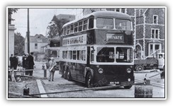
 | Trolleybus Terminus (for the Pierhead) at the end of Bute Street | 1950s | Butetown | Gordon W Fox (Donated by Bernard Fox (Son) and Family) | M Witty | 2024 | BUT025 |
 | Ye Olde Pilot Inn Frieze (Depicting a Cardiff pilot cutter), George Street | 1950s | Butetown | Gordon W Fox (Donated by Bernard Fox (Son) and Family) | M Witty | 2024 | BUT026 |
 | Ye Olde Pilot Inn, George Street | 1950s | Butetown | Gordon W Fox (Donated by Bernard Fox (Son) and Family) | M Witty | 2024 | BUT027 |
 | Barclays Bank on Mount Stuart Square | 1960s | Butetown | Gordon W Fox (Donated by Bernard Fox (Son) and Family) | M Witty | 2024 | BUT028 |
 | View of Clarence Road Swing Bridge, Railway Spur and Grangetown from Nelson House (Filled in canal in foreground) | 1960s | Butetown | Gordon W Fox (Donated by Bernard Fox (Son) and Family) | M Witty | 2024 | BUT029 |
 | Windsor Terrace | 1960s | Butetown | Auction | M Witty | 2024 | BUT030 |
 | Stuart Street and George Street | 1969 | Butetown | Auction | M Witty | 2024 | BUT031 |
 | Caerau Iron Age Hillfort, Aerial View | 1988 | Caerau | Unknown | Unknown | 2005 | CAE001 |
 | Heol Trelai, Looking East | 2005 | Caerau | N/A | M Witty | 2006 | CAE002 |
 | Heol Trelai, Looking West | 2005 | Caerau | N/A | M Witty | 2006 | CAE003 |
 | St. Mary's Church | 2005 | Caerau | N/A | M Witty | 2006 | CAE004 |
 | St. Mary's Church and Caerau Ringwork, high elevation view over Caerau and the City | 2005 | Caerau | N/A | M Witty | 2006 | CAE005 |
 | St. Mary's Church, and my Brother standing by an example of how neglected the churchyard is | 2005 | Caerau | N/A | M Witty | 2006 | CAE006 |
 | St. Mary's Church, and one of the monuments | 2005 | Caerau | N/A | M Witty | 2006 | CAE007 |
 | St. Mary's Church, close up of the bell tower | 2005 | Caerau | N/A | M Witty | 2006 | CAE008 |
 | St. Mary's Church, Front Entrance and Archways | 2005 | Caerau | N/A | M Witty | 2006 | CAE009 |
 | St. Mary's Church | 1940s | Caerau | Unknown | Unknown | 2010 | CAE010 |
 | Canton Bridge | 1903 | Canton and Pontcanna | Unknown | Unknown | 2006 | CAN001 |
 | Cowbridge Road East (approaching town) | 1914 | Canton and Pontcanna | Unknown | Unknown | 2007 | CAN002 |
 | Cowbridge Road East, on the junction with Kings Road, and the Kings Castle pub | 1920 | Canton and Pontcanna | Unknown | Unknown | 2007 | CAN003 |
 | Victoria Park, The Monkey House | 1920s | Canton and Pontcanna | Cardiff Yesterday 03 / Cardiff Central Library | Unknown | 2010 | CAN004 |
 | Flooding at St Lukes Church Hall, on the junction of Lansdowne Road and Cowbridge Road East | 1921 | Canton and Pontcanna | Bob Baird | Unknown | 2009 | CAN005 |
 | Popes Photo Service, Cowbridge Road East | 1934 | Canton and Pontcanna | Unknown | Unknown | 2007 | CAN006 |
 | Various shops on Cowbridge Road East | 1937 | Canton and Pontcanna | Cardiff Yesterday 02 / Dennis C. Pope | Unknown | 2006 | CAN007 |
 | Sophia Gardens Lower Lodge, Cowbridge Road East | 1939 | Canton and Pontcanna | Gordon W Fox (Donated by Bernard Fox (Son) and Family) | M Witty | 2024 | CAN008 |
 | Harlech TV Studios (built around Pontcanna Farm) Demolished mid 1980s (01) | 1968 | Canton and Pontcanna | Auction | M Witty | 2024 | CAN009 |
 | Harlech TV Studios (built around Pontcanna Farm) Demolished mid 1980s (02) | 1968 | Canton and Pontcanna | Auction | M Witty | 2024 | CAN010 |
 | Sophia Gardens Pavillion Front Entrance | 1968 | Canton and Pontcanna | Auction | M Witty | 2024 | CAN011 |
 | Penhill Road | 1970 | Canton and Pontcanna | Auction | M Witty | 2015 | CAN012 |
 | Ryder Street | 1971 | Canton and Pontcanna | Auction | M Witty | 2024 | CAN013 |
 | Conway Road after a blizzard (01) | 1979 | Canton and Pontcanna | Hank Hall | M Witty | 2011 | CAN014 |
 | Conway Road after a blizzard (02) | 1979 | Canton and Pontcanna | Hank Hall | M Witty | 2011 | CAN015 |
 | Flooding at Sophia Gardens | 1979 | Canton and Pontcanna | Nick Lia | M Witty | 2009 | CAN016 |
 | Flooding at Sophia Gardens (Alternate View) | 1979 | Canton and Pontcanna | Nick Lia | M Witty | 2009 | CAN017 |
 | Flooding on Cathedral Road (North) | 1979 | Canton and Pontcanna | Gordon W Fox (Donated by Bernard Fox (Son) and Family) | M Witty | 2024 | CAN018 |
 | Flooding on Cowbridge Road East outside St Davids Hospital | 1979 | Canton and Pontcanna | Gordon W Fox (Donated by Bernard Fox (Son) and Family) | M Witty | 2024 | CAN019 |
 | Sophia Gardens Pavilion after flooding | 1979 | Canton and Pontcanna | Gordon W Fox (Donated by Bernard Fox (Son) and Family) | M Witty | 2024 | CAN020 |
 | Flooding on Cathedral Road (North) | 1980 | Canton and Pontcanna | Nick Lia | M Witty | 2009 | CAN021 |
 | Flooding on Cathedral Road (South) | 1980 | Canton and Pontcanna | Nick Lia | M Witty | 2009 | CAN022 |
 | Flooding on Coopers Field and Standing Stones | 1980 | Canton and Pontcanna | Nick Lia | M Witty | 2009 | CAN023 |
 | Flooding on Cowbridge Road East (junction of Neville Street) | 1980 | Canton and Pontcanna | Nick Lia | M Witty | 2009 | CAN024 |
 | Cowbridge Road East (flooded) (02) | 1980 | Canton and Pontcanna | Nick Lia | M Witty | 2009 | CAN025 |
 | Flooding in Pontcanna Fields | 1980 | Canton and Pontcanna | Nick Lia | M Witty | 2009 | CAN026 |
 | Flooding on Sophia Close | 1980 | Canton and Pontcanna | Nick Lia | M Witty | 2009 | CAN027 |
 | Flooding in Sophia Gardens Car Park | 1980 | Canton and Pontcanna | Nick Lia | M Witty | 2009 | CAN028 |
 | Flooded Circus Camp at Sophia Gardens Pavilion | 1980 | Canton and Pontcanna | Nick Lia | M Witty | 2009 | CAN029 |
 | Escaped Circus animals after the floods at Sophia Gardens Pavilion | 1980 | Canton and Pontcanna | Nick Lia | M Witty | 2009 | CAN030 |
 | National Sports Centre for Wales Rugby Pitch after flooding | 1980 | Canton and Pontcanna | Nick Lia | M Witty | 2009 | CAN031 |
 | National Sports Centre for Wales after flooding | 1980 | Canton and Pontcanna | Nick Lia | M Witty | 2009 | CAN032 |
 | National Sports Centre Wales after flooding (Note the lack of the Swalec Cricket Stadium) | 1980 | Canton and Pontcanna | Nick Lia | M Witty | 2009 | CAN033 |
 | Cowbridge Road East after a blizzard | 1982 | Canton and Pontcanna | Richard Porch | M Witty | 2015 | CAN034 |
 | Market Road after a blizzard | 1982 | Canton and Pontcanna | Richard Porch | M Witty | 2015 | CAN035 |
 | National Sports Centre for Wales, after a blizzard | 1982 | Canton and Pontcanna | Nick Lia | M Witty | 2009 | CAN036 |
 | Pontcanna Fields and the Avenue of Trees after a blizzard | 1982 | Canton and Pontcanna | Nick Lia | M Witty | 2009 | CAN037 |
 | River Taff after heavy snowfall (site of the Millennium Footbridge, constructed 1999) | 1982 | Canton and Pontcanna | Nick Lia | M Witty | 2009 | CAN038 |
 | Sophia Gardens Pavilion, collapsed roof after heavy snowfall | 1982 | Canton and Pontcanna | Nick Lia | M Witty | 2009 | CAN039 |
 | Canton Branch Library (Built 1905), Cowbridge Road East | 2005 | Canton and Pontcanna | N/A | M Witty | 2005 | CAN040 |
 | C.E. Watts (no longer trading) Kings Road (A reminder of businesses of old) | 2007 | Canton and Pontcanna | N/A | M Witty | 2007 | CAN041 |
 | Welsh Institute of Sport (Sports Council for Wales) | 2007 | Canton and Pontcanna | N/A | M Witty | 2007 | CAN042 |
 | Law Courts | 1930s | Cathays and Maindy | Unknown | Unknown | 2008 | CAT001 |
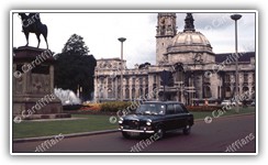
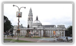
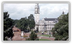
 | Lord Tredegars Statue and City Hall (then the Town Hall) | 1930s | Cathays and Maindy | Unknown | Unknown | 2008 | CAT002 |
 | Woodville Road | 1904 | Cathays and Maindy | Unknown | Unknown | 2010 | CAT003 |
 | Newly built Town Hall | 1906 | Cathays and Maindy | Unknown | Unknown | 2010 | CAT004 |
 | Lisvane Street, after heavy snowfall (01) | 1982 | Cathays and Maindy | Nick Lia | M Witty | 2015 | CAT005 |
 | Lisvane Street, after heavy snowfall (02) | 1982 | Cathays and Maindy | Nick Lia | M Witty | 2015 | CAT006 |
 | Lisvane Street, after heavy snowfall (03) | 1982 | Cathays and Maindy | Nick Lia | M Witty | 2015 | CAT007 |
 | Nathan Joseph (Paper Bag Manufacturer) - 02 Coburn Street damaged by WWII bombs | 1940 | Cathays and Maindy | Gordon W Fox (Donated by Bernard Fox (Son) and Family) | M Witty | 2024 | CAT008 |
 | Maindy Stadium and Velodrome building works near completion | 1957 | Cathays and Maindy | Gordon W Fox (Donated by Bernard Fox (Son) and Family) | M Witty | 2024 | CAT009 |
 | Whitchurch Road, looking south to Crwys Road | 1960s | Cathays and Maindy | Gordon W Fox (Donated by Bernard Fox (Son) and Family) | M Witty | 2024 | CAT010 |
 | High Corner House (now Demolished), Castle Street | 1870 | City Centre | Unknown | Unknown | 2005 | CIT001 |
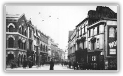
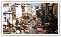
 | High Street | 1872 | City Centre | Unknown | Unknown | 2005 | CIT002 |
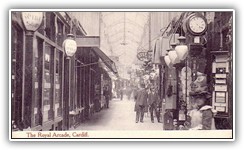 | Royal Arcade | 1920 | City Centre | Unknown | Unknown | 2005 | CIT003 |
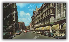
 | Queen Street (Lloyds Bank and Boots) | 1985 | City Centre | Unknown | Unknown | 2005 | CIT004 |
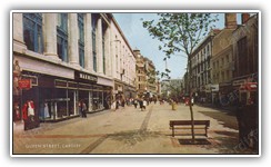 | Queen Street (Marments) | 1985 | City Centre | Unknown | Unknown | 2005 | CIT005 |
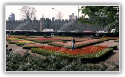
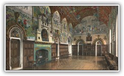 | Banqueting Hall - Cardiff Castle | 1992 | City Centre | Unknown | Unknown | 2005 | CIT006 |
 | Billboard Display, Rear Of C.I.A. | 2005 | City Centre | N/A | M Witty | 2005 | CIT007 |
 | Brunel House, Knox Road | 2005 | City Centre | N/A | M Witty | 2005 | CIT008 |
 | Aerial view of the Cardiff City Centre | 1950s | City Centre | Auction | Aerofilms Ltd | 2005 | CIT009 |
 | Aerial view of the City Centre (with caption) | 1950s | City Centre | Unknown | Unknown | 2005 | CIT010 |
 | View of Canton Bridge from the Castle Clock Tower | 1871 | City Centre | Unknown | Unknown | 2006 | CIT011 |
 | View of Westgate Street from the Castle Clock Tower | 1871 | City Centre | Unknown | Unknown | 2006 | CIT012 |
 | Castle Clock Tower, View from the, showing the High Street and St John's Church | 1875 | City Centre | Unknown | Unknown | 2006 | CIT013 |
 | Queen Street | 1890 | City Centre | Unknown | Unknown | 2006 | CIT014 |
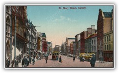
 | St. Mary Street, Aerial view of the south end of | 1890 | City Centre | Unknown | Unknown | 2006 | CIT015 |
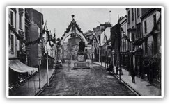
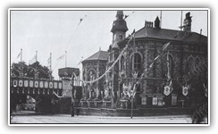
 | St. Mary Street, Decorated For Prince Of Wales Visit | 1890 | City Centre | Unknown | Unknown | 2006 | CIT016 |
 | Cardiff Castle, Excavations | 1898 | City Centre | Unknown | Unknown | 2006 | CIT017 |
 | Cardiff Castle, Dock Feeder | 1900 | City Centre | Unknown | Unknown | 2006 | CIT018 |
 | Queen Street (opposite Railway Bridges and Taff Vale Station) | 1905 | City Centre | Unknown | Unknown | 2006 | CIT019 |
 | King George V and Queen Mary Leave Cardiff Castle | 1912 | City Centre | Unknown | Unknown | 2006 | CIT020 |
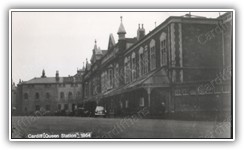
 | Queen Street Station (original Taff Vale Railway building) on the junction of Newport Road | 1912 | City Centre | Unknown | Unknown | 2006 | CIT021 |
 | Duke Street | 1921 | City Centre | Unknown | Unknown | 2006 | CIT022 |
 | Cardiff Castle and Duke Street | 1940 | City Centre | Unknown | Unknown | 2006 | CIT023 |
 | Guildford Crescent looking up towards Queen Street, and the dock feeder | 1947 | City Centre | Cardiff Yesterday 02 / South Glamorgan County Libraries | Unknown | 2006 | CIT024 |
 | Queen Street Railway Station, Frontage | 1954 | City Centre | CB Swallow | Unknown | 2006 | CIT025 |
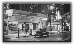
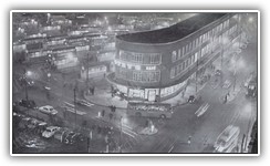 | Central Bus Station and Asteys at night | 1957 | City Centre | Unknown | Unknown | 2006 | CIT026 |
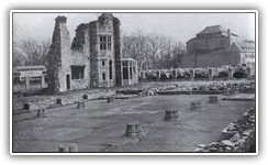 | The ruins of Herbert House in Greyfriars Road, demolished in 1965-66 - Capital Tower is located here now | 1957 | City Centre | Unknown | Unknown | 2006 | CIT027 |
 | View of Queen Street from the Castle Wall (Refuge Assurance Company in background) NEW | 1980s | City Centre | Auction | M Witty | 2025 | CIT028 |
 | Stuttgarter Strasse (construction of) which linked Park Place to Newport Road | 1965 | City Centre | Unknown | Unknown | 2006 | CIT029 |
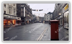
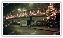
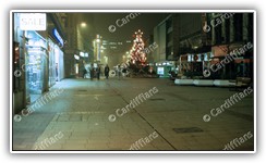
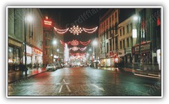 | Christmas Lights - Queen Street | 1973 | City Centre | Unknown | Unknown | 2006 | CIT030 |
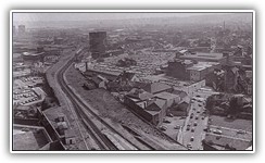 | Guildford Crescent and Queen Street Station railway line, aerial view | 1980 | City Centre | Unknown | Unknown | 2006 | CIT031 |
 | Cardiff Castle and Civic Centre, Aerial View | 2001 | City Centre | Unknown | Unknown | 2006 | CIT032 |
 | Central Market and St Johns Church Graveyard | 2005 | City Centre | N/A | M Witty | 2006 | CIT033 |
 | City Planning Offices at Central Station, demolished 2006 | 2005 | City Centre | N/A | M Witty | 2006 | CIT034 |
 | David Morgan Department Store, The Hayes | 2005 | City Centre | Unknown | Unknown | 2006 | CIT035 |
 | High Street | 2005 | City Centre | N/A | M Witty | 2006 | CIT036 |
 | Wood Street | 2005 | City Centre | N/A | M Witty | 2006 | CIT037 |
 | Carlton Restaurant in Queen Street, the remains after WW2 | 1940s | City Centre | Unknown | Unknown | 2006 | CIT038 |
 | Churchill Way & Queen Street Station, aerial view | 1950s | City Centre | Unknown | Unknown | 2006 | CIT039 |
 | Empire Pool on Wood Street | 1960s | City Centre | Unknown | Unknown | 2006 | CIT040 |
 | Central Free Library, view from Trinity Street before pedestrianisation | 1970s | City Centre | Unknown | Unknown | 2006 | CIT041 |
 | Hayes House, The Hayes | 1970s | City Centre | Unknown | Unknown | 2006 | CIT042 |
 | Pearl Assurance Tower (now Capital Towet), Greyfriars Road | 1980s | City Centre | Unknown | Unknown | 2006 | CIT043 |
 | Taff Vale Railway Station (Queen Street) | 1900 | City Centre | Unknown | Unknown | 2007 | CIT044 |
 | Globe Hotel, Castle Street | 1903 | City Centre | Cardiff Yesterday 01 / Cardiff Central Library | Unknown | 2007 | CIT045 |
 | Cardiff Castle | 1905 | City Centre | Unknown | Unknown | 2007 | CIT046 |
 | Temperance Town, which used to be located where the Central Bus Station stands now | 1930 | City Centre | Cardiff Yesterday 04 / Cardiff Central Library | Unknown | 2007 | CIT047 |
 | St. Mary Street | 1932 | City Centre | Unknown | Unknown | 2007 | CIT048 |
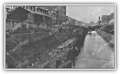
 | Glamorganshire Canal lock at Queen Street (then Crockherbtown) | 1952 | City Centre | Cardiff Yesterday 02 / Cardiff Central Library | Unknown | 2007 | CIT049 |
 | Wood Street, before Central Bus Station was built | 1953 | City Centre | Unknown | Unknown | 2007 | CIT050 |
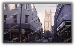
 | St. Mary Street | 1971 | City Centre | Unknown | Unknown | 2007 | CIT051 |
 | City Hall | 1972 | City Centre | Gareth W. Evans | M Witty | 2007 | CIT052 |
 | City Planning Offices under construction, viewed from across the River Taff | 1972 | City Centre | Gareth W. Evans | M Witty | 2007 | CIT053 |
 | Queen Street | 1972 | City Centre | Gareth W. Evans | M Witty | 2007 | CIT054 |
 | Queen Street early on Christmas morning | 1972 | City Centre | Gareth W. Evans | M Witty | 2007 | CIT055 |
 | South Wales Institute of Engineering Headquarters on Park Place | 1973 | City Centre | Gareth W. Evans | M Witty | 2007 | CIT056 |
 | Cardiff Central Railway Station (01) | 1974 | City Centre | Gareth W. Evans | M Witty | 2007 | CIT057 |
 | Marments and traffic in Queen Street | 1974 | City Centre | Gareth W. Evans | M Witty | 2007 | CIT058 |
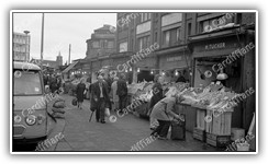 | Mill Lane Market | 1974 | City Centre | Gareth W. Evans | M Witty | 2007 | CIT059 |
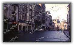
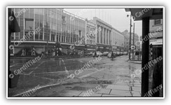 | Queen Street | 1974 | City Centre | Gareth W. Evans | M Witty | 2007 | CIT060 |
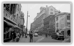 | High Street (01) | 1975 | City Centre | Gareth W. Evans | M Witty | 2007 | CIT061 |
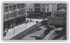
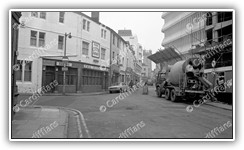 | Quay Street, and the construction of the NCP car park | 1975 | City Centre | Gareth W. Evans | M Witty | 2007 | CIT062 |
 | Royal Arcade | 1975 | City Centre | Gareth W. Evans | M Witty | 2007 | CIT063 |
 | St. John Street and Working Street | 1975 | City Centre | Gareth W. Evans | M Witty | 2007 | CIT064 |
 | Womanby Street - Looking towards the Castle Clock Tower | 1975 | City Centre | Gareth W. Evans | M Witty | 2007 | CIT065 |
 | Cardiff Castle | 2003 | City Centre | Unknown | Unknown | 2007 | CIT066 |
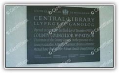 | Cardiff Central Library, Dedication Plaque | 2005 | City Centre | Unknown | Unknown | 2007 | CIT067 |
 | BT building in Sandon Street being renovated (for University of South Wales) | 2006 | City Centre | N/A | M Witty | 2007 | CIT068 |
 | Hayes Island Snack Bar | 2006 | City Centre | N/A | M Witty | 2007 | CIT069 |
 | North Road subway, and the old lock workings from the days of the Glamorganshire Canal | 2006 | City Centre | N/A | M Witty | 2007 | CIT070 |
 | North Road subway, and the post which has been worn away by ropes used to pull canal boats through | 2006 | City Centre | N/A | M Witty | 2007 | CIT071 |
 | North Road subway, previously the old Glamorganshire Canal tunnel | 2006 | City Centre | N/A | M Witty | 2007 | CIT072 |
 | Castle Street and the Castle Clock Tower | 1870s | City Centre | Unknown | Unknown | 2007 | CIT073 |
 | Shewing University, Newport Road | 1890s | City Centre | Unknown | Unknown | 2007 | CIT074 |
 | St. Mary Street | 1890s | City Centre | Unknown | Unknown | 2007 | CIT075 |
 | Town Hall in St Mary Street (demolished in 1914) | 1910s | City Centre | Unknown | Unknown | 2007 | CIT076 |
 | Central Free Library | 1920s | City Centre | Unknown | Unknown | 2007 | CIT077 |
 | St. John's Church, The Hayes | 1940s | City Centre | Unknown | Unknown | 2007 | CIT078 |
 | County Council Offices | 1950s | City Centre | Unknown | Unknown | 2007 | CIT079 |
 | Thomson House Printing Press, Havelock Street | 1950s | City Centre | Unknown | Unknown | 2007 | CIT080 |
 | Cardiff Castle | 1960s | City Centre | Unknown | Unknown | 2007 | CIT081 |
 | Rose & Crown Pub in Kingsway (demolished in 1974) | 1960s | City Centre | Unknown | Unknown | 2007 | CIT082 |
 | Snelling House in Bute Terrace was once the headquarters of the Wales Gas Board | 1960s | City Centre | Unknown | Unknown | 2007 | CIT083 |
 | City Planning Offices, Central Station | 1970s | City Centre | Unknown | Unknown | 2007 | CIT084 |
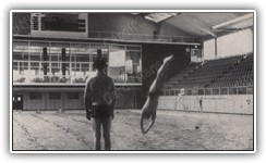
 | Empire Pool training baths | 1970s | City Centre | Unknown | Unknown | 2007 | CIT085 |
 | Empire Pool, inside (01) | 1970s | City Centre | Unknown | Unknown | 2007 | CIT086 |
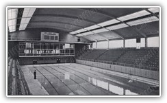 | Empire Pool, inside (02) | 1970s | City Centre | Unknown | Unknown | 2007 | CIT087 |
 | Empire Pool, view from the lowest diving board | 1970s | City Centre | Unknown | Unknown | 2007 | CIT088 |
 | St. John's Church, View from Trinity Street before pedestrianisation | 1970s | City Centre | Unknown | Unknown | 2007 | CIT089 |
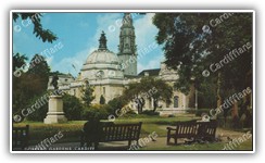 | Gorsedd Gardens, City Hall | 1980s | City Centre | Unknown | Unknown | 2007 | CIT090 |
 | North Street (Re-named Kingway in 1909) | 1887 | City Centre | Unknown | Unknown | 2008 | CIT091 |
 | City Hall Dome (Note the Ornate Dragon at the top) - view from the Admiral Eye Big Wheel | 2008 | City Centre | N/A | M Witty | 2008 | CIT092 |
 | Winter Wonderland Outdoor Ice Rink - view from the Admiral Eye Big Wheel | 2008 | City Centre | N/A | M Witty | 2008 | CIT093 |
 | High Street | 1910s | City Centre | Unknown | Unknown | 2008 | CIT094 |
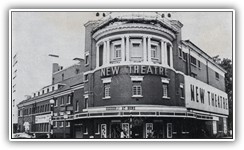 | New Theatre | 1970s | City Centre | Unknown | Unknown | 2008 | CIT095 |
 | St. Mary Street (Looking North) | 1891 | City Centre | Unknown | Unknown | 2009 | CIT096 |
 | Queen Street | 1902 | City Centre | Unknown | Unknown | 2009 | CIT097 |
 | Salisbury's Tyre and Retreads Ltd, Frederick Street | 1923 | City Centre | Bill Phelps | M Witty | 2009 | CIT098 |
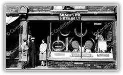 | Salisburys Tyre and Retreads Ltd, Frederick Street (Owned by Charles Patrick and Lilian May Salisbury) | 1923 | City Centre | Bill Phelps | M Witty | 2009 | CIT099 |
 | Queen Street | 1934 | City Centre | Unknown | Unknown | 2009 | CIT100 |
 | St John's Church, view from Church Street | 1946 | City Centre | Unknown | Unknown | 2009 | CIT101 |
| St John Street and Working Street | 1978 | City Centre | Unknown | Unknown | 2009 | CIT102 |
 | Bute Park (flooded) with National Sports Centre Wales in background, view from roof of Welsh College of Music and Drama | 1980 | City Centre | Nick Lia | M Witty | 2009 | CIT103 |
 | Queen Street | 1950s | City Centre | Unknown | Unknown | 2009 | CIT105 |
 | Pearl Assurance Building, Greyfriars Road | 1970s | City Centre | Unknown | Unknown | 2009 | CIT106 |
 | Prudential Buildings, Kingsway | 1970s | City Centre | Unknown | Unknown | 2009 | CIT107 |
 | St. John's Street (and Evans Court which was demolished in 1892) | 1890 | City Centre | Unknown | Unknown | 2010 | CIT108 |
 | St. Mary Street | 1905 | City Centre | Unknown | Unknown | 2010 | CIT109 |
 | Queen Street | 1910 | City Centre | Unknown | Unknown | 2010 | CIT110 |
 | St. Mary Street | 1912 | City Centre | Unknown | Unknown | 2010 | CIT111 |
 | Westgate Street Fire Station, Appliance Room | 1917 | City Centre | Unknown | Unknown | 2010 | CIT112 |
 | Queen Street and Dominion Buildings | 1920 | City Centre | Unknown | Unknown | 2010 | CIT113 |
 | Turkish Baths in Guildford Crescent, and the dock feeder | 1947 | City Centre | Cardiff Yesterday 02 / South Glamorgan County Libraries | Unknown | 2010 | CIT114 |
 | St. Mary Street, Aerial View | 1950s | City Centre | Unknown | Unknown | 2010 | CIT115 |
 | Taff Vale Railway bridge and Rhymney Railway bridge over Newport Road | 1950s | City Centre | Unknown | Unknown | 2010 | CIT116 |
 | Thomson House, Havelock Street | 1950s | City Centre | Unknown | Unknown | 2010 | CIT117 |
 | Queen Street | 1960s | City Centre | Unknown | Unknown | 2010 | CIT118 |
 | Philharmonic Restaurant, St. Mary Street | 1890 | City Centre | Unknown | Unknown | 2011 | CIT119 |
 | Norman fortifications revealed during the excavations at Cardiff Castle | 1898 | City Centre | Unknown | Unknown | 2011 | CIT120 |
 | Boulevard de Nantes and North Road, decorated for the Empire Games | 1958 | City Centre | Stan Phillips | M Witty | 2011 | CIT121 |
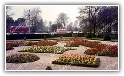
 | Bute Park, looking towards City Hall. The bungalow in the foreground has been replaced by Tennis Courts | 1958 | City Centre | Stan Phillips | M Witty | 2011 | CIT122 |
 | Canton Bridge | 1958 | City Centre | Stan Phillips | M Witty | 2011 | CIT123 |
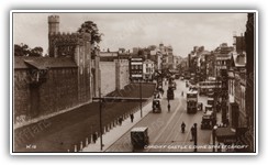
 | Cardiff Castle and Castle Street | 1958 | City Centre | Stan Phillips | M Witty | 2011 | CIT124 |
 | Cardiff Castle Clock Tower - close up | 1958 | City Centre | Stan Phillips | M Witty | 2011 | CIT125 |
 | Cardiff City Hall (01) | 1958 | City Centre | Stan Phillips | M Witty | 2011 | CIT126 |
 | Cardiff City Hall (02) | 1958 | City Centre | Stan Phillips | M Witty | 2011 | CIT127 |
 | Castle Street, looking East towards Queen Street | 1958 | City Centre | Stan Phillips | M Witty | 2011 | CIT128 |
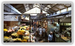 | Central Market | 1958 | City Centre | Stan Phillips | M Witty | 2011 | CIT129 |
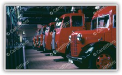 | Fire Engines at the Westgate Street Fire Station | 1958 | City Centre | Stan Phillips | M Witty | 2011 | CIT130 |
 | Museum Avenue, looking North | 1958 | City Centre | Stan Phillips | M Witty | 2011 | CIT131 |
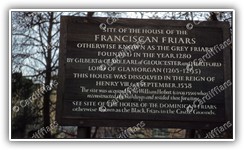 | Site of the Franciscan (Grey) Friars and ruins of Herbert House - Information Board | 1958 | City Centre | Stan Phillips | M Witty | 2011 | CIT132 |
 | The GEC (General Electric Company), Magnet House, 1 Kingsway | 1958 | City Centre | Stan Phillips | M Witty | 2011 | CIT133 |
 | The ruins of Herbert House in Greyfriars Road, demolished around 1965-67 - Capital Tower is located here now | 1958 | City Centre | Stan Phillips | M Witty | 2011 | CIT134 |
 | Hayes Island Snack Bar | 1972 | City Centre | Unknown | Unknown | 2011 | CIT135 |
 | Mill Lane Market - Trippe Tex Tailoring warehouse later became the Moon Club | 1981 | City Centre | South Glamorgan County Libraries | Unknown | 2011 | CIT136 |
 | Golden Cross Public House, junction of Hayes Bridge Road and Custom House Street | 1982 | City Centre | Unknown | Unknown | 2011 | CIT137 |
 | Cardiff Town Wall, one of the last remaining sections in existence, just off Kingsway (01) | 2011 | City Centre | N/A | M Witty | 2011 | CIT138 |
 | Guildford Crescent and Queen Street Station railway line, view from Brunel House | 2011 | City Centre | Paul Lewis | M Witty | 2011 | CIT139 |
 | Greyhound, The - Bridge Street | 1940s | City Centre | David Wilton (Ex-Landlord of the Vulcan Hotel) | M Witty | 2011 | CIT140 |
 | Marchioness of Bute - Frederick Street | 1940s | City Centre | David Wilton (Ex-Landlord of the Vulcan Hotel) | M Witty | 2011 | CIT141 |
 | Taff Vale, The - On the junction of Queen Street and Paradise Place | 1940s | City Centre | David Wilton (Ex-Landlord of the Vulcan Hotel) | M Witty | 2011 | CIT142 |
 | Cardiff Castle and Castle Street, view from Queen Street | 1974 | City Centre | Auction | M Witty | 2015 | CIT143 |
 | Cardiff Central Railway and Bus Stations | 1974 | City Centre | Auction | M Witty | 2015 | CIT144 |
 | Cardiff Central Railway Station (02) | 1974 | City Centre | Gareth W. Evans | M Witty | 2015 | CIT145 |
 | Rear of Mackross, Paradise Place | 1974 | City Centre | Gareth W. Evans | M Witty | 2015 | CIT146 |
 | High Street (02) | 1975 | City Centre | Gareth W. Evans | M Witty | 2015 | CIT147 |
 | St. Mary Street | 1975 | City Centre | Gareth W. Evans | M Witty | 2015 | CIT148 |
 | King Edward VII Avenue | 1976 | City Centre | Gareth W. Evans | M Witty | 2015 | CIT149 |
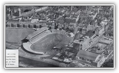
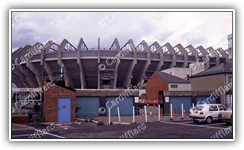
 | Cardiff Arms Park | 1978 | City Centre | Unknown | Unknown | 2015 | CIT150 |
 | New Street - The building to the left is the back of Trippe Tex Tailoring warehouse (later the Moon Club) | 1981 | City Centre | South Glamorgan County Libraries | Unknown | 2015 | CIT151 |
 | Tripp Tex Tailoring warehouse (later became the Moon Club). Demolished 1981 | 1981 | City Centre | South Glamorgan County Libraries | Unknown | 2015 | CIT152 |
 | Central Library | 2006 | City Centre | N/A | M Witty | 2015 | CIT153 |
 | Oxford Arcade (01) | 2006 | City Centre | N/A | M Witty | 2015 | CIT154 |
 | Oxford Arcade (02) | 2006 | City Centre | N/A | M Witty | 2015 | CIT155 |
 | Oxford Arcade (03) | 2006 | City Centre | N/A | M Witty | 2015 | CIT156 |
 | Oxford Arcade (04) | 2006 | City Centre | N/A | M Witty | 2015 | CIT157 |
 | Oxford Arcade (05) | 2006 | City Centre | N/A | M Witty | 2015 | CIT158 |
 | St David's 2 Construction (01) | 2008 | City Centre | Adam Witty | M Witty | 2015 | CIT159 |
 | St David's 2 Construction (02) | 2008 | City Centre | Adam Witty | M Witty | 2015 | CIT160 |
 | St David's 2 Construction (03) | 2008 | City Centre | Adam Witty | M Witty | 2015 | CIT161 |
 | St David's 2 Construction (04) | 2008 | City Centre | Adam Witty | M Witty | 2015 | CIT162 |
 | St David's 2 Construction (05) | 2008 | City Centre | Adam Witty | M Witty | 2015 | CIT163 |
 | Cardiff Town Wall, one of the last remaining sections in existence, just off Kingsway (02) | 2011 | City Centre | N/A | M Witty | 2015 | CIT164 |
 | Cardiff Castle, Inside the Walls | 2013 | City Centre | Unknown | Unknown | 2015 | CIT165 |
 | Cardiff Castle, Interior (01) | 2013 | City Centre | Unknown | Unknown | 2015 | CIT166 |
 | Cardiff Castle, Interior (02) | 2013 | City Centre | Unknown | Unknown | 2015 | CIT167 |
 | Cardiff Castle, Interior (03) | 2013 | City Centre | Unknown | Unknown | 2015 | CIT168 |
 | Cardiff Castle, Interior (04) | 2013 | City Centre | Unknown | Unknown | 2015 | CIT169 |
 | Cardiff Castle, Interior (05) | 2013 | City Centre | Unknown | Unknown | 2015 | CIT170 |
 | Cardiff Castle, Interior (06) | 2013 | City Centre | Unknown | Unknown | 2015 | CIT171 |
 | Cardiff Castle, Interior (07) | 2013 | City Centre | Unknown | Unknown | 2015 | CIT172 |
 | Cardiff Castle, Interior (08) | 2013 | City Centre | Unknown | Unknown | 2015 | CIT173 |
 | Cardiff Castle, Interior (09) | 2013 | City Centre | Unknown | Unknown | 2015 | CIT174 |
 | City Hall Lawn - Lord Tredegar Statue in the distance | 1958 | City Centre | Auction | M Witty | 2018 | CIT175 |
 | Howells - St Mary Street | 1958 | City Centre | Auction | M Witty | 2018 | CIT176 |
 | Western Mail and Echo Offices - St Mary Street | 1958 | City Centre | Auction | M Witty | 2018 | CIT177 |
 | Evan Roberts (Just Looking Promotion) - Queen Street | 1970 | City Centre | Auction | M Witty | 2018 | CIT178 |
 | Cardiff Arms Park (National Stadium) Rugby Ground - Club Entrance | 1990 | City Centre | Auction | M Witty | 2018 | CIT179 |
 | Cardiff Arms Park (National Stadium) Rugby Ground - South Lower Stand | 1990 | City Centre | Auction | M Witty | 2018 | CIT180 |
 | Cardiff Arms Park (National Stadium) Rugby Ground - View from Westgate Street | 1990 | City Centre | Auction | M Witty | 2018 | CIT181 |
 | Cardiff Arms Park (National Stadium) Rugby Ground - West Enclosure | 1990 | City Centre | Auction | M Witty | 2018 | CIT182 |
 | Castle Arcade - High Street | 1960s | City Centre | Auction | M Witty | 2018 | CIT183 |
 | Church Street | 1960s | City Centre | Auction | M Witty | 2018 | CIT184 |
 | Friary Gardens 01 | 1960s | City Centre | Auction | M Witty | 2018 | CIT185 |
 | Friary Gardens 02 | 1960s | City Centre | Auction | M Witty | 2018 | CIT186 |
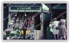 | E. Tucker Flower Stall - Mill Lane Market | 1970s | City Centre | Auction | M Witty | 2018 | CIT187 |
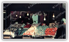 | Harry Chiplin Fruit and Veg Stall (01) - Mill Lane Market | 1970s | City Centre | Auction | M Witty | 2018 | CIT188 |
 | Harry Chiplin Fruit and Veg Stall (02) - Mill Lane Market | 1970s | City Centre | Auction | M Witty | 2018 | CIT189 |
 | Huxleys Sugical Stores - 26 High Street | 1970s | City Centre | Auction | M Witty | 2018 | CIT190 |
 | JA Williams - Fruit and Veg Stall - Mill Lane Market | 1970s | City Centre | Auction | M Witty | 2018 | CIT191 |
 | La Locanda and Hodge House - Guildhall Place | 1970s | City Centre | Auction | M Witty | 2018 | CIT192 |
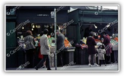
 | Mill Lane Market (01) | 1970s | City Centre | Auction | M Witty | 2018 | CIT193 |
 | Mill Lane Market (02) | 1970s | City Centre | Auction | M Witty | 2018 | CIT194 |
 | Mill Lane Market (03) | 1970s | City Centre | Auction | M Witty | 2018 | CIT195 |
 | Nuths Fruit and Veg Stall - Mill Lane Market | 1970s | City Centre | Auction | M Witty | 2018 | CIT196 |
 | Quay Street | 1970s | City Centre | Auction | M Witty | 2018 | CIT197 |
 | Sign of the Steer - 49 St Mary Street | 1970s | City Centre | Auction | M Witty | 2018 | CIT198 |
 | Wyndham Arcade (Edward Piller Ltd) | 1970s | City Centre | Auction | M Witty | 2018 | CIT199 |
 | St Marys Street (Looking north to High Street) | 1960s | City Centre | Auction | M Witty | 2024 | CIT200 |
 | Merchant Navy Club and Hayes Bridge over the Glamorganshire Canal | 1940s | City Centre | Gordon W Fox (Donated by Bernard Fox (Son) and Family) | M Witty | 2024 | CIT201 |
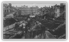
 | Churchill Way Canal being covered up (looking towards Guildford Street) | 1949 | City Centre | Gordon W Fox (Donated by Bernard Fox (Son) and Family) | M Witty | 2024 | CIT202 |
 | Churchill Way Canal being covered up (looking towards Queen Street) | 1949 | City Centre | Gordon W Fox (Donated by Bernard Fox (Son) and Family) | M Witty | 2024 | CIT203 |
 | Guildford Crescent Turkish Baths, Churchill Way | 1949 | City Centre | Gordon W Fox (Donated by Bernard Fox (Son) and Family) | M Witty | 2024 | CIT204 |
| Herbert House (The Ruins of Grey Friars) - Demolished 1967 | 1950s | City Centre | Gordon W Fox (Donated by Bernard Fox (Son) and Family) | M Witty | 2024 | CIT205 |
 | High Street | 1950s | City Centre | Gordon W Fox (Donated by Bernard Fox (Son) and Family) | M Witty | 2024 | CIT206 |
 | Cardiff Central Railway Station Booking Hall | 1953 | City Centre | Gordon W Fox (Donated by Bernard Fox (Son) and Family) | M Witty | 2024 | CIT207 |
 | Central Square | 1953 | City Centre | Gordon W Fox (Donated by Bernard Fox (Son) and Family) | M Witty | 2024 | CIT208 |
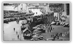 | Crowds gather on North Road ahead of Queen Elizabeth II's Coronation Procession | 1953 | City Centre | Gordon W Fox (Donated by Bernard Fox (Son) and Family) | M Witty | 2024 | CIT209 |
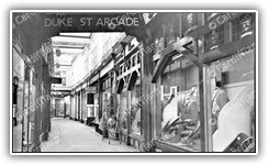 | Duke Street Arcade | 1960s | City Centre | Gordon W Fox (Donated by Bernard Fox (Son) and Family) | M Witty | 2024 | CIT210 |
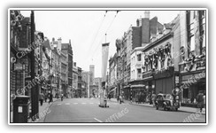 | High Street (Looking North to Castle) | 1960s | City Centre | Gordon W Fox (Donated by Bernard Fox (Son) and Family) | M Witty | 2024 | CIT211 |
 | High Street (Looking South to St Mary Street) | 1960s | City Centre | Gordon W Fox (Donated by Bernard Fox (Son) and Family) | M Witty | 2024 | CIT212 |
 | Monument Roundabout (Statue of the Second Marquess of Bute) - St Mary Street | 1960s | City Centre | Gordon W Fox (Donated by Bernard Fox (Son) and Family) | M Witty | 2024 | CIT213 |
 | Queen Street (Halford Cycle Co and the Park Hall Hotel) | 1960s | City Centre | Gordon W Fox (Donated by Bernard Fox (Son) and Family) | M Witty | 2024 | CIT214 |
 | The Hayes | 1960s | City Centre | Gordon W Fox (Donated by Bernard Fox (Son) and Family) | M Witty | 2024 | CIT215 |
 | Capitol Theatre and New Continental Resturant - Queen Street | 1965 | City Centre | Gordon W Fox (Donated by Bernard Fox (Son) and Family) | M Witty | 2024 | CIT216 |
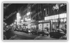 | Odeon, Olympia Theatre, Swears and Wells - Queen Street | 1965 | City Centre | Gordon W Fox (Donated by Bernard Fox (Son) and Family) | M Witty | 2024 | CIT217 |
 | Churchill Way (looking south) | 1969 | City Centre | Auction | M Witty | 2024 | CIT218 |
 | St John Street traffic (The Hayes) | 1969 | City Centre | Auction | M Witty | 2024 | CIT219 |
 | Queen Street traffic | 1970 | City Centre | Auction | M Witty | 2024 | CIT220 |
 | Kingsway and North Road | 1972 | City Centre | Auction | M Witty | 2024 | CIT221 |
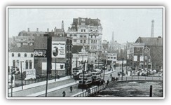
 | Newport Road (approaching City Road) | 1972 | City Centre | Auction | M Witty | 2024 | CIT222 |
 | View of Cardiff Arms Park from Coldstream Terrace | 1974 | City Centre | Auction | M Witty | 2024 | CIT223 |
 | Wood Street Bridge (View from Fitzhammon Embankment) | 1974 | City Centre | Auction | M Witty | 2024 | CIT224 |
 | Brunel House, Knox Road | 1976 | City Centre | Auction | M Witty | 2024 | CIT225 |
 | Construction of St Davids Hall, The Hayes | 1979 | City Centre | Auction | M Witty | 2024 | CIT226 |
 | David Morgan's Christmas Tree, The Hayes | 1981 | City Centre | Auction | M Witty | 2024 | CIT227 |
 | Queen Street Christmas Tree | 1981 | City Centre | Auction | M Witty | 2024 | CIT228 |
 | Cardiff Castle Clock Tower - Before the animal wall was redesigned to incorporate a driveway NEW | 1999 | City Centre | Auction | M Witty | 2025 | CIT229 |
 | Castle Arcade (Partizan, City Surf) NEW | 1999 | City Centre | Auction | M Witty | 2025 | CIT230 |
 | Castle Grounds - View from the Norman Keep NEW | 1999 | City Centre | Auction | M Witty | 2025 | CIT231 |
 | Queen Street (near Marks and Spencer) NEW | 1999 | City Centre | Auction | M Witty | 2025 | CIT232 |
 | Corpus Christi procession - 01 - St Patrick's Hall, Bishop Street | 1962 | Corpus Christi 1962 Procession | Auction | M Witty | 2015 | COR001 |
 | Corpus Christi procession - 02 - St Patrick's Hall, Bishop Street | 1962 | Corpus Christi 1962 Procession | Auction | M Witty | 2015 | COR002 |
 | Corpus Christi procession - 03 - Grangetown | 1963 | Corpus Christi 1962 Procession | Auction | M Witty | 2015 | COR003 |
 | Corpus Christi procession - 04 - St. Mary Street | 1962 | Corpus Christi 1962 Procession | Auction | M Witty | 2015 | COR004 |
 | Corpus Christi procession - 05 - St. Mary Street | 1962 | Corpus Christi 1962 Procession | Auction | M Witty | 2015 | COR005 |
 | Corpus Christi procession - 06 - St. Mary Street | 1962 | Corpus Christi 1962 Procession | Auction | M Witty | 2015 | COR006 |
 | Corpus Christi procession - 07 - St. Mary Street | 1962 | Corpus Christi 1962 Procession | Auction | M Witty | 2015 | COR007 |
 | Corpus Christi procession - 08 - St. Mary Street | 1962 | Corpus Christi 1962 Procession | Auction | M Witty | 2015 | COR008 |
 | Corpus Christi procession - 09 - St. Mary Street | 1962 | Corpus Christi 1962 Procession | Auction | M Witty | 2015 | COR009 |
 | Corpus Christi procession - 10 - St. Mary Street | 1962 | Corpus Christi 1962 Procession | Auction | M Witty | 2015 | COR010 |
 | Corpus Christi procession - 11 - St. Mary Street | 1962 | Corpus Christi 1962 Procession | Auction | M Witty | 2015 | COR011 |
 | Corpus Christi procession - 12 - St. Mary Street | 1962 | Corpus Christi 1962 Procession | Auction | M Witty | 2015 | COR012 |
 | Corpus Christi procession - 13 - St. Mary Street | 1962 | Corpus Christi 1962 Procession | Auction | M Witty | 2015 | COR013 |
 | Corpus Christi procession - 14 - St. Mary Street | 1962 | Corpus Christi 1962 Procession | Auction | M Witty | 2015 | COR014 |
 | Corpus Christi procession - 15 - St. Mary Street | 1962 | Corpus Christi 1962 Procession | Auction | M Witty | 2015 | COR015 |
 | Corpus Christi procession - 16 - St. Mary Street | 1962 | Corpus Christi 1962 Procession | Auction | M Witty | 2015 | COR016 |
 | Corpus Christi procession - 17 - St. Mary Street | 1962 | Corpus Christi 1962 Procession | Auction | M Witty | 2015 | COR017 |
 | Corpus Christi procession - 18 - St. Mary Street | 1962 | Corpus Christi 1962 Procession | Auction | M Witty | 2015 | COR018 |
 | Corpus Christi procession - 19 - St. Mary Street | 1962 | Corpus Christi 1962 Procession | Auction | M Witty | 2015 | COR019 |
 | Corpus Christi procession - 20 - St. Mary Street | 1962 | Corpus Christi 1962 Procession | Auction | M Witty | 2015 | COR020 |
 | Cae-yr-Arfau Ancient Burial Chamber (Known as a Comlech) located in Cae-Yr-Arfau House | 1978 | Creigiau and St. Fagans | Unknown | Unknown | 2006 | CRE001 |
 | St Fagans Level Crossing (Railway crossing for cars and pedestrians, still in use today) | 1962 | Creigiau and St. Fagans | Jim Stubbs | M Witty | 2007 | CRE002 |
 | Creigiau Golf Course | 2006 | Creigiau and St. Fagans | Unknown | Unknown | 2007 | CRE003 |
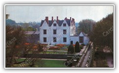 | St Fagans Castle (Better known as a Manor House) | 1980s | Creigiau and St. Fagans | N/A | M Witty | 2011 | CRE004 |
 | Devonia Shop and Post Office on Cyncoed Road | 1930s | Cyncoed and Llanedeyrn | Unknown | Unknown | 2006 | CYN001 |
 | Llanedeyrn Council Housing estate - newly constructed | 1970s | Cyncoed and Llanedeyrn | Unknown | Unknown | 2008 | CYN002 |
 | Chapel Wood | 1970s | Cyncoed and Llanedeyrn | Auction | M Witty | 2024 | CYN003 |
 | Mill Road, at the junction with Cowbridge Road | 1906 | Ely | Unknown | Unknown | 2005 | ELY001 |
 | Crosswells and Ely Breweries, separated by the railway line (Aerial View) | 1950s | Ely | Unknown | Unknown | 2005 | ELY002 |
 | Glan Ely High School pupils protesting on Grand Avenue, about being sent home for not wearing the correct uniform | 1980s | Ely | South Wales Echo | South Wales Echo | 2005 | ELY003 |
 | Aerial View of Ely | 2001 | Ely | Unknown | Unknown | 2006 | ELY004 |
 | Ely Bridge | 1911 | Ely | Cardiff Yesterday 24 / Fred Jones | Unknown | 2006 | ELY005 |
 | Ely Paper Mills (Aerial View) | 1930 | Ely | Unknown | Unknown | 2006 | ELY006 |
 | Ely Paper Mills (Flooded) | 1912 | Ely | Unknown | Unknown | 2006 | ELY007 |
 | Ely Railway Station | 1920s | Ely | Unknown | Unknown | 2006 | ELY008 |
 | Hywel Dda Infant (in situ, middle) and Junior Schools (right, destroyed by arson in 2011), and the outline of the old Nursery (left) demolished in the late 1980s - Aerial View | 2005 | Ely | Unknown | Unknown | 2006 | ELY009 |
 | Parker Place | 2005 | Ely | N/A | M Witty | 2006 | ELY010 |
 | Parker Road | 2005 | Ely | N/A | M Witty | 2006 | ELY011 |
 | Glan Ely High School | 1990s | Ely | Unknown | Unknown | 2007 | ELY012 |
 | Grand Avenue | 1930s | Ely | Unknown | Unknown | 2007 | ELY013 |
 | Ely Brewery | 1910 | Ely | Rudiger Eggert | M Witty | 2015 | ELY014 |
 | Ely Brewery | 1920 | Ely | Rudiger Eggert | M Witty | 2015 | ELY015 |
 | Ely Paper Mill Redevelopment Site (01) | 2008 | Ely | N/A | M Witty | 2018 | ELY016 |
 | Ely Paper Mill Redevelopment Site (02) - Panorama | 2008 | Ely | N/A | M Witty | 2018 | ELY017 |
 | Cambria Road School Sports Field (01) and site of original Hywel Dda Junior School, destroyed by arson in 2011 - Panorama | 2015 | Ely | N/A | M Witty | 2018 | ELY018 |
 | Cambria Road School Sports Field (02) and modern Hywel Dda Schools - Panorama | 2015 | Ely | N/A | M Witty | 2018 | ELY019 |
 | Cambria Road School Sports Field (03) - Upper field - Panorama | 2015 | Ely | N/A | M Witty | 2018 | ELY020 |
 | Ely Paper Mill Redevelopment Site (01 of 06) | 2015 | Ely | N/A | M Witty | 2018 | ELY021 |
 | Ely Paper Mill Redevelopment Site (02 of 06) | 2015 | Ely | N/A | M Witty | 2018 | ELY022 |
 | Ely Paper Mill Redevelopment Site (03 of 06) | 2015 | Ely | N/A | M Witty | 2018 | ELY023 |
 | Ely Paper Mill Redevelopment Site (04 of 06) - Old railway line | 2015 | Ely | N/A | M Witty | 2018 | ELY024 |
 | Ely Paper Mill Redevelopment Site (05 of 06) - Old railway lights | 2015 | Ely | N/A | M Witty | 2018 | ELY025 |
 | Ely Paper Mill Redevelopment Site (06 of 06) | 2015 | Ely | N/A | M Witty | 2018 | ELY026 |
 | Ely Paper Mill Redevelopment Site - Panorama | 2015 | Ely | N/A | M Witty | 2018 | ELY027 |
 | Ely Paper Mill Redevelopment Site (01) (March) - Panorama | 2017 | Ely | N/A | M Witty | 2018 | ELY028 |
 | Ely Paper Mill Redevelopment Site (02) (March) - Old railway bridge (filled in) | 2017 | Ely | N/A | M Witty | 2018 | ELY029 |
 | Ely Paper Mill Redevelopment Site (01) (October) - Panorama | 2017 | Ely | N/A | M Witty | 2018 | ELY030 |
 | Ely Paper Mill Redevelopment Site (02) (October) - Panorama | 2017 | Ely | N/A | M Witty | 2018 | ELY031 |
 | Ely Paper Mill Redevelopment Site - Panorama | 2018 | Ely | N/A | M Witty | 2018 | ELY032 |
 | Ely Paper Mill Redevelopment Site - Panorama | 2019 | Ely | N/A | M Witty | 2021 | ELY033 |
 | Grand Avenue (approaching Wilson Road) | 1960s | Ely | Auction | M Witty | 2024 | ELY034 |
 | McDonald Road | 1960s | Ely | Auction | M Witty | 2024 | ELY035 |
 | Swiss Cottage (built in the 1890's and demolished in 1972) on St. Fagans Road | 1920 | Fairwater | Unknown | Unknown | 2010 | FAI001 |
 | Antonio Luigi 'Tony' Leo | 2000s | Famous Cardiffians | South Wales Echo | Unknown | 2005 | PRO001 |
 | Billy Boston BME | 1950s | Famous Cardiffians | Unknown | Unknown | 2005 | PRO002 |
 | Cerys Matthews | 2000s | Famous Cardiffians | Unknown | Unknown | 2005 | PRO003 |
 | Charlotte Church | 2010s | Famous Cardiffians | Unknown | Unknown | 2005 | PRO004 |
 | Colin Jackson CBE | 2000s | Famous Cardiffians | Unknown | Unknown | 2005 | PRO005 |
 | Dame Shirley Bassey DBE | 1960s | Famous Cardiffians | Unknown | Unknown | 2005 | PRO006 |
 | Dame Tanni Grey-Thompson DBE | 2000s | Famous Cardiffians | Tanni Grey-Thompson DBE | Tanni Grey-Thompson DBE | 2005 | PRO007 |
 | Dannie Abse | 1990s | Famous Cardiffians | Unknown | Unknown | 2005 | PRO008 |
 | Gary Buckland | 2010s | Famous Cardiffians | Hatton Promotions | Hatton Promotions | 2005 | PRO009 |
 | Ivor Novello | 1930s | Famous Cardiffians | Unknown | Unknown | 2005 | PRO010 |
 | Jason Mohammad | 2010s | Famous Cardiffians | BBC Wales | BBC Wales | 2005 | PRO011 |
 | Jeremy Bowen | 2000s | Famous Cardiffians | The Telegraph | Andrew Crowley | 2005 | PRO012 |
 | John Crichton-Stuart | 1830s | Famous Cardiffians | Cardiff Council | Henry Raeburn | 2005 | PRO013 |
 | John Humphrys | 2000s | Famous Cardiffians | Unknown | Unknown | 2005 | PRO014 |
 | John Patrick Crichton-Stuart | 1890s | Famous Cardiffians | Glasgow University | Glasgow University | 2005 | PRO015 |
 | Lynne Bowles | 2010s | Famous Cardiffians | Radio Times | Radio Times | 2005 | PRO016 |
 | Michael Barratt aka Shakin' Stevens | 1990s | Famous Cardiffians | Fabio Nosotti | Fabio Nosotti / Corbis | 2005 | PRO017 |
 | Nicky Piper MBE | 1990s | Famous Cardiffians | Unknown | Unknown | 2005 | PRO018 |
 | Nigel Walker | 2000s | Famous Cardiffians | BBC | BBC | 2005 | PRO019 |
 | Ninjha | 2010s | Famous Cardiffians | Steffan Rhys | 2005 | PRO020 | |
 | Peerless' Jim Driscoll | 1910s | Famous Cardiffians | Unknown | Unknown | 2005 | PRO021 |
 | Roald Dahl | 1980s | Famous Cardiffians | Unknown | Unknown | 2005 | PRO022 |
 | Ryan Giggs | 2010s | Famous Cardiffians | Manchester Evening News | Manchester Evening News | 2005 | PRO023 |
 | Sir Michael Jonathan Moritz KBE | 2010s | Famous Cardiffians | celebritynetworth.com | Unknown | 2005 | PRO024 |
 | Sir Terry Wogan KBE | 2000s | Famous Cardiffians | The Guardian | Lorenzo Agius | 2005 | PRO025 |
 | Sir William Goscombe-John R.A. | 1940s | Famous Cardiffians | findagrave.com | Unknown | 2005 | PRO026 |
 | Steve Andrews aka The Bard of Ely | 1996 | Famous Cardiffians | N/A | M Witty | 2005 | PRO027 |
 | SuperTed | 1980s | Famous Cardiffians | Mike Young / Siriol | Mike Young / Siriol / Abbey Home Media | 2005 | PRO028 |
 | Terry Nation | 1970s | Famous Cardiffians | Unknown | Unknown | 2005 | PRO029 |
 | Heathfield Road and Maitland Street (Aerial View) | 1968 | Gabalfa | Unknown | Unknown | 2006 | GAB001 |
 | View from Gabalfa Flyover, looking towards Llandaff | 2005 | Gabalfa | N/A | M Witty | 2006 | GAB002 |
 | North Road Interchange (aka Gabalfa Flyover) | 1970s | Gabalfa | Unknown | Unknown | 2006 | GAB003 |
 | Building of the Gabalfa Roundabout (Aerial View - directly above) | 1960s | Gabalfa | Unknown | Unknown | 2007 | GAB004 |
 | Building of the Gabalfa Roundabout (Aerial view from the west) | 1960s | Gabalfa | Unknown | Unknown | 2007 | GAB005 |
 | View of Mynachdy from Gabalfa Flyover | 1972 | Gabalfa | Gareth W. Evans | M Witty | 2015 | GAB006 |
 | North Road before the Gabalfa Flyover (St Mark the Evangelist Church on the left) | 1960s | Gabalfa | Unknown | Unknown | 2008 | GAB007 |
 | University Hospital Wales, view from Eastern by-pass | 1970s | Gabalfa | Unknown | Unknown | 2010 | GAB008 |
 | Gabalfa Flyover, view from North Road | 1970s | Gabalfa | Gareth W. Evans | M Witty | 2015 | GAB009 |
 | Heath Hospital (UHW) - View from under the Gabalfa Roundabout | 1972 | Gabalfa | Gareth W. Evans | M Witty | 2015 | GAB010 |
 | View of Western Avenue from Radyr Place Bridge | 1973 | Gabalfa | Gareth W. Evans | M Witty | 2015 | GAB011 |
 | Approaching Gabalfa Flyover | 1972 | Gabalfa | Auction | M Witty | 2024 | GAB012 |
 | Heath Hospital (UHW) - View from the Gabalfa Roundabout | 1972 | Gabalfa | Gordon W Fox (Donated by Bernard Fox (Son) and Family) | M Witty | 2024 | GAB013 |
 | Glan Ely High School Demolition (01) | 2020 | Glan Ely High School Demolition | N/A | M Witty | 2024 | GLA001 |
 | Glan Ely High School Demolition (02) | 2020 | Glan Ely High School Demolition | N/A | M Witty | 2024 | GLA002 |
 | Glan Ely High School Demolition (03) | 2020 | Glan Ely High School Demolition | N/A | M Witty | 2024 | GLA003 |
 | Glan Ely High School Demolition (04) | 2020 | Glan Ely High School Demolition | N/A | M Witty | 2024 | GLA004 |
 | Glan Ely High School Demolition (05) | 2020 | Glan Ely High School Demolition | N/A | M Witty | 2024 | GLA005 |
 | Glan Ely High School Demolition (06) | 2020 | Glan Ely High School Demolition | N/A | M Witty | 2024 | GLA006 |
 | Glan Ely High School Demolition (07) | 2020 | Glan Ely High School Demolition | N/A | M Witty | 2024 | GLA007 |
 | Glan Ely High School Demolition (08) | 2020 | Glan Ely High School Demolition | N/A | M Witty | 2024 | GLA008 |
 | Glan Ely High School Demolition (09) | 2020 | Glan Ely High School Demolition | N/A | M Witty | 2024 | GLA009 |
 | Glan Ely High School Demolition (10) | 2020 | Glan Ely High School Demolition | N/A | M Witty | 2024 | GLA010 |
 | Glan Ely High School Demolition (11) | 2020 | Glan Ely High School Demolition | N/A | M Witty | 2024 | GLA011 |
 | Glan Ely High School Demolition (12) | 2020 | Glan Ely High School Demolition | N/A | M Witty | 2024 | GLA012 |
 | Glan Ely High School Demolition (13) | 2020 | Glan Ely High School Demolition | N/A | M Witty | 2024 | GLA013 |
 | Glan Ely High School Demolition (14) | 2020 | Glan Ely High School Demolition | N/A | M Witty | 2024 | GLA014 |
 | Glan Ely High School Demolition (15) | 2020 | Glan Ely High School Demolition | N/A | M Witty | 2024 | GLA015 |
 | Glan Ely High School Demolition (16) | 2020 | Glan Ely High School Demolition | N/A | M Witty | 2024 | GLA016 |
 | Glan Ely High School Demolition (17) | 2020 | Glan Ely High School Demolition | N/A | M Witty | 2024 | GLA017 |
 | Glan Ely High School Demolition (18) | 2020 | Glan Ely High School Demolition | N/A | M Witty | 2024 | GLA018 |
 | Glan Ely High School Demolition (19) | 2020 | Glan Ely High School Demolition | N/A | M Witty | 2024 | GLA019 |
 | Glan Ely High School Demolition (20) | 2020 | Glan Ely High School Demolition | N/A | M Witty | 2024 | GLA020 |
 | Glan Ely High School Demolition (21) | 2020 | Glan Ely High School Demolition | N/A | M Witty | 2024 | GLA021 |
 | Glan Ely High School Demolition (22) | 2020 | Glan Ely High School Demolition | N/A | M Witty | 2024 | GLA022 |
 | Glan Ely High School Demolition (23) | 2020 | Glan Ely High School Demolition | N/A | M Witty | 2024 | GLA023 |
 | Glan Ely High School Demolition (24) | 2020 | Glan Ely High School Demolition | N/A | M Witty | 2024 | GLA024 |
 | Glan Ely High School Demolition (25) | 2020 | Glan Ely High School Demolition | N/A | M Witty | 2024 | GLA025 |
 | Glan Ely High School Demolition (26) | 2020 | Glan Ely High School Demolition | N/A | M Witty | 2024 | GLA026 |
 | Glan Ely High School Demolition (27) | 2020 | Glan Ely High School Demolition | N/A | M Witty | 2024 | GLA027 |
 | Glan Ely High School Demolition (28) | 2020 | Glan Ely High School Demolition | N/A | M Witty | 2024 | GLA028 |
 | Glan Ely High School Demolition (29) | 2020 | Glan Ely High School Demolition | N/A | M Witty | 2024 | GLA029 |
 | Glan Ely High School Demolition (30) | 2020 | Glan Ely High School Demolition | N/A | M Witty | 2024 | GLA030 |
 | Glan Ely High School Demolition (31) | 2020 | Glan Ely High School Demolition | N/A | M Witty | 2024 | GLA031 |
 | Glan Ely High School Demolition (32) | 2020 | Glan Ely High School Demolition | N/A | M Witty | 2024 | GLA032 |
 | Glan Ely High School Demolition (33) | 2020 | Glan Ely High School Demolition | N/A | M Witty | 2024 | GLA033 |
 | Glan Ely High School Demolition (34) | 2020 | Glan Ely High School Demolition | N/A | M Witty | 2024 | GLA034 |
 | Glan Ely High School Demolition (35) | 2020 | Glan Ely High School Demolition | N/A | M Witty | 2024 | GLA035 |
 | Glan Ely High School Demolition (36) | 2020 | Glan Ely High School Demolition | N/A | M Witty | 2024 | GLA036 |
 | Glan Ely High School Demolition (37) | 2020 | Glan Ely High School Demolition | N/A | M Witty | 2024 | GLA037 |
 | Glan Ely High School Demolition (38) | 2020 | Glan Ely High School Demolition | N/A | M Witty | 2024 | GLA038 |
 | Glan Ely High School Demolition (39) | 2020 | Glan Ely High School Demolition | N/A | M Witty | 2024 | GLA039 |
 | Glan Ely High School Demolition (40) | 2020 | Glan Ely High School Demolition | N/A | M Witty | 2024 | GLA040 |
 | Glan Ely High School Demolition (41) | 2020 | Glan Ely High School Demolition | N/A | M Witty | 2024 | GLA041 |
 | Glan Ely High School Demolition (42) | 2020 | Glan Ely High School Demolition | N/A | M Witty | 2024 | GLA042 |
 | Glan Ely High School Demolition (43) | 2020 | Glan Ely High School Demolition | N/A | M Witty | 2024 | GLA043 |
 | Glan Ely High School Demolition (44) | 2020 | Glan Ely High School Demolition | N/A | M Witty | 2024 | GLA044 |
 | Glan Ely High School Demolition (45) | 2020 | Glan Ely High School Demolition | N/A | M Witty | 2024 | GLA045 |
 | Glan Ely High School Demolition (46) | 2020 | Glan Ely High School Demolition | N/A | M Witty | 2024 | GLA046 |
 | Glan Ely High School Demolition (47) | 2020 | Glan Ely High School Demolition | N/A | M Witty | 2024 | GLA047 |
 | Glan Ely High School Demolition (48) | 2020 | Glan Ely High School Demolition | N/A | M Witty | 2024 | GLA048 |
 | Glan Ely High School Demolition (49) | 2020 | Glan Ely High School Demolition | N/A | M Witty | 2024 | GLA049 |
 | Glan Ely High School Demolition (50) | 2020 | Glan Ely High School Demolition | N/A | M Witty | 2024 | GLA050 |
 | Grange Farm, Clive Street | 1913 | Grangetown | Unknown | Unknown | 2006 | GRA001 |
 | Grange Farm, Clive Street, rear view | 2005 | Grangetown | Steve Duffy - www.grangetowncardiff.co.uk | M Witty | 2006 | GRA002 |
 | Grange Farm, Clive Street, side view | 2005 | Grangetown | Steve Duffy - www.grangetowncardiff.co.uk | M Witty | 2006 | GRA003 |
 | Clarence Road Swing Bridge | 1920s | Grangetown | Unknown | Unknown | 2007 | GRA004 |
 | Grangetown Railway Station | 1901 | Grangetown | David Wilton (Ex-Landlord of the Vulcan Hotel) | M Witty | 2011 | GRA005 |
 | Clarence Road Swing Bridge 01 - Close up of metalwork design | 1970 | Grangetown | Auction | M Witty | 2015 | GRA006 |
 | Clarence Road Swing Bridge 02 - Erection Plaque | 1970 | Grangetown | Auction | M Witty | 2015 | GRA007 |
 | Clarence Road Swing Bridge 03 - Erection Plaque Close Up (Engineer - William Harpur M.Inst.C.E.) | 1970 | Grangetown | Auction | M Witty | 2015 | GRA008 |
 | Clarence Road Swing Bridge 04 - Prior to demolition | 1974 | Grangetown | Auction | M Witty | 2015 | GRA009 |
 | Clarence Road Swing Bridge 05 - Closed for demolition | 1975 | Grangetown | Auction | M Witty | 2015 | GRA010 |
 | Clarence Road Swing Bridge 06 - Demolition (and construction of new bridge) | 1975 | Grangetown | Auction | M Witty | 2015 | GRA011 |
 | Clarence Road Swing Bridge 07 - Demolition | 1975 | Grangetown | Auction | M Witty | 2015 | GRA012 |
 | Clarence Road Swing Bridge 08 - Demolition | 1975 | Grangetown | Auction | M Witty | 2015 | GRA013 |
 | Clarence Road Swing Bridge 09 - Final remains after demolition | 1975 | Grangetown | Auction | M Witty | 2015 | GRA014 |
 | Clarence Road Swing Bridge 10 - Final remains after demolition (view from the new bridge) | 1976 | Grangetown | Auction | M Witty | 2015 | GRA015 |
 | Penarth Road Bridge, view from Taff Mead Embankment | 1977 | Grangetown | Auction | M Witty | 2015 | GRA016 |
 | Clarence Road Railway Goods Station | 1960s | Grangetown | Auction | M Witty | 2015 | GRA017 |
 | Stoughton Street destroyed by bombs (Now Jubilee Street and Sussex Street) | 1940s | Grangetown | Gordon W Fox (Donated by Bernard Fox (Son) and Family) | M Witty | 2024 | GRA018 |
 | The Nu Products Co Ltd and Cafe on Court Road | 1972 | Grangetown | Auction | M Witty | 2024 | GRA019 |
 | Heath Halt Road, after snowfall | 2005 | Heath | N/A | M Witty | 2006 | HEA001 |
 | Heath High Level Station, after snowfall (01) | 2005 | Heath | N/A | M Witty | 2006 | HEA002 |
 | Three Arches Railway Bridge, Heathwood Road | 1974 | Heath | Gareth W. Evans | M Witty | 2007 | HEA003 |
 | University Hospital Wales (UHW) - Close up | 1970s | Heath | Unknown | Unknown | 2010 | HEA004 |
 | Heath House | 1962 | Heath | Paul Vaccari | M Witty | 2011 | HEA005 |
 | Heath High Level Station, after snowfall (02) | 2005 | Heath | N/A | M Witty | 2015 | HEA006 |
 | University Hospital Wales (UHW) Concourse | 2006 | Heath | N/A | M Witty | 2015 | HEA007 |
 | Lightship 2000 - Bridge (01 of 02) | 2009 | Lightship 2000 (Helwick) | Auction | M Witty | 2021 | HEL01 |
 | Lightship 2000 - Bridge (02 of 02) | 2009 | Lightship 2000 (Helwick) | Auction | M Witty | 2021 | HEL02 |
 | Lightship 2000 - Chapel (01 of 02) | 2009 | Lightship 2000 (Helwick) | Auction | M Witty | 2021 | HEL03 |
 | Lightship 2000 - Chapel (02 of 02) | 2009 | Lightship 2000 (Helwick) | Auction | M Witty | 2021 | HEL04 |
 | Lightship 2000 - Comms Equipment | 2009 | Lightship 2000 (Helwick) | Auction | M Witty | 2021 | HEL05 |
 | Lightship 2000 - Crew Roster | 2009 | Lightship 2000 (Helwick) | Auction | M Witty | 2021 | HEL06 |
 | Lightship 2000 - Engine Room | 2009 | Lightship 2000 (Helwick) | Auction | M Witty | 2021 | HEL07 |
 | Lightship 2000 - External Bow View | 2009 | Lightship 2000 (Helwick) | Auction | M Witty | 2021 | HEL08 |
 | Lightship 2000 - External Port View | 2009 | Lightship 2000 (Helwick) | Auction | M Witty | 2021 | HEL09 |
 | Lightship 2000 - External Starboard View | 2009 | Lightship 2000 (Helwick) | Auction | M Witty | 2021 | HEL10 |
 | Lightship 2000 - Library | 2009 | Lightship 2000 (Helwick) | Auction | M Witty | 2021 | HEL11 |
 | Lightship 2000 - Lifeboat | 2009 | Lightship 2000 (Helwick) | Auction | M Witty | 2021 | HEL12 |
 | Lightship 2000 - Light Tower Close Up | 2009 | Lightship 2000 (Helwick) | Auction | M Witty | 2021 | HEL13 |
 | Lightship 2000 - Light Tower | 2009 | Lightship 2000 (Helwick) | Auction | M Witty | 2021 | HEL14 |
 | Lightship 2000 - Main Switchboard | 2009 | Lightship 2000 (Helwick) | Auction | M Witty | 2021 | HEL15 |
 | Lightship 2000 - Power Gauges | 2009 | Lightship 2000 (Helwick) | Auction | M Witty | 2021 | HEL16 |
 | Lightship 2000 - Sleeping Quarters (01 of 05) | 2009 | Lightship 2000 (Helwick) | Auction | M Witty | 2021 | HEL17 |
 | Lightship 2000 - Sleeping Quarters (02 of 05) | 2009 | Lightship 2000 (Helwick) | Auction | M Witty | 2021 | HEL18 |
 | Lightship 2000 - Sleeping Quarters (03 of 05) | 2009 | Lightship 2000 (Helwick) | Auction | M Witty | 2021 | HEL19 |
 | Lightship 2000 - Sleeping Quarters (04 of 05) | 2009 | Lightship 2000 (Helwick) | Auction | M Witty | 2021 | HEL20 |
 | Lightship 2000 - Sleeping Quarters (05 of 05) | 2009 | Lightship 2000 (Helwick) | Auction | M Witty | 2021 | HEL21 |
 | Lightship 2000 - View of the Bow | 2009 | Lightship 2000 (Helwick) | Auction | M Witty | 2021 | HEL22 |
 | Lightship 2000 - Winch and Lifeboat | 2009 | Lightship 2000 (Helwick) | Auction | M Witty | 2021 | HEL23 |
 | Lightship 2000 - Winch Mechanism | 2009 | Lightship 2000 (Helwick) | Auction | M Witty | 2021 | HEL24 |
 | Lightship 2000 - Winch | 2009 | Lightship 2000 (Helwick) | Auction | M Witty | 2021 | HEL25 |
 | Fairwater Road, Llandaff | 1920 | Llandaff | Unknown | Unknown | 2007 | LLA001 |
 | Open Air Pool at Llandaff Fields | 1963 | Llandaff | Jim Stubbs | M Witty | 2007 | LLA002 |
 | Bridge Street, and the Heathcock Pub | 1974 | Llandaff | Gareth W. Evans | M Witty | 2007 | LLA003 |
 | Fairwater Road, Llandaff | 1900s | Llandaff | Unknown | Unknown | 2007 | LLA004 |
 | Llandaff Cathedral, Nave East | 1893 | Llandaff | Unknown | Unknown | 2008 | LLA005 |
 | Llandaff High Street | 1910 | Llandaff | Unknown | Unknown | 2008 | LLA006 |
 | Llandaff Mill Stream | 1930s | Llandaff | Unknown | Unknown | 2008 | LLA007 |
 | Llandaff Cathedral (01) | 1970 | Llandaff | N/A | M Witty | 2015 | LLA008 |
 | Llandaff Cathedral (02) | 1970 | Llandaff | N/A | M Witty | 2015 | LLA009 |
 | Station Road, and the Railway Hotel pub | 1912 | Llandaff North | Cardiff Yesterday 02 / Fred Jones | Unknown | 2007 | LLN001 |
 | Llandaff Railway Station - An example of the architecture from decades ago | 2007 | Llandaff North | N/A | M Witty | 2007 | LLN002 |
 | Llandaff Railway Station which was opened in 1840. The train is departing for Pontypridd | 2007 | Llandaff North | N/A | M Witty | 2007 | LLN003 |
 | Ball Road, and a Cardiff Bus making its way back to Central Station | 1972 | Llanrumney | Unknown | Unknown | 2005 | LLR001 |
 | Fidlas Road | 1910 | Llanishen and Ty Glas | Unknown | Unknown | 2007 | LLT001 |
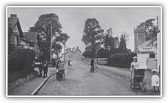 | Llanishen Village (the Post and Telegraph Offices are on the left) | 1912 | Llanishen and Ty Glas | Cardiff Yesterday 02 / Fred Jones | Unknown | 2008 | LLT002 |
 | Cooks Cottages, opposite Elm Cottage in Heol Hir | 1936 | Llanishen and Ty Glas | Bill Phelps | Unknown | 2009 | LLT003 |
 | Elm Cottage, at the village end of Heol Hir | 1936 | Llanishen and Ty Glas | Bill Phelps | Unknown | 2009 | LLT004 |
 | Brocklehurst Yarns Nylon Factory | 1950s | Llanishen and Ty Glas | Gordon W Fox (Donated by Bernard Fox (Son) and Family) | M Witty | 2024 | LLT005 |
 | Cardiff viewed from the Garth Mountain | 1973 | Pentyrch and Tongwynlais | Gareth W. Evans | M Witty | 2007 | PEN001 |
 | St. Michael and All Angels Church, Merthyr Road | 2008 | Pentyrch and Tongwynlais | N/A | M Witty | 2008 | PEN002 |
 | Castell Coch (Red Castle), view from Tongwynlais Village | 2008 | Pentyrch and Tongwynlais | N/A | M Witty | 2015 | PEN003 |
 | View of Taffs Well and Walnut Tree Viaduct from The Garth | 1950s | Pentyrch and Tongwynlais | Gordon W Fox (Donated by Bernard Fox (Son) and Family) | M Witty | 2024 | PEN004 |
 | St James the Great, and Roath Road Wesleyan Churches on the junction of City and Newport Roads | 1896 | Plasnewydd | Unknown | Unknown | 2006 | PLA001 |
 | City Road junction with Newport Road | 1937 | Plasnewydd | Cardiff Yesterday 02 / H. B. Priestley | Unknown | 2007 | PLA002 |
 | Glossop Road, junction with City and Newport Roads | 2006 | Plasnewydd | N/A | M Witty | 2007 | PLA003 |
 | City Road Car Showrooms (01) | 1988 | Plasnewydd | Steve and Ann Witty | M Witty | 2008 | PLA004 |
 | City Road Car Showrooms (02) | 1988 | Plasnewydd | Steve and Ann Witty | M Witty | 2008 | PLA005 |
 | City Road Car Showrooms (03) | 1988 | Plasnewydd | Steve and Ann Witty | M Witty | 2008 | PLA006 |
 | St. Peters Church, St. Peters Street | 1940s | Plasnewydd | Unknown | Unknown | 2010 | PLA007 |
 | City Road Wesleyan Methodist Church - demolished in 1955 (St James Church lies ahead) | 1950s | Plasnewydd | Unknown | Unknown | 2015 | PLA008 |
 | 75 City Road | 1930s | Plasnewydd | Gordon W Fox (Donated by Bernard Fox (Son) and Family) | M Witty | 2024 | PLA009 |
 | 2 and 4 Angus Street destroyed by WWII bombs (Albany Road Methodist Chapel in background) | 1940 | Plasnewydd | Gordon W Fox (Donated by Bernard Fox (Son) and Family) | M Witty | 2024 | PLA010 |
 | Albany Road English Wesleyan Methodist Chapel roof damaged by WWII bombs (Junction of Albany Road and Bangor Street - Built 1898, Grade 2 Listed) | 1940 | Plasnewydd | Gordon W Fox (Donated by Bernard Fox (Son) and Family) | M Witty | 2024 | PLA011 |
 | Bomb Damage - 1 and 3 Angus Street destroyed (A.G. Meek Shoe Shop damaged) | 1940 | Plasnewydd | Gordon W Fox (Donated by Bernard Fox (Son) and Family) | M Witty | 2024 | PLA012 |
 | Byron Street Motors, looking towards City Road (Capital Tower in distance) | 1950s | Plasnewydd | Gordon W Fox (Donated by Bernard Fox (Son) and Family) | M Witty | 2024 | PLA013 |
 | Crofts Street | 1950s | Plasnewydd | Gordon W Fox (Donated by Bernard Fox (Son) and Family) | M Witty | 2024 | PLA014 |
 | Roath Castle Hotel Public House, Penlline Street | 1950s | Plasnewydd | Gordon W Fox (Donated by Bernard Fox (Son) and Family) | M Witty | 2024 | PLA015 |
 | Wellfield Road and the Globe Theatre | 1951 | Plasnewydd | Gordon W Fox (Donated by Bernard Fox (Son) and Family) | M Witty | 2024 | PLA016 |
 | Radyr Train Station | 1960s | Radyr and Morganstown | Unknown | Unknown | 2005 | RAD001 |
 | Ty-Nant Road - Looking North | 1974 | Radyr and Morganstown | Gareth W. Evans | M Witty | 2007 | RAD002 |
 | Melingriffith Water Pump Workings in Radyr (01 of 02) | 2008 | Radyr and Morganstown | N/A | M Witty | 2008 | RAD003 |
 | Melingriffith Water Pump Workings in Radyr (02 of 02) | 2008 | Radyr and Morganstown | N/A | M Witty | 2008 | RAD004 |
 | Radyr Bridge - Connects the Taff Trail to Radyr Village and the Railway Station | 2008 | Radyr and Morganstown | N/A | M Witty | 2008 | RAD005 |
 | Melingriffith Overflow (01 of 02) | 2013 | Radyr and Morganstown | N/A | M Witty | 2015 | RAD006 |
 | Melingriffith Overflow (02 of 02) | 2013 | Radyr and Morganstown | N/A | M Witty | 2015 | RAD007 |
 | Melingriffith and Pentryrch Tramway (1815-1871) - Small section of track preserved as an architectural reminder | 2013 | Radyr and Morganstown | N/A | M Witty | 2015 | RAD008 |
 | Pen-y-Dre | 1926 | Rhiwbina | Unknown | Unknown | 2011 | RHW001 |
 | Rhiwbina School (newly constructed) | 1928 | Rhiwbina | Unknown | Unknown | 2011 | RHW002 |
 | Rhiwbina Halt (Railway Station) - The footbridge and a single track are still in use in 2021 | 1929 | Rhiwbina | Unknown | Unknown | 2011 | RHW003 |
 | Monico Cinema on Pantbach Road (converted into flats in 2003) | 2001 | Rhiwbina | Unknown | Unknown | 2011 | RHW004 |
 | Aerial view of Rhiwbina Garden Village | 1920s | Rhiwbina | Unknown | Unknown | 2011 | RHW005 |
 | Heol-y-Deri and Beulah Road Junction | 1920s | Rhiwbina | Unknown | Unknown | 2011 | RHW006 |
 | Lon-y-Dail (01) | 1920s | Rhiwbina | Unknown | Unknown | 2011 | RHW007 |
 | Lon-y-Dail (02) | 1920s | Rhiwbina | Unknown | Unknown | 2011 | RHW008 |
 | Lon Isa | 1930s | Rhiwbina | Unknown | Unknown | 2011 | RHW009 |
 | No. 38 Bus travels through Rhiwbina Garden Village | 1930s | Rhiwbina | Unknown | Unknown | 2011 | RHW010 |
 | The Tea Rooms (owned by William Smart) and ROP Petrol Pumps | 1930s | Rhiwbina | Unknown | Unknown | 2011 | RHW011 |
 | Beulah Road | 1950s | Rhiwbina | Unknown | Unknown | 2011 | RHW012 |
 | View of the (Rhiwbina) Wenallt Reservoir off Rhiwbina Hill | 1950s | Rhiwbina | Unknown | Unknown | 2011 | RHW013 |
 | Heol-y-Deri and Beulah Road Junction | 1960s | Rhiwbina | Unknown | Unknown | 2011 | RHW014 |
 | Heol-y-Deri and Beulah Road Junction | 2003 | Rhiwbina | Unknown | Unknown | 2015 | RHW015 |
 | Monico Cinema, Pre Demolition | 2008 | Rhiwbina | Unknown | Unknown | 2015 | RHW016 |
 | Monico Cinema, Undergoing Demolition | 2009 | Rhiwbina | David Thomas | M Witty | 2015 | RHW017 |
 | Rhiwbina Garages | 1920s | Rhiwbina | Unknown | Unknown | 2015 | RHW018 |
 | Heol-y-Deri and Beulah Road Junction | 1970s | Rhiwbina | Unknown | Unknown | 2015 | RHW019 |
 | Rawden Place, view from De Burgh Street, following a raid in the second World War | 1941 | Riverside | Unknown | Unknown | 2008 | RIV001 |
 | Neville Street | 1978 | Riverside | Steve and Ann Witty | M Witty | 2008 | RIV002 |
 | Bandstand, Roath Park | 1920s | Penylan and Roath | Unknown | Unknown | 2005 | ROA001 |
 | Waterfall, Roath Park | 1920s | Penylan and Roath | Unknown | Unknown | 2005 | ROA002 |
 | St. Margaret's Church in Roath was which demolished in 1869 | 1860s | Penylan and Roath | Unknown | Unknown | 2006 | ROA003 |
 | Roath Park Lake, a fisherman sat on the bank at | 1973 | Penylan and Roath | Gareth W. Evans | M Witty | 2007 | ROA004 |
 | Roath Power Station, Colchester Avenue | 1974 | Penylan and Roath | Gareth W. Evans | M Witty | 2007 | ROA005 |
 | Roath Park Lake (frozen over) | 1981 | Penylan and Roath | Nick Lia | M Witty | 2015 | ROA006 |
 | Tram Sheds, Newport Road | 1970 | Penylan and Roath | Unknown | M Witty | 2015 | ROA007 |
 | Victorian Commercial Launderette (33 Marlborough Road), Demolished 2012 (01) | 2007 | Penylan and Roath | N/A | M Witty | 2015 | ROA008 |
 | Victorian Commercial Launderette (33 Marlborough Road), Demolished 2012 (02) | 2007 | Penylan and Roath | N/A | M Witty | 2015 | ROA009 |
 | Victorian Commercial Launderette (33 Marlborough Road), Demolished 2012 (03) | 2007 | Penylan and Roath | N/A | M Witty | 2015 | ROA010 |
 | Victorian Commercial Launderette (33 Marlborough Road), Demolished 2012 (04) | 2007 | Penylan and Roath | N/A | M Witty | 2015 | ROA011 |
 | View of Colchester Avenue Power Station's last cooling tower from Eastern Avenue (Dorchester Avenue Houses in foreground) | 1972 | Penylan and Roath | Auction | M Witty | 2024 | ROA012 |
 | The Cross Inn | 1896 | Rumney | Jan Leak | M Witty | 2011 | RUM001 |
 | Rumney Memorial Hall | 1950s | Rumney | Jan Leak | M Witty | 2011 | RUM002 |
 | St Augustine's Church | 1950s | Rumney | Jan Leak | M Witty | 2011 | RUM003 |
 | The Rompney Castle, Wentloog Road | 1950s | Rumney | Jan Leak | M Witty | 2011 | RUM004 |
 | (1950s) Newport Rd - Bottom of Rumney Hill (Rumney Pottery to the right, now demolished Brandon Tool Hire centre left) | 1950s | Rumney | Gordon W Fox (Donated by Bernard Fox (Son) and Family) | M Witty | 2024 | RUM005 |
 | Thayers Factory - Wentloog Road | 1972 | Rumney | Auction | M Witty | 2024 | RUM006 |
 | Gallamuir Road (No. 7) | 1956 | Splott and Tremorfa | Jim Stubbs | M Witty | 2007 | SPL001 |
 | Dowlais Works | 1960 | Splott and Tremorfa | Jim Stubbs | M Witty | 2007 | SPL002 |
 | View from Pengam Road Bridge (now Rover Way) (01) | 1960 | Splott and Tremorfa | Jim Stubbs | M Witty | 2007 | SPL003 |
 | East Moors Road, looking North | 1974 | Splott and Tremorfa | Gareth W. Evans | M Witty | 2007 | SPL004 |
 | East Moors Road (01) - (Cardiff Galvanizers 1969 Ltd) | 2007 | Splott and Tremorfa | N/A | M Witty | 2007 | SPL005 |
 | East Moors Road (02) | 2007 | Splott and Tremorfa | N/A | M Witty | 2007 | SPL006 |
 | Splott Baseball Team | 1920s | Splott and Tremorfa | Jim Stubbs | Unknown | 2007 | SPL007 |
 | East Moors Roll Mill | 1978 | Splott and Tremorfa | Unknown | Unknown | 2015 | SPL008 |
 | Splotland Board School, Splott Road, Demolished in 1971 | 1903 | Splott and Tremorfa | South Glamorgan County Libraries | Unknown | 2015 | SPL009 |
 | Splott Road | 1982 | Splott and Tremorfa | South Glamorgan County Libraries | Unknown | 2015 | SPL010 |
 | Top of Portmanmoor Road, looking towards Walker Street (Fleurs Sports and Social Club at top left) | 1970s | Splott and Tremorfa | Gordon W Fox (Donated by Bernard Fox (Son) and Family) | M Witty | 2024 | SPL011 |
 | Celsa Steel Recycling Facilities | 2021 | Splott and Tremorfa | N/A | M Witty | 2024 | SPL012 |
 | Fox and Hounds Pub, on the junction with Newport Road and Chapel Row | 1914 | Pontprennau and St. Mellons | Cardiff Yesterday 02 / Fred Jones | Unknown | 2007 | STM001 |
 | Willowbrook Drive Park, after snow | 2010 | Pontprennau and St. Mellons | N/A | M Witty | 2015 | STM002 |
 | Crockherbtown Sidings 01 - Lines to Cathays, view from Queen Street Station | 1960s | Transport | Clipping from an old railway magazine | Unknown | 2006 | TRA001 |
 | Crockherbtown Sidings 02 - Lines to Caerphilly, view from Queen Street Station | 1960s | Transport | Clipping from an old railway magazine | Unknown | 2006 | TRA002 |
 | Crockherbtown Sidings 03 - View of the lines leading to Splott Woodyards and Queen Street Station | 1960s | Transport | Clipping from an old railway magazine | Unknown | 2007 | TRA003 |
 | MFD 643 Bus AEC Regent KG 5005 - Location Unknown | 1948 | Transport | Auction | M Witty | 2015 | TRA004 |
 | British Railways Steam Loco 41 at East Dock Shed | 1955 | Transport | Auction | M Witty | 2015 | TRA005 |
 | Steam Loco 6416 at Cardiff Cathays | 1956 | Transport | Auction | M Witty | 2015 | TRA006 |
 | Cardiff Trolleybus Bristol KW6G Bruce H33 DUH 311 on Wood Street | 1961 | Transport | Auction | M Witty | 2015 | TRA007 |
 | Cardiff Bus EBO 899 on Wood Street | 1961 | Transport | Auction | M Witty | 2015 | TRA008 |
 | Cardiff Trolleybus 255 EBO 912 BUT 9641T approaching Wood Street | 1966 | Transport | Auction | M Witty | 2015 | TRA009 |
 | Cardiff Trolleybus 273 FBO 93, Victoria Park, Canton | 1968 | Transport | Auction | M Witty | 2015 | TRA010 |
 | Cardiff Trolleybus 275 KBO 948, Clive Arms, Canton | 1968 | Transport | Auction | M Witty | 2015 | TRA011 |
 | Cardiff Trolleybus 275 KBO 948, Grand Avenue, Ely | 1968 | Transport | Auction | M Witty | 2015 | TRA012 |
 | Cardiff Trolleybus 282 KBO 955, Route 10B, Grand Avenue, Ely | 1968 | Transport | Auction | M Witty | 2015 | TRA013 |
 | Cardiff Trolleybus EBO 919 and DBO 475 on High Street | 1968 | Transport | Auction | M Witty | 2015 | TRA014 |
 | Cardiff Bus Daimler Fleetine PKG 545H | 1968 | Transport | Auction | M Witty | 2015 | TRA015 |
 | Newport Bristol Bus RESL ECW No. 101 JDW 301F passing Rover Way | 1968 | Transport | Auction | M Witty | 2015 | TRA016 |
 | Cardiff Trolleybus 275 KBO 948 on Newport Road | 1968 | Transport | Auction | M Witty | 2015 | TRA017 |
 | Cardiff Trolleybus 220 DBO 480 Route 10A, Macdonald Road, Ely | 1969 | Transport | Auction | M Witty | 2015 | TRA018 |
 | Cardiff Trolleybus 285 KBO 958, Grand Avenue, Ely | 1969 | Transport | Auction | M Witty | 2015 | TRA019 |
 | Cardiff Bus Guy Arab Alexander EUH 469D at Central Square | 1969 | Transport | Auction | M Witty | 2015 | TRA020 |
 | Cardiff Bus Daimler Fleetline Willowbrook PKG 532H on Greyfriars Road | 1969 | Transport | Auction | M Witty | 2015 | TRA021 |
 | Cardiff Trolleybus 277 KBO 950, towed by ex-Rotherham Corporation Bristol L5G converted bus, Ely Bridge | 1970 | Transport | Auction | M Witty | 2015 | TRA022 |
 | Cardiff Bus Daimler Fleetline PKG 550H Silexine Paint at Mill Lane Market (Barbarellas Club in distance) | 1971 | Transport | Auction | M Witty | 2015 | TRA023 |
 | Cardiff Bus Leyland PD2 East Lancs 393 BUH at Central Station | 1972 | Transport | Auction | M Witty | 2015 | TRA024 |
 | Queen Street Railway Station, view from Platform 1 | 1972 | Transport | Auction | M Witty | 2015 | TRA025 |
 | Cardiff Bus Daimler Fleetline Metro Cammell JKG 488F (Steel must stay in Cardiff) | 1973 | Transport | Auction | M Witty | 2015 | TRA026 |
 | Class 120 B554 at Health Halt (Low Level) | 1973 | Transport | Auction | M Witty | 2015 | TRA027 |
 | Multiple Class 100 DMUs at Heath Halt (High Level) | 1973 | Transport | Auction | M Witty | 2015 | TRA028 |
 | Cardiff Bus AEC Swift MP2R Alexander W Type B47D MBO 519F at Wyndham Arcade, St Mary Street | 1974 | Transport | Auction | M Witty | 2015 | TRA029 |
 | Cardiff Bus AEC Swift MP2R Alexander W Type B47D MBO 521F at Cardiff Central | 1974 | Transport | Auction | M Witty | 2015 | TRA030 |
 | Cardiff Bus AEC Swift MP2R Alexander W Type B47D MBO 522F at Cardiff Central | 1974 | Transport | Auction | M Witty | 2015 | TRA031 |
 | Cardiff Bus Daimler Fleetline JKG 488F at Wood Street | 1975 | Transport | Auction | M Witty | 2015 | TRA032 |
 | East Lancs bodied Leyland Titan AHB 134B Bus at Cardiff Central | 1975 | Transport | Auction | M Witty | 2015 | TRA033 |
 | Cardiff Bus Guy Arab Open Top 424 ABO 424B at Central Square | 1975 | Transport | Auction | M Witty | 2015 | TRA034 |
 | Cardiff Queen Street Railway Station - Frontage | 1975 | Transport | Auction | M Witty | 2015 | TRA035 |
 | Diesel Locomotives at Cardiff Canton | 1976 | Transport | Auction | M Witty | 2015 | TRA036 |
 | Cardiff Bus Guy Arab Alexander ABO 420B at Central Station | 1977 | Transport | Auction | M Witty | 2015 | TRA037 |
 | Cardiff Buses passing Evan Roberts - Junction of North Road and Queen Street | 1979 | Transport | Auction | M Witty | 2015 | TRA038 |
 | Cardiff Bus Alexander WTG 343T at Cardiff Central | 1979 | Transport | Auction | M Witty | 2015 | TRA039 |
 | DMU C450 arriving at Cardiff Central | 1980 | Transport | Auction | M Witty | 2015 | TRA040 |
 | DMU C453 and SU L101, Cardiff Central | 1980 | Transport | Auction | M Witty | 2015 | TRA041 |
 | Class 25 Locomotive 055 at Cardiff Central | 1980 | Transport | Auction | M Witty | 2015 | TRA042 |
 | Class 37 Locomotive 213 at Cardiff Central | 1980 | Transport | Auction | M Witty | 2015 | TRA043 |
 | Class 37 Locomotive 251 at Cardiff Central | 1980 | Transport | Auction | M Witty | 2015 | TRA044 |
 | Class 45 Locomotive 062 approaching Cardiff Central | 1980 | Transport | Auction | M Witty | 2015 | TRA045 |
 | Class 56 Locomotives 56037 and 56043, Cardiff Central | 1980 | Transport | Auction | M Witty | 2015 | TRA046 |
 | Cardiff Bus Bristol Alexander CTX 388V at Central Station | 1980 | Transport | Auction | M Witty | 2015 | TRA047 |
 | C-K of Cardiff Bus Leyland Tital PD, Bed 724C Ex Warrington at Dumfries Place | 1981 | Transport | Auction | M Witty | 2015 | TRA048 |
 | Cardiff Open Top Bus Daimler Fleetline JKG 485F at National Museum of Wales | 1981 | Transport | Auction | M Witty | 2015 | TRA049 |
 | Diesel-Electric Class 56 No. 56041 and Class 47s at Cardiff Canton | 1982 | Transport | Auction | M Witty | 2015 | TRA050 |
 | South Wales Transport Bus Bristol VR ECW no.979 BEP 979V - X1 to Swansea, Scott Road | 1982 | Transport | Auction | M Witty | 2015 | TRA051 |
 | Cardiff Bus Volvo Ailsa NDW 409X on North Road | 1983 | Transport | Auction | M Witty | 2015 | TRA052 |
 | Cardiff Bus Leyland Olympian, B55 9ATX, No 30, Central Station | 1985 | Transport | Auction | M Witty | 2015 | TRA053 |
 | Cardiff Bus Seddon Pennine 4 MJK 94L on Wood Street | 1986 | Transport | Auction | M Witty | 2015 | TRA054 |
 | Class 37 Diesel-Electric Loco 37177 departing Cardiff Central | 1986 | Transport | Auction | M Witty | 2015 | TRA055 |
 | Class 47 Diesel-Electric Loco 47112 passing through Cardiff Central | 1986 | Transport | Auction | M Witty | 2015 | TRA056 |
 | Class 37 Diesel Loco 37505 departing Cardiff Central | 1986 | Transport | Auction | M Witty | 2015 | TRA057 |
 | Cardiff Bus Bristol VRT Willowbrook SWO 306S on Wood Street | 1987 | Transport | Auction | M Witty | 2015 | TRA058 |
 | Class 37 Diesel-Electric Loco 37146 at Cardiff Central | 1990 | Transport | Auction | M Witty | 2015 | TRA059 |
 | Class 37 Diesel-Electric Loco 37158 passing through Cardiff Central | 1990 | Transport | Auction | M Witty | 2015 | TRA060 |
 | Class 37 Diesel-Electric Loco 37797 at Cardiff Central | 1991 | Transport | Auction | M Witty | 2015 | TRA061 |
 | Class 37 Diesel-Electric Loco 37350 passing through Cardiff Central | 1991 | Transport | Auction | M Witty | 2015 | TRA062 |
 | Class 37 Diesel-Electric Loco 37885 passing through Cardiff Central | 1991 | Transport | Auction | M Witty | 2015 | TRA063 |
 | Class 37 Diesel-Electric Loco 37048 at Cardiff Central | 1993 | Transport | Auction | M Witty | 2015 | TRA064 |
 | Optare Metrorider N142 PTG, Central Station | 1996 | Transport | Auction | M Witty | 2015 | TRA065 |
 | Cardiff Trolleybus AEC 664T no.209 CKG 199 at Roath Depot | 1950s | Transport | Auction | M Witty | 2015 | TRA066 |
 | Cardiff Trolleybus BUT 9641T Trolleybus 282 KBO 955 at Roath Depot | 1950s | Transport | Auction | M Witty | 2015 | TRA067 |
 | Cardiff Bus AEC Regent II Air Dispatch double deck DKG 835 outside Herbert (Greyfriars) House | 1950s | Transport | Auction | M Witty | 2015 | TRA068 |
 | Cardiff Bus Bristol K6A CKG 670 on Wood Street | 1950s | Transport | Auction | M Witty | 2015 | TRA069 |
 | Hulley (Baslow) Bus LRB 750 at Cardiff Central | 1950s | Transport | Auction | M Witty | 2015 | TRA070 |
 | Class 52 D1072 and 6657 with Western Glory Rolling Stones chalked (GWR 113), Central | 1960s | Transport | Auction | M Witty | 2015 | TRA071 |
 | Cardiff Trolleybus 286 KBO 959 1955 BUT 9641T East Lancs H70R on Wood Street | 1960s | Transport | Auction | M Witty | 2015 | TRA072 |
 | Cardiff Bus Bristol VRT ECW - PKG 589M at Cardiff Central | 1970s | Transport | Auction | M Witty | 2015 | TRA073 |
 | Class 08 D3371 at Cardiff Queen Street | 1970s | Transport | Auction | M Witty | 2015 | TRA074 |
 | Cardiff Bus Daimler Fleetline Metro-Cammell JKG 482F at Central Station | 1970s | Transport | Auction | M Witty | 2015 | TRA075 |
 | Cardiff Bus Daimler Fleetline Willowbrook PKG 547H and PKG 550H (experimental livery) at Park Place | 1970s | Transport | Auction | M Witty | 2015 | TRA076 |
 | Cardiff Bus Daimler Fleetline MCW K-liner WUH 571K on corner of Churchill Way and Queen Street | 1970s | Transport | Auction | M Witty | 2015 | TRA077 |
 | Cardiff Bus Daimler Fleetline Willowbrook PKG 533H at Central Station | 1970s | Transport | Auction | M Witty | 2015 | TRA078 |
 | Cardiff Bus Bristol VRT PKG 593M on Caerphilly Road | 1970s | Transport | Auction | M Witty | 2015 | TRA079 |
 | Cardiff Bus Guy Arab EUH 438D and Western Welsh Leyland PKG 632G approaching Central Square (Wales Empire Pool in background) | 1970s | Transport | Auction | M Witty | 2015 | TRA080 |
 | Cardiff Bus Guy Arab EUH 461D approaching Central Station | 1970s | Transport | Auction | M Witty | 2015 | TRA081 |
 | Cardiff Bus Guy Arab V Alexander EUH 440D approaching Central Station | 1970s | Transport | Auction | M Witty | 2015 | TRA082 |
 | Cardiff Bus Guy Arab V Alexander EUH 445D at Central Station | 1970s | Transport | Auction | M Witty | 2015 | TRA083 |
| Cardiff Bus Daimler Fleetline Willowbrook PKG 547H and PKG 550H (experimental livery) at Park Place | 1970s | Transport | Auction | M Witty | 2015 | TRA084 |
 | Western Welsh Bus LR1262 XUH 343 (303 to Cadoxton) at Cardiff Central | 1970s | Transport | Auction | M Witty | 2015 | TRA085 |
 | Western Welsh Bus VKG 323 approaching Cardiff Central | 1970s | Transport | Auction | M Witty | 2015 | TRA086 |
 | Western Welsh Bus XBO 522K approaching Cardiff Central | 1970s | Transport | Auction | M Witty | 2015 | TRA087 |
 | Cardiff Bus Willowbrook PKG 532H Daimler Fleetline on Adam Street, heading west to town | 1970s | Transport | Auction | M Witty | 2015 | TRA088 |
 | Cardiff Bluebird Bus M200 CBB, No 262, Castle Street | 1980s | Transport | Auction | M Witty | 2015 | TRA089 |
 | Cardiff Bluebird Bus UWW 519X, No 262, Wood Street | 1980s | Transport | Auction | M Witty | 2015 | TRA090 |
 | Cardiff Bluebird Bus, Tellings Golden Miller (TGM), F101 YVP, No 207, Castle Street | 1980s | Transport | Auction | M Witty | 2015 | TRA091 |
 | Cardiff Transport 287 L287 ETG at High Street | 1980s | Transport | Auction | M Witty | 2015 | TRA092 |
 | Cardiff Bus Guy Arab Alexander EUH 451D (No 57) at Queen Street | 1980s | Transport | Auction | M Witty | 2015 | TRA093 |
 | Loco 37184 approaching Cardiff Central | 1980s | Transport | Auction | M Witty | 2015 | TRA094 |
 | Cardiff Leyland National GBO 143N (No 39) at Central Station | 1980s | Transport | Auction | M Witty | 2015 | TRA095 |
 | Cardiff Bus Bristol VRT ECW Alexander Willowbrook PKG 600M, WTG 330T and SWO 324S at Sloper Road Depot | 1990s | Transport | Auction | M Witty | 2015 | TRA096 |
 | Cardiff Bus Bristol VRT Willowbrook, SWO 314S (No 58) at Kingsway | 1990s | Transport | Auction | M Witty | 2015 | TRA097 |
 | Cardiff Bus Leyland Lynx F247 CNY (No 12 for Ely) at Kingsway | 1990s | Transport | Auction | M Witty | 2015 | TRA098 |
 | Various Cardiff Bus Volvo Saloon and Leyland Lynx at Central Station | 1990s | Transport | Auction | M Witty | 2015 | TRA099 |
 | Cardiff Bus Volvo Ailsa NDW 406X (No 13 to Ely) on Wood Street | 1990s | Transport | Auction | M Witty | 2015 | TRA100 |
 | Cardiff Bus Bristol VRT Alexander WTG 359T on Kingsway | 1998 | Transport | Auction | M Witty | 2016 | TRA101 |
 | Cardiff General Station (Looking East) | 1950 | Transport | Auction | M Witty | 2018 | TRA102 |
 | Cardiff General Station - Frontage | 1950 | Transport | Auction | M Witty | 2018 | TRA103 |
 | Western Welsh ex-Devon General AEC Regent Bus JUO 559 at Central Station | 1961 | Transport | Auction | M Witty | 2018 | TRA104 |
 | Neath and Cardiff AEC Reliance Bus 568 ECY at Central Station | 1964 | Transport | Auction | M Witty | 2018 | TRA105 |
 | Bute Road Railway Station - Platform View | 1965 | Transport | Auction | M Witty | 2018 | TRA106 |
 | Bute Road Railway Station - Frontage and Shop | 1965 | Transport | Auction | M Witty | 2018 | TRA107 |
 | Taffs Well Station and Walnut Tree Viaduct | 1965 | Transport | Auction | M Witty | 2018 | TRA108 |
 | Cardiff Bus Daimler LBO 525 at Canton Bridge | 1968 | Transport | Auction | M Witty | 2018 | TRA109 |
 | Cardiff Bus Leyland 400 BUH at Canton Bridge | 1968 | Transport | Auction | M Witty | 2018 | TRA110 |
 | Cardiff Trolleybus 228 DUH 723 on Newport Road | 1969 | Transport | Auction | M Witty | 2018 | TRA111 |
 | Cardiff Trolleybus 287 KBO 960 at Cowbridge Road West and Crossways Road, Ely | 1969 | Transport | Auction | M Witty | 2018 | TRA112 |
 | Cardiff Trolleybus DBO 475 crosses the new Ely Bridge, heading west | 1969 | Transport | Auction | M Witty | 2018 | TRA113 |
 | Cardiff Trolleybuses DBO 478 and GKP 511 at Green Farm Road, Ely | 1969 | Transport | Auction | M Witty | 2018 | TRA114 |
 | Cardiff Bus AEC Swift Alexander MBO 522F at Central Station | 1971 | Transport | Auction | M Witty | 2018 | TRA115 |
 | Cardiff Queen Street Railway Station - Frontage | 1971 | Transport | Auction | M Witty | 2018 | TRA116 |
| Cardiff Queen Street Railway Station - Frontage | 1975 | Transport | Auction | M Witty | 2018 | TRA117 |
 | Cardiff Bus Guy Arab V EUH 470D at Cardiff Castle | 1971 | Transport | Auction | M Witty | 2018 | TRA118 |
 | Queen Street Station (View from Cab of approaching DMU Train) | 1972 | Transport | Auction | M Witty | 2018 | TRA119 |
 | Cardiff Bus Open Top Guy Arab ABO 434B outside National Museum | 1976 | Transport | Auction | M Witty | 2018 | TRA120 |
 | Cardiff Bus ABO 421B at Dumfries Place | 1977 | Transport | Auction | M Witty | 2018 | TRA121 |
 | Cardiff Bus Guy Arab EUH 445D at Wood Street | 1977 | Transport | Auction | M Witty | 2018 | TRA122 |
 | Cardiff Bus MCW Daimler Fleetline JKG 476F on Castle Street | 1977 | Transport | Auction | M Witty | 2018 | TRA123 |
 | Cardiff Bus AEC Regent 416 DBO at Birchgrove | 1978 | Transport | Auction | M Witty | 2018 | TRA124 |
 | Cardiff Bus Alexander Guy Arab V EUH 442D on Albany Road | 1978 | Transport | Auction | M Witty | 2018 | TRA125 |
 | Cardiff Bus Guy Arab EUH 465D entering Dumfries Place | 1978 | Transport | Auction | M Witty | 2018 | TRA126 |
 | Cardiff Bus Guy Arab EUH 465D leaving Dumfries Place | 1978 | Transport | Auction | M Witty | 2018 | TRA127 |
 | Cardiff Bus Guy Arab V Alexander EUH 466D at Central Station | 1978 | Transport | Auction | M Witty | 2018 | TRA128 |
 | Cardiff Bus Guy Arab V Neepsend ABO 424B at Central Station | 1978 | Transport | Auction | M Witty | 2018 | TRA129 |
 | Cardiff Bus Willowbrook bodied Bristol VRT SWO 311S at Queen Street | 1978 | Transport | Auction | M Witty | 2018 | TRA130 |
 | Cardiff Bus Guy Arab EUH 471D on Newport Road, approaching Queen Street | 1978 | Transport | Auction | M Witty | 2018 | TRA131 |
 | Cardiff Bus Ex Tyne and Wear Leyland Alexander Mk.II 41 JVK approaching Tudor Street | 1978 | Transport | Auction | M Witty | 2018 | TRA132 |
 | Cardiff Bus Guy Arab ABO 422B at Birchgrove | 1979 | Transport | Auction | M Witty | 2018 | TRA133 |
 | Cardiff Bus Guy Arab EUH 446D on Newport Road, near Rhymney River | 1979 | Transport | Auction | M Witty | 2018 | TRA134 |
 | Cardiff Bus Regent V 410 DBO on Broadway | 1979 | Transport | Auction | M Witty | 2018 | TRA135 |
 | Cardiff Bus Dennis WXT 51T at Kingsway | 1979 | Transport | Auction | M Witty | 2018 | TRA136 |
 | Cardiff Buses at Sloper Road Depot | 1980 | Transport | Auction | M Witty | 2018 | TRA137 |
 | Class 08 Shunter 581 at Cardiff Central | 1980 | Transport | Auction | M Witty | 2018 | TRA138 |
 | BR Class 33 Loco 33027 Earl Mountbatten of Burma passing Pengam Junction marshalling yards - Rover Way | 1981 | Transport | Auction | M Witty | 2018 | TRA139 |
 | Cardiff Bus Seddon Pennine 4 RNY 101M on High Street | 1981 | Transport | Auction | M Witty | 2018 | TRA140 |
 | Cardiff Bus Daimler Fleetline PKG 530H at Wood Street | 1982 | Transport | Auction | M Witty | 2018 | TRA141 |
 | Cardiff Bus Leyland RBO 503Y at Central Central | 1983 | Transport | Auction | M Witty | 2018 | TRA142 |
 | Cardiff Bus Ailsa A431 VNY at junction of Crwys Road and Mackintosh Place | 1984 | Transport | Auction | M Witty | 2018 | TRA143 |
 | Queen Street Railway Station - Platform 01 (Looking north 1) | 1986 | Transport | Auction | M Witty | 2018 | TRA144 |
 | Queen Street Railway Station - Platform 01 (Looking north 2) | 1986 | Transport | Auction | M Witty | 2018 | TRA145 |
 | Queen Street Railway Station - Platform 01 (Looking south) | 1986 | Transport | Auction | M Witty | 2018 | TRA146 |
 | Queen Street Railway Station - Platform 03 (Looking north) | 1986 | Transport | Auction | M Witty | 2018 | TRA147 |
 | BR Class 08, 08361 Diesel-Electric Shunter at Cardiff Central | 1987 | Transport | Auction | M Witty | 2018 | TRA148 |
 | Bute Road Station Platforms | 1987 | Transport | Auction | M Witty | 2018 | TRA149 |
 | Cardiff Central Station - Frontage | 1987 | Transport | Auction | M Witty | 2018 | TRA150 |
 | Cardiff Central and Riverside Stations - Platform View 1 | 1987 | Transport | Auction | M Witty | 2018 | TRA151 |
 | Cardiff Central and Riverside Stations - Platform View 2 | 1987 | Transport | Auction | M Witty | 2018 | TRA152 |
 | Cardiff Queen Street Railway Station - Frontage | 1987 | Transport | Auction | M Witty | 2018 | TRA153 |
 | Class 37 37800 Glo Cymru at Queen Street Station | 1987 | Transport | Auction | M Witty | 2018 | TRA154 |
 | Class 116 set C320 at Bute Road Station | 1987 | Transport | Auction | M Witty | 2018 | TRA155 |
 | Class 150 150281 Sprinter passing Riverside Station | 1987 | Transport | Auction | M Witty | 2018 | TRA156 |
 | Intercity 125 and Sprinter Class 150 at Cardiff Central Station | 1987 | Transport | Auction | M Witty | 2018 | TRA157 |
 | Harris of Pengam Coach ANY 165T on Wood Street | 1989 | Transport | Auction | M Witty | 2018 | TRA158 |
 | Cardiff Bus MCW Metrorider Clipper E120 RDW passing the Golden Cross on Custom House Street | 1990 | Transport | Auction | M Witty | 2018 | TRA159 |
 | Cardiff Bus Willowbrook Bristol VRT SWO 307S on Whitchurch Road | 1990 | Transport | Auction | M Witty | 2018 | TRA160 |
 | Cardiff Bus Clipper E138 SNY MCW Metrorider at Bute Street | 1994 | Transport | Auction | M Witty | 2018 | TRA161 |
 | Cardiff Bluebird Bus Dennis Dart 2 M200 CBB on Newport Road (Courts Home Furnishing Store in the background) | 1995 | Transport | Auction | M Witty | 2018 | TRA162 |
 | Tram 133 passing Cardiff Castle | 1940s | Transport | Auction | M Witty | 2018 | TRA163 |
 | Cardiff Trolleybus BUT 96411T East Lancs DUH 723 turning right past the Royal Hotel onto St Mary Street | 1960s | Transport | Auction | M Witty | 2018 | TRA164 |
 | Cardiff Trolleybus Guy Arab IV MUH 323 at Central Station | 1960s | Transport | Auction | M Witty | 2018 | TRA165 |
 | Cardiff Trolleybus 283 KB0 956 on Canton Bridge | 1960s | Transport | Auction | M Witty | 2018 | TRA166 |
 | Maidstone Trolleybus 56 GKP 511 on tour at Cardiff Central Station | 1960s | Transport | Auction | M Witty | 2018 | TRA167 |
 | Red and White Services Buses JAX 110D and LAX 114E at Cardiff Central | 1960s | Transport | Auction | M Witty | 2018 | TRA168 |
 | Western Welsh Bus PBO 702 on Wood Street | 1960s | Transport | Auction | M Witty | 2018 | TRA169 |
 | Western Welsh Coach DBO 155C at Cardiff Central | 1960s | Transport | Auction | M Witty | 2018 | TRA170 |
 | Cardiff Bus Daimler Fleetline WUH 570K at Cardiff Central (Colour TV by Rediffusion Full Advert) | 1970s | Transport | Auction | M Witty | 2018 | TRA171 |
 | Cardiff Bus Guy Arab IV ABO 425C at Cardiff Central | 1970s | Transport | Auction | M Witty | 2018 | TRA172 |
 | Cardiff Bus Guy Arab IV MUH 329 departing Central Square | 1970s | Transport | Auction | M Witty | 2018 | TRA173 |
 | Cardiff Bus Guy Arab V ABO 432C, passing St Davids Hospital on Cowbridge Road West | 1970s | Transport | Auction | M Witty | 2018 | TRA174 |
 | Cardiff Bus Guy Arab V Alexander EUH 467D | 1970s | Transport | Auction | M Witty | 2018 | TRA175 |
 | Cardiff Bus Guy Arab V EUH 447D at Cardiff Central | 1970s | Transport | Auction | M Witty | 2018 | TRA176 |
 | Cardiff Bus Guy Arab V EUH 470D at Cardiff Central | 1970s | Transport | Auction | M Witty | 2018 | TRA177 |
 | Cardiff Bus Guy Arab V EUH 473D departing Cardiff Central | 1970s | Transport | Auction | M Witty | 2018 | TRA178 |
 | Cardiff Bus Guy Arab V Neepsend ABO 430C outside Top Gear, on St Marys Street | 1970s | Transport | Auction | M Witty | 2018 | TRA179 |
 | Cardiff Bus AEC Regent V East Lancs 410 DBO, leaving Dumfries Place | 1970s | Transport | Auction | M Witty | 2018 | TRA180 |
 | Western Welsh Bus Leyland Atlantean BTG 513J at Cardiff Central | 1970s | Transport | Auction | M Witty | 2018 | TRA181 |
 | Cardiff Bus AEC Regent V East Lancs 409 DBO on Dumfries Place | 1970s | Transport | Auction | M Witty | 2018 | TRA182 |
 | Cardiff Bus AEC Regent V East Lancs 410 DBO on Dumfries Place | 1970s | Transport | Auction | M Witty | 2018 | TRA183 |
 | Cardiff Bus AEC Regent V East Lancs 410 DBO on Tudor Road | 1970s | Transport | Auction | M Witty | 2018 | TRA184 |
 | Cardiff Bus Bristol VRT PKG 593M at Gabalfa Interchange | 1980s | Transport | Auction | M Witty | 2018 | TRA185 |
 | Cardiff Bus Seddon Pennine IV RNY 103M at Central Square | 1980s | Transport | Auction | M Witty | 2018 | TRA186 |
 | Cardiff Bus VRT Willowbrook SWO 316S on Kingsway | 1980s | Transport | Auction | M Witty | 2018 | TRA187 |
 | Cardiff Bus A512 VKG Leyland Olympian passing Cardiff Castle on North Road | 1990s | Transport | Auction | M Witty | 2018 | TRA188 |
 | Cardiff Bus East Lancs Leyland Olympian A514 VKG entering Central Square | 1990s | Transport | Auction | M Witty | 2018 | TRA189 |
 | Cardiff Bus Station | 1990s | Transport | Auction | M Witty | 2018 | TRA190 |
 | Taff Vale Railway Headquarters - Disused - (Now Cardiff Bay Station) | 1994 | Transport | Auction | M Witty | 2018 | TRA191 |
 | Cardiff Trolleybus EBO 919, towed by ex-Rotherham Corporation Bristol L5G converted bus, crosses the partially constructed new Ely Bridge, heading east | 1970 | Transport | Auction | M Witty | 2021 | TRA192 |
 | Cardiff Trolleybus EBO 919, adorned with Christmas lights at night - Central Station | 1970 | Transport | Auction | M Witty | 2021 | TRA193 |
 | Cardiff Trolleybus KBO 950 passing Victoria Park, Canton | 1970 | Transport | Auction | M Witty | 2021 | TRA194 |
 | Cardiff Bus No 81 to Thornhill approaches junction to High Street and Castle Street | 1985 | Transport | Auction | M Witty | 2021 | TRA195 |
 | Cardiff Bus Volvo Ailsa RKG 425Y at lower Bute Street (now pedestrianised) | 1983 | Transport | Auction | M Witty | 2021 | TRA196 |
 | British Railways Steam Locomotive - Capitals United Express - passing through Pengam Junction | 1962 | Transport | Auction | M Witty | 2021 | TRA197 |
 | British Railways Steam Locomotive No 6004 (Class 6000) - Passing through Pengam Junction | 1962 | Transport | Auction | M Witty | 2021 | TRA198 |
 | Cardiff Trolleybus BUT 9641T East Lancs 215 DBO 475 on Westgate Street | 1968 | Transport | Auction | M Witty | 2021 | TRA199 |
 | Cardiff Trolleybus East Lancs 252 BUT 9641T EBO 909 undergoing Pantograph repairs at Victoria Park, Canton | 1967 | Transport | Auction | M Witty | 2021 | TRA200 |
 | British Railways Class 47 47230 Diesel-Electric locomotive parked at the Freightliner terminals at Pengam Junction | 1987 | Transport | Auction | M Witty | 2021 | TRA201 |
 | British Railways Class 40 D200 Diesel-Electric locomotive passing through Pengam Junction | 1987 | Transport | Auction | M Witty | 2021 | TRA202 |
 | British Railways Class 56 56032 Diesel-Electric locomotive approaching Rover Way bridge at Pengam Junction | 1987 | Transport | Auction | M Witty | 2021 | TRA203 |
 | British Railways Class 117 DMU set B433 passing through Pengam Junction | 1987 | Transport | Auction | M Witty | 2021 | TRA204 |
 | British Railways Class 33 33030 Diesel-Electric locomotive approaching Rover Way bridge at Pengam Junction | 1987 | Transport | Auction | M Witty | 2021 | TRA205 |
 | British Railways Class 08 08787 (aka 08296) Diesel locomotive and varied wagons passing through Pengam Junction | 1987 | Transport | Auction | M Witty | 2021 | TRA206 |
 | British Railways Class 47 47230 Diesel-Electric locomotive parked at the Freightliner terminals at Pengam Junction (Wider angle) | 1987 | Transport | Auction | M Witty | 2021 | TRA207 |
 | British Railways Class 47 (Reg unknown) Diesel locomotive and varied wagons passing through Pengam Junction | 1987 | Transport | Auction | M Witty | 2021 | TRA208 |
 | British Railways Class 37 37430 Diesel-Electric locomotive approaching Rover Way bridge at Pengam Junction | 1987 | Transport | Auction | M Witty | 2021 | TRA209 |
 | British Railways Class 37 37197 Diesel-Electric locomotive approaching Pengam Junction from East Moors | 1987 | Transport | Auction | M Witty | 2021 | TRA210 |
 | British Railways HST 253040 approaching Rover Way bridge at Pengam Junction | 1987 | Transport | Auction | M Witty | 2021 | TRA211 |
 | British Railways Class 37 37227 and 37257 Diesel-Electric locomotives parked at the Freightliner terminals at Pengam Junction | 1987 | Transport | Auction | M Witty | 2021 | TRA212 |
 | Cardiff Queen Street Station - View of multiple DMUs, from platform 2 | 1976 | Transport | Auction | M Witty | 2021 | TRA213 |
 | British Rail Class 116 C306 DMU at Bute Road Station (Platform 2) | 1976 | Transport | Auction | M Witty | 2021 | TRA214 |
 | British Rail Class 116 DMU approaching Bute Road Station (Platform 2) | 1976 | Transport | Auction | M Witty | 2021 | TRA215 |
 | HST passing through Cardiff Central Railway Station (Platform level) | 1976 | Transport | Auction | M Witty | 2021 | TRA216 |
 | DMUs at Cardiff Central (Platform Level) | 1976 | Transport | Auction | M Witty | 2021 | TRA217 |
 | Cardiff Queen Street Station (Platform View) - Note the construction of the AA building in the distance | 1974 | Transport | Auction | M Witty | 2021 | TRA218 |
 | Taffs Well Station and Walnut Tree Junction, view from Walnut Tree Viaduct | 1965 | Transport | Auction | M Witty | 2021 | TRA219 |
 | Llanishen Railway Station | 1960s | Transport | Auction | M Witty | 2021 | TRA220 |
 | Cardiff Trolleybus East Lancs BUT KBO 958 on Grand Avenue, stop after Parker Road | 1967 | Transport | Auction | M Witty | 2021 | TRA221 |
 | Cardiff Bus AEC 523 MBO 523F at Roath Depot, Newport Road | 1968 | Transport | Auction | M Witty | 2021 | TRA222 |
 | Cardiff Trolleybus 284 KBO 957 at the junction of Grand Avenue and Cowbridge Road | 1968 | Transport | Auction | M Witty | 2021 | TRA223 |
 | Cardiff Trolleybus 282 KBO 955 passing St Davids Hospital | 1968 | Transport | Auction | M Witty | 2021 | TRA224 |
 | Neath and Cardiff Bus AEC NCY 886 passing St Davids Hospital | 1968 | Transport | Auction | M Witty | 2021 | TRA225 |
 | Cardiff Trolleybus 286 KBO 959 on Grand Avenue | 1968 | Transport | Auction | M Witty | 2021 | TRA226 |
 | Cardiff Trolleybus 215 DBO 475 on Grand Avenue. | 1968 | Transport | Auction | M Witty | 2021 | TRA227 |
 | Cardiff Trolleybus 255 EBO 912 on Grand Avenue | 1968 | Transport | Auction | M Witty | 2021 | TRA228 |
 | Cardiff Queen Street Railway Station (Platform Level) | 1951 | Transport | Auction | M Witty | 2021 | TRA229 |
 | Cardiff Bus Scania N113 609 J609 VDW passing Rover Way | 1992 | Transport | Auction | M Witty | 2021 | TRA230 |
 | Cardiff Bus Bristol VR 386 CTX 386V passing Rover Way | 1992 | Transport | Auction | M Witty | 2021 | TRA231 |
 | Diesel Loco Class 37 37803 at Pengam | 1992 | Transport | Auction | M Witty | 2021 | TRA232 |
 | Cardiff Bus Bristol VR 353 WTG 353T passing Rover Way | 1992 | Transport | Auction | M Witty | 2021 | TRA233 |
 | Cardiff Bus Bristol VR 332 WTG 332T outside Kwik-Fit on Newport Road | 1992 | Transport | Auction | M Witty | 2021 | TRA234 |
 | Cardiff Bluebird Bus 38 E138 KYW | 1994 | Transport | Auction | M Witty | 2021 | TRA235 |
 | Cardiff Trolleybus BUT 9641T 227 DUH722 passes by the Kow Loon Resturant, Cowbridge Road East, Canton | 1960s | Transport | Auction | M Witty | 2024 | TRA236 |
 | Cardiff Trolleybus BUT 9641T 230 DUH725 passing St David's Hospital, Cowbridge Road East, Canton | 1960s | Transport | Auction | M Witty | 2024 | TRA237 |
 | Cardiff Trolleybus BUT 9641T 251 EBO908, passing St David's Hospital, Cowbridge Road East, Canton | 1960s | Transport | Auction | M Witty | 2024 | TRA238 |
 | Cardiff Trolleybus BUT 9641T 273 FBO93, passing by K.W. Davies Chemist, Cowbridge Road East, Canton | 1960s | Transport | Auction | M Witty | 2024 | TRA239 |
 | Cardiff Trolleybus BUT 9641T 276 KBO949, Cowbridge Road East, Canton (Picton Place on the right) | 1960s | Transport | Auction | M Witty | 2024 | TRA240 |
 | Cardiff Trolleybus BUT 9641T 280 KBO953 passes by the National Benzole Petrol Station on Cowbridge Road East, Canton | 1960s | Transport | Auction | M Witty | 2024 | TRA241 |
 | Cardiff Trolleybus BUT 9641T 283 KBO956, passing St David's Hospital, Cowbridge Road East, Canton | 1960s | Transport | Auction | M Witty | 2024 | TRA242 |
 | Cardiff Trolleybus BUT 9641T 287 KBO960, passing F. W. Woolworth and Co. on Cowbridge Road East, Canton | 1960s | Transport | Auction | M Witty | 2024 | TRA243 |
 | Class 104 DMU approaches Herbert Street Bridge from Bute Road Station, heading to Queen Street Station | 1960s | Transport | Auction | M Witty | 2024 | TRA244 |
 | Railway passengers passing through Walnut Tree Junction, bound for Penrhos Junction and Caerphilly | 1960s | Transport | Auction | M Witty | 2024 | TRA245 |
 | DMU bound for Rhymney approaches Queen Street Station | 1964 | Transport | Auction | M Witty | 2024 | TRA246 |
 | DMU crossing Bute Street Bridge, view looking towards town | 1965 | Transport | Auction | M Witty | 2024 | TRA247 |
 | Loco 0-6-2T 5692 passed through Taffs Well - The Garth can be seen in the distance. | 1965 | Transport | Auction | M Witty | 2024 | TRA248 |
 | Cardiff Trolleybus JKG 498F at Victoria Park Terminus | 1968 | Transport | Auction | M Witty | 2024 | TRA249 |
 | Cardiff Trolleybus BUT 9641T 279 KBO952 crossing Canton Bridge, approaching Riverside | 1969 | Transport | Auction | M Witty | 2024 | TRA250 |
 | Cardiff Trolleybus BUT 9641T KBO 955 at junction of Green Farm Road and Grand Avenue, Ely | 1969 | Transport | Auction | M Witty | 2024 | TRA251 |
 | Cardiff Trolleybus BUT 9641T KBO 955, passing by Wood Street Congregational Church | 1969 | Transport | Auction | M Witty | 2024 | TRA252 |
 | Cardiff Trolleybus BUT 9641T KBO958 at McDonald Road, Ely | 1969 | Transport | Auction | M Witty | 2024 | TRA253 |
 | Maidstone Corporation Trolleybus Sunbeam W4 56 GKP511 at Central Square | 1969 | Transport | Auction | M Witty | 2024 | TRA254 |
 | Maidstone Corporation Trolleybus Sunbeam W4 56 GKP511 at Green Farm Road, Ely | 1969 | Transport | Auction | M Witty | 2024 | TRA255 |
 | Maidstone Corporation Trolleybus Sunbeam W4 56 GKP511 at Newport Road Tramshed Depot (01) | 1969 | Transport | Auction | M Witty | 2024 | TRA256 |
 | Maidstone Corporation Trolleybus Sunbeam W4 56 GKP511 at Newport Road Tramshed Depot (02) | 1969 | Transport | Auction | M Witty | 2024 | TRA257 |
 | Maidstone Corporation Trolleybus Sunbeam W4 56 GKP511 at Newport Road, approaching Broadway Junction | 1969 | Transport | Auction | M Witty | 2024 | TRA258 |
 | Newport Transport Leyland Titan Longwell Green 51 PDW992 at Newport Road, approaching Broadway junction | 1969 | Transport | Auction | M Witty | 2024 | TRA259 |
 | Walnut Tree Junction Signal Box and view of the Walnut Tree Viaduct Pillars (after removal of the railway) | 1969 | Transport | Auction | M Witty | 2024 | TRA260 |
 | Bute Road Station - Low trackside point of view from a distance | 1970 | Transport | Auction | M Witty | 2024 | TRA261 |
 | Bute Road Station - View from Platform 1 | 1970 | Transport | Auction | M Witty | 2024 | TRA262 |
 | Cardiff Bus Bl KW6G 131 DUH318, approaching Sloper Road Depot | 1970s | Transport | Auction | M Witty | 2024 | TRA263 |
 | Cardiff Bus C.T. MUH 329 GUY ARAB IV East Lancs passing under Newport Road Railway Bridges, approaching town | 1970s | Transport | Auction | M Witty | 2024 | TRA264 |
 | Cardiff Bus Daimler Fleetline WUH 555K - No 5 to Pengam on Newport Road, heading to Tremorfa | 1970s | Transport | Auction | M Witty | 2024 | TRA265 |
 | Taffs Well Station and Walnut Tree Junction Signal Box (01) | 1972 | Transport | Auction | M Witty | 2024 | TRA266 |
 | Taffs Well Station and Walnut Tree Junction Signal Box (02) | 1972 | Transport | Auction | M Witty | 2024 | TRA267 |
 | DMU C320 at Queen Street Station | 1973 | Transport | Auction | M Witty | 2024 | TRA268 |
 | Taffs Well Station | 1976 | Transport | Auction | M Witty | 2024 | TRA269 |
 | Cardiff Bus Guy Arab V EUH450D on Castle Street | 1977 | Transport | Auction | M Witty | 2024 | TRA270 |
 | British Rail HST 43055 Class 253 passing through Canton | 1979 | Transport | Auction | M Witty | 2024 | TRA271 |
 | Cardiff Bus AEC 419 DBO outside Stead & Simpson, Cowbridge Road West, Canton | 1979 | Transport | Auction | M Witty | 2024 | TRA272 |
 | Cardiff Bus AEC Rt V 419 DBO at the bottom of Rumney Hill | 1979 | Transport | Auction | M Witty | 2024 | TRA273 |
 | Cardiff Bus Guy Arab EUH 465D at the top of Rumney Hill (Carpenters Arms Pub in background) | 1979 | Transport | Auction | M Witty | 2024 | TRA274 |
 | DMU C508 at Platform 2, Bute Road Station | 1980 | Transport | Auction | M Witty | 2024 | TRA275 |
 | BR Class 45 (D57) 45042 passing Windsor Road Bridge Goods Platform | 1983 | Transport | Auction | M Witty | 2024 | TRA276 |
 | C332 DMU at Bute Road Station (View of old dock sidings) | 1983 | Transport | Auction | M Witty | 2024 | TRA277 |
 | C332 DMU at Bute Road Station Platform Two | 1983 | Transport | Auction | M Witty | 2024 | TRA278 |
 | Cab View of Bute Road Junction from C332 DMU | 1983 | Transport | Auction | M Witty | 2024 | TRA279 |
 | Cab View of the City Centre from C332 DMU on the Bute Road line | 1983 | Transport | Auction | M Witty | 2024 | TRA280 |
 | View of Cathays Station (Platform 2) | 1983 | Transport | Auction | M Witty | 2024 | TRA281 |
 | Cathays Railway Station (Looking North) | 1984 | Transport | Auction | M Witty | 2024 | TRA282 |
 | Cathays Railway Station (Looking South) | 1984 | Transport | Auction | M Witty | 2024 | TRA283 |
 | DMU C319 at Taffs Well Station | 1985 | Transport | Auction | M Witty | 2024 | TRA284 |
 | DMU C334 at Taffs Well Station | 1985 | Transport | Auction | M Witty | 2024 | TRA285 |
 | Adventure of Barry Bus DEM976Y crossing Wood Street Bridge | 2002 | Transport | Auction | M Witty | 2024 | TRA286 |
 | Taffs Well Metro Depot Construction (Panoramic) | 2020 | Transport | Auction | M Witty | 2024 | TRA287 |
 | Taffs Well Metro Depot Construction and A470 | 2023 | Transport | Auction | M Witty | 2024 | TRA288 |
 | South Wales Pullman passes by Ely Station (Chivers Jam Factory in the background) NEW | 1950s | Transport | Auction | M Witty | 2025 | TRA289 |
 | South Wales Pullman passes by Ely Station (Cowbridge Road in background) NEW | 1950s | Transport | Auction | M Witty | 2025 | TRA290 |
 | Locomotive 0-6-0PT 8789 starts the climb up Big Hill in Taffs Well NEW | 1957 | Transport | Auction | M Witty | 2025 | TRA291 |
 | Locomotive 5040 Stokesay Castle heads east through Ely NEW | 1957 | Transport | Auction | M Witty | 2025 | TRA292 |
 | Locomotive Britannia 70028 Royal Star heads west through Ely Mill NEW | 1957 | Transport | Auction | M Witty | 2025 | TRA293 |
 | GWR Locomotive 3408 holds position at Newport Road sidings - Pengam Junction NEW | 1958 | Transport | Auction | M Witty | 2025 | TRA294 |
 | GWR Locomotive 4273 heads east past Newport Road sidings - Pengam Junction NEW | 1958 | Transport | Auction | M Witty | 2025 | TRA295 |
 | GWR Locomotive 9315 heads east through Pengam Junction (Schweppes in the background) NEW | 1958 | Transport | Auction | M Witty | 2025 | TRA296 |
 | Locomotive Britannia A58 passing Ely Signal Box (Rhymney and Crosswells Brewery in background) NEW | 1960s | Transport | Auction | M Witty | 2025 | TRA297 |
 | Trolleybus CKG 191 - Service 10A - Heading East past Victoria Park NEW | 1965 | Transport | Auction | M Witty | 2025 | TRA298 |
 | Platform view of Cardiff Queen Street Station buildings, 3 years before demolition NEW | 1970 | Transport | Auction | M Witty | 2025 | TRA299 |
 | BR Locomotive Class 08 No. D3268 at Newtown Sidings NEW | 1971 | Transport | Auction | M Witty | 2025 | TRA300 |
 | Demolition of Walnut Tree Viaduct (close up of what will become the Jubilee Pillar) NEW | 1973 | Transport | Auction | M Witty | 2025 | TRA301 |
 | Demolition of Walnut Tree Viaduct (close up view of the hillside arches) NEW | 1973 | Transport | Auction | M Witty | 2025 | TRA302 |
 | Demolition of Walnut Tree Viaduct (The first pillar and brick embankment along the A470) NEW | 1973 | Transport | Auction | M Witty | 2025 | TRA303 |
 | Demolition of Walnut Tree Viaduct (view from a DMU at Taffs Well) NEW | 1973 | Transport | Auction | M Witty | 2025 | TRA304 |
 | Demolition of Walnut Tree Viaduct (view of pillars from a DMU at Taffs Well) NEW | 1973 | Transport | Auction | M Witty | 2025 | TRA305 |
 | Demolition of Walnut Tree Viaduct (view of the hillside arches and first pillar) NEW | 1973 | Transport | Auction | M Witty | 2025 | TRA306 |
 | Taffs Well Signal Box NEW | 1973 | Transport | Auction | M Witty | 2025 | TRA307 |
 | Cardiff Corporation Bus AEC Swift MB0 512F at Wyndham Arcade NEW | 1974 | Transport | Auction | M Witty | 2025 | TRA308 |
 | BR Locomotive Class 47 47321 heads east through Newtown NEW | 1985 | Transport | Auction | M Witty | 2025 | TRA309 |
 | Diesel Loco Class 47 47640 at Cardiff Central (Royal Tudor Pub in background) NEW | 1986 | Transport | Auction | M Witty | 2025 | TRA310 |
 | Llandaff Loop Signal Box NEW | 1997 | Transport | Auction | M Witty | 2025 | TRA311 |
 | View of two Pacer trains from Cardiff Central (1 to 3 Bute Square under construction in background) NEW | 1999 | Transport | Auction | M Witty | 2025 | TRA312 |
 | Sir Anthony Hopkins Drama Studio - Coleg Glan Hafren | 1997 | Trowbridge | N/A | M Witty | 2023 | TRO001 |
 | Lewis's Moderator Lamps (Angel Street) | 1855 | Vintage Adverts | 1855 Wakeford's Directory of Cardiff and District | N/A | 2015 | VIN001 |
 | Artists and Saddle Makers, East Wharf and Wood Street | 1890 | Vintage Adverts | Cardiff Directory | N/A | 2015 | VIN002 |
 | Postcard - Time Flies at Cardiff | 1910 | Vintage Adverts | B B London | N/A | 2015 | VIN003 |
 | Go Great Western | 1932 | Vintage Adverts | Unknown | N/A | 2015 | VIN004 |
 | Royal Typewriters, West Bute Street | 1937 | Vintage Adverts | Cardiff Directory | N/A | 2015 | VIN005 |
 | Cardiff Corporation Transport Dept - PAYE Tolley Bus Advert | 1942 | Vintage Adverts | Unknown | N/A | 2015 | VIN006 |
 | Julian S Hodge & Company Ltd - Bankers - Newport Road | 1972 | Vintage Adverts | Unknown | N/A | 2015 | VIN007 |
 | Turner - Building & Civil Engineering Contractors | 1972 | Vintage Adverts | Unknown | N/A | 2015 | VIN008 |
 | Wales Gas (Nwy Cymru) | 1972 | Vintage Adverts | Unknown | N/A | 2015 | VIN009 |
 | Bearings (Cardiff) Ltd | 1970s | Vintage Adverts | Auction | N/A | 2015 | VIN010 |
 | Western Welsh - National Bus Company | 1970s | Vintage Adverts | Unknown | N/A | 2015 | VIN011 |
 | Coryton Train Station (the double line used to run on to Tongwynlais) | 1955 | Coryton and Whitchurch | Unknown | Unknown | 2006 | WHI001 |
 | Whitchurch Village Shopping Centre, Merthyr Road | 1972 | Coryton and Whitchurch | Gareth W. Evans | M Witty | 2007 | WHI002 |
 | Whitchurch Village Shopping Centre, Merthyr Road | 1974 | Coryton and Whitchurch | Gareth W. Evans | M Witty | 2007 | WHI003 |
 | Coryton Train Station (now only single track) | 2006 | Coryton and Whitchurch | N/A | M Witty | 2007 | WHI004 |
 | St. Mary's Church | 2006 | Coryton and Whitchurch | N/A | M Witty | 2007 | WHI005 |
 | St. Mary's Church Graveyard | 2006 | Coryton and Whitchurch | N/A | M Witty | 2007 | WHI006 |
 | Llandaff and Whitchurch Railway Station | 1962 | Coryton and Whitchurch | Unknown | Unknown | 2008 | WHI007 |
 | Melingriffith Water Pump - Main Pump | 2008 | Coryton and Whitchurch | N/A | M Witty | 2008 | WHI008 |
 | Melingriffith Water Pump - Water Wheel | 2008 | Coryton and Whitchurch | N/A | M Witty | 2008 | WHI009 |
 | Oak Cottage (old Lock Keeper house) | 2008 | Coryton and Whitchurch | N/A | M Witty | 2008 | WHI010 |
 | North Road | 1960s | Coryton and Whitchurch | Unknown | Unknown | 2008 | WHI011 |
PAGE UPDATE HISTORY
04 November 2025 (33 new images listed, 1 duplicate removed, spelling corrections, coding updates)
March 2024 (178 new images listed, 30 old images removed, new gallery filter added, updates to titles and coding, improved image previews)
February 2024 (16 new images listed, 1 image removed, coding updates)
29 October 2023 (Title and coding updates)
30 March 2021 (77 new images listed, multiple title updates and corrections, coding updates (resolve graphic glitches and decrease load times), new mini-previews added for all images, new search function added)
24 September 2018 (83 new images listed, title updates and multiple corrections throughout)
August 2015 (79 images listed, 29 profiles added, new credits added)
12 December 2014 (Site rebuilt and new design launched)
02 December 2005 (Page Created)