CITY CENTRE IMAGE GALLERY
Incorporating Temperance Town and southern Cathays
233 IMAGES
Images are presented in chronological order, starting with the oldest.
 (1870) High Corner House, Castle Street
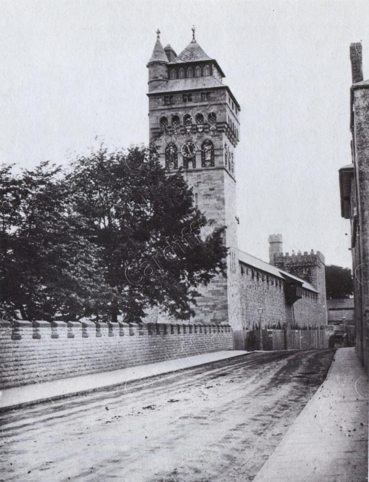 (1870s) Castle Street and the Castle Clock Tower
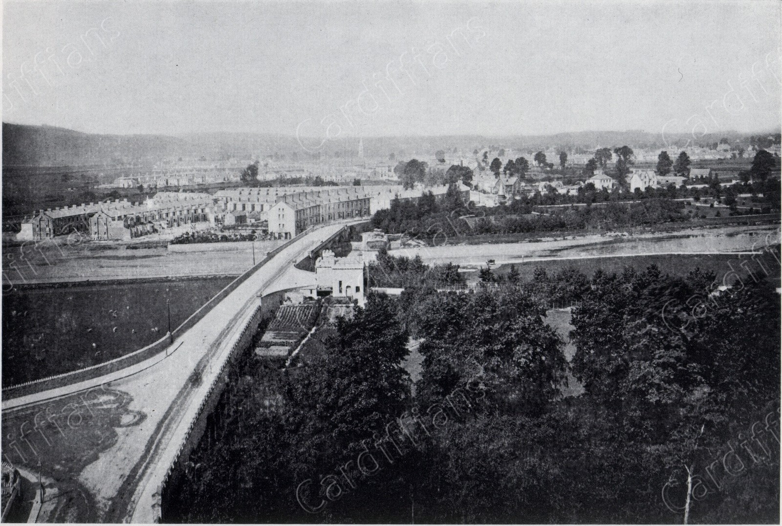 (1871) View of Canton Bridge from the Castle Clock Tower
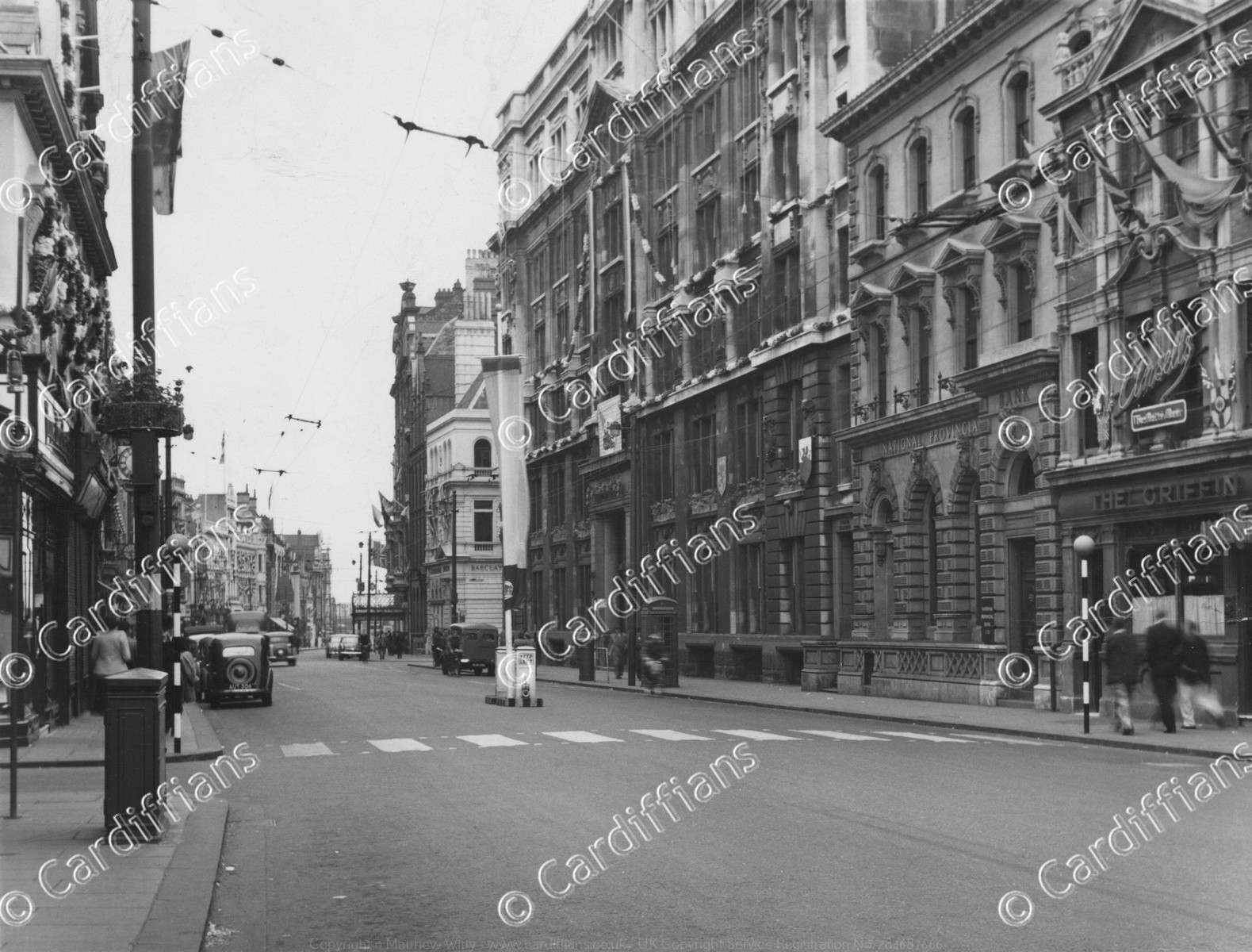
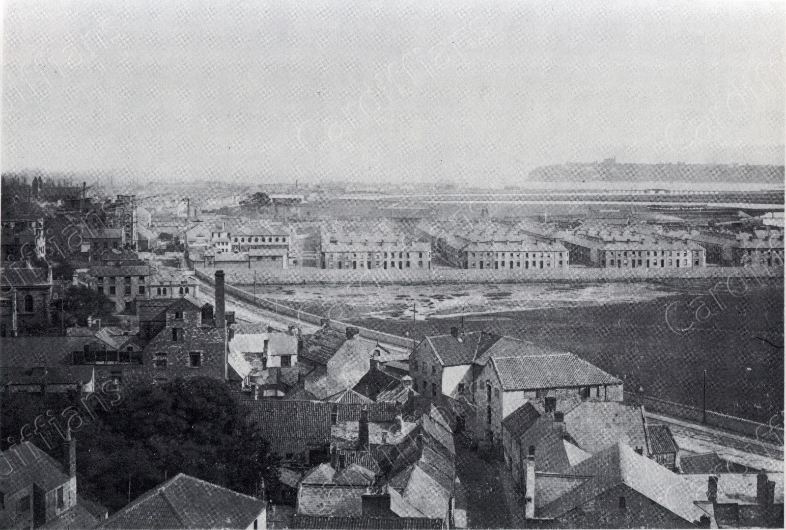 (1871) View of Westgate Street from the Castle Clock Tower
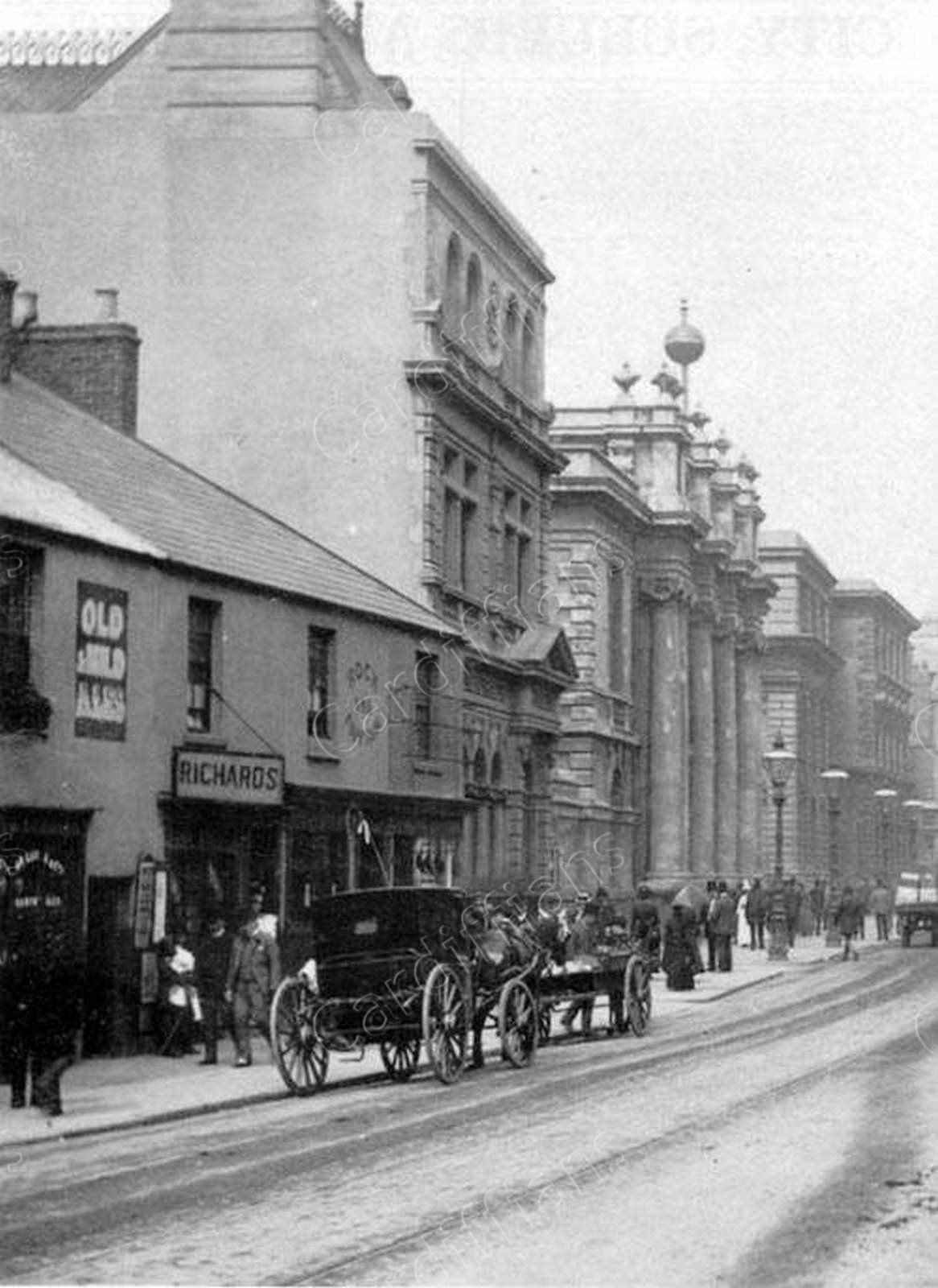
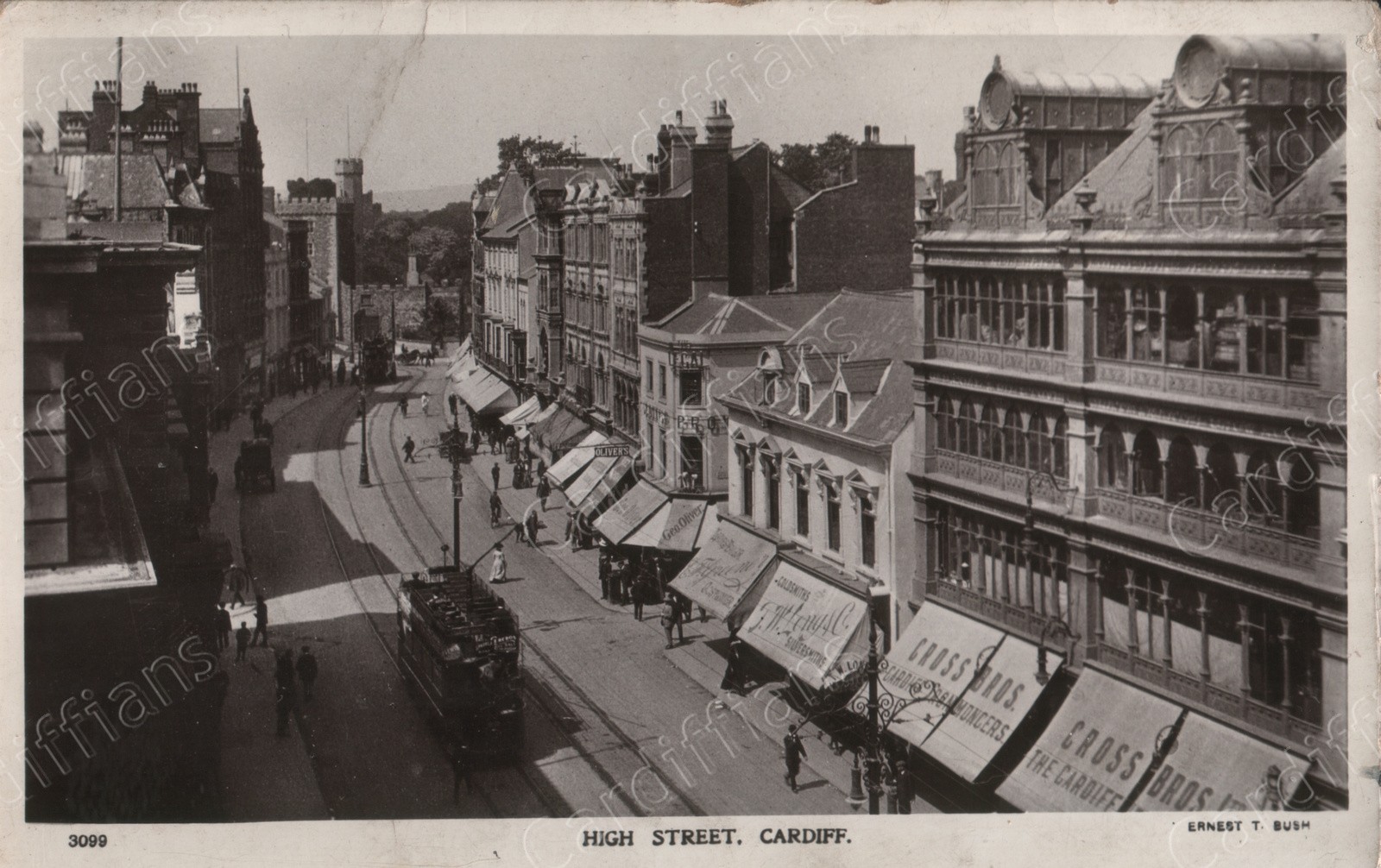
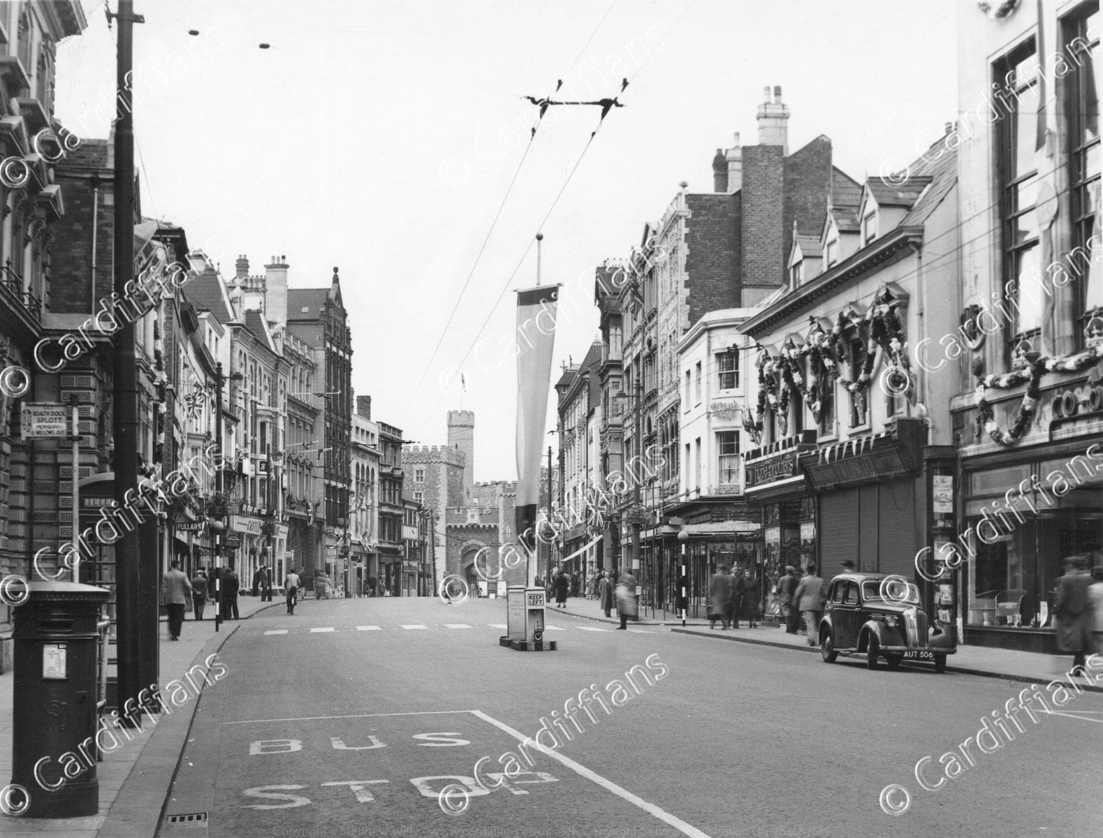
 (1872) High Street
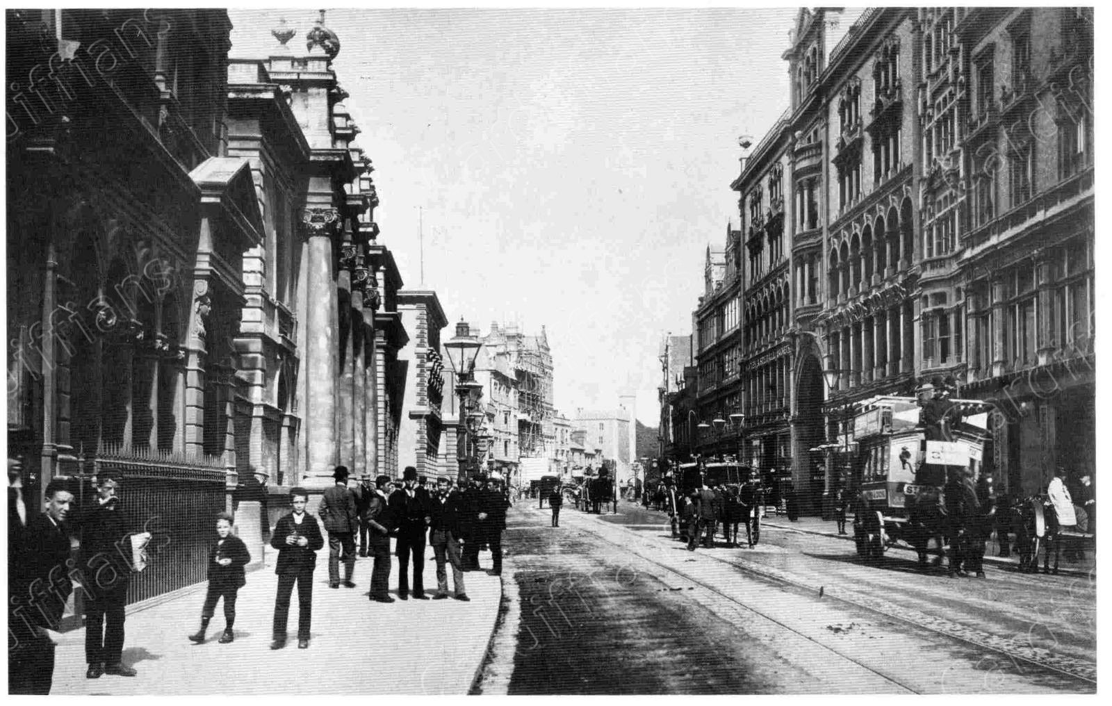
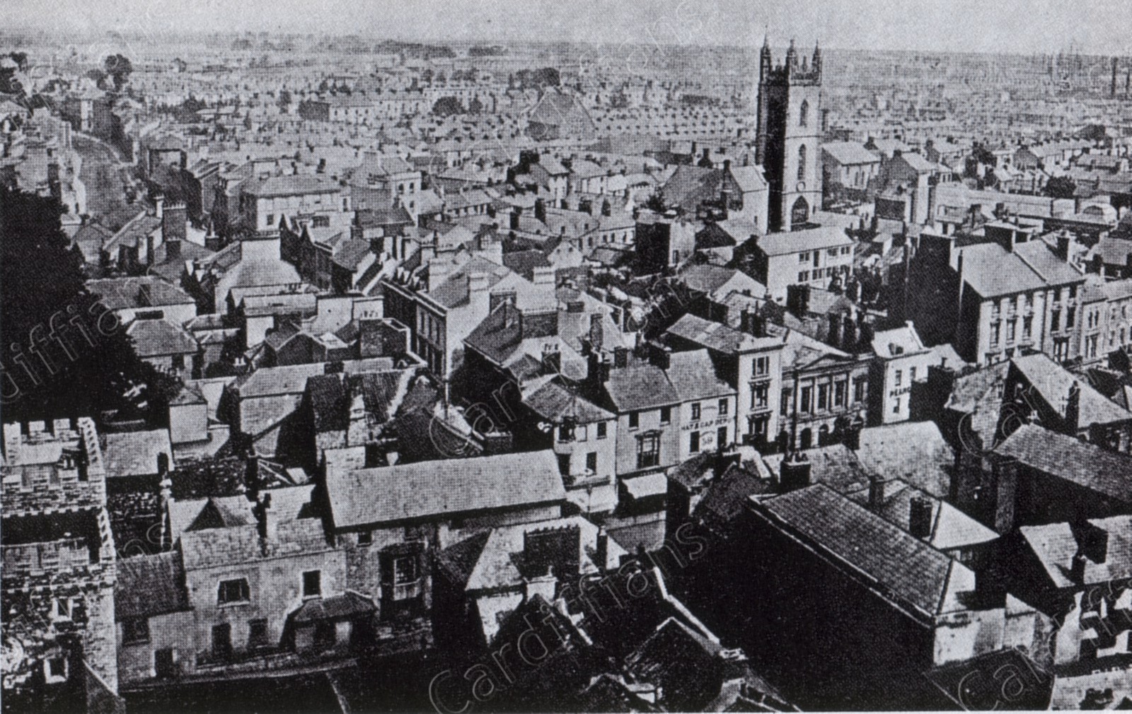 (1875) View from the Castle Clock Tower, showing the High Street and St Johns Church
 (1887) North Street (Re-named Kingsway in 1909)
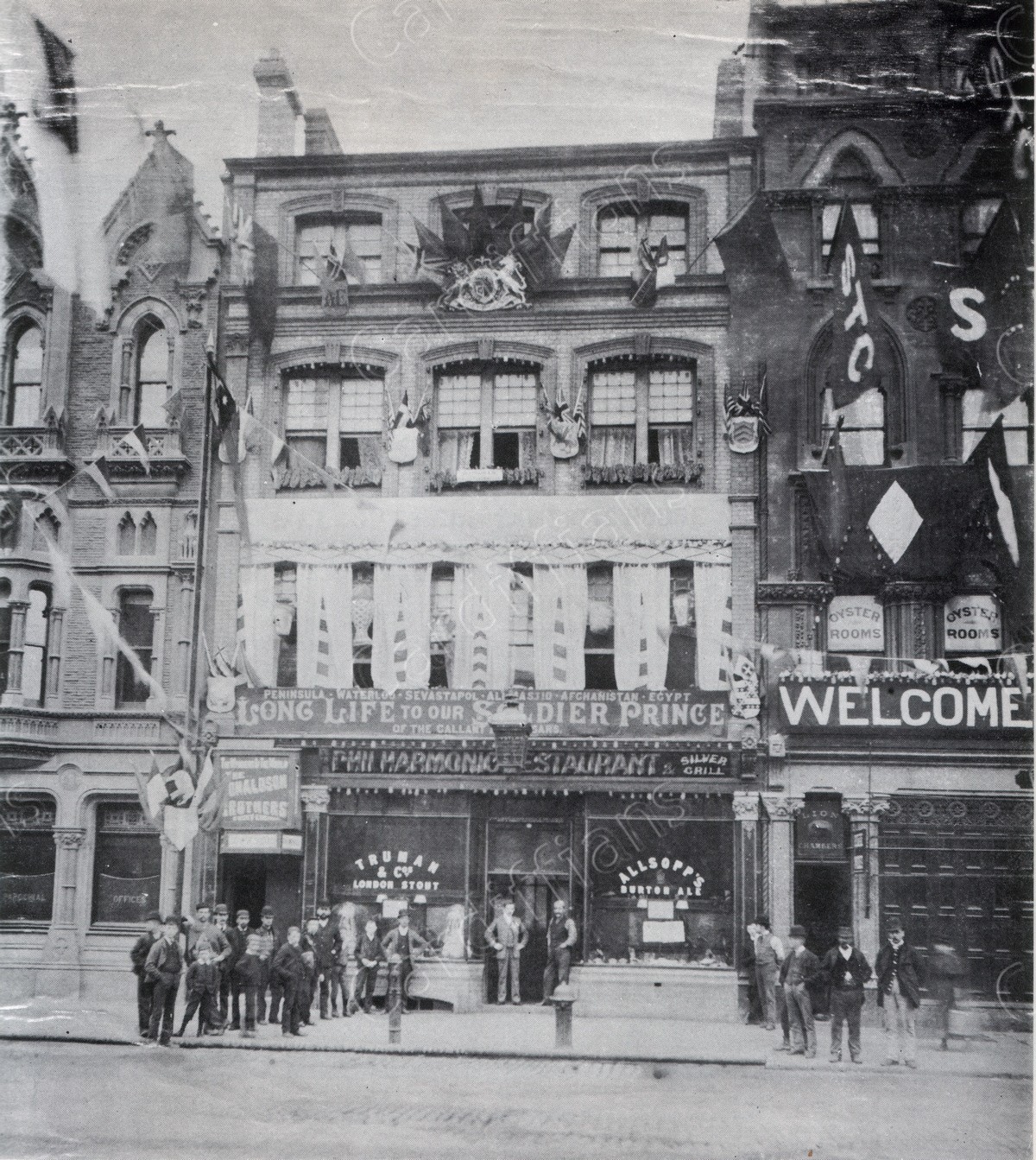 (1890) Philharmonic Restaurant, St. Mary Street
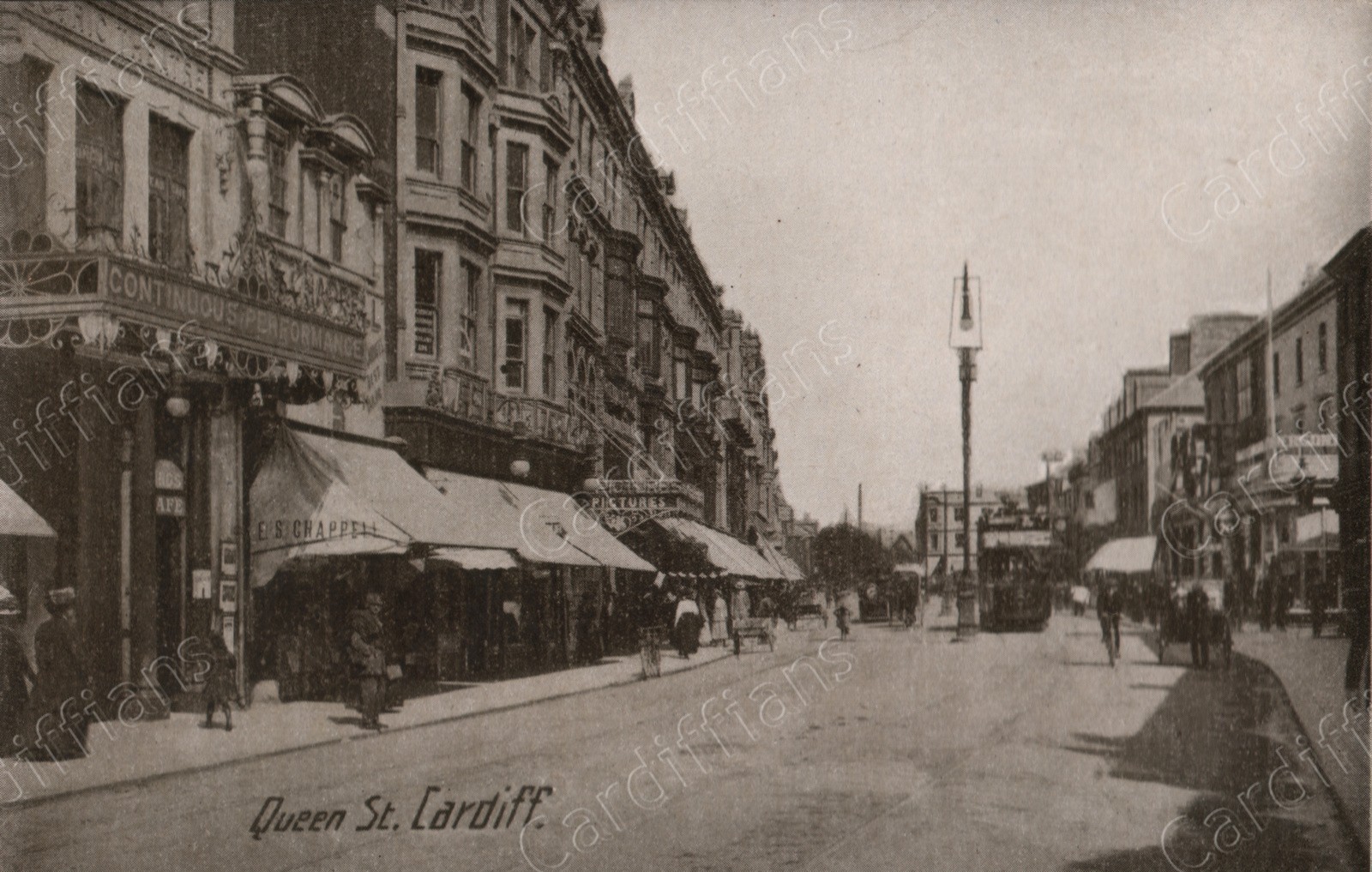
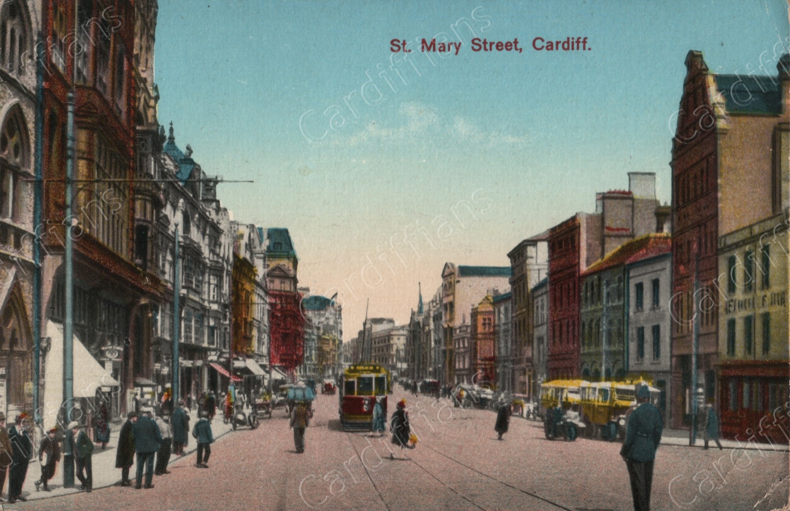
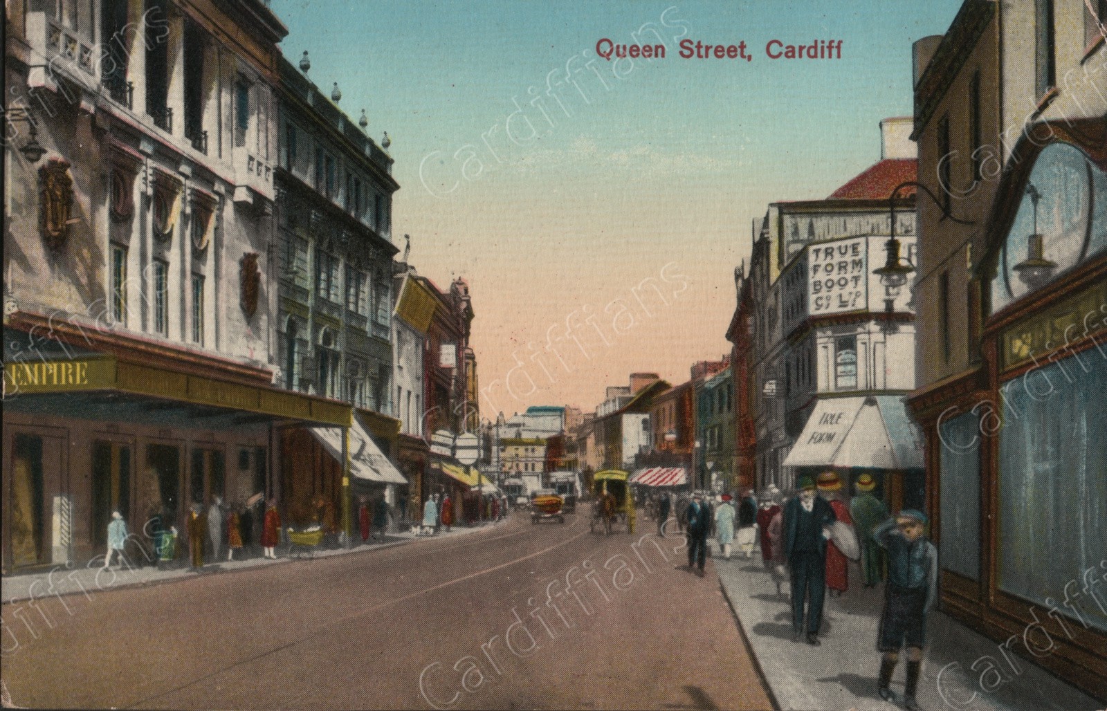
 (1890) Queen Street
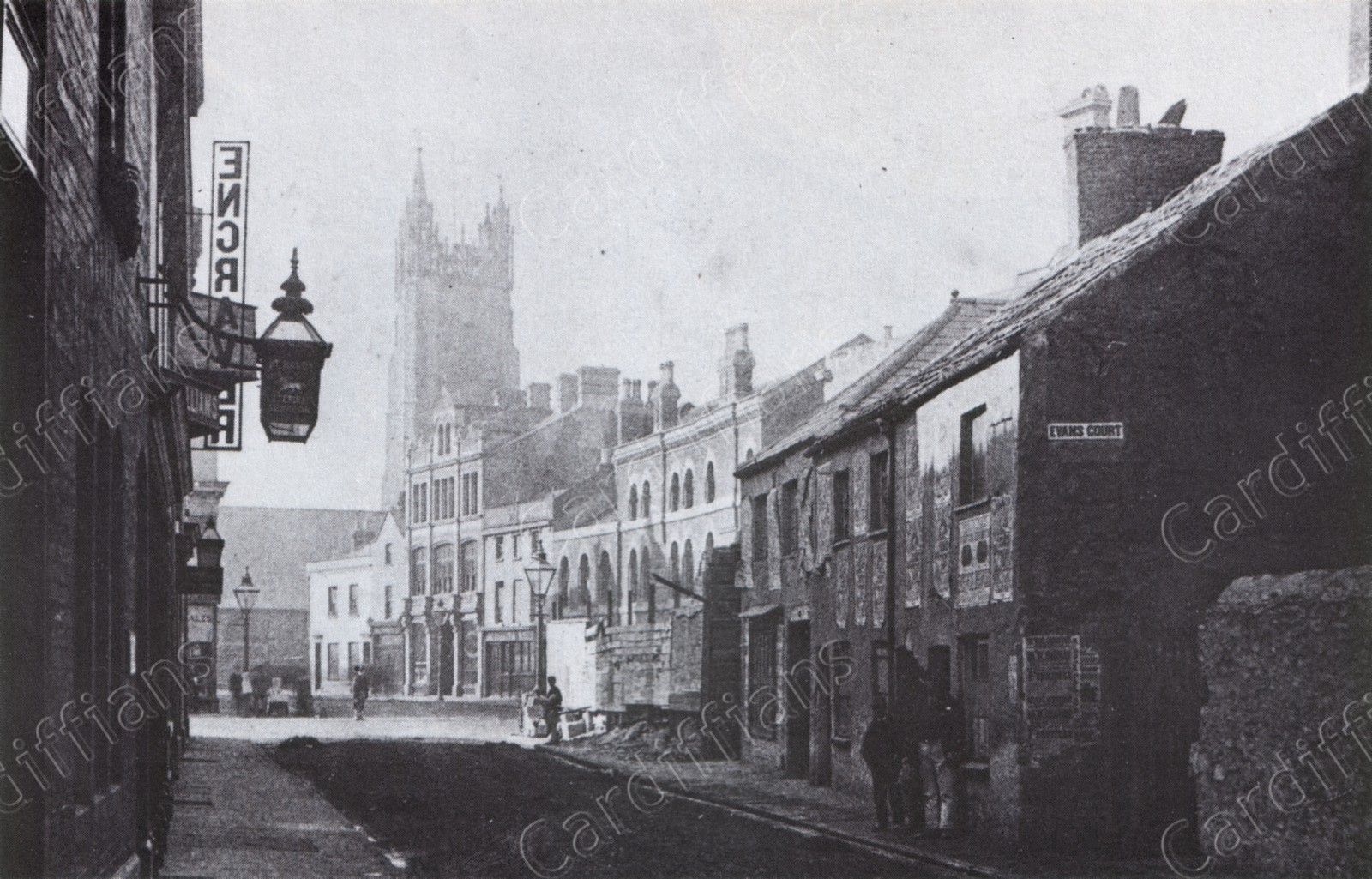 (1890) St. Johns Street (and Evans Court; demolished 1892)
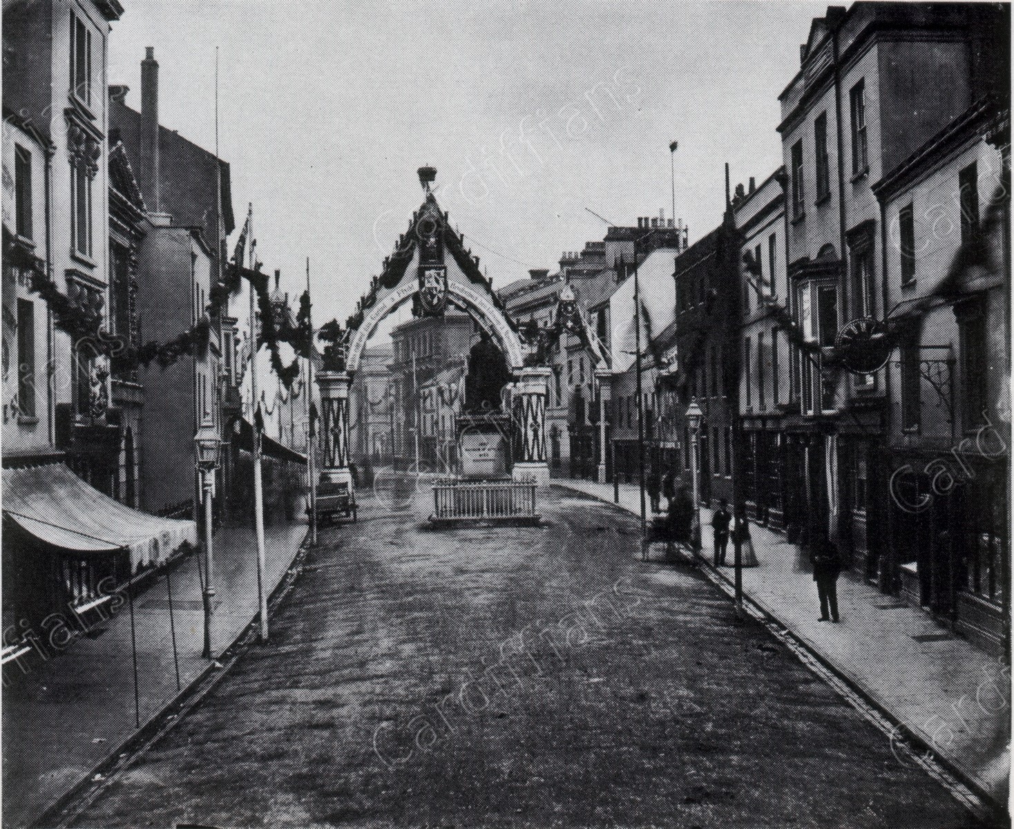
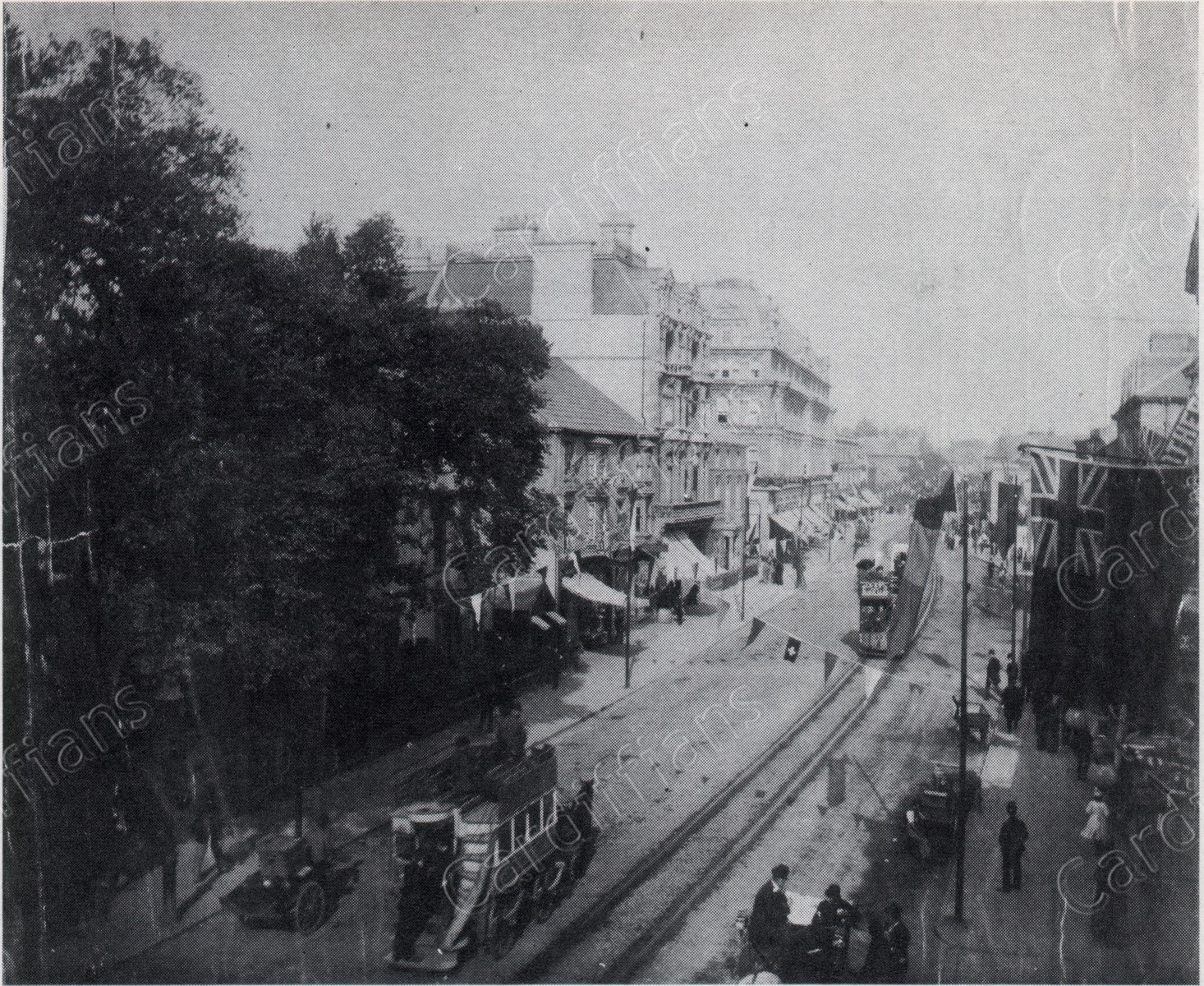
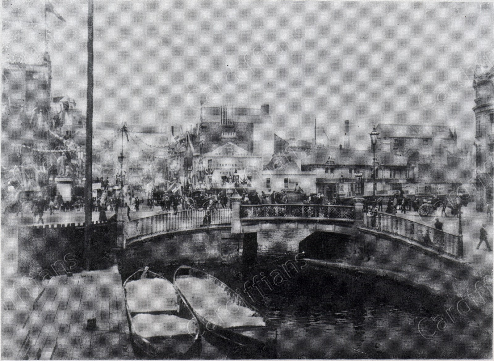 (1890) St. Mary Street, Decorated for Prince of Wales Visit
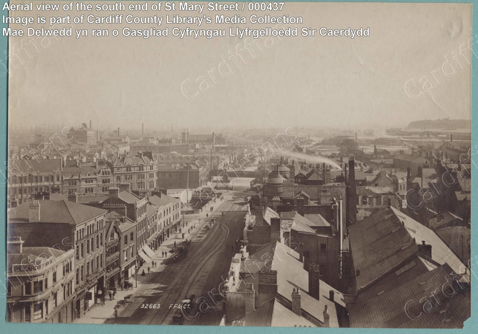 (1890s) Aerial view of the south end of St Mary Street
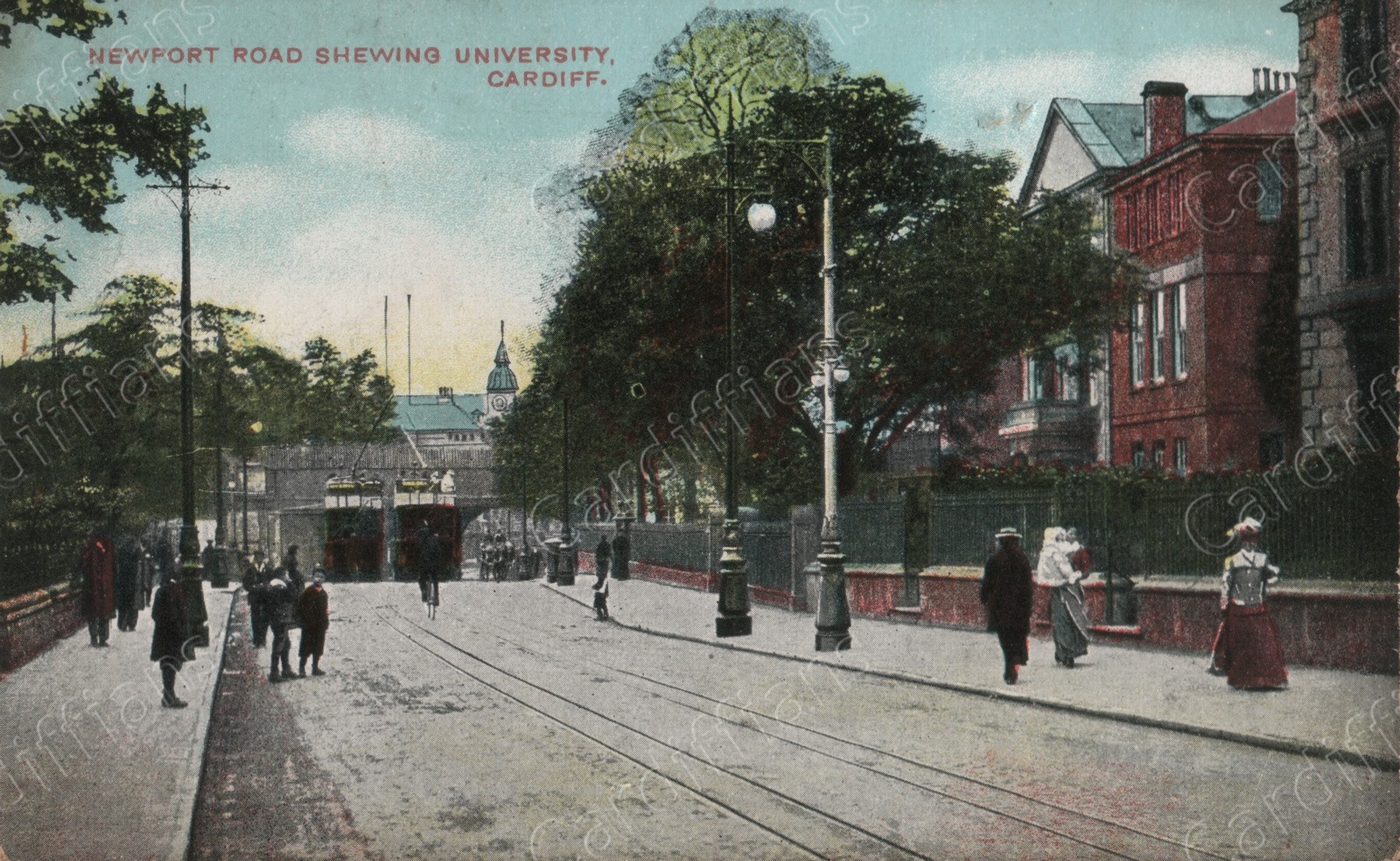 (1890s) Shewing University, Newport Road
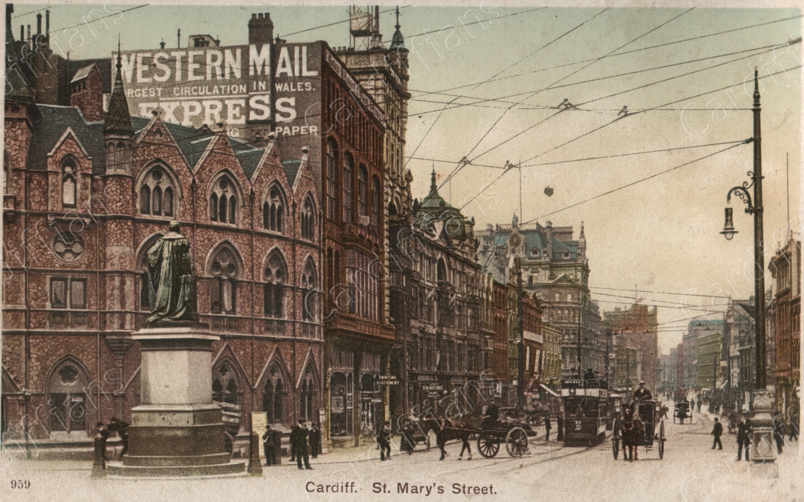
 (1890s) St. Mary Street
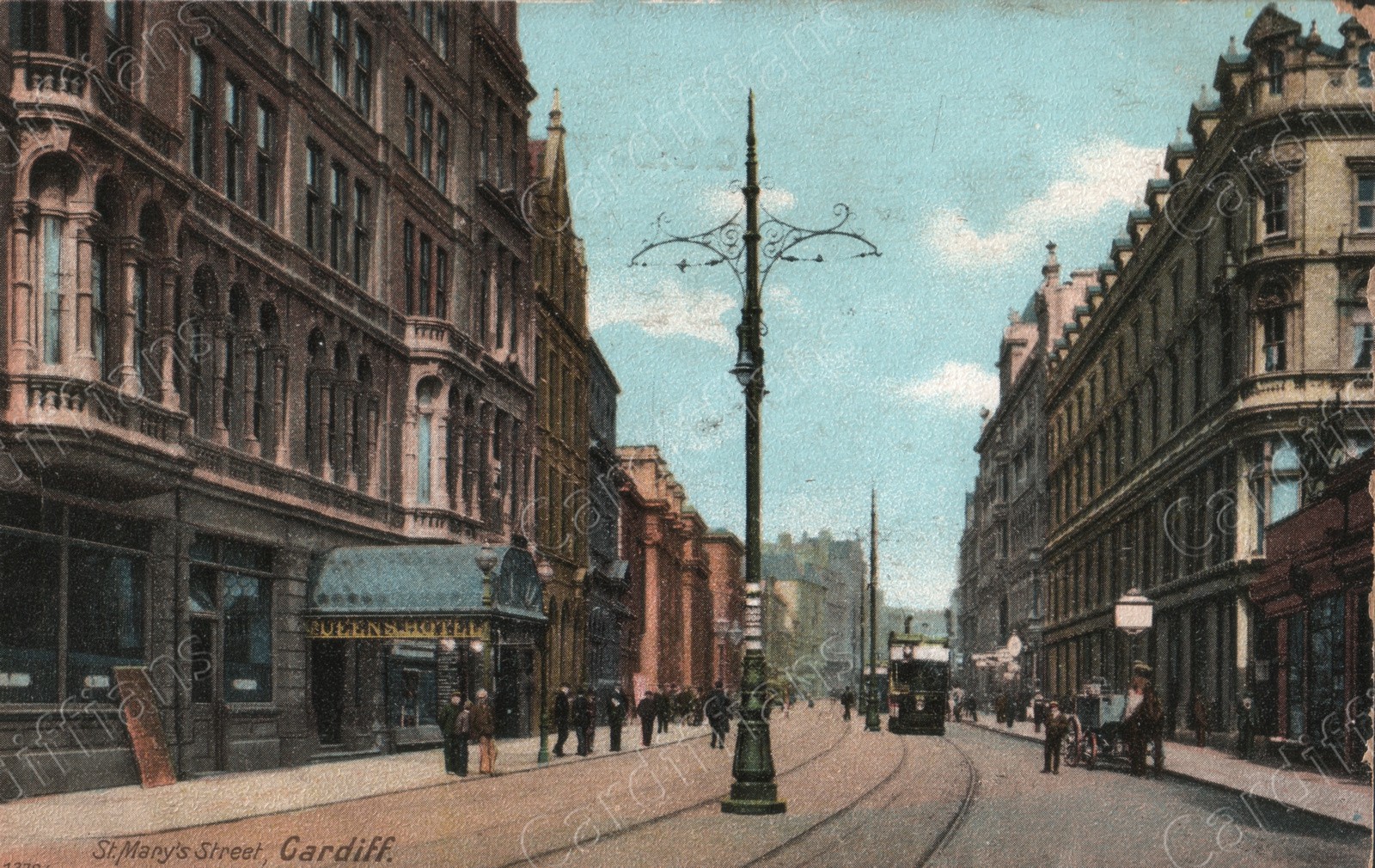
 (1891) St Mary Street (Looking North)
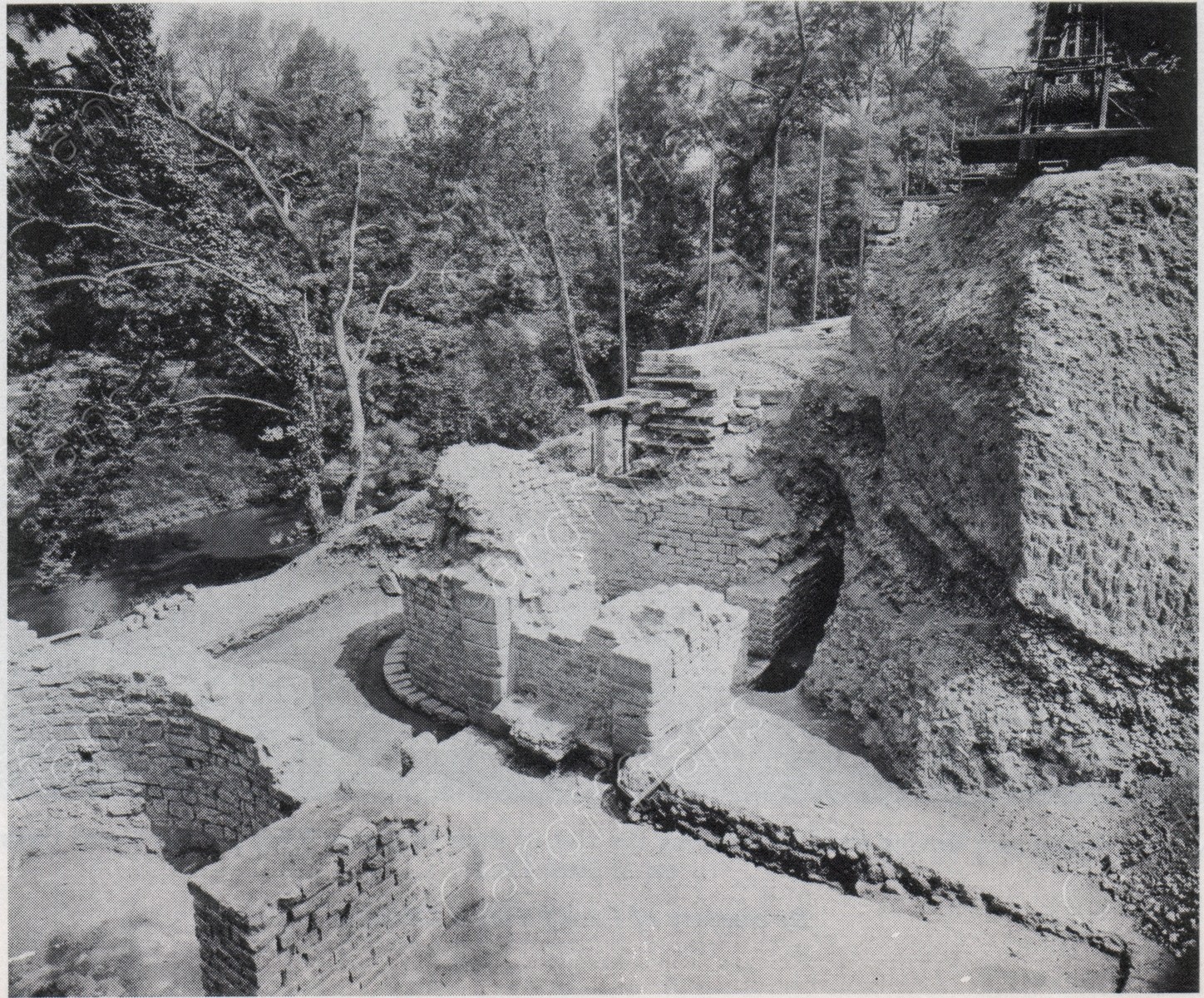
 (1898) Cardiff Castle, Excavations
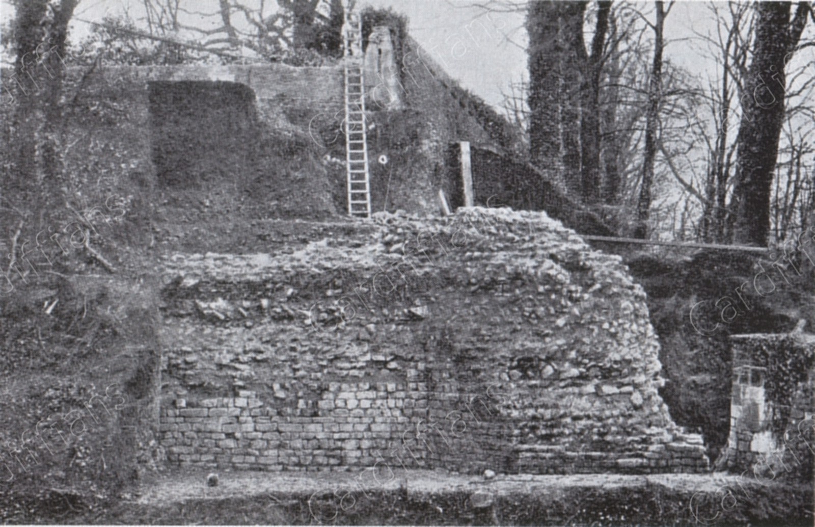 (1898) Norman fortifications revealed during the excavations at Cardiff Castle
 (1900) Cardiff Castle, Dock Feeder
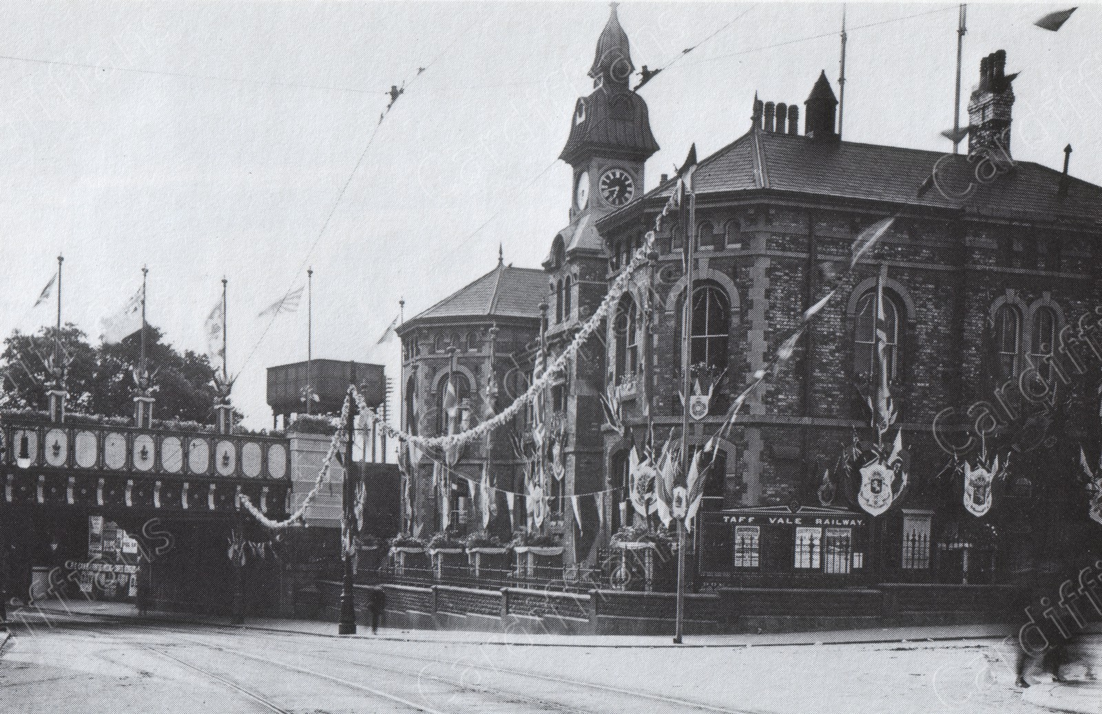
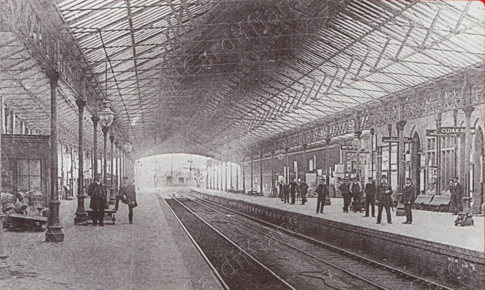 (1900) Taff Vale Railway Station (Queen Street)
 (1902) Queen Street
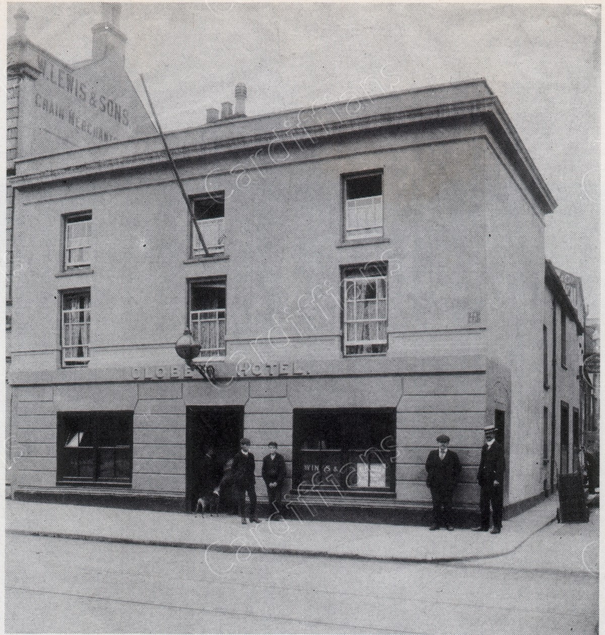 (1903) Globe Hotel, Castle Street
 (1905) Cardiff Castle
 (1905) Queen Street (opposite Railway Bridges and Taff Vale Station)
 (1905) St. Mary Street
 (1910) Queen Street
 (1910s) High Street
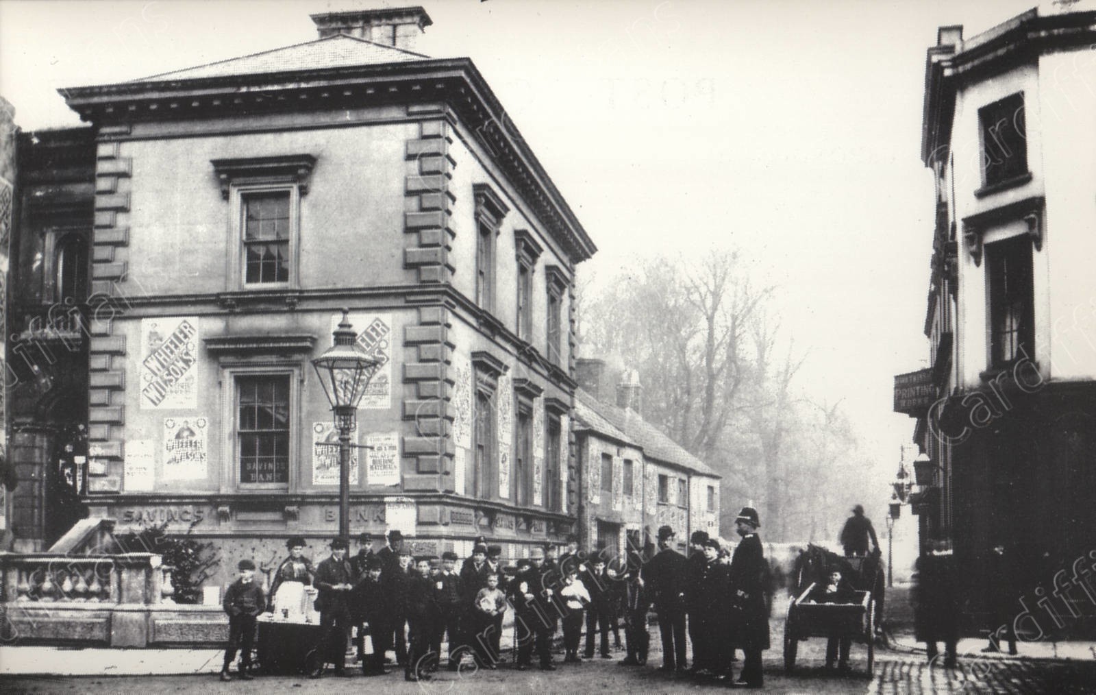
 (1910s) Town Hall in St Mary Street (demolished in 1914)
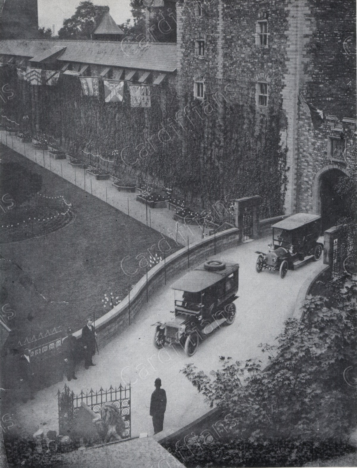 (1912) King George V and Queen Mary leave Cardiff Castle
 (1912) Queen Street Station (original Taff Vale Railway building) on the junction of Newport Rd
 (1912) St. Mary Street
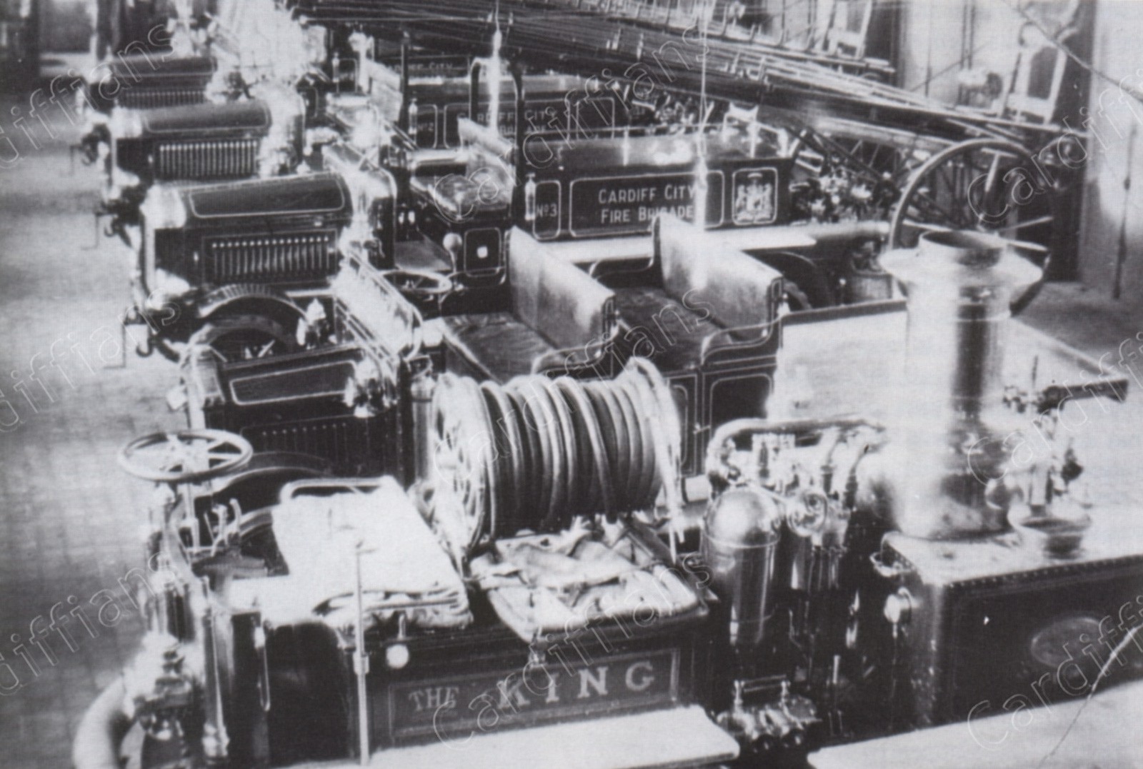 (1917) Westgate Street Fire Station, Appliance Room
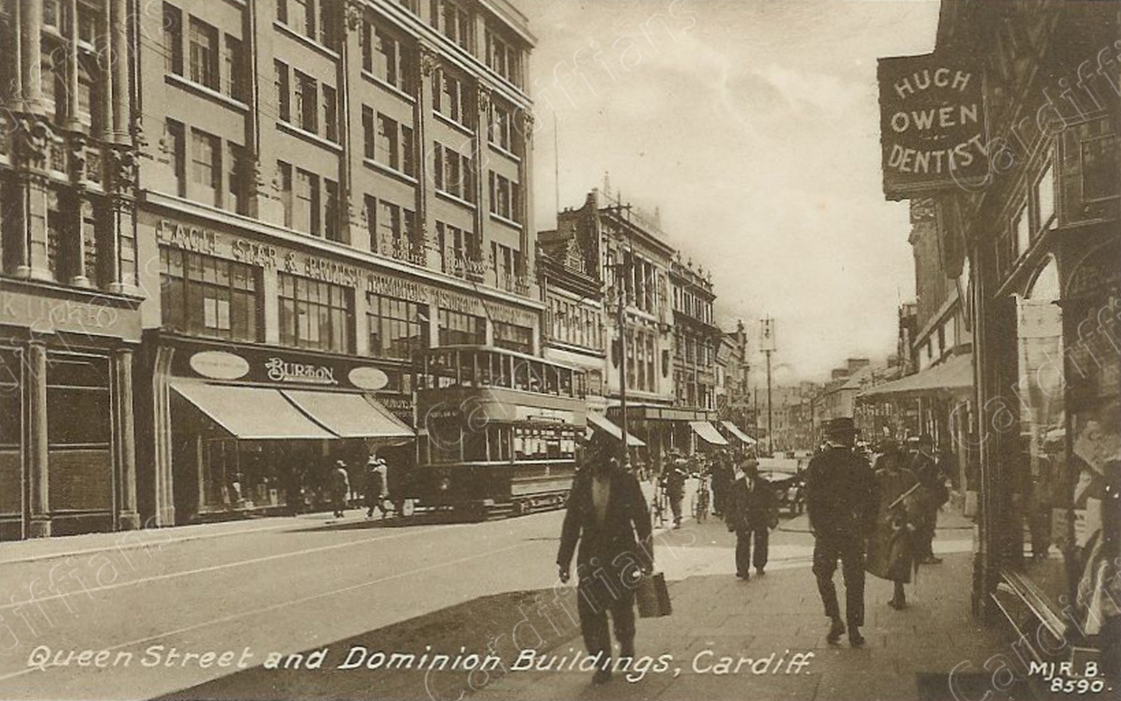 (1920) Queen Street and Dominion Buildings
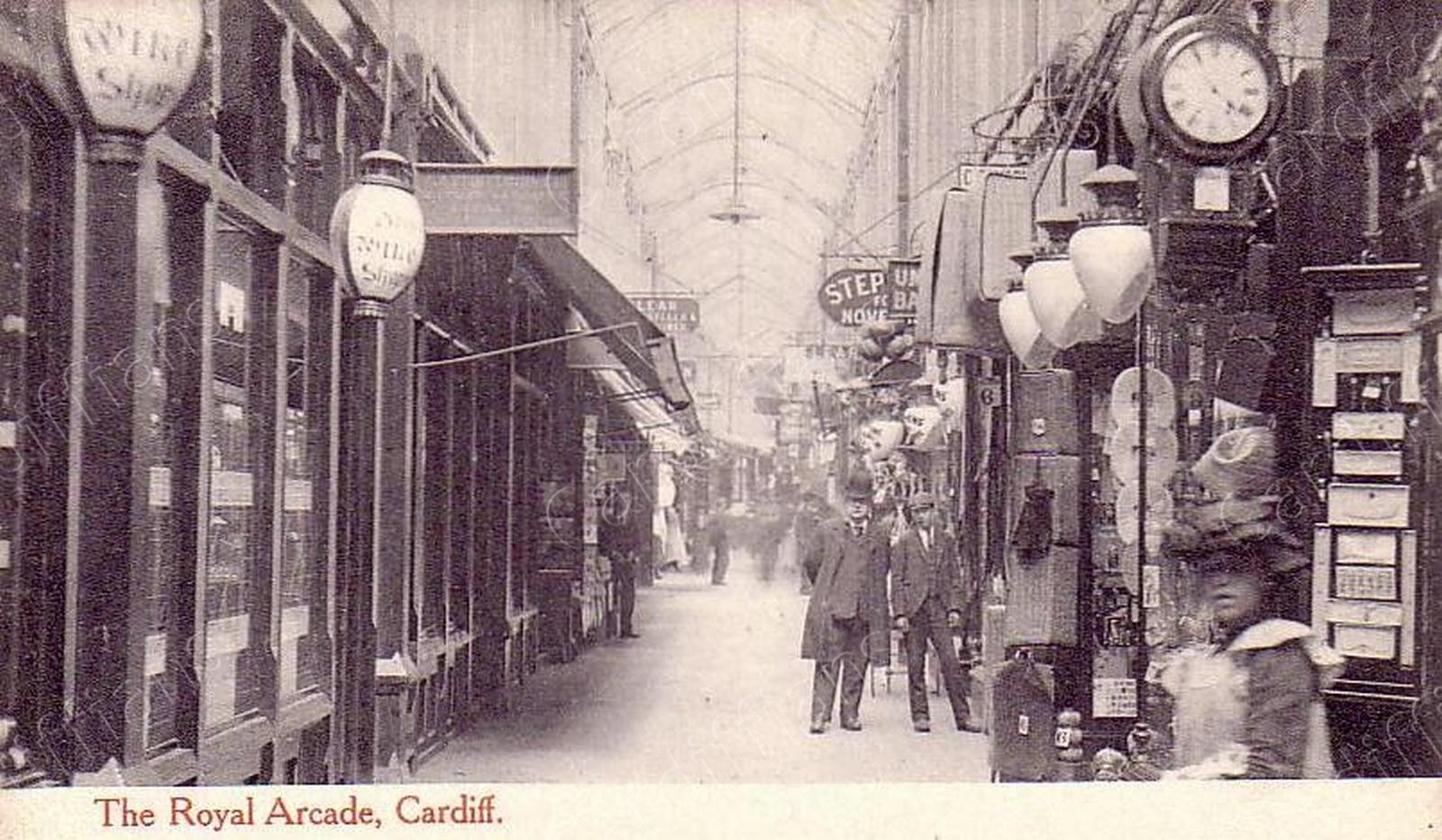 (1920) Royal Arcade
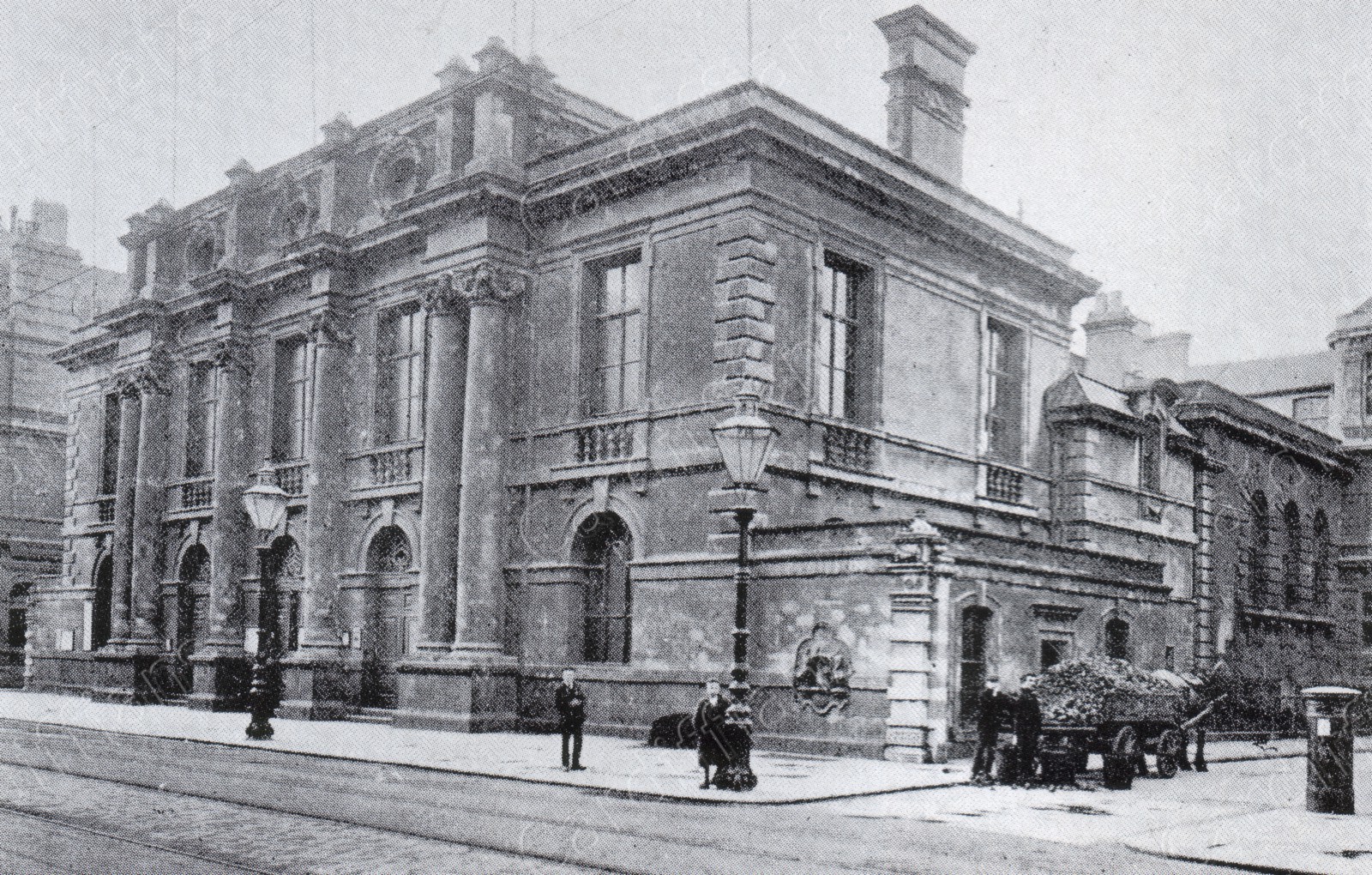
 (1920s) Central Free Library
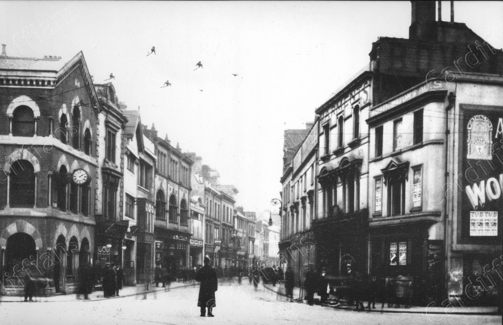 (1921) Duke Street
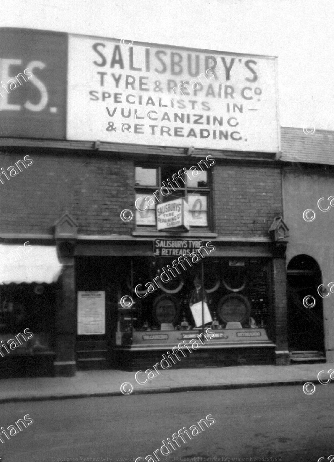 (1923) Salisburys Tyre and Retreads Ltd, Frederick Street
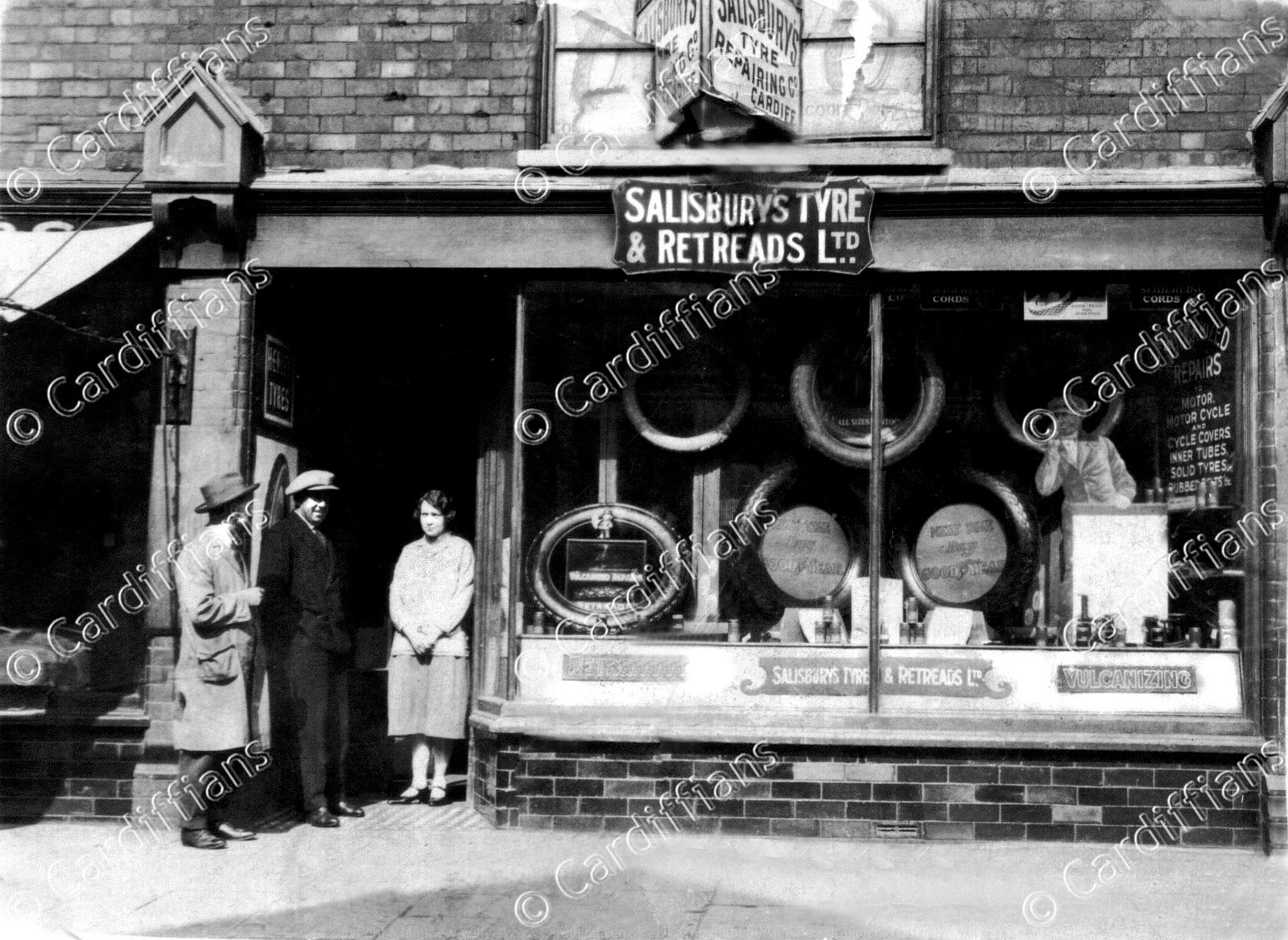 (1923) Salisburys Tyre and Retreads Ltd, Frederick Street (Owned by Charles Patrick and Lilian May Salisbury)
 (1930) Temperance Town, which used to be located where the Central Bus Station stands now
 (1932) St. Mary Street
 (1934) Queen Street
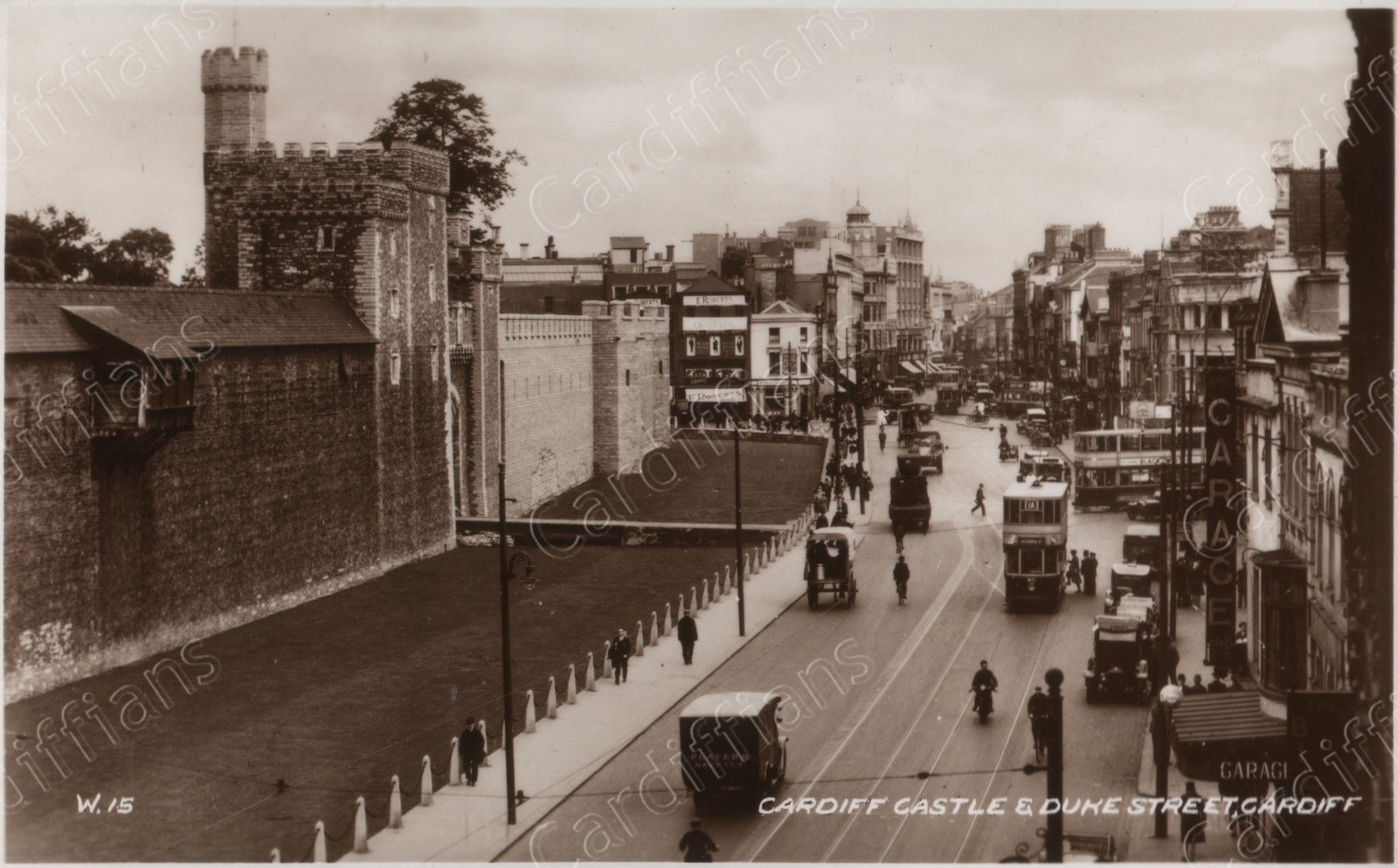 (1940) Cardiff Castle and Duke Street
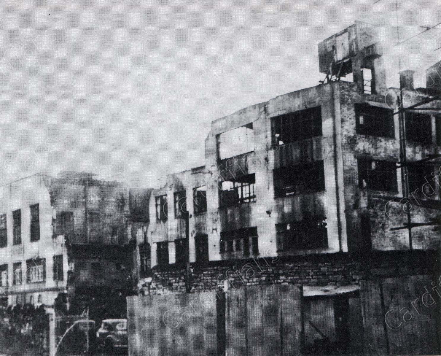 (1940s) Carlton Restaurant in Queen Street, the remains after WW2
 (1940s) Marchioness of Bute, Frederick Street
 (1940s) Merchant Navy Club and Hayes Bridge over the Glamorganshire Canal
 (1940s) St. Johns Church, The Hayes
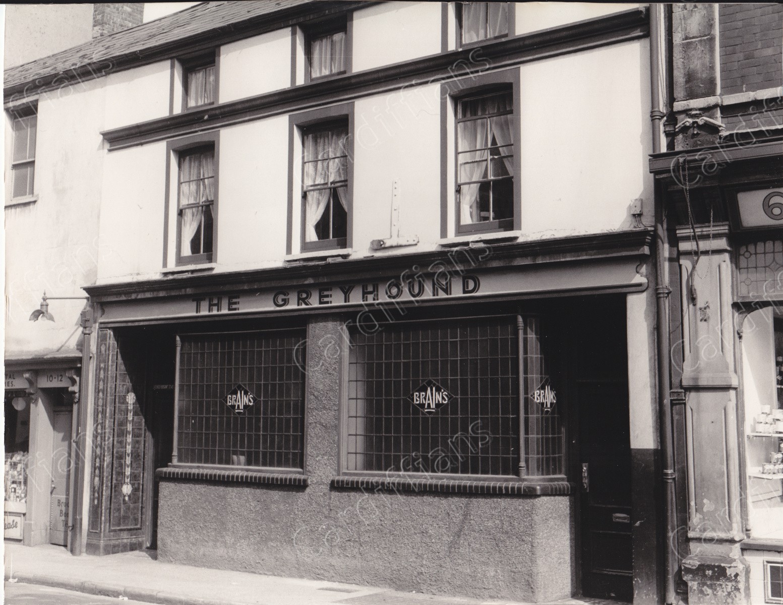 (1940s) The Greyhound, Bridge Street
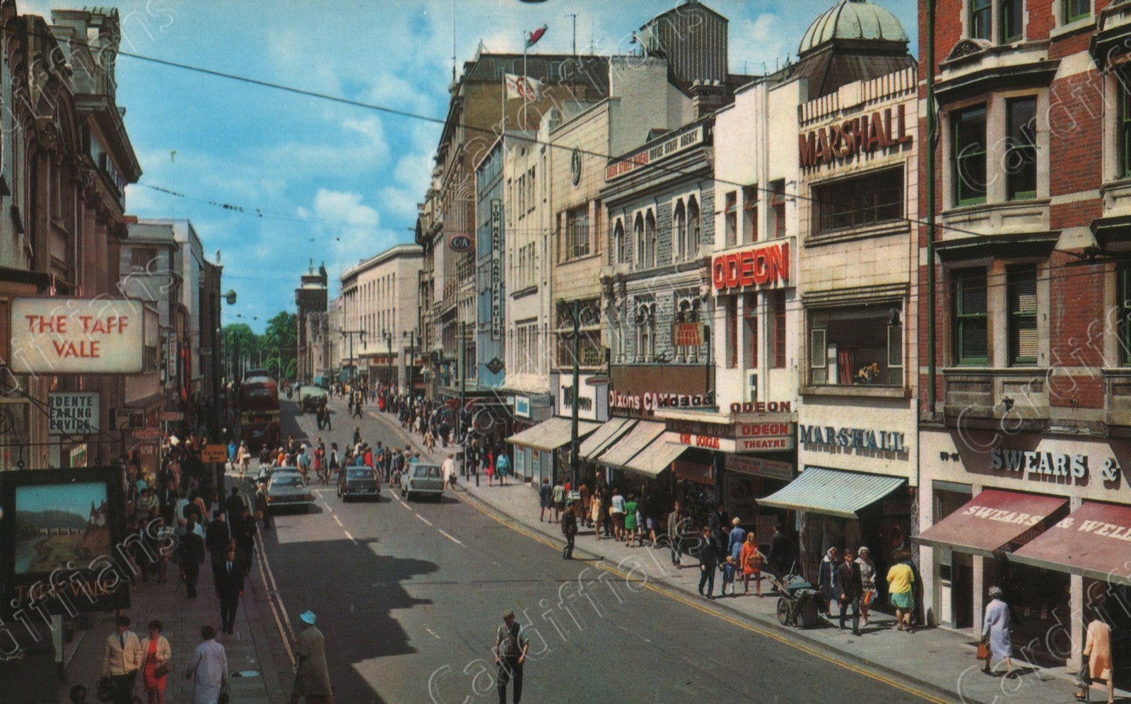
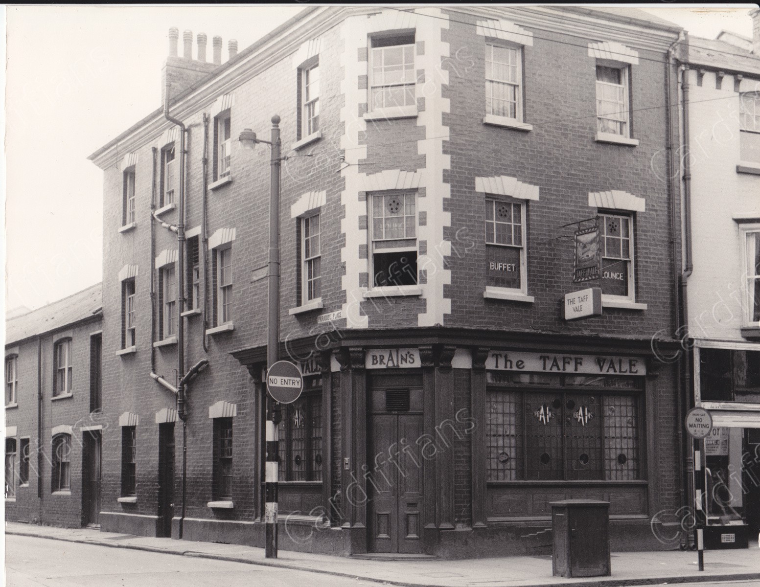 (1940s) The Taff Vale, junction of Queen Street and Paradise Place
 (1946) St. Johns Church, Church Street - The Hayes
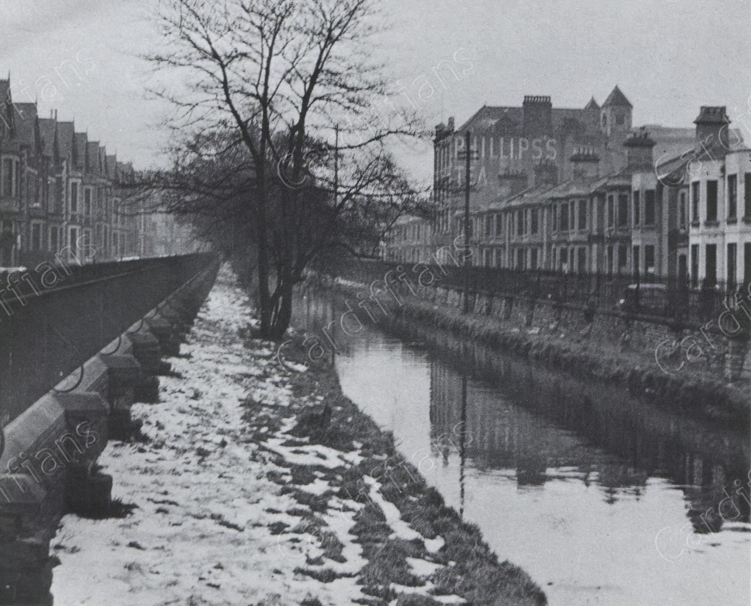 (1947) Guildford Crescent looking up towards Queen Street, and the dock feeder
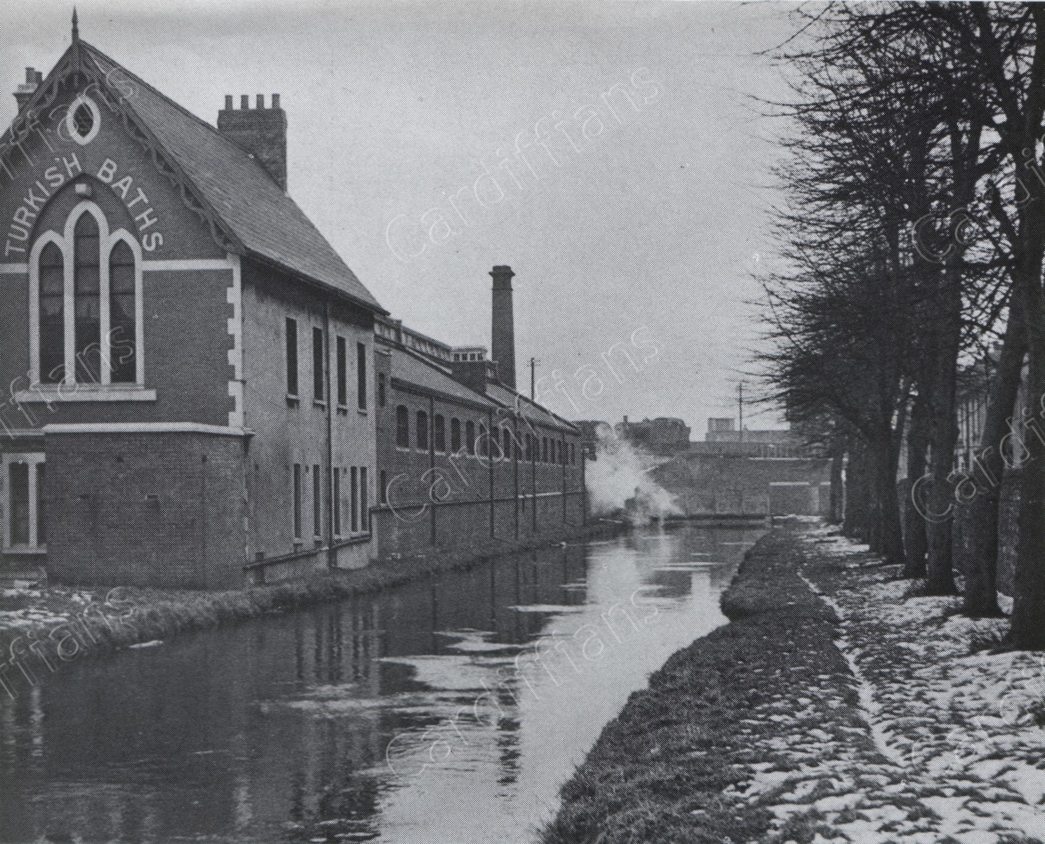 (1947) Turkish Baths in Guildford Crescent, and the dock feeder
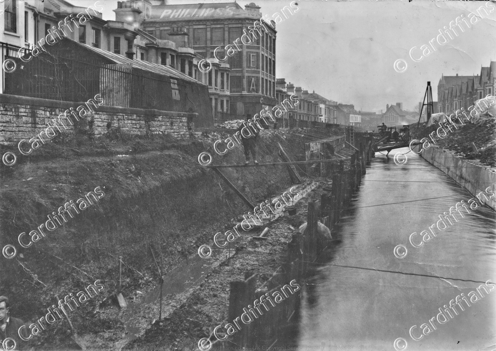 (1949) Churchill Way Canal being covered up (looking towards Guildford Street).jpg
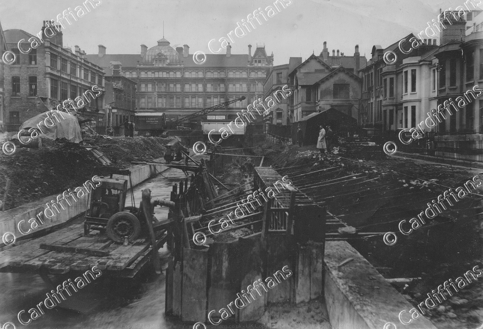 (1949) Churchill Way Canal being covered up (looking towards Queen Street)
 (1949) Guildford Crescent Turkish Baths, Churchill Way
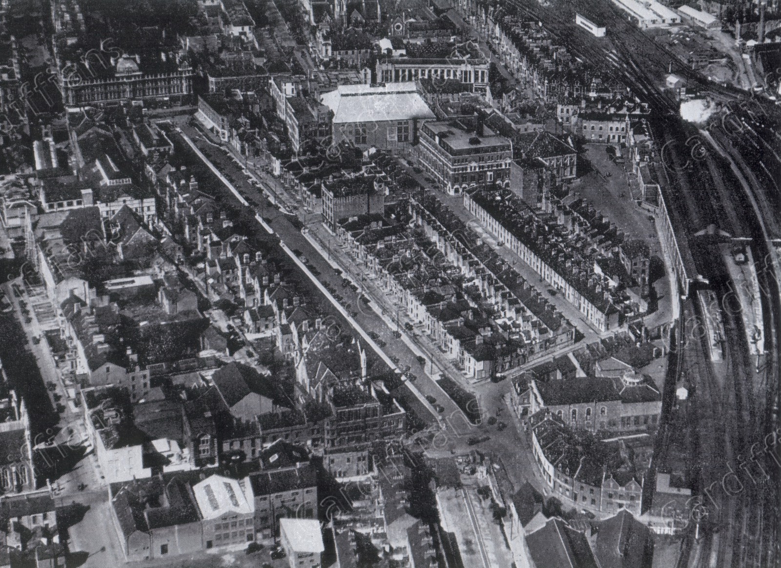
 (1950s) Aerial view of Cardiff City Centre
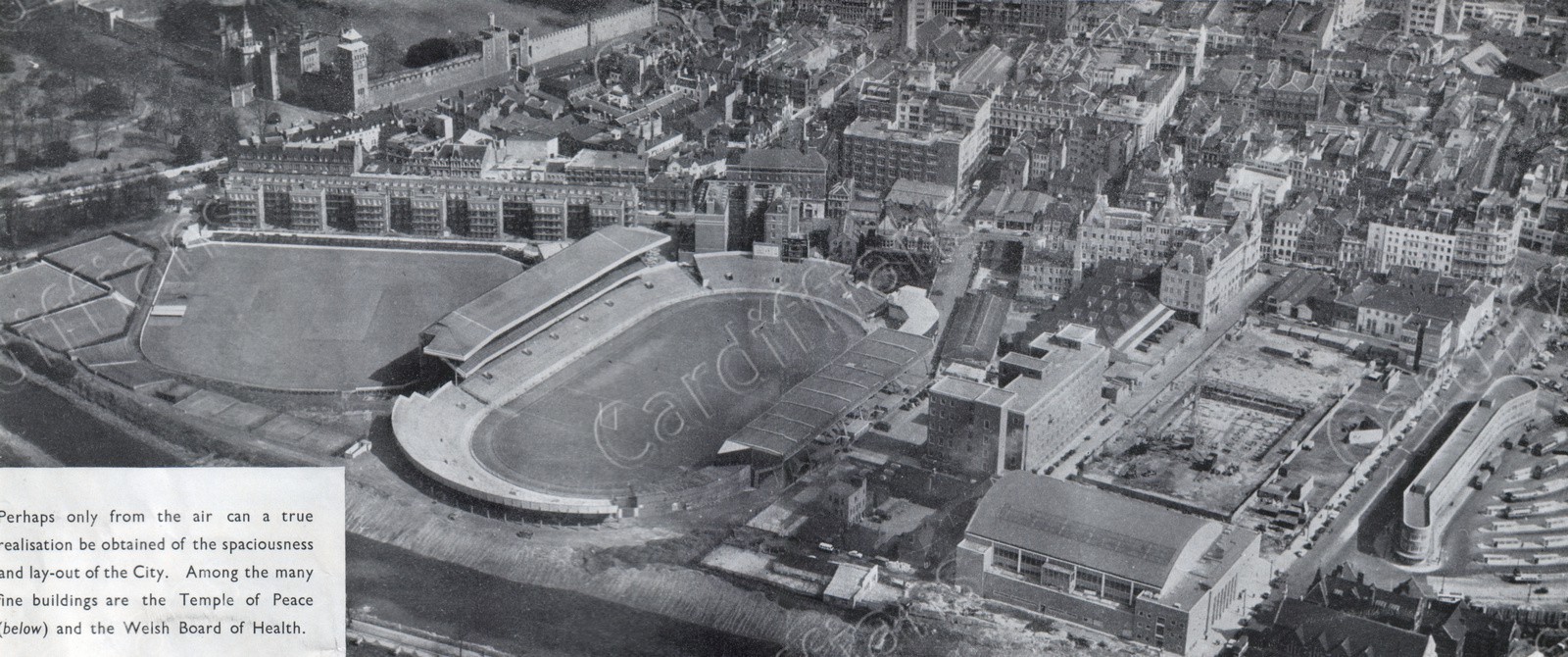 (1950s) Aerial view of the City Centre
 (1950s) Churchill Way and Queen Street Station, aerial view
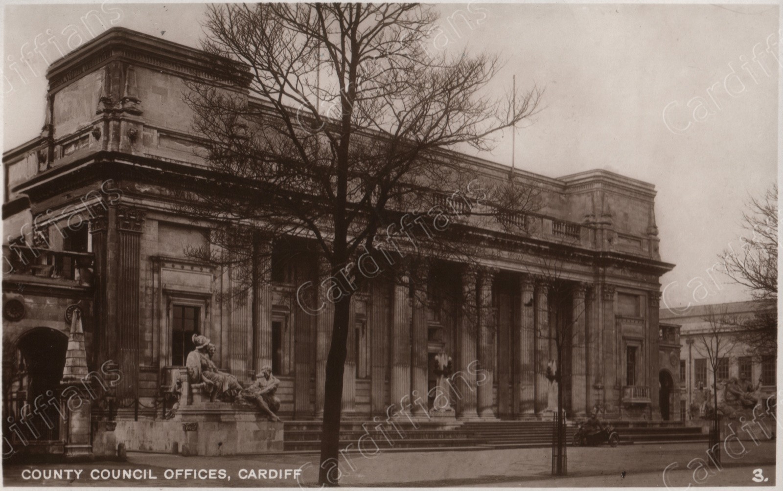 (1950s) County Council Offices
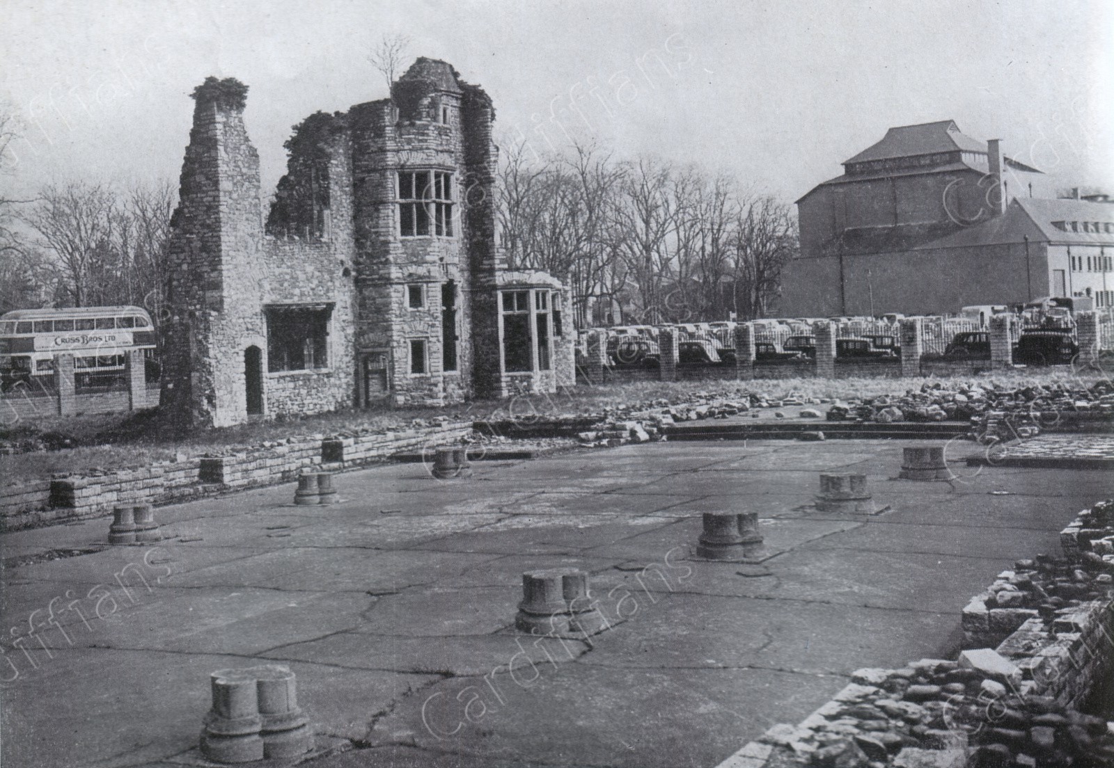
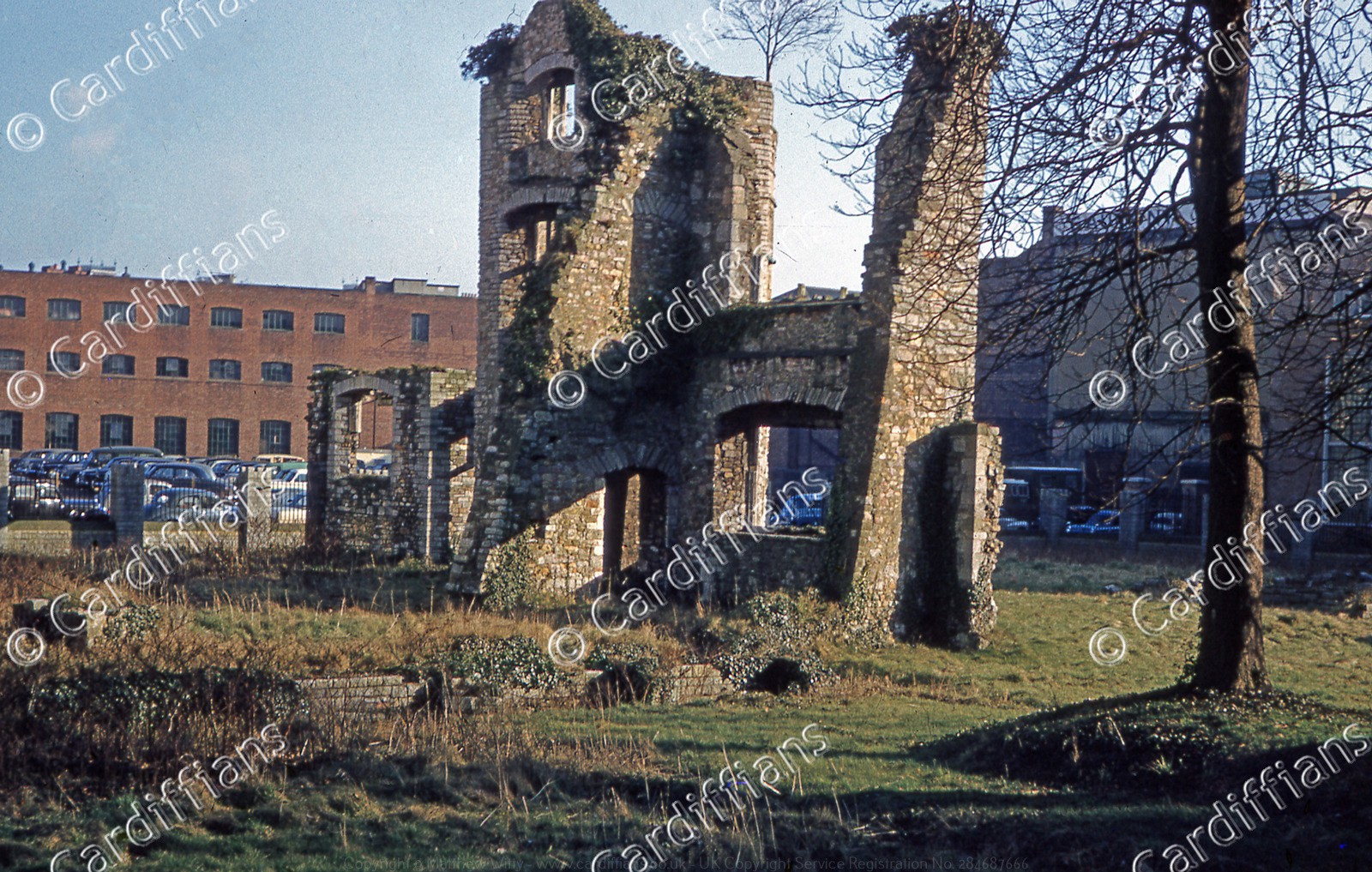
 (1950s) Herbert House (The Ruins of Grey Friars) - Demolished 1967
 (1950s) High Street
 (1950s) Queen Street
 (1950s) St. Mary Street, Aerial View
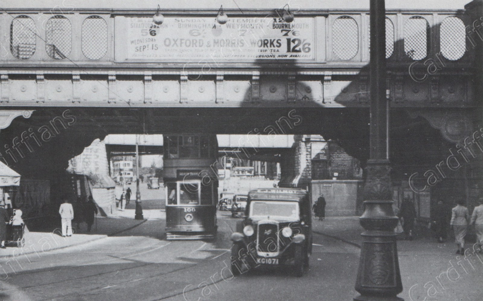 (1950s) Taff Vale Railway bridge and Rhymney Railway bridge over Newport Road
 (1950s) Thomson House Printing Press, Havelock Street
 (1950s) Thomson House, Havelock Street
 (1952) Glamorganshire Canal lock at Queen Street (then Crockherbtown)
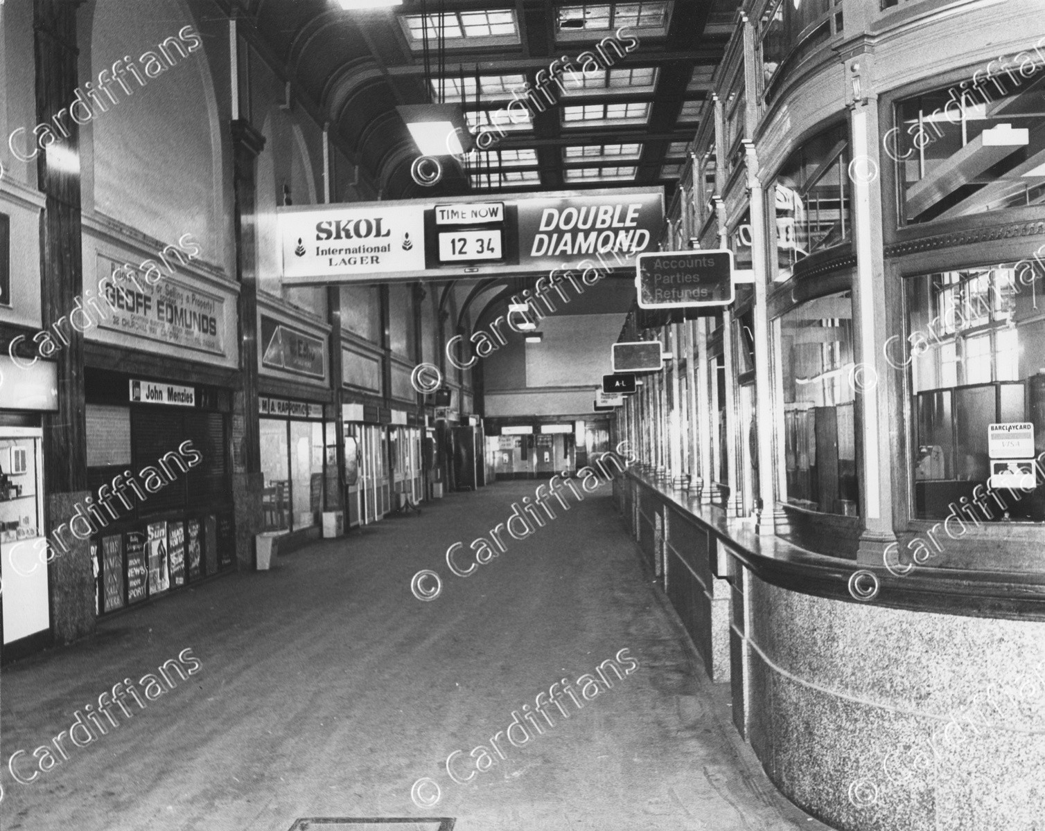 (1953) Cardiff Central Railway Station Booking Hall
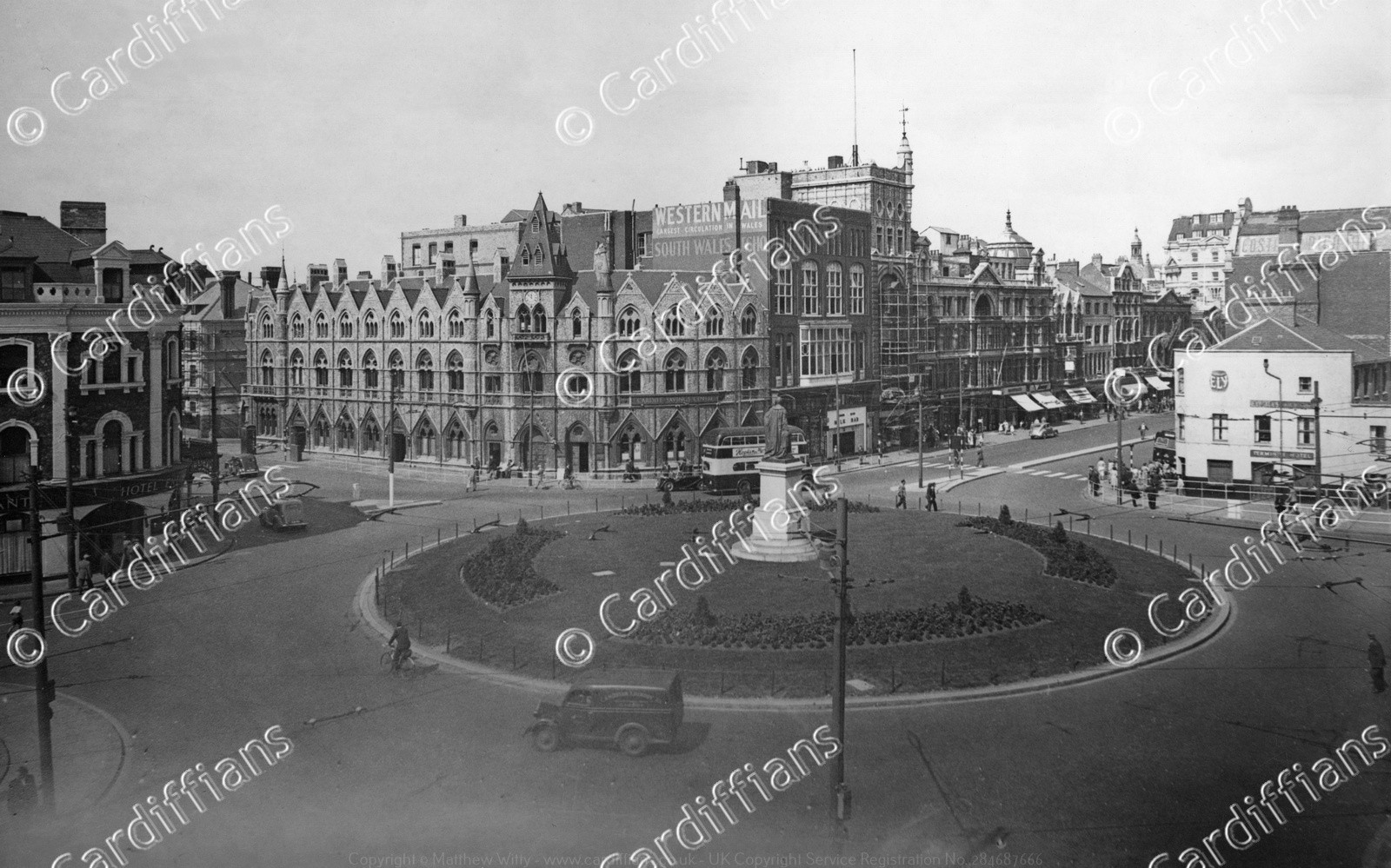
 (1953) Central Square
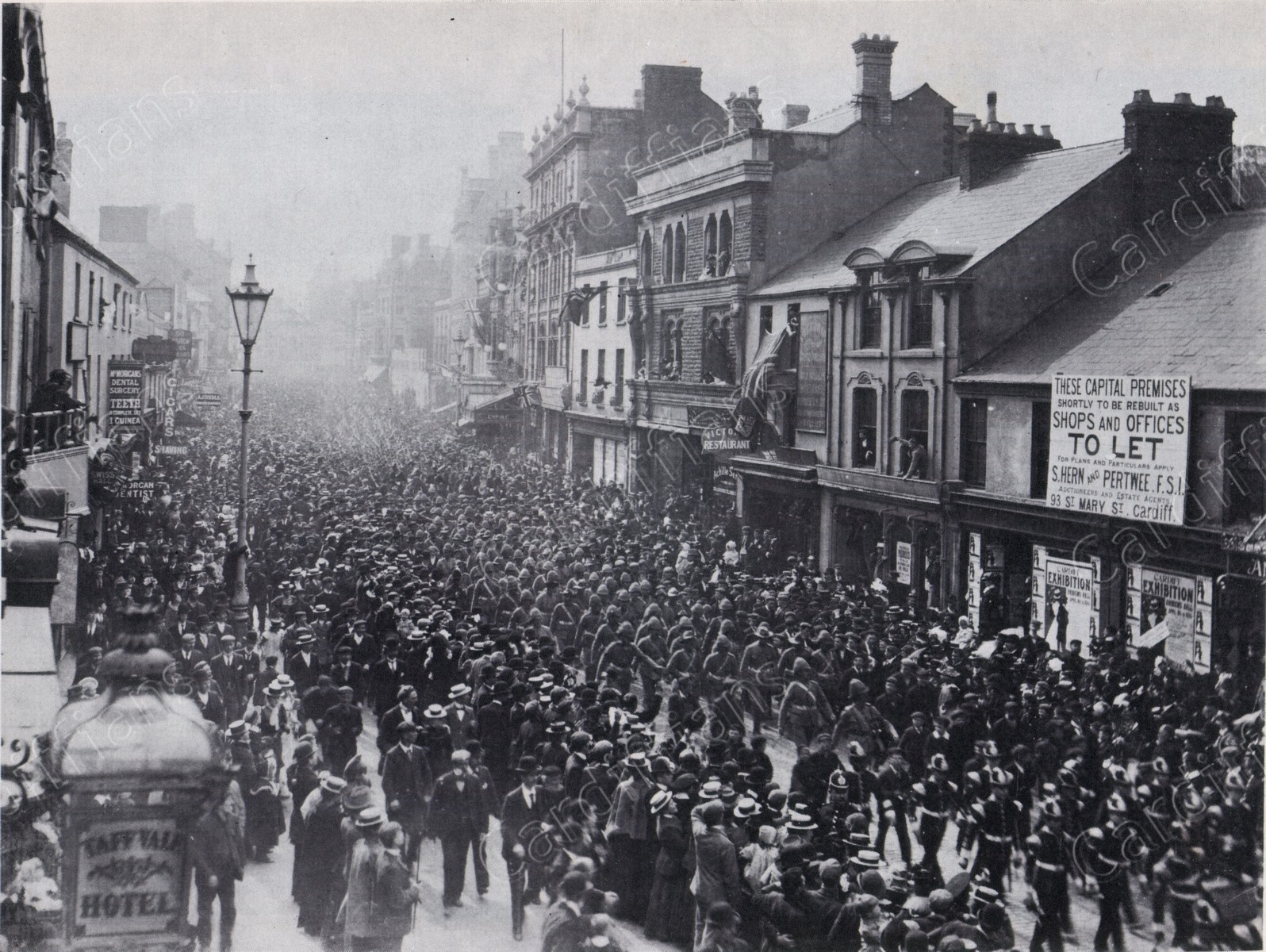
 (1953) Crowds gather on North Road ahead of Queen Elizabeth II's Coronation Procession
 (1953) Wood Street, before Central Bus Station was built
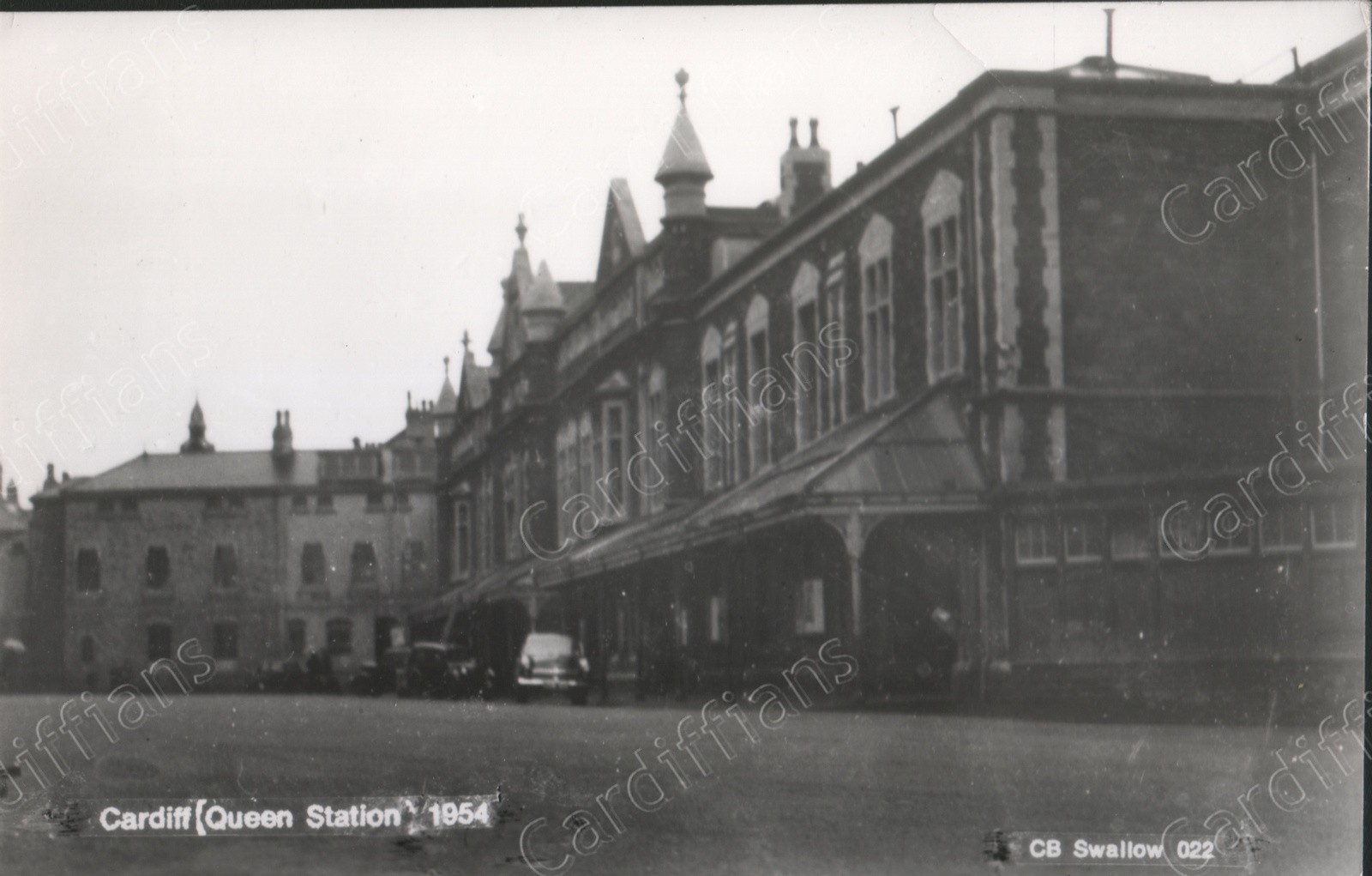 (1954) Queen Street Railway Station - Frontage
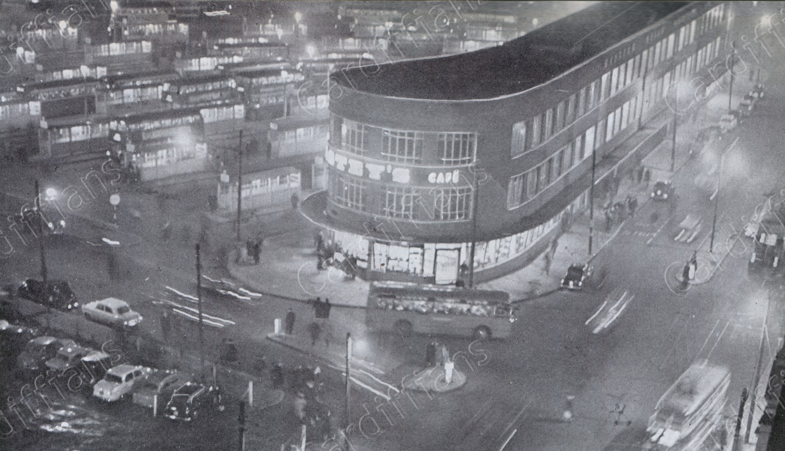 (1957) Central Bus Station and Asteys at night
 (1957) Herbert House remains in Greyfriars Road - demolished 1965-66 - Capital Tower is located here now
 (1958) Boulevard de Nantes and North Road, decorated for the Empire Games
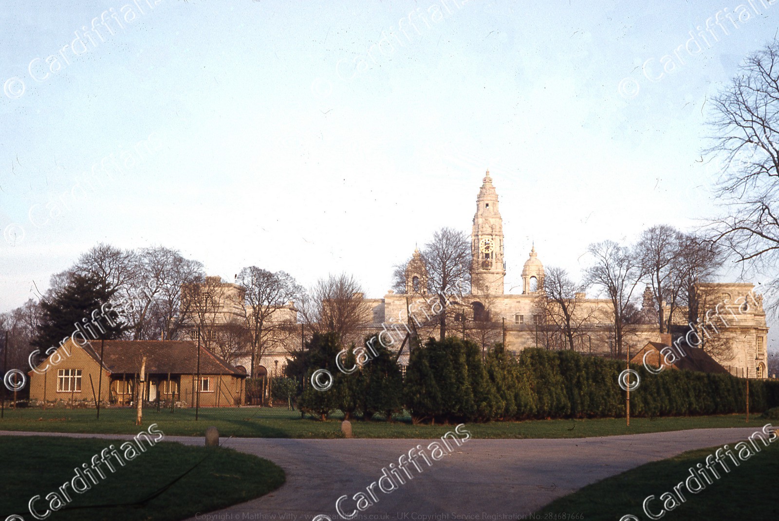 (1958) Bute Park, looking towards City Hall. The bungalow in the foreground has been replaced by Tennis Courts
 (1958) Canton Bridge
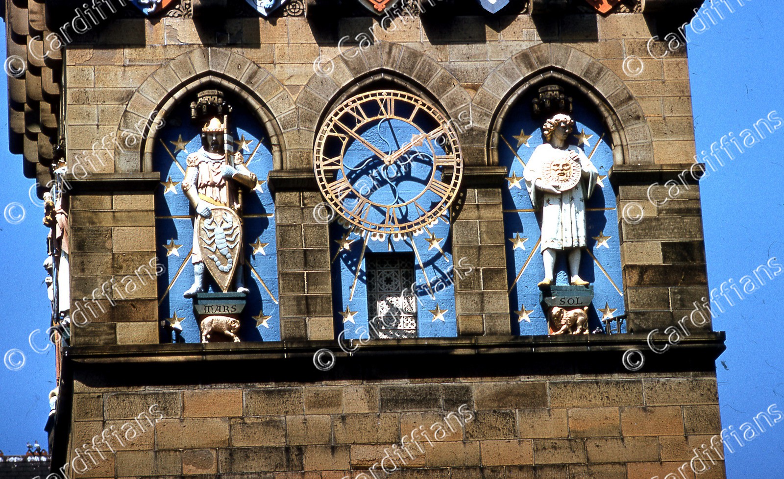 (1958) Cardiff Castle Clock Tower - close up
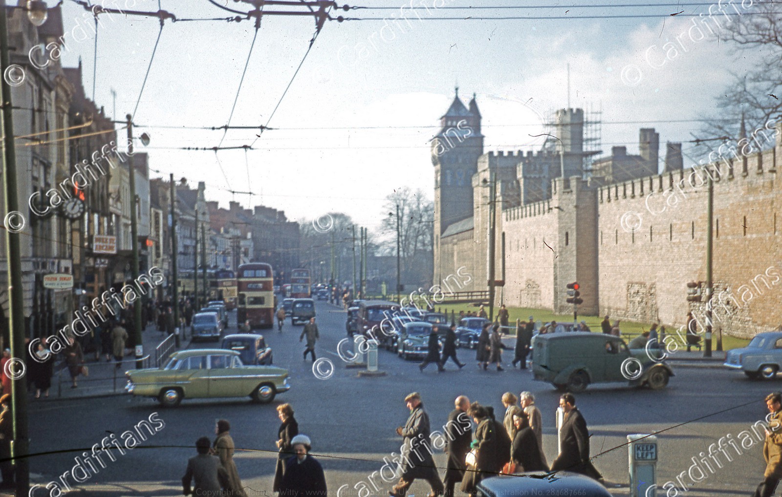 (1958) Cardiff Castle and Castle Street
 (1958) Cardiff City Hall (01)
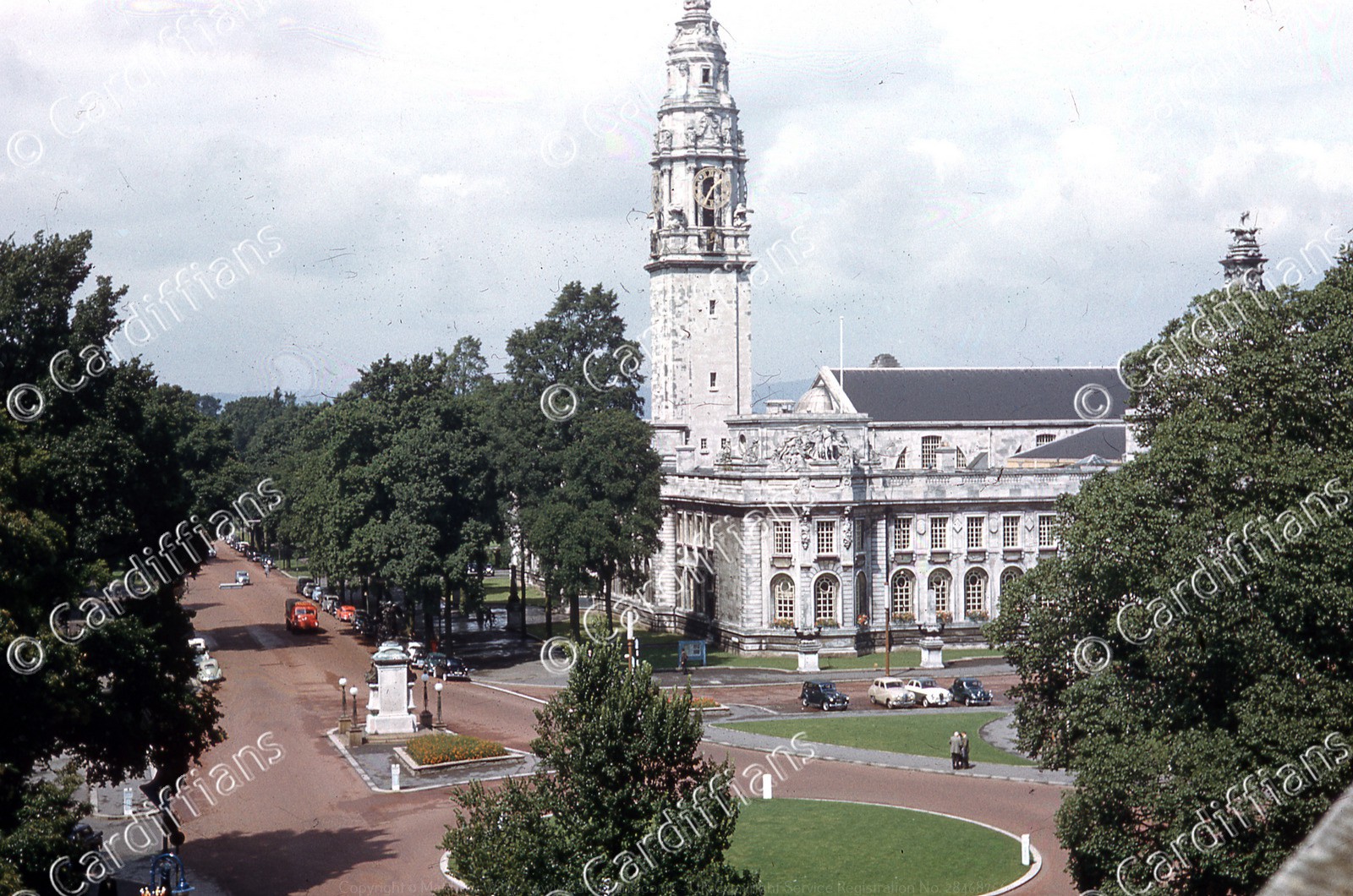 (1958) Cardiff City Hall (03)
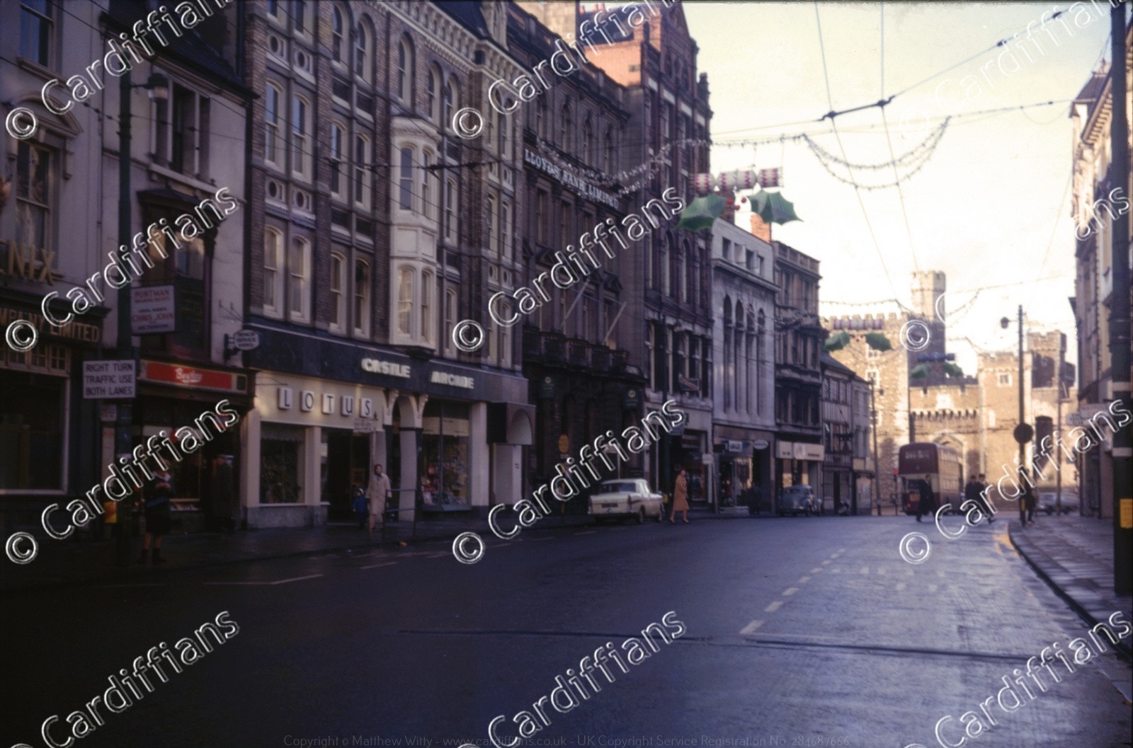
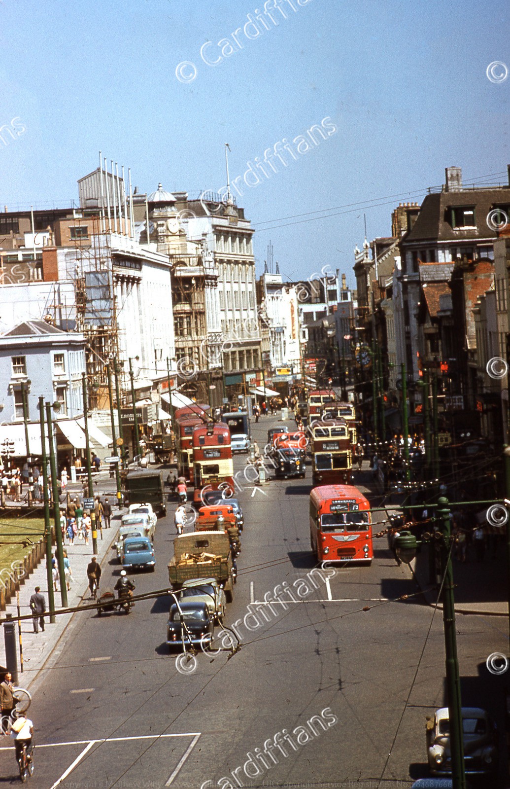 (1958) Castle Street, looking East towards Queen Street
 (1958) Central Market
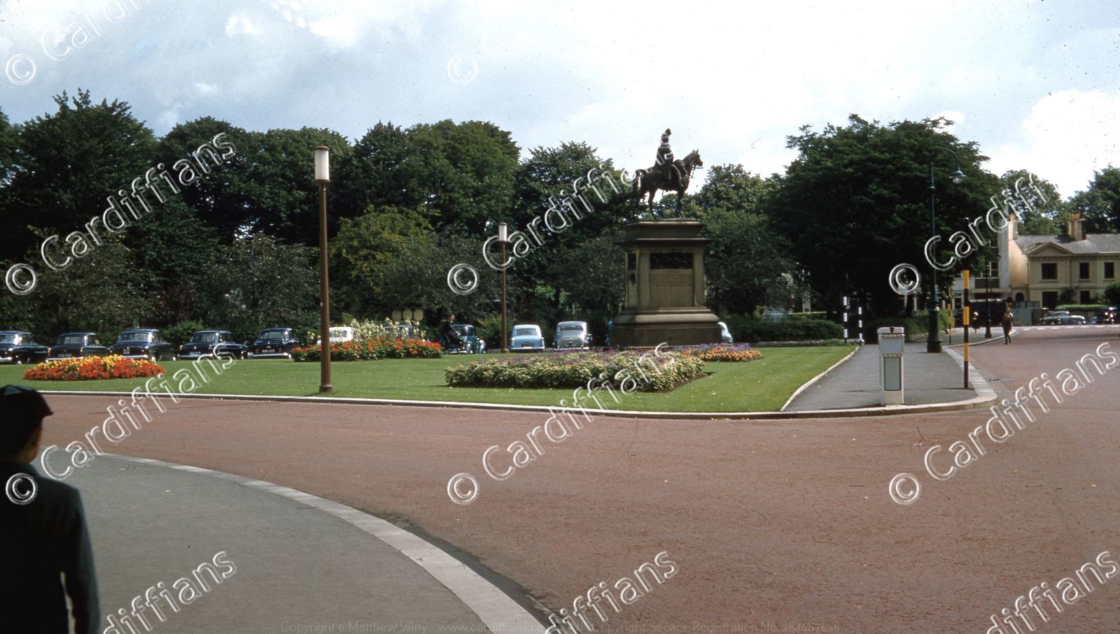 (1958) City Hall Lawn - Lord Tredegar Statue in the distance
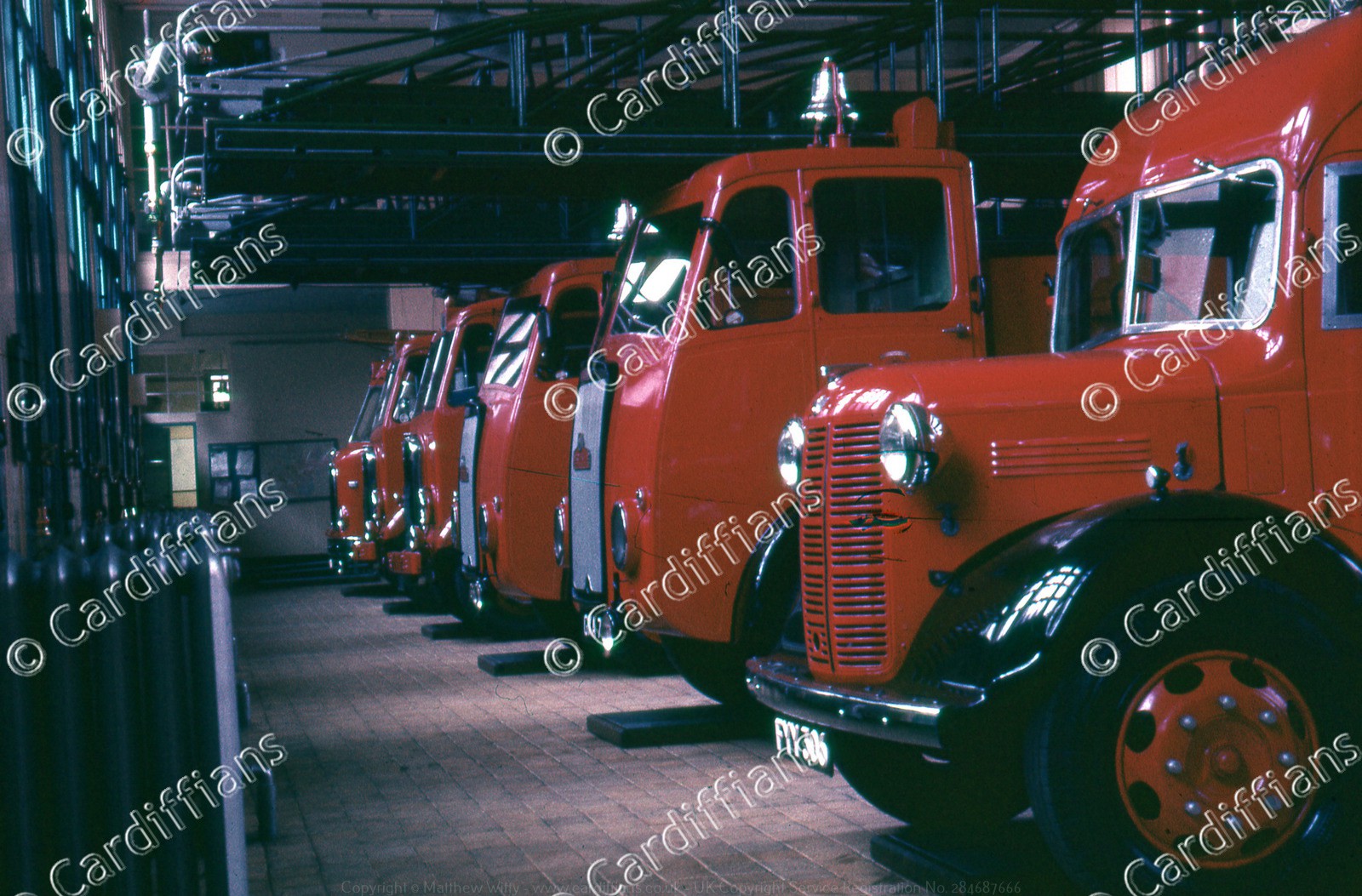 (1958) Fire Engines at the Westgate Street Fire Station
 (1958) Howells - St Mary Street
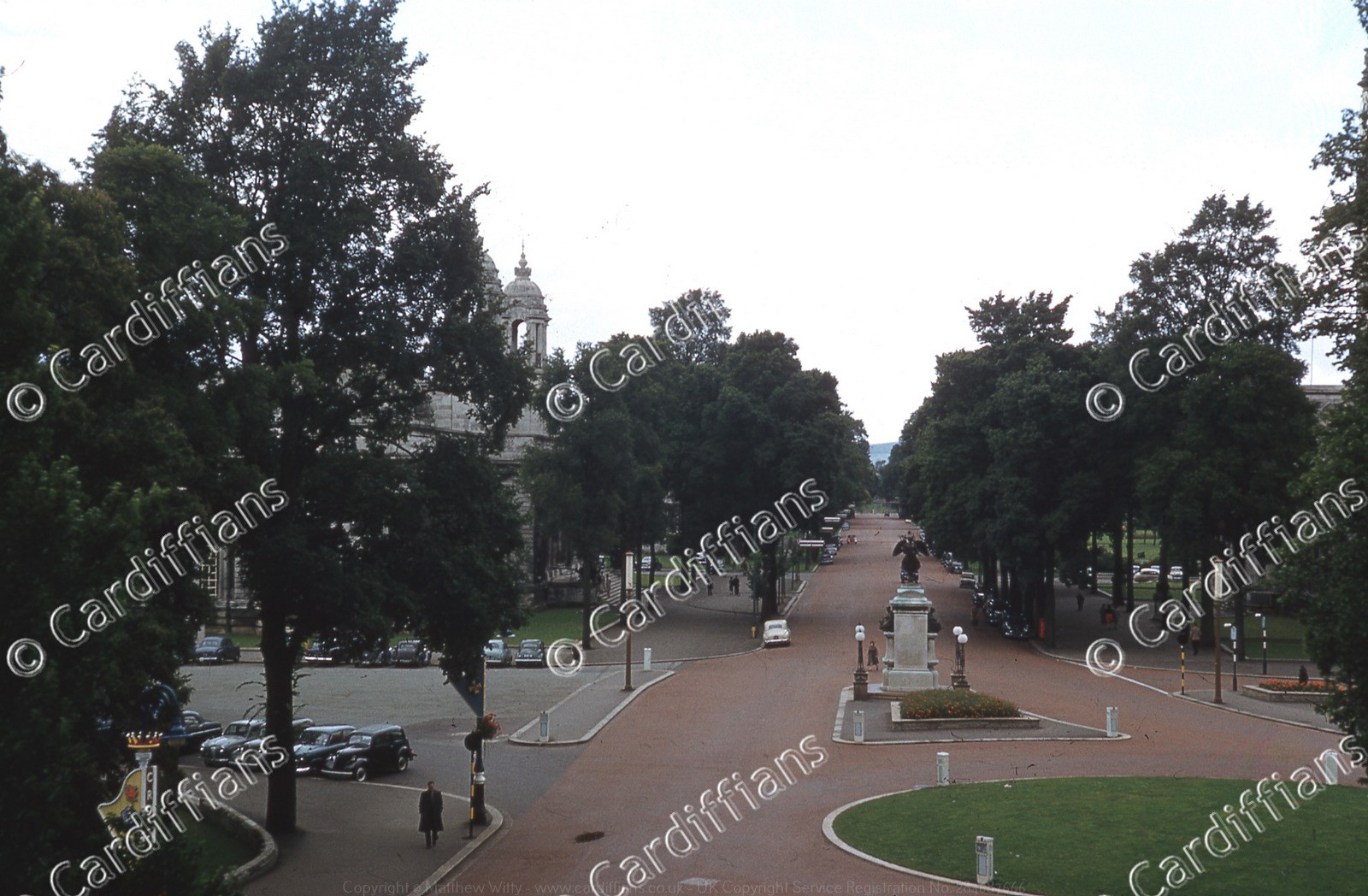 (1958) Museum Avenue, looking North
 (1958) Site of the Franciscan (Grey) Friars and ruins of Herbert House - Information Board
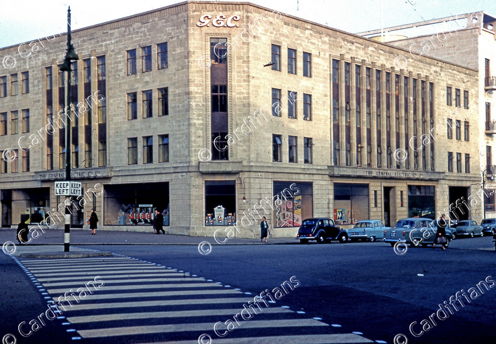 (1958) The GEC (General Electric Company), Magnet House, 1 Kingsway
 (1958) The ruins of Herbert House, site of the Franciscan (Grey) Friars - Demolished 1965-66
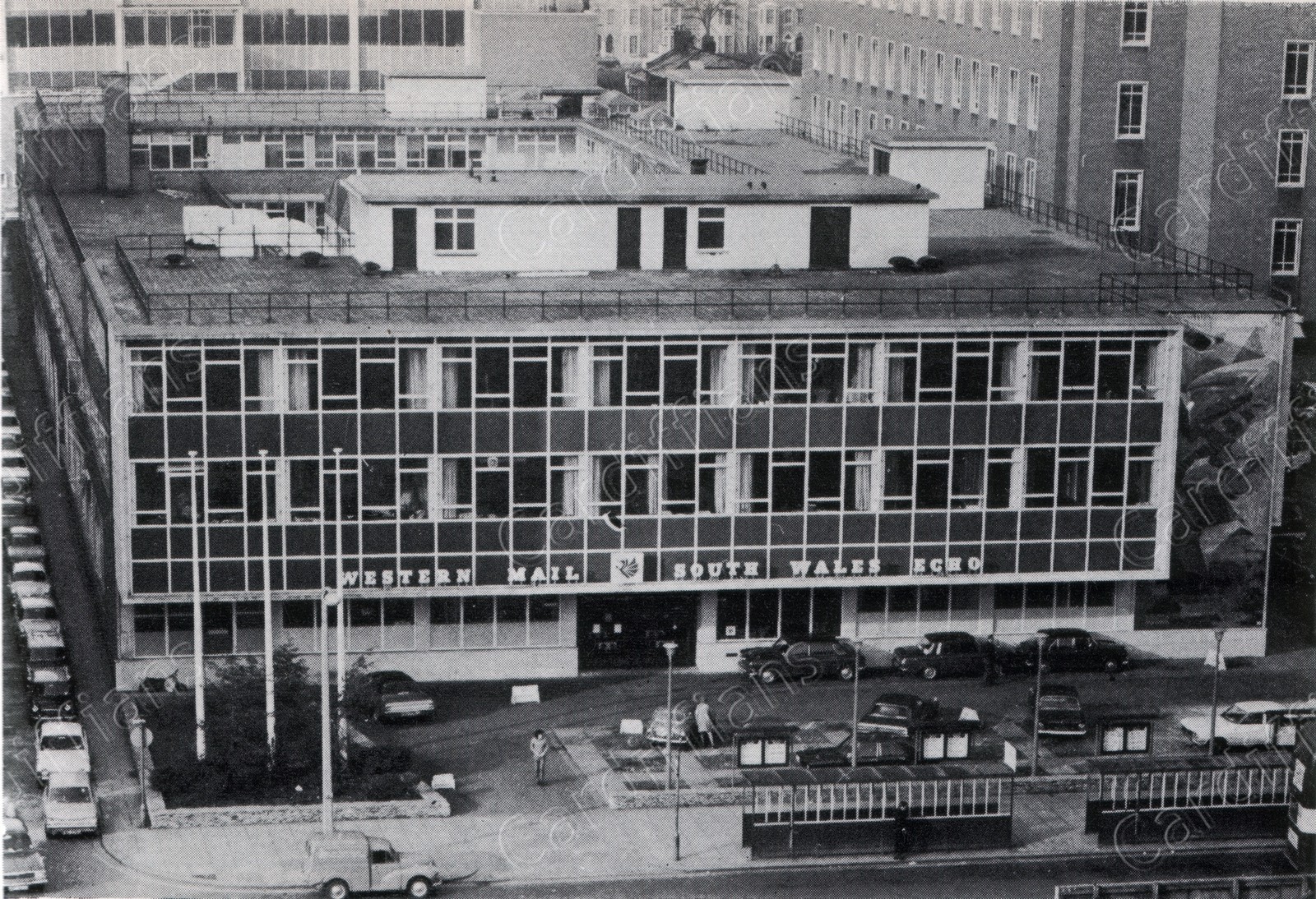
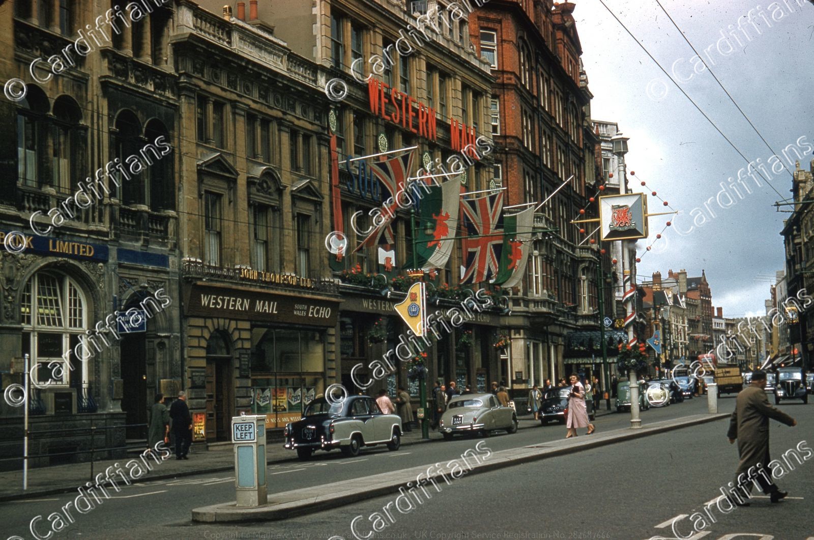 (1958) Western Mail and Echo Offices - St Mary Street
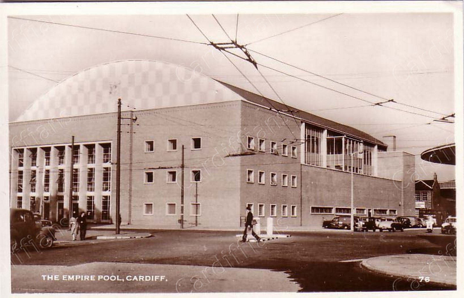 (1960) Empire pool
 (1960s) Cardiff Castle
 (1960s) Castle Arcade - High Street
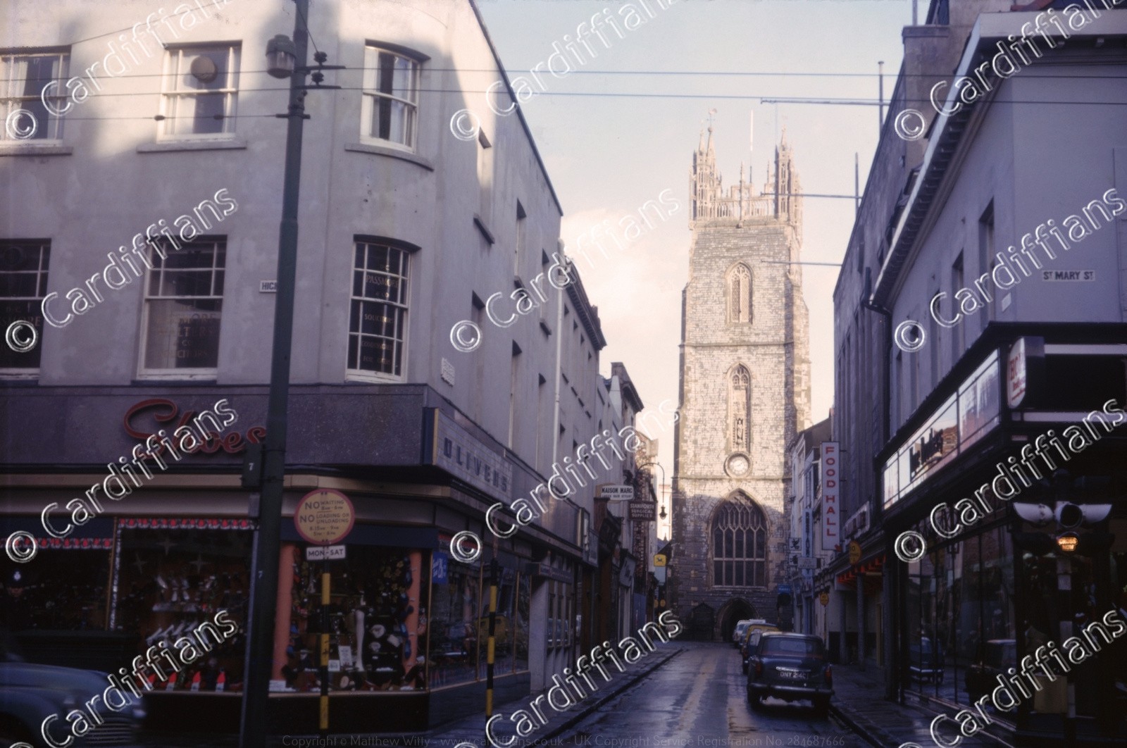 (1960s) Church Street
 (1960s) Duke Street Arcade
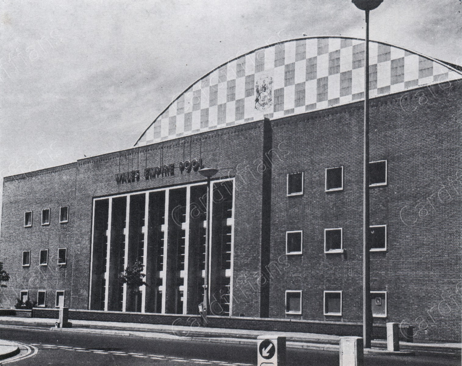 (1960s) Empire Pool on Wood Street
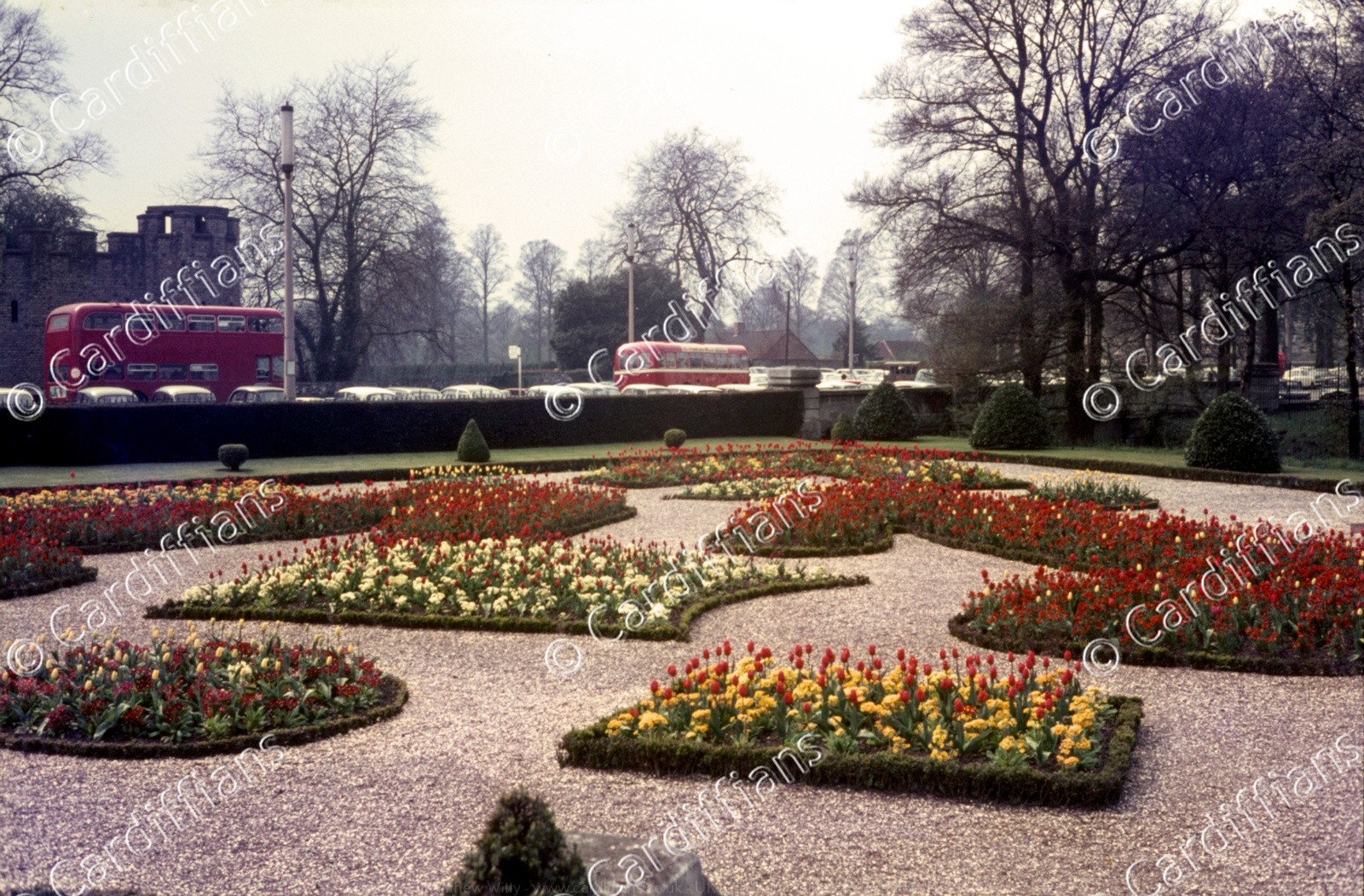 (1960s) Friary Gardens 01
 (1960s) Friary Gardens 02
 (1960s) High Street (Looking North to Castle)
 (1960s) High Street (Looking South to St Mary Street)
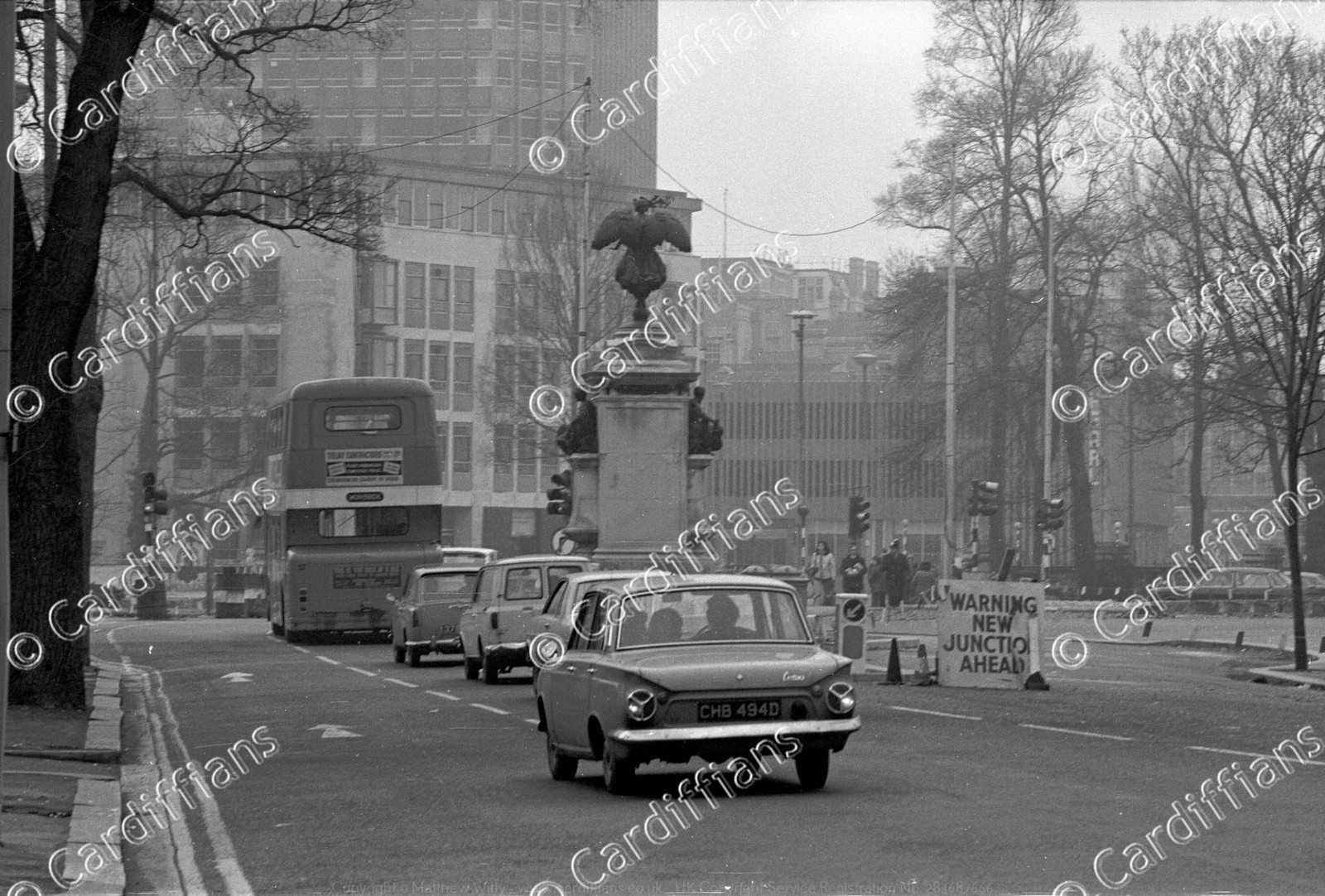
 (1960s) Monument Roundabout (Statue of the Second Marquess of Bute) - St Mary Street
 (1960s) Queen Street
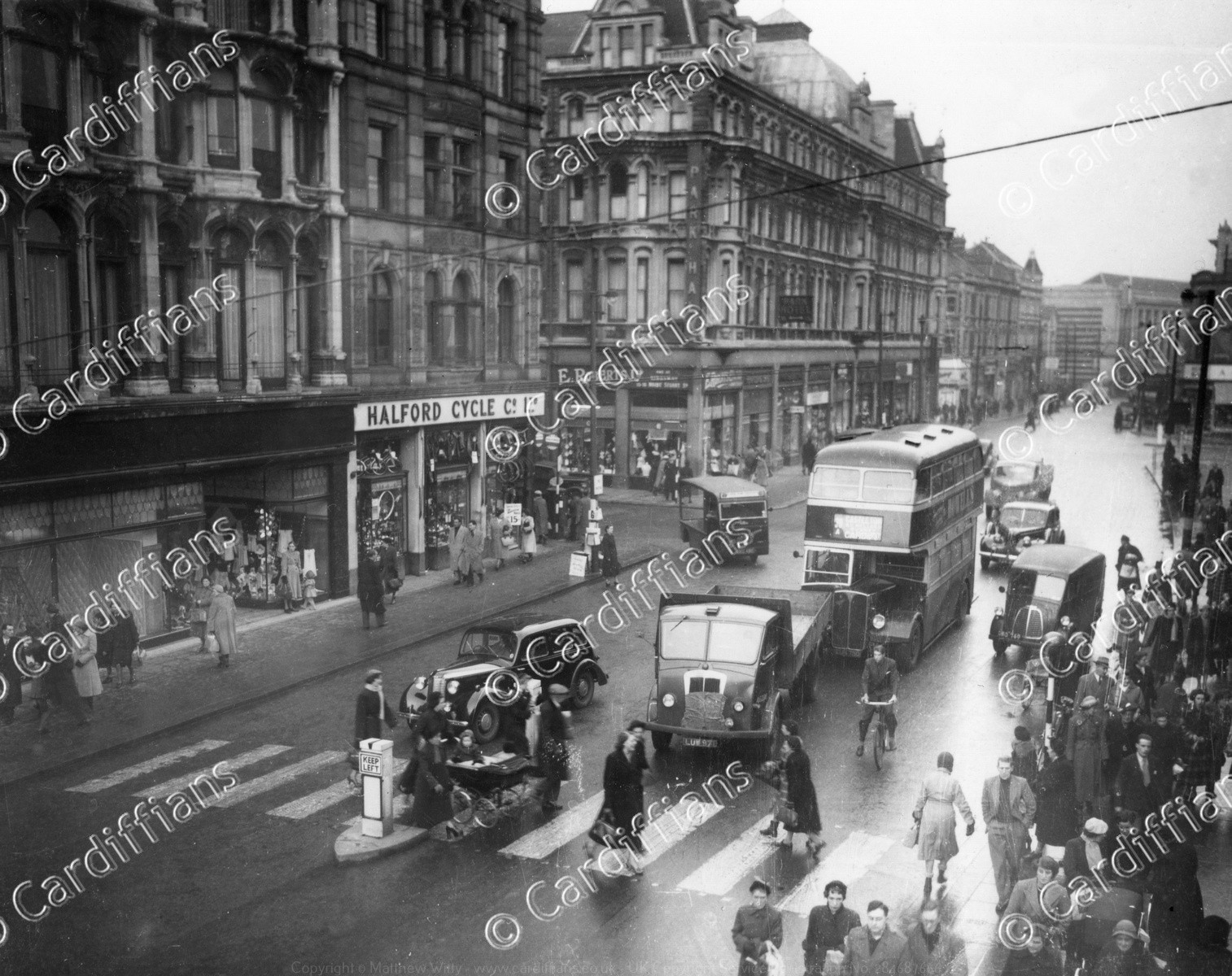 (1960s) Queen Street (Halford Cycle Co and the Park Hall Hotel)
 (1960s) Rose & Crown Pub in Kingsway (demolished in 1974)
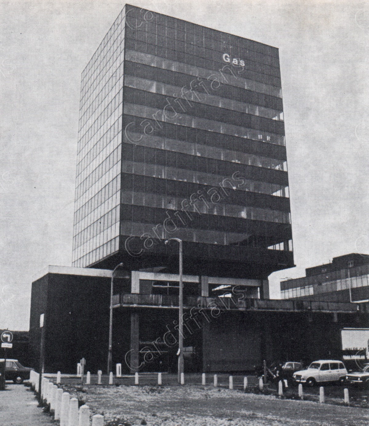 (1960s) Snelling House (Then Big Sleep, now Citrus Hotel) in Bute Terrace, which was once the headquarters of the Wales Gas Board
 (1960s) St Marys Street (Looking north to High Street)
 (1960s) The Hayes
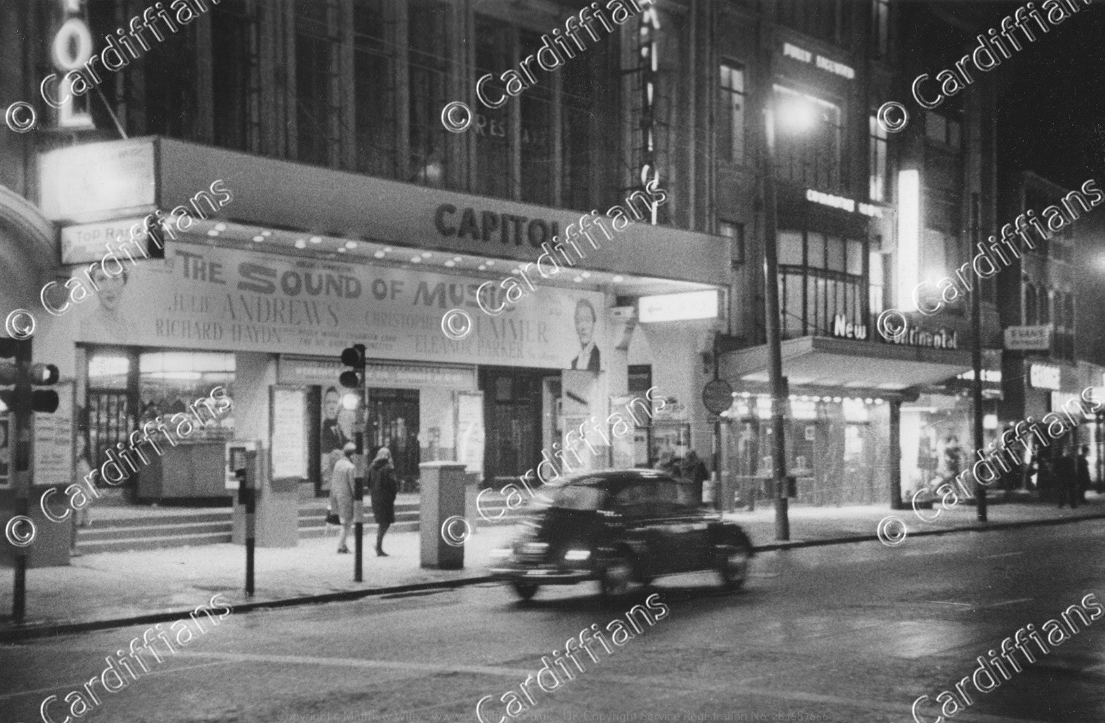 (1965) Capitol Theatre and New Continental Resturant - Queen Street
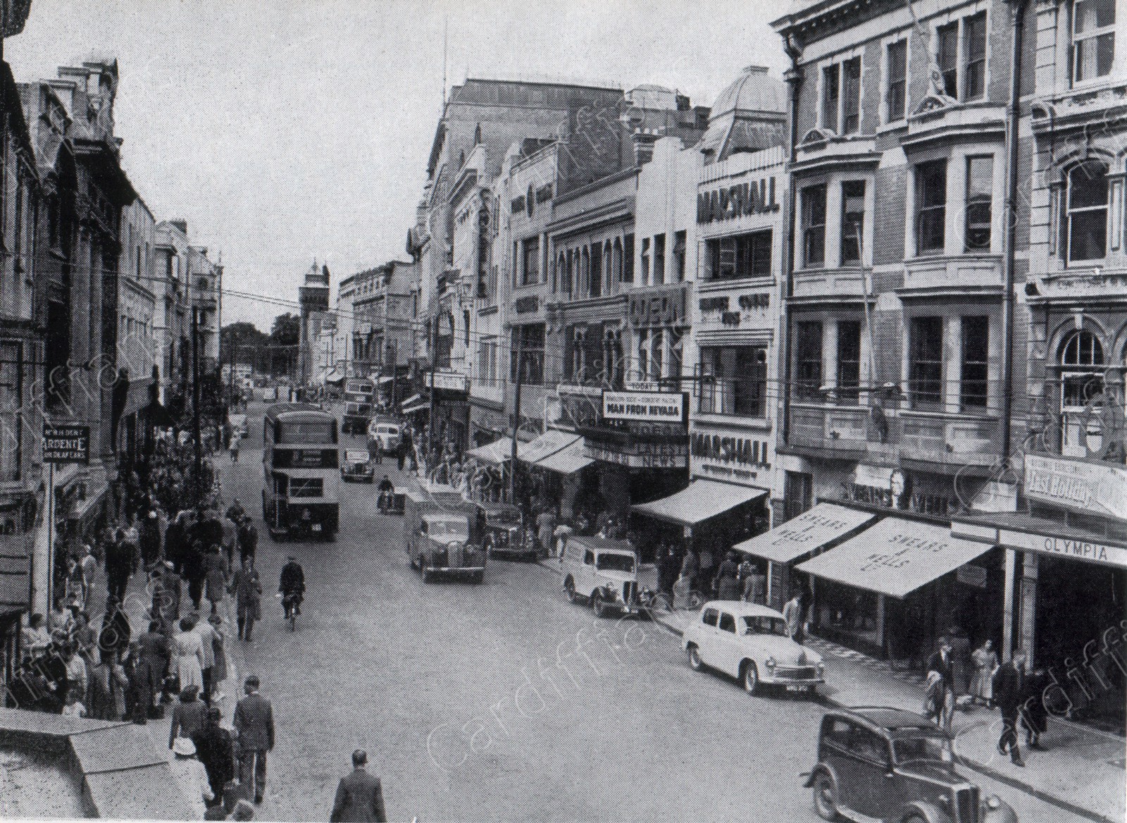
 (1965) Odean, Olympia Theatre, Swears and Wells - Queen Street
 (1965) Stuttgarter Strasse (construction of) which linked Park Place to Newport Road
 (1969) Churchill Way (looking south)
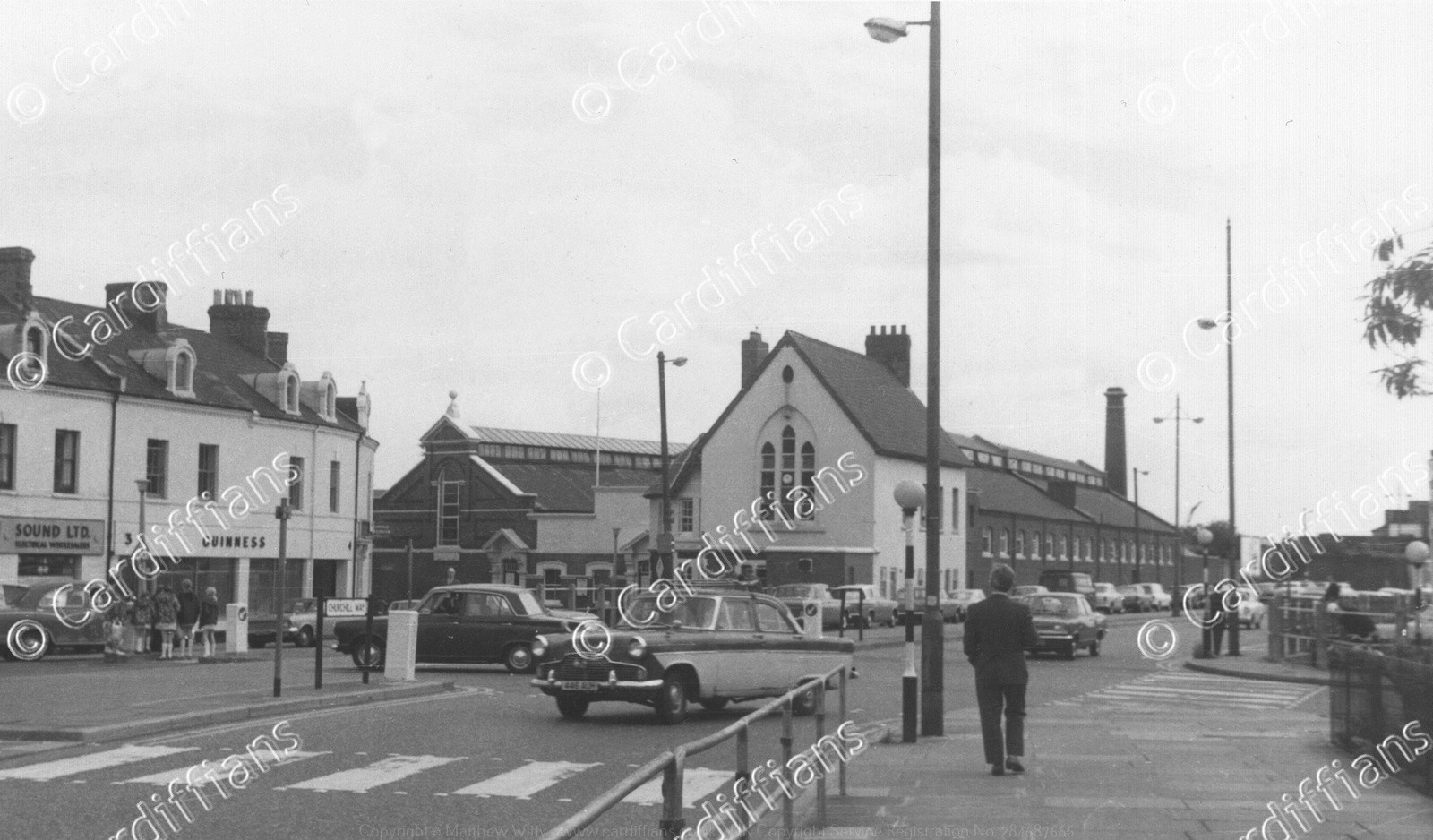
 (1969) St John Street traffic (The Hayes)
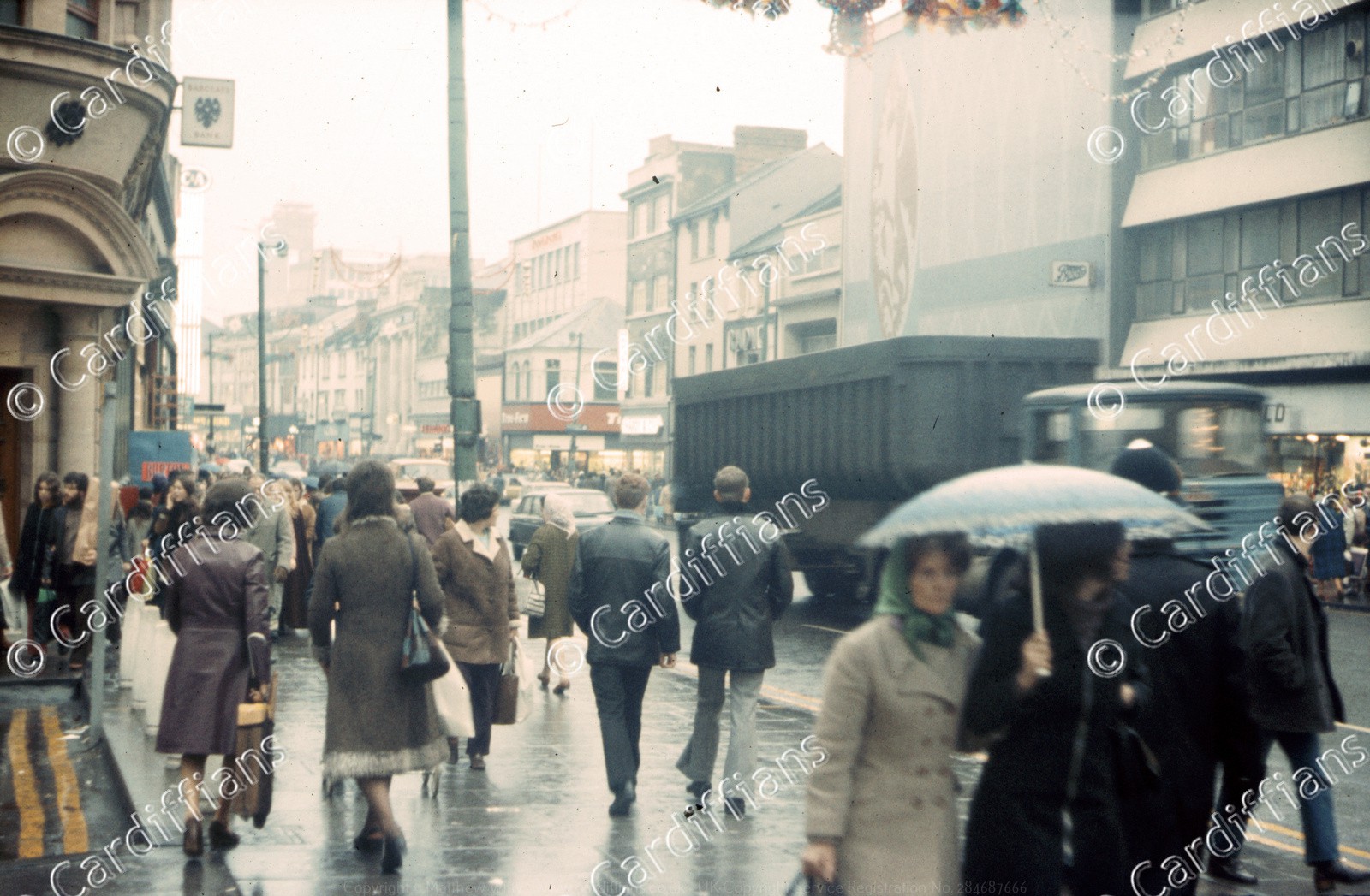
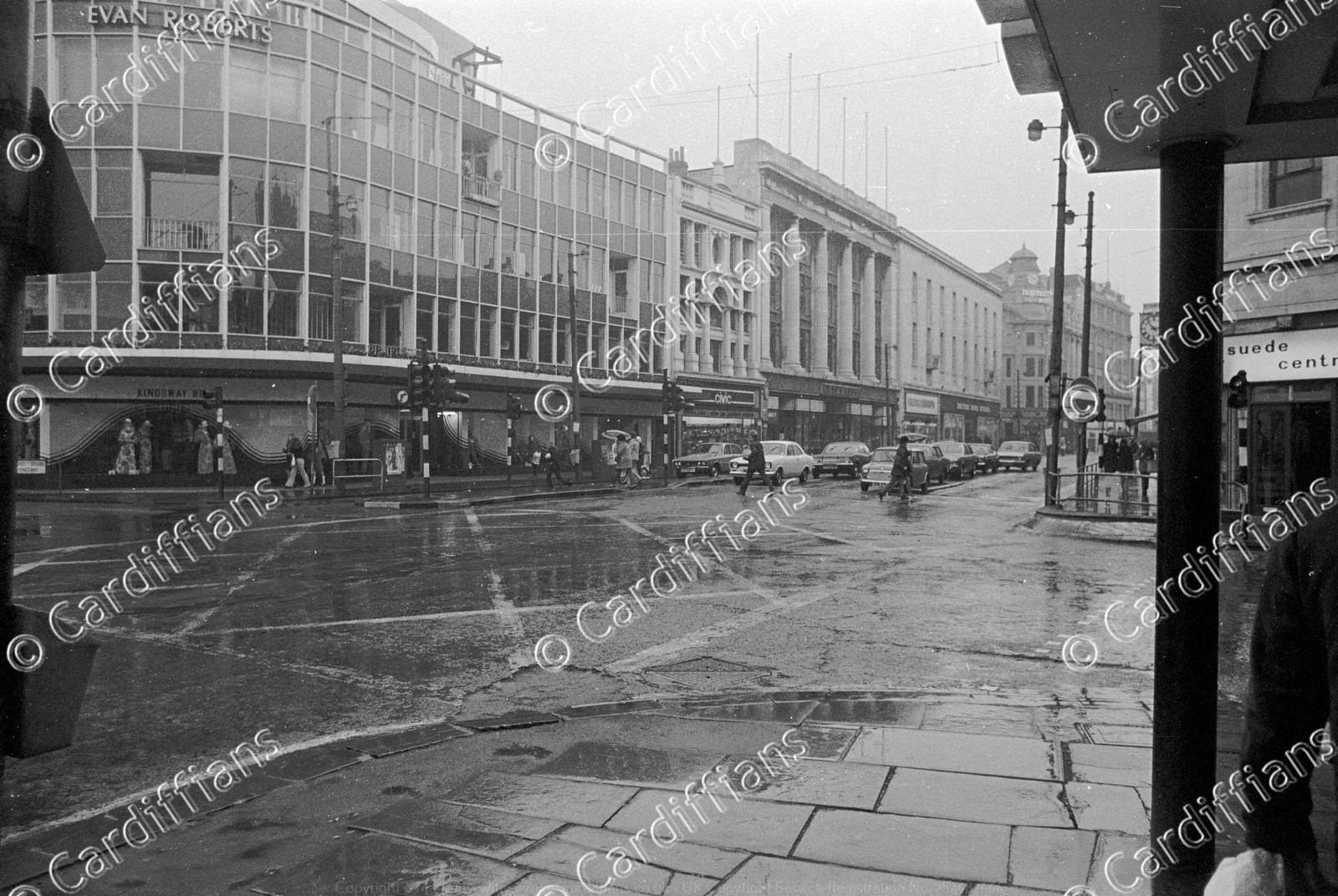
 (1970) Evan Roberts (Just Looking Promotion) - Queen Street
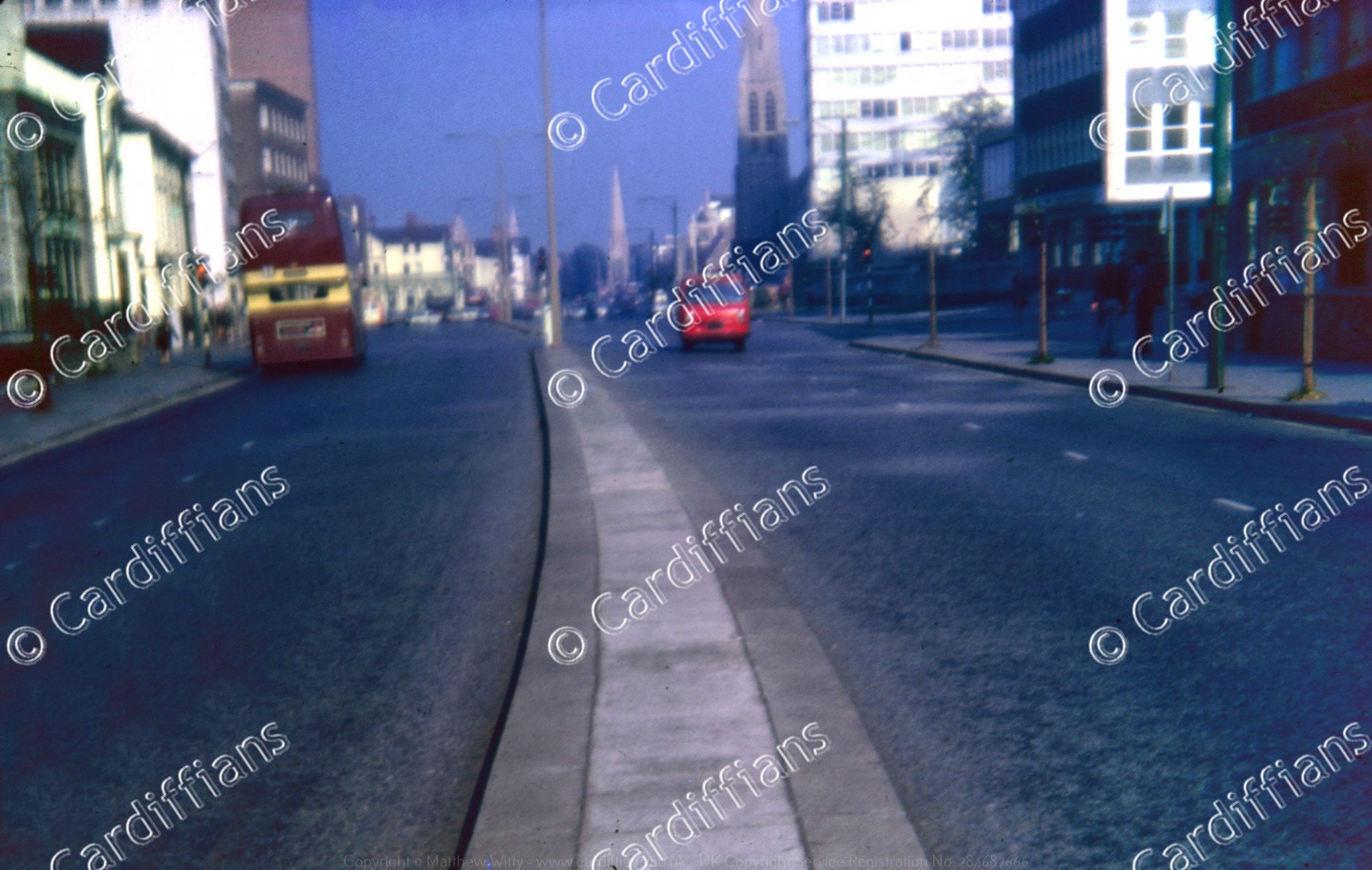
 (1970) Queen Street traffic
 (1970s) Central Free Library, View from Trinity Street before pedestrianisation
 (1970s) City Planning Offices, Central Station
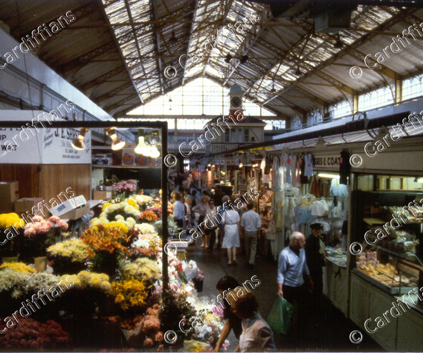
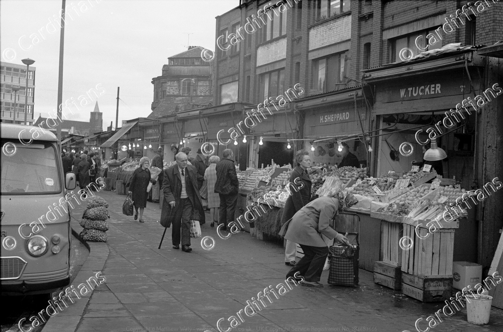
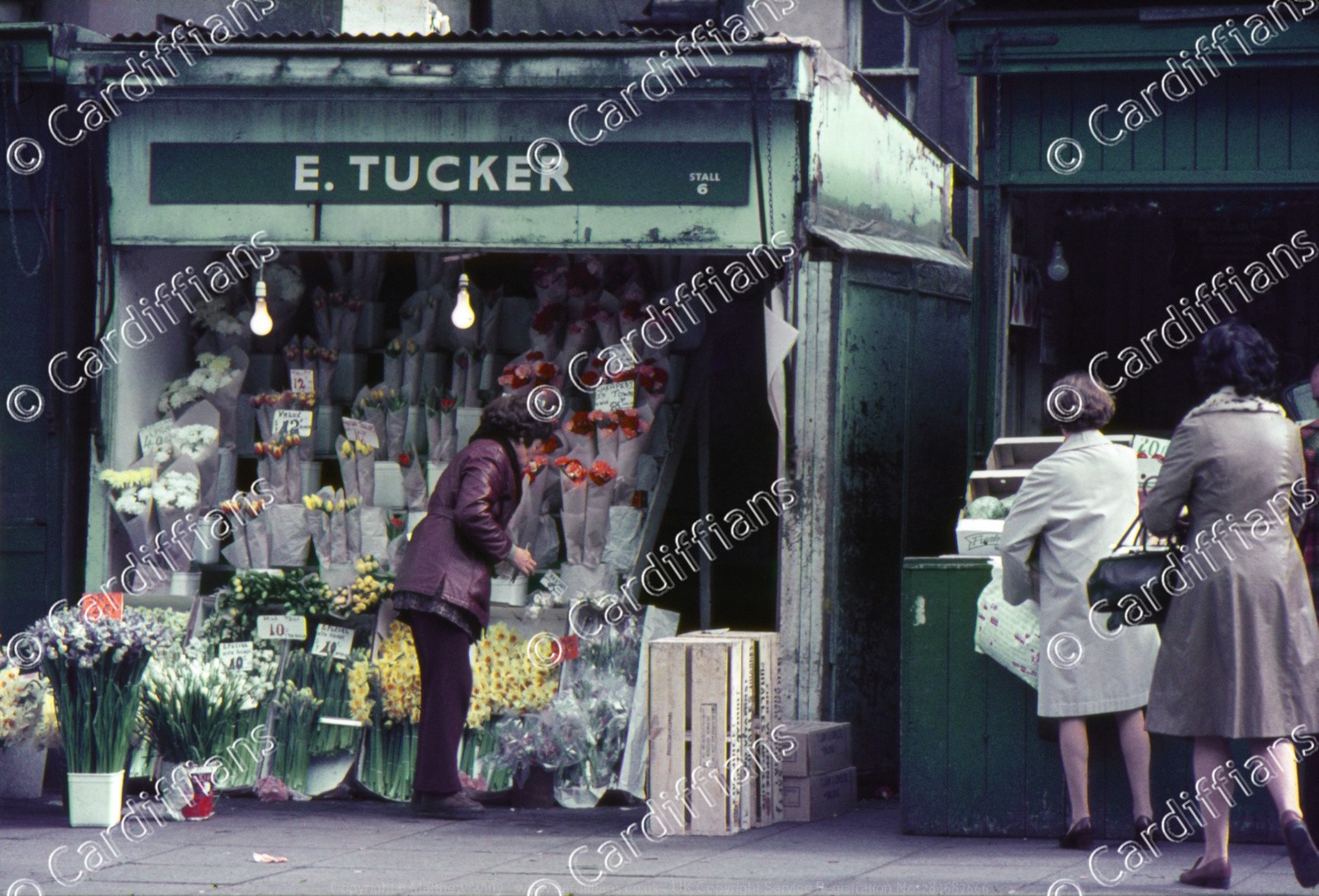 (1970s) E. Tucker Flower Stall - Mill Lane Market
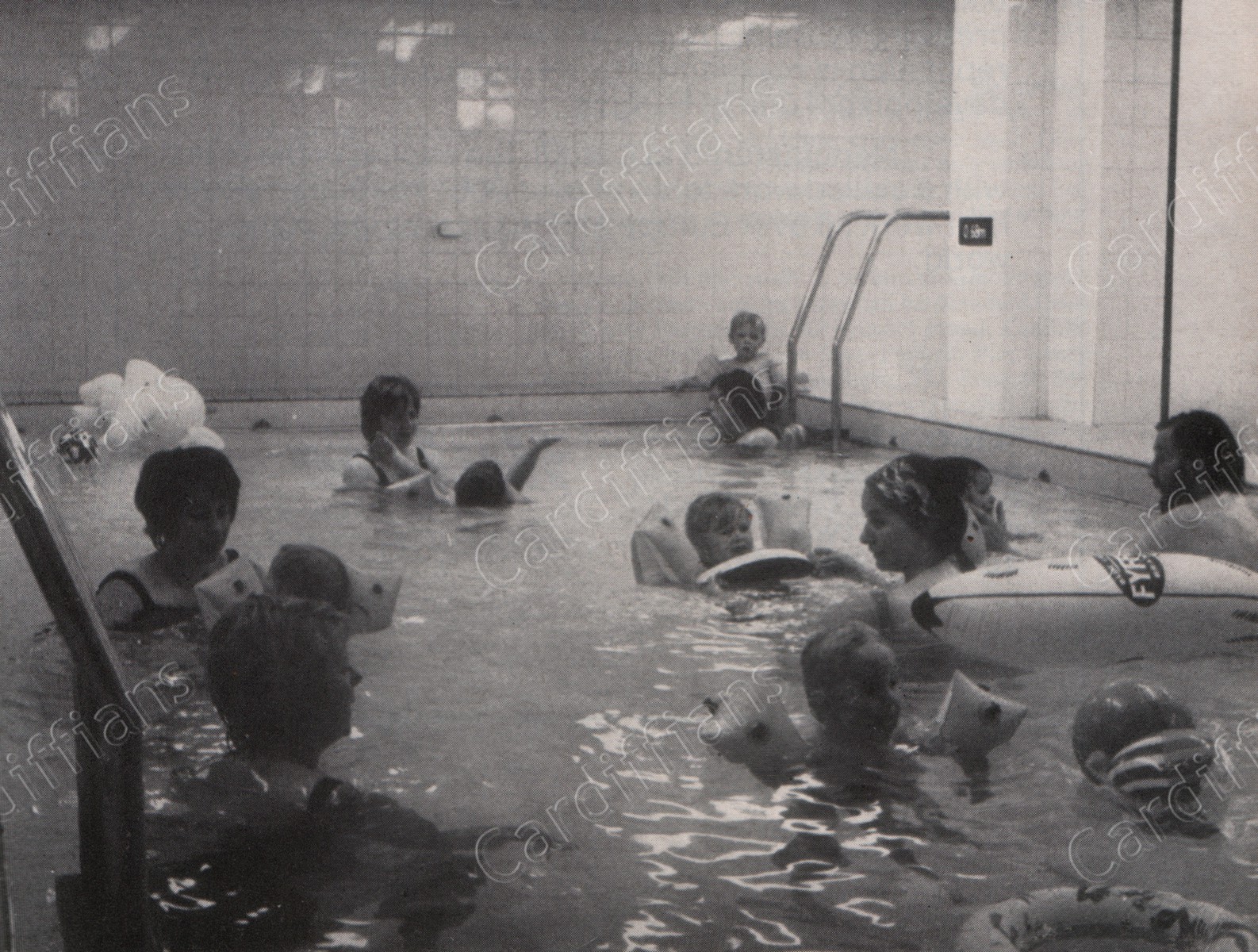 (1970s) Empire Pool training baths
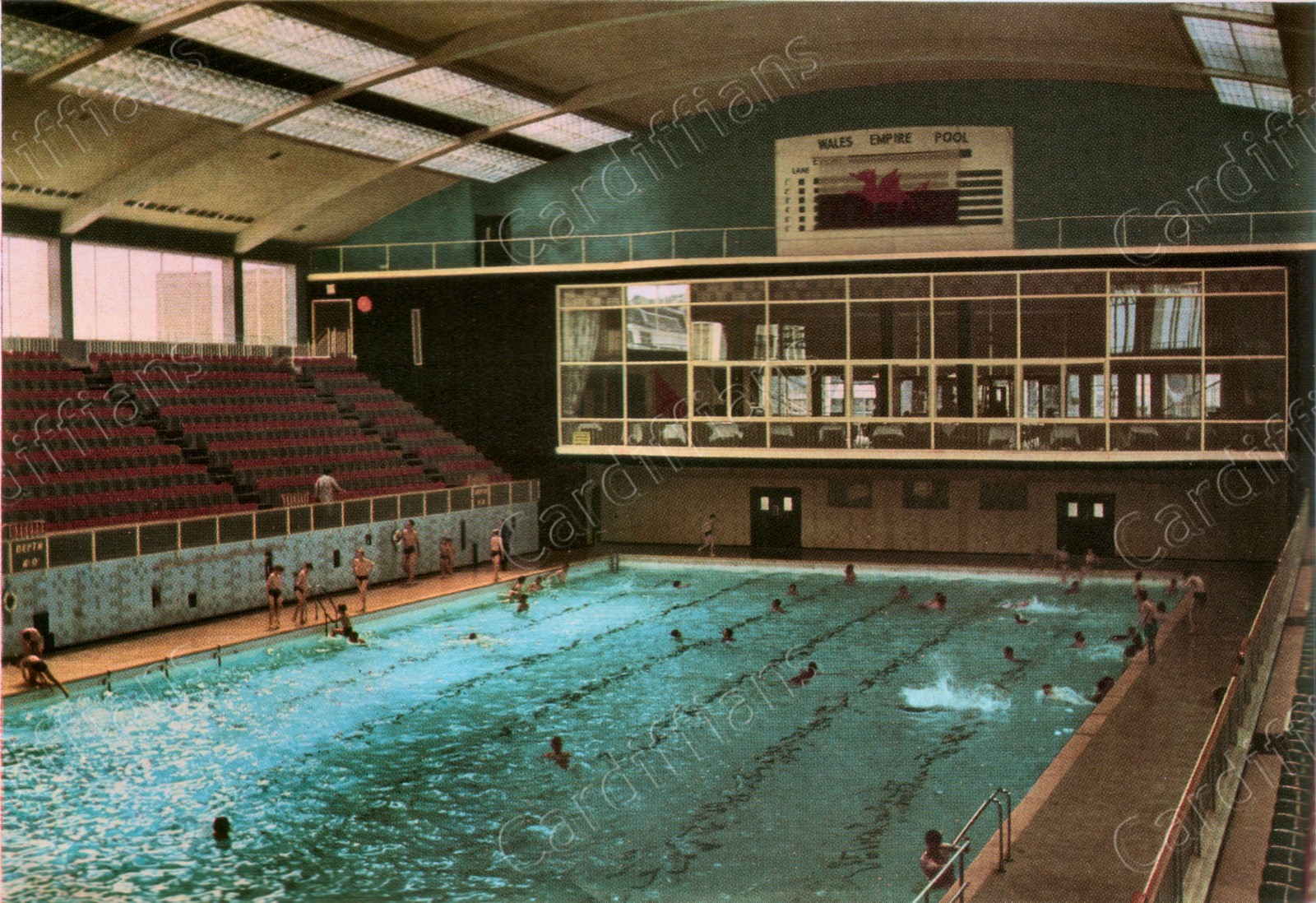 (1970s) Empire Pool, inside view 1
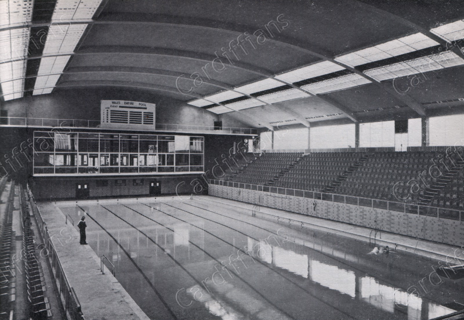 (1970s) Empire Pool, inside view 2
 (1970s) Empire Pool, view from the lowest diving board
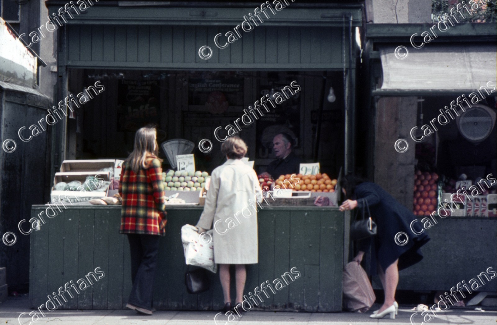
 (1970s) Harry Chiplin Fruit and Veg Stall (01) - Mill Lane Market
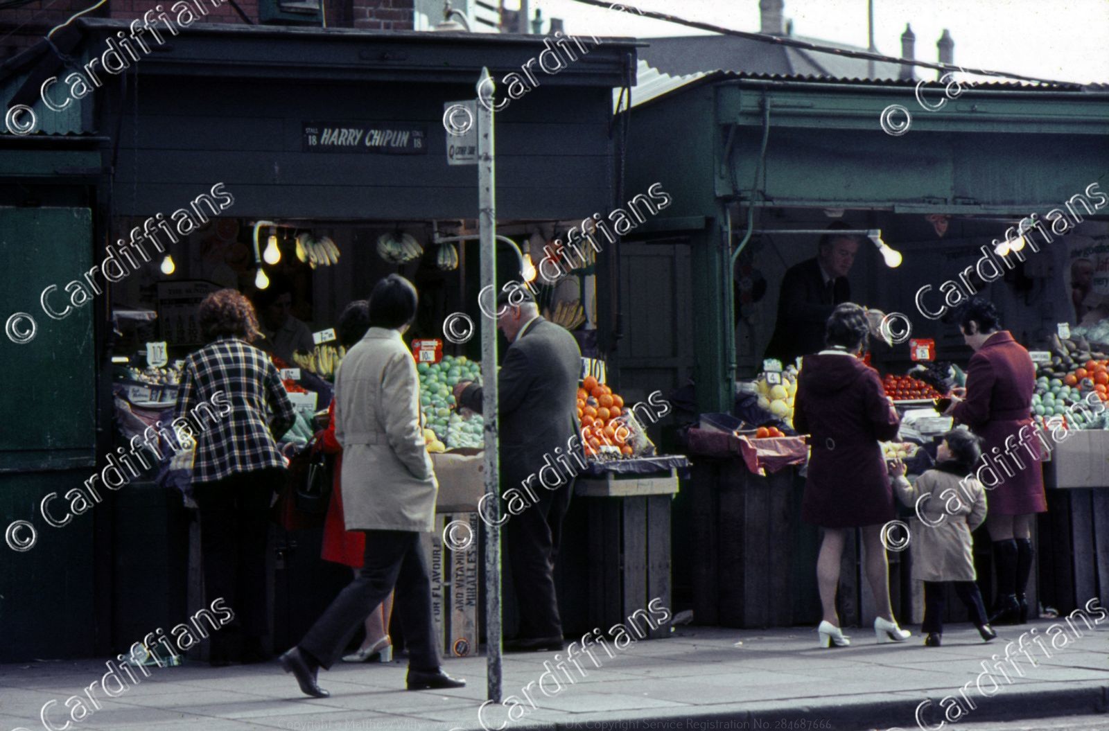 (1970s) Harry Chiplin Fruit and Veg Stall (02) - Mill Lane Market
 (1970s) Hayes House, The Hayes
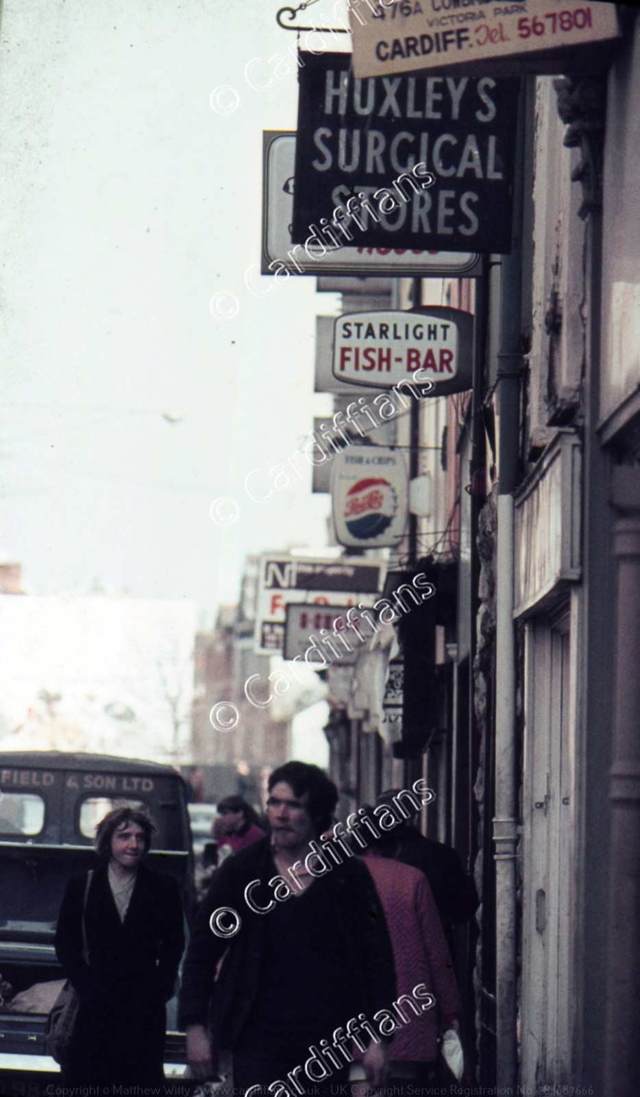 (1970s) Huxleys Sugical Stores - 26 High Street
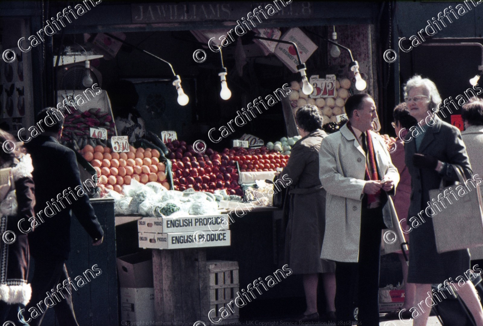 (1970s) JA Williams - Fruit and Veg Stall - Mill Lane Market
 (1970s) La Locanda and Hodge House - Guildhall Place
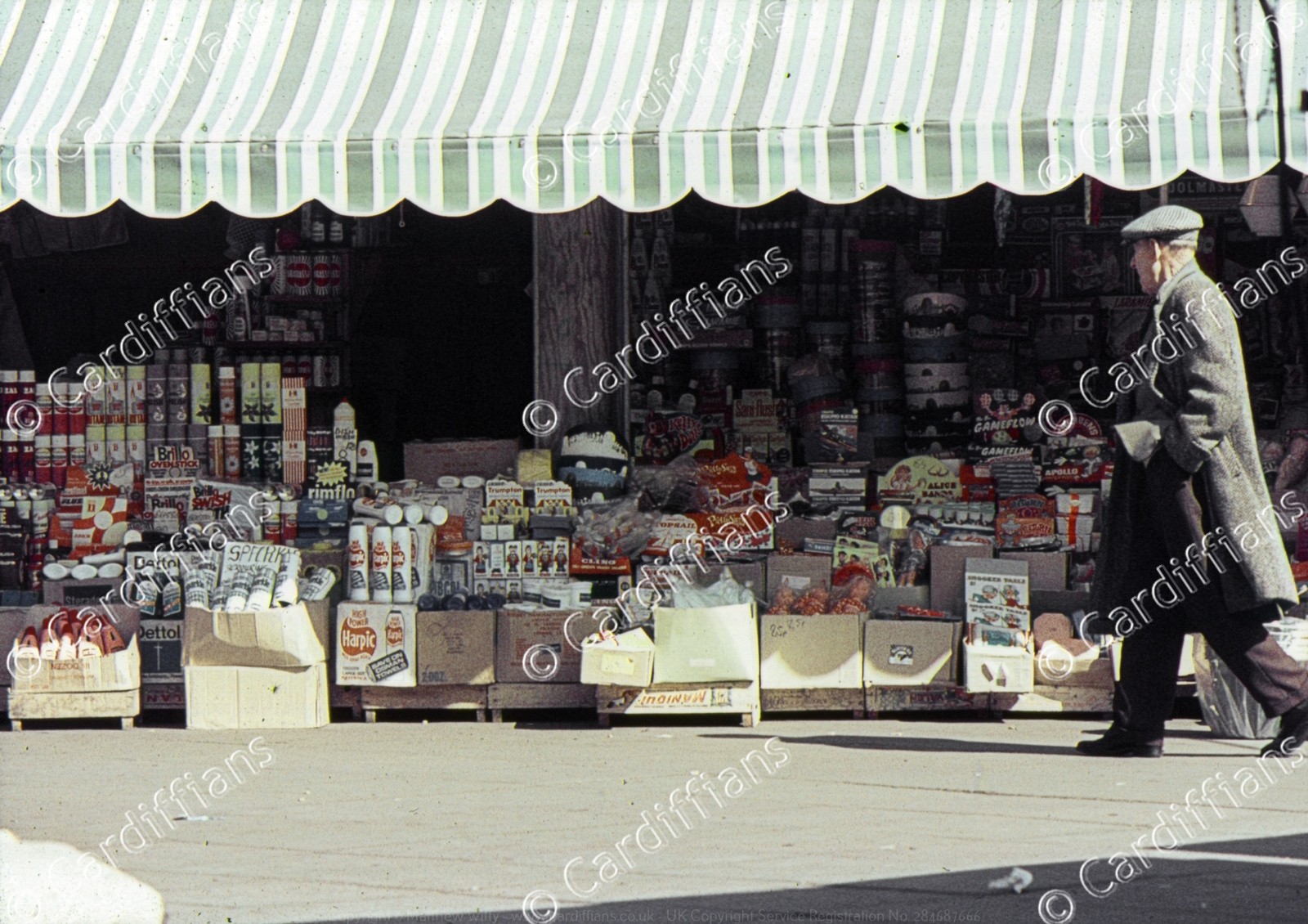 (1970s) Mill Lane Market (01)
 (1970s) Mill Lane Market (02)
 (1970s) Mill Lane Market (03)
 (1970s) New Theatre
 (1970s) Nuths Fruit and Veg Stall - Mill Lane Market
 (1970s) Pearl Assurance Building, Greyfriers Road
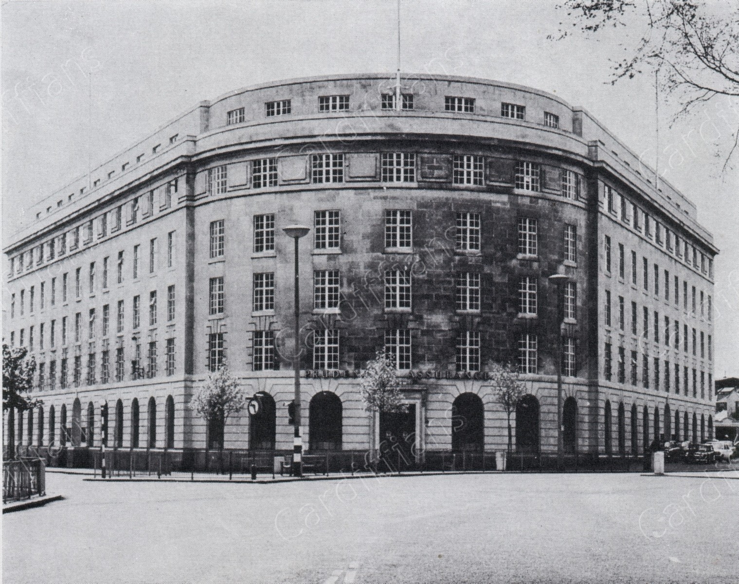 (1970s) Prudential Buildings, Kingsway
 (1970s) Quay Street
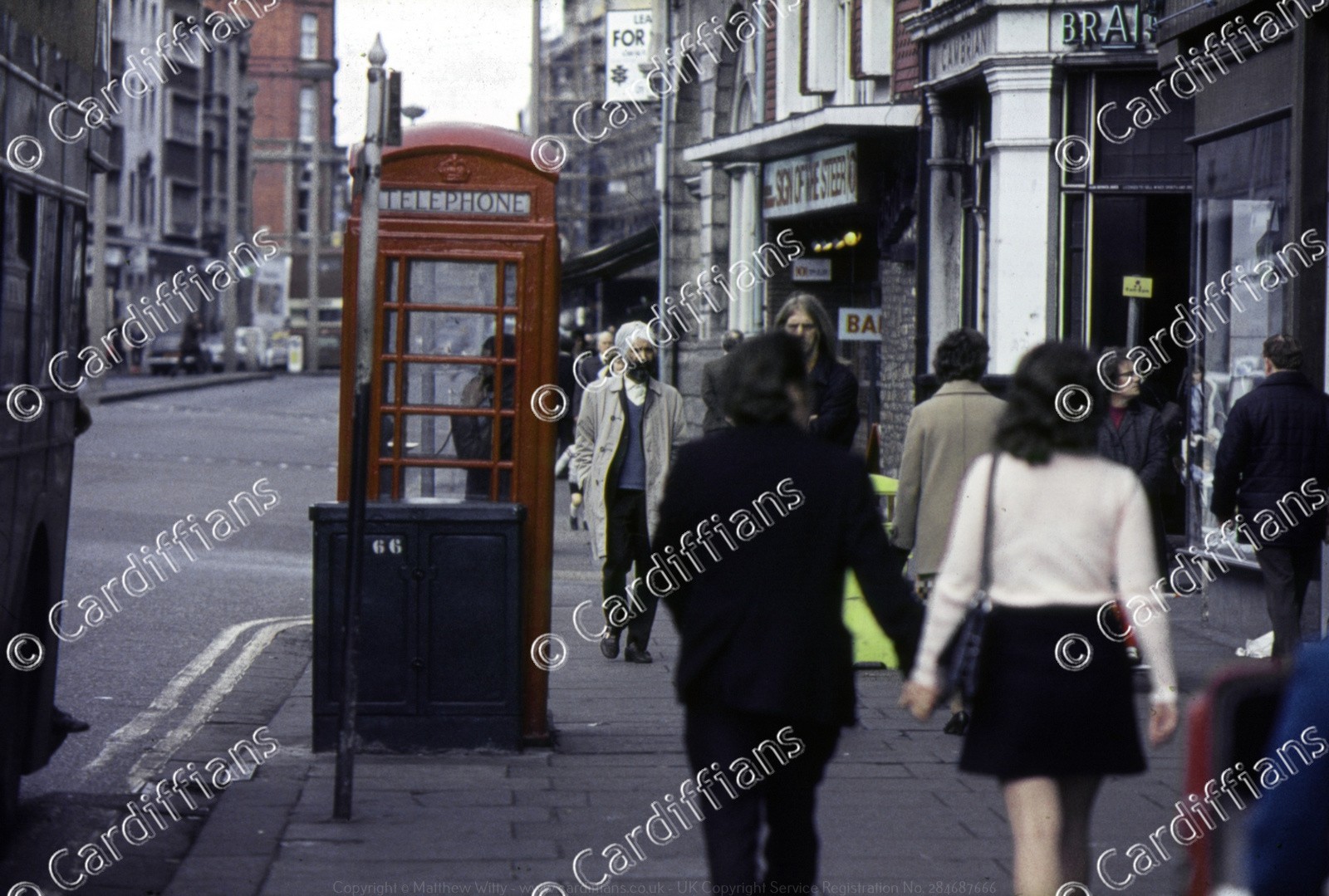 (1970s) Sign of the Steer - 49 St Mary Street
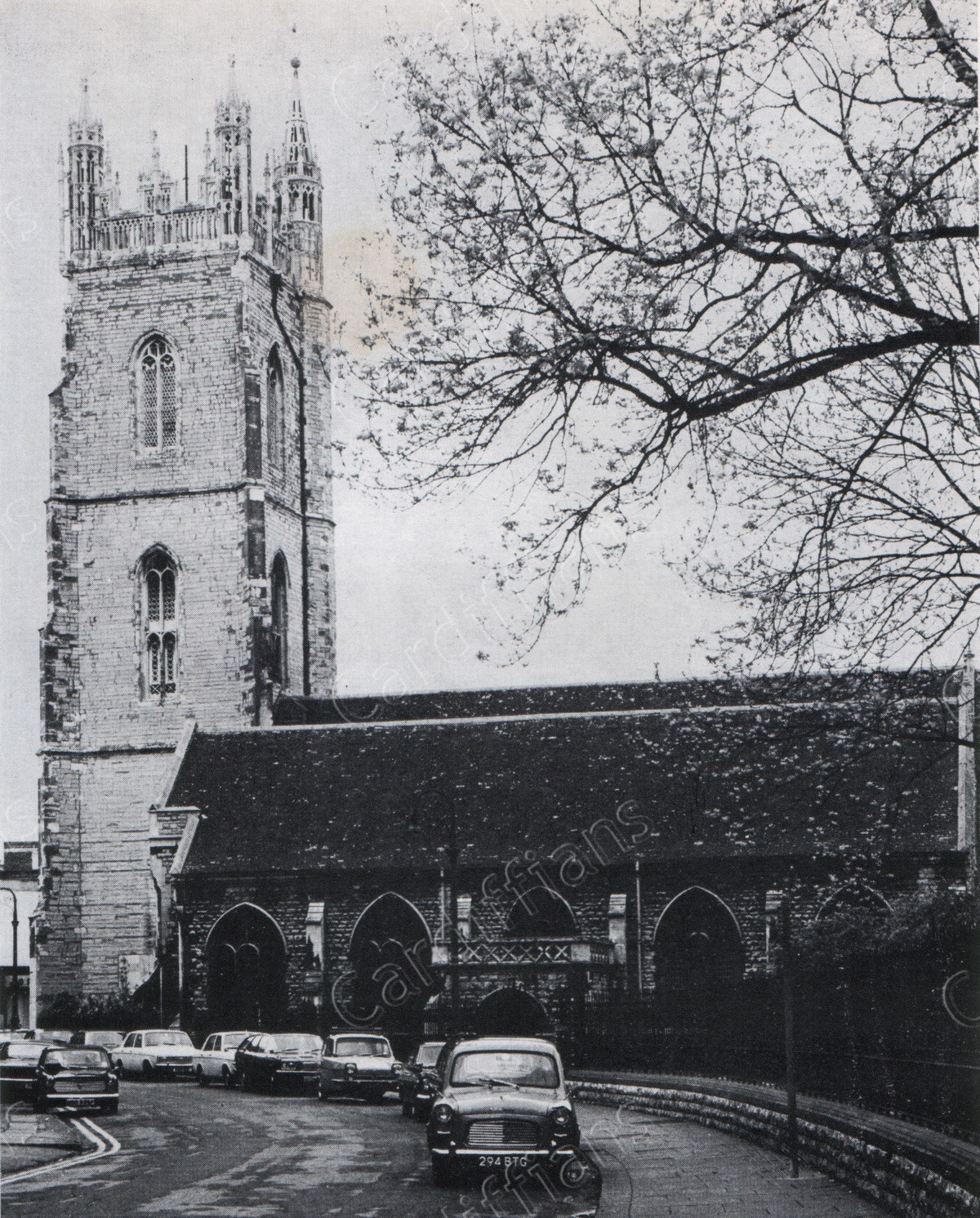 (1970s) St. Johns Church, View from Trinity Street before pedestrianisation
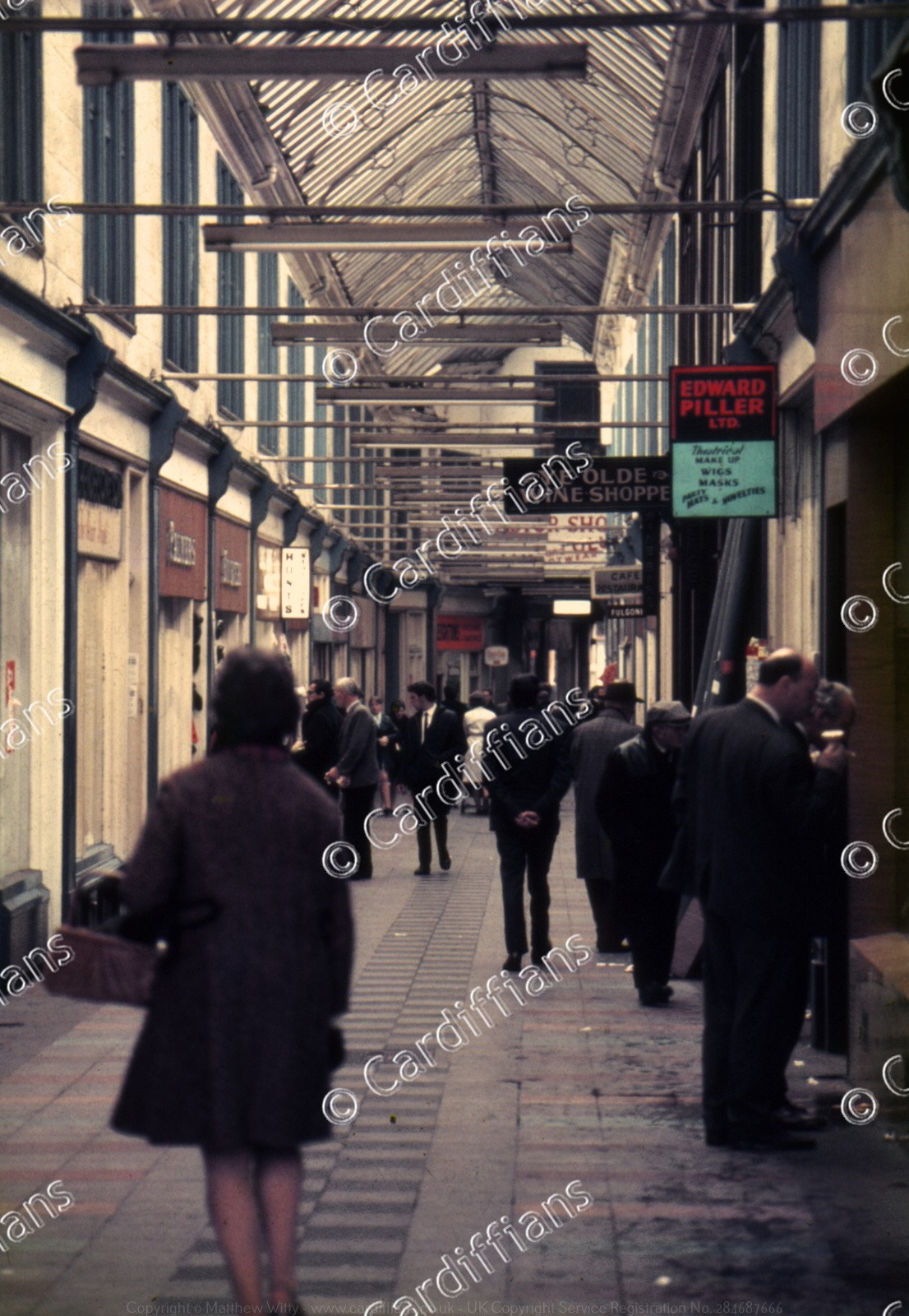 (1970s) Wyndham Arcade (Edward Piller Ltd)
 (1971) St. Mary Street
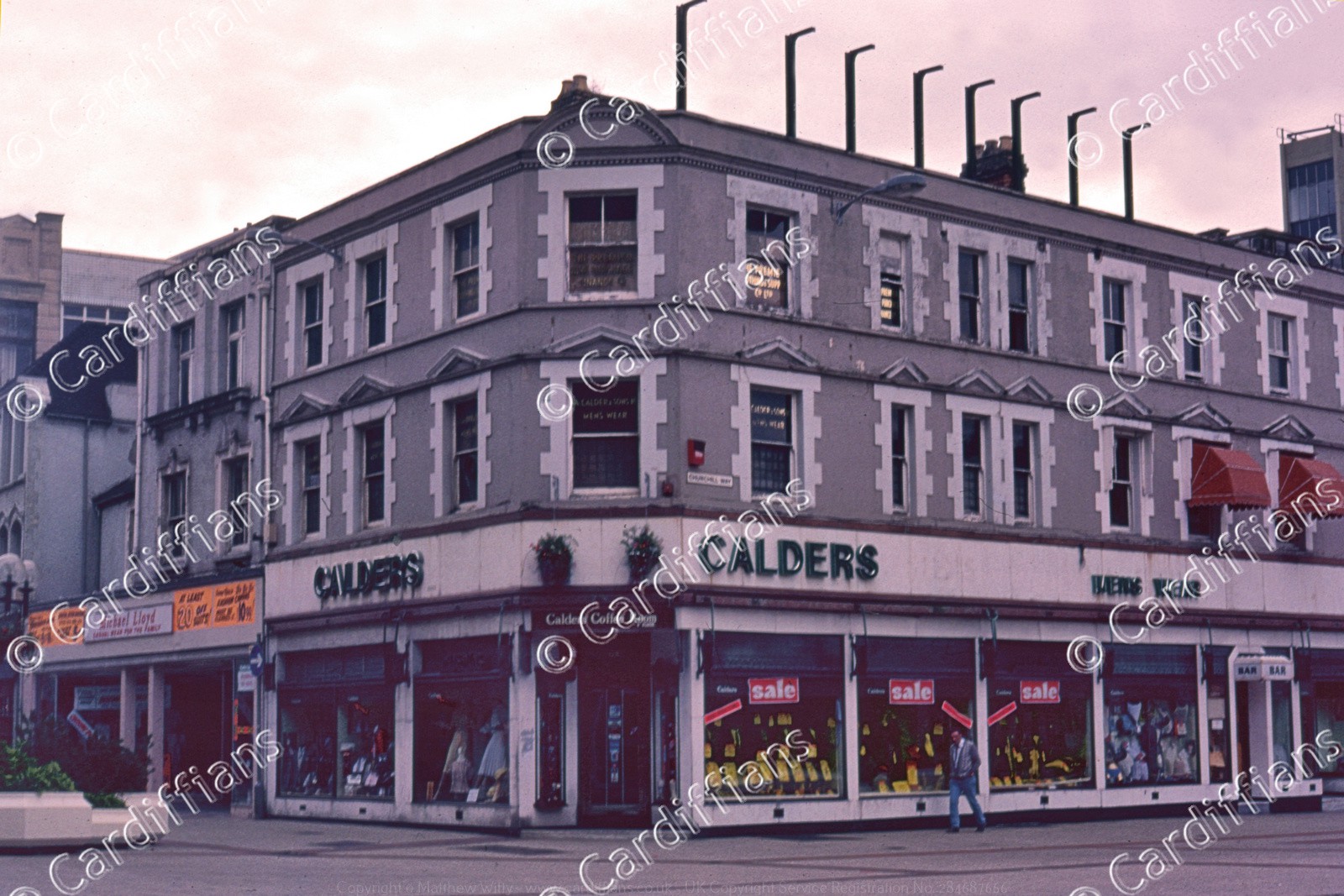 (1972) Caulders (junction of Churchill Way and Queen Street)
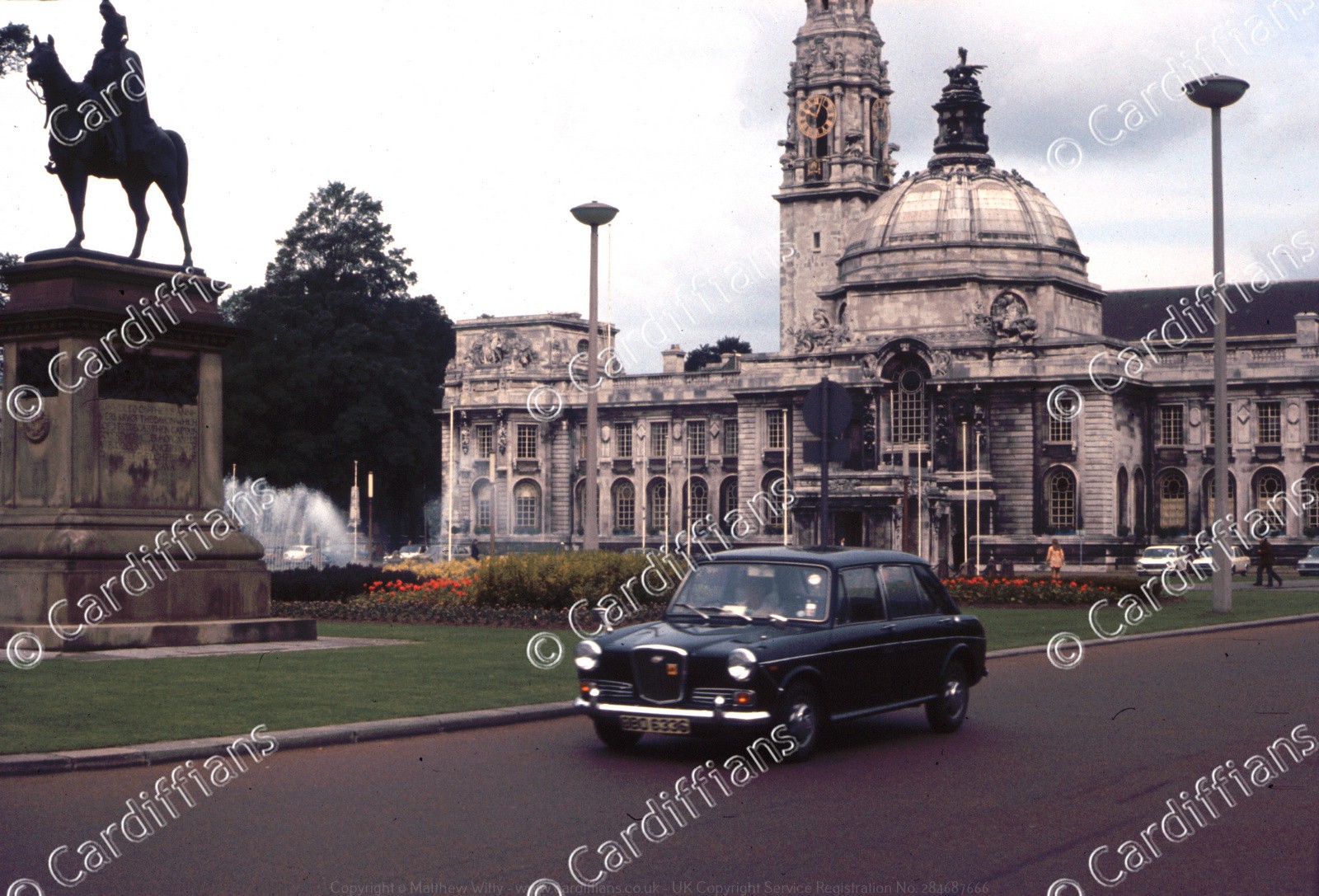 (1972) City Hall
 (1972) City Planning Offices under construction, viewed from across the River Taff
 (1972) Hayes Island
 (1972) Kingsway and North Road
 (1972) Newport Road (approaching City Road)
 (1972) Queen Street
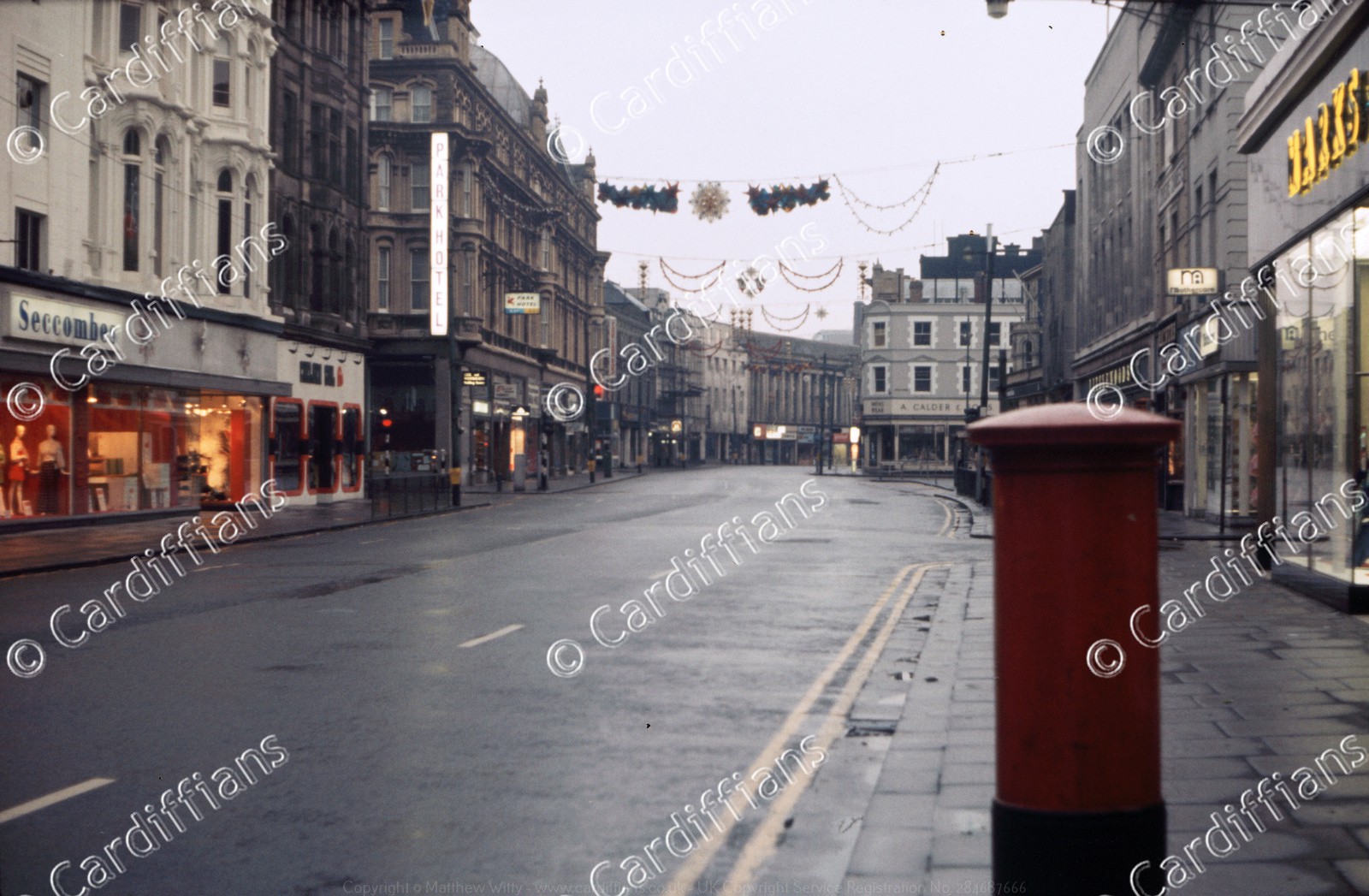 (1972) Queen Street early on Christmas morning
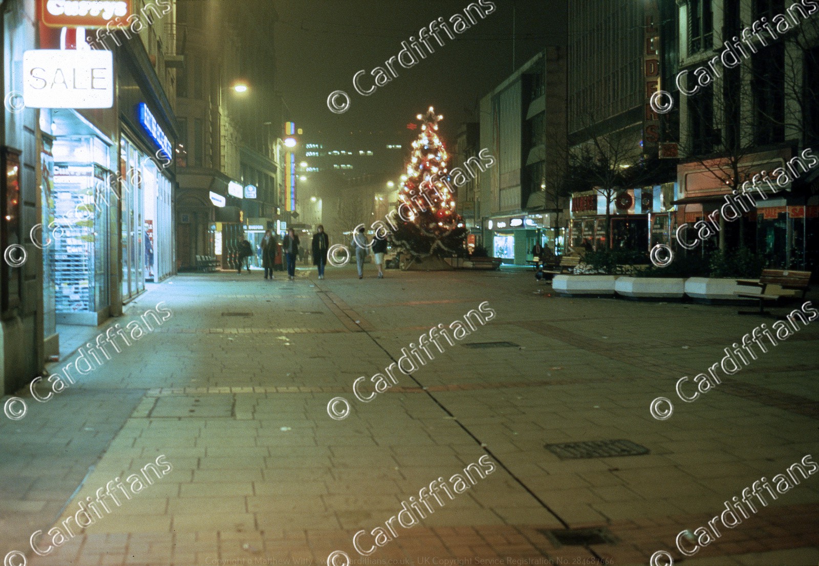
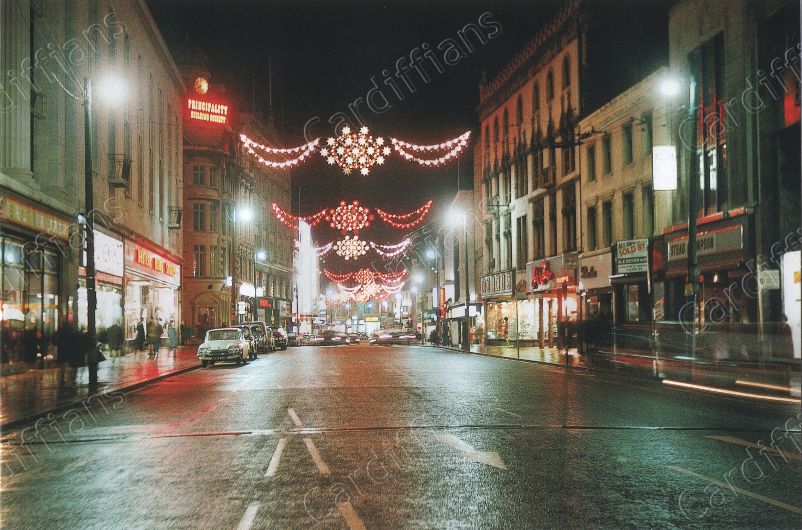 (1973) Queen Street, Christmas Lights
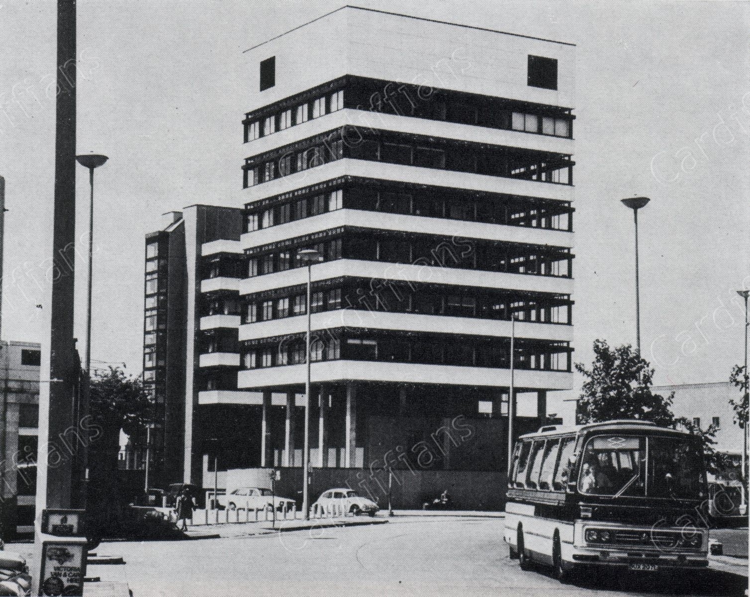
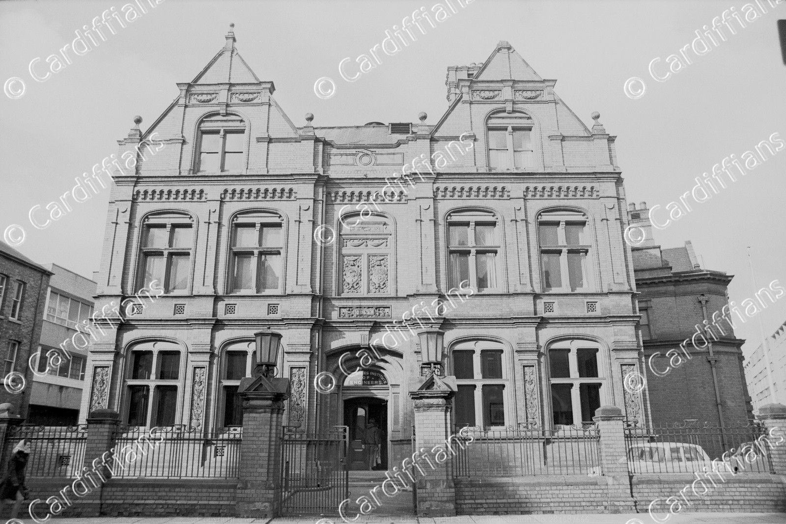 (1973) South Wales Institute of Engineering Headquarters on Park Place
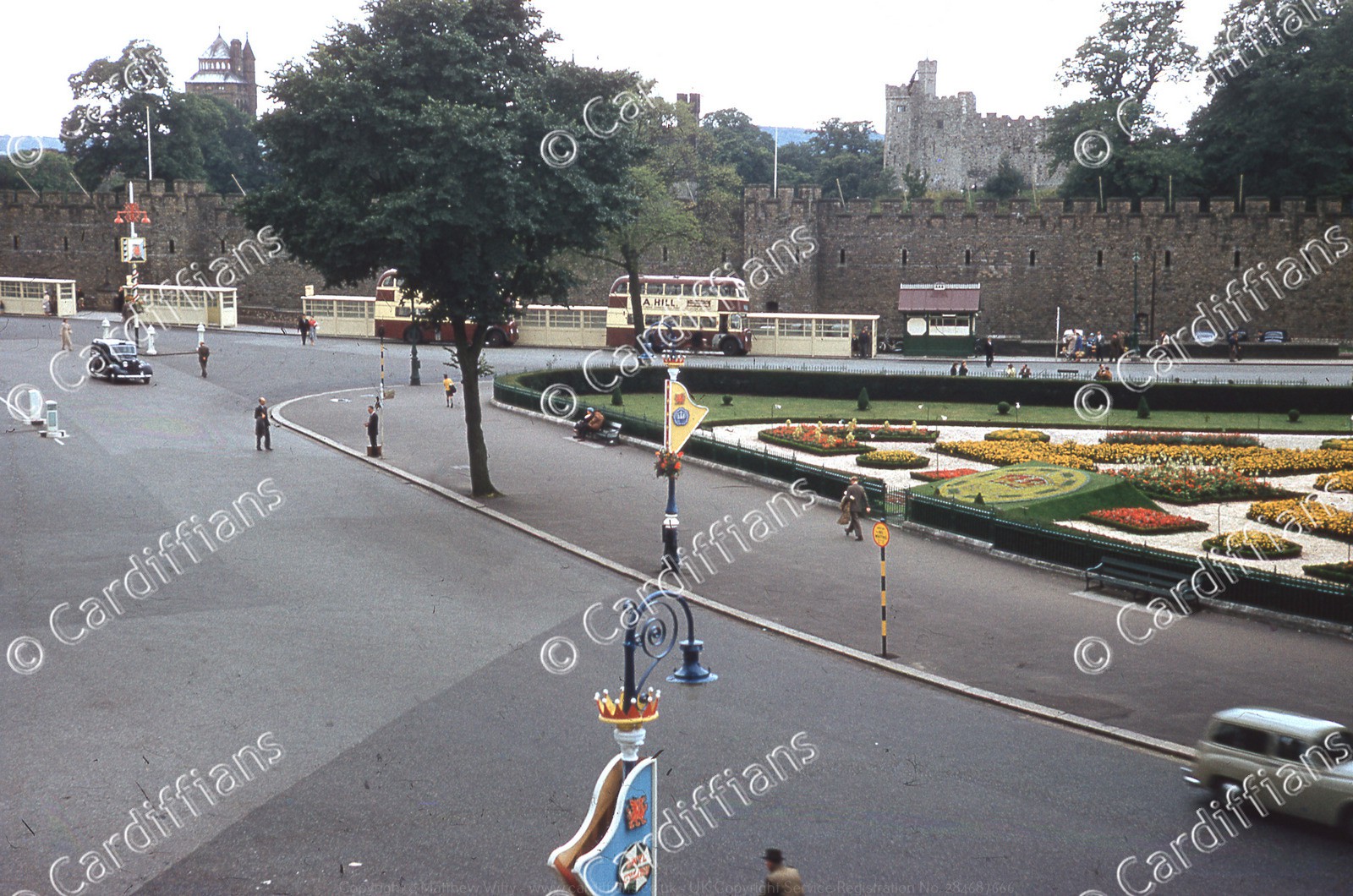
 (1974) Cardiff Castle and Castle Street, view from Queen Street
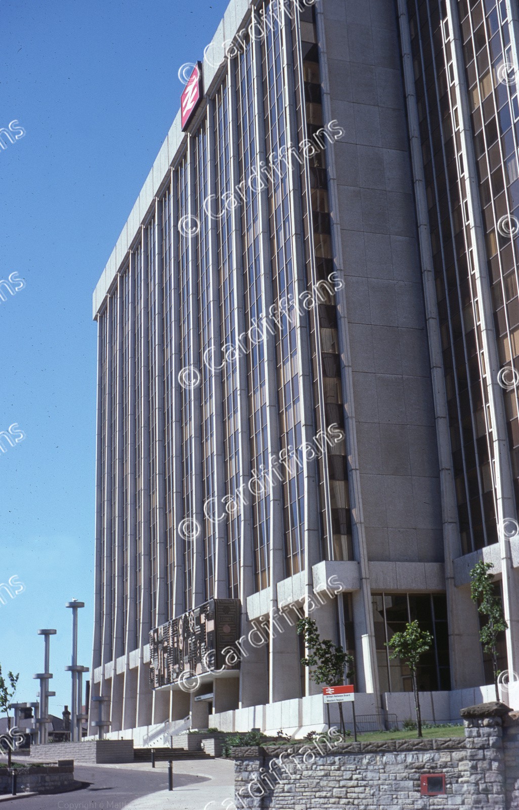
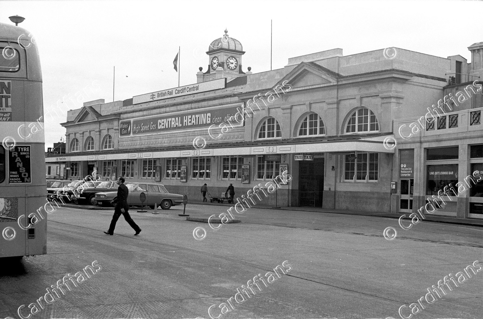 (1974) Cardiff Central Railway Station (01)
 (1974) Cardiff Central Railway Station (02)
 (1974) Cardiff Central Railway and Bus Stations
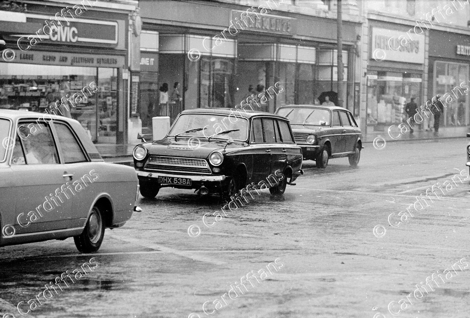 (1974) Marments and traffic in Queen Street
 (1974) Mill Lane Market
 (1974) Queen Street
 (1974) Rear of Mackross, Paradise Place
 (1974) View of Cardiff Arms Park from Coldstream Terrace
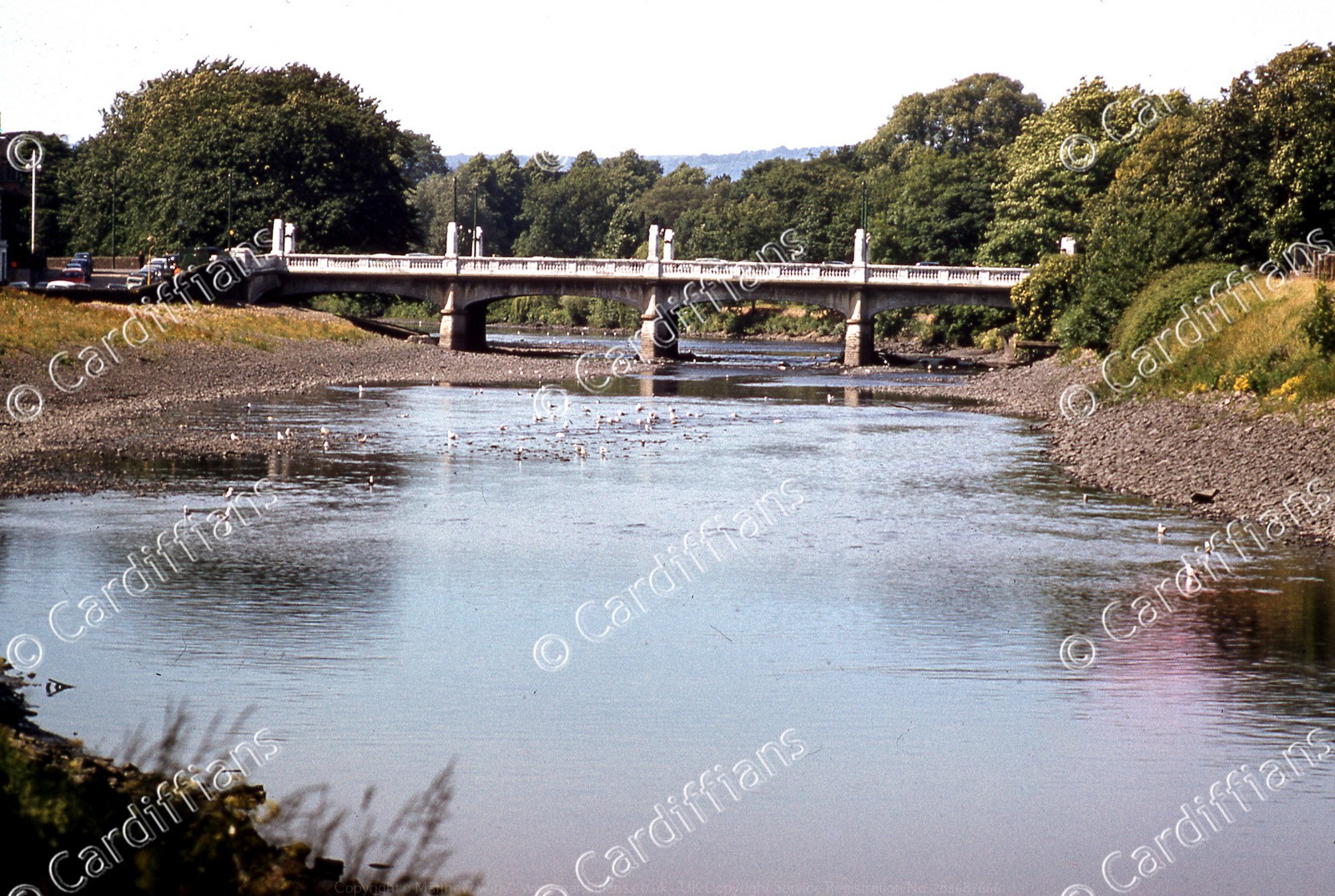
 (1974) Wood Street Bridge (View from Fitzhammon Embankment)
 (1975) High Street (01)
 (1975) High Street (02)
 (1975) King Edward VII Avenue
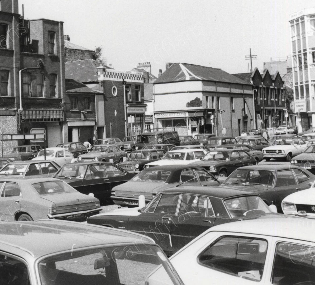
 (1975) Quay Street, and the construction of the NCP car park
 (1975) Royal Arcade
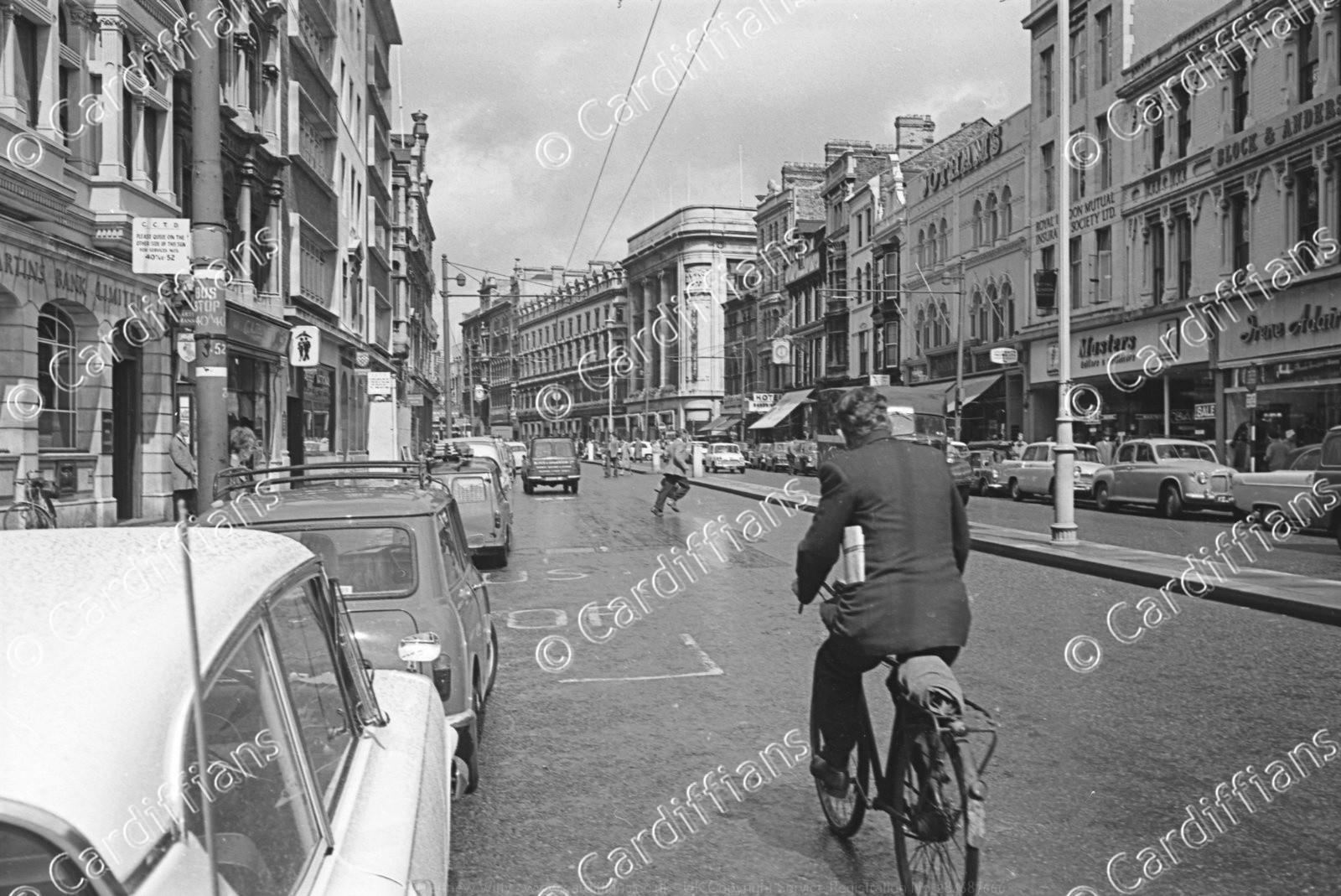
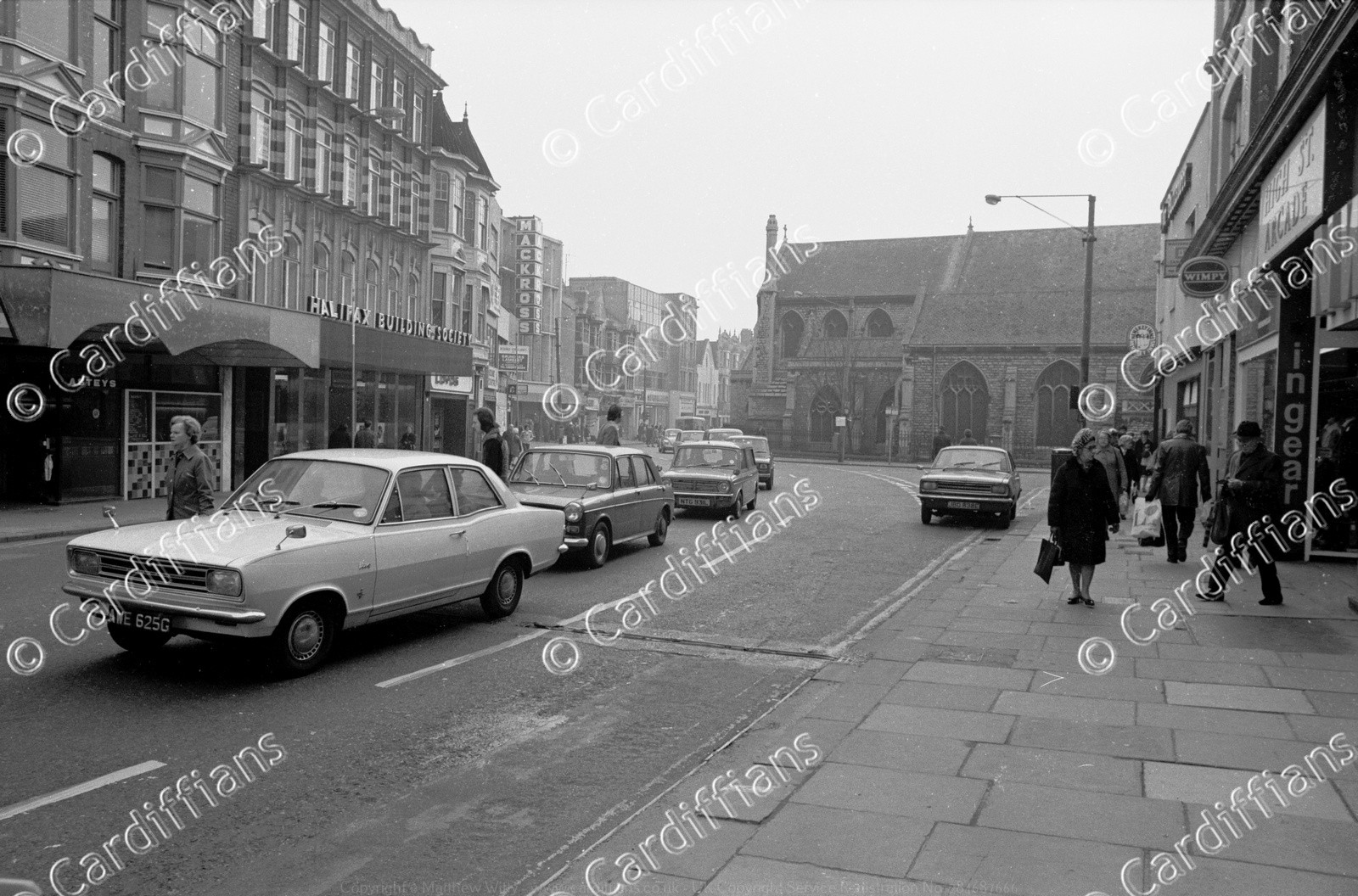 (1975) St John Street and Working Street
 (1975) St Mary Street
 (1975) Womanby Street - Looking towards the Castle Clock Tower
 (1976) Brunel House
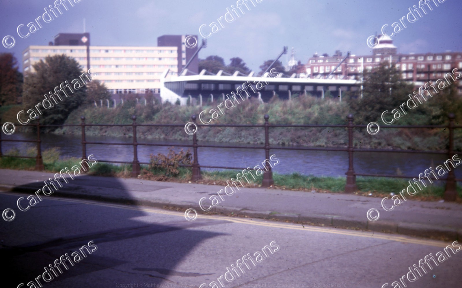
 (1978) Cardiff Arms Park
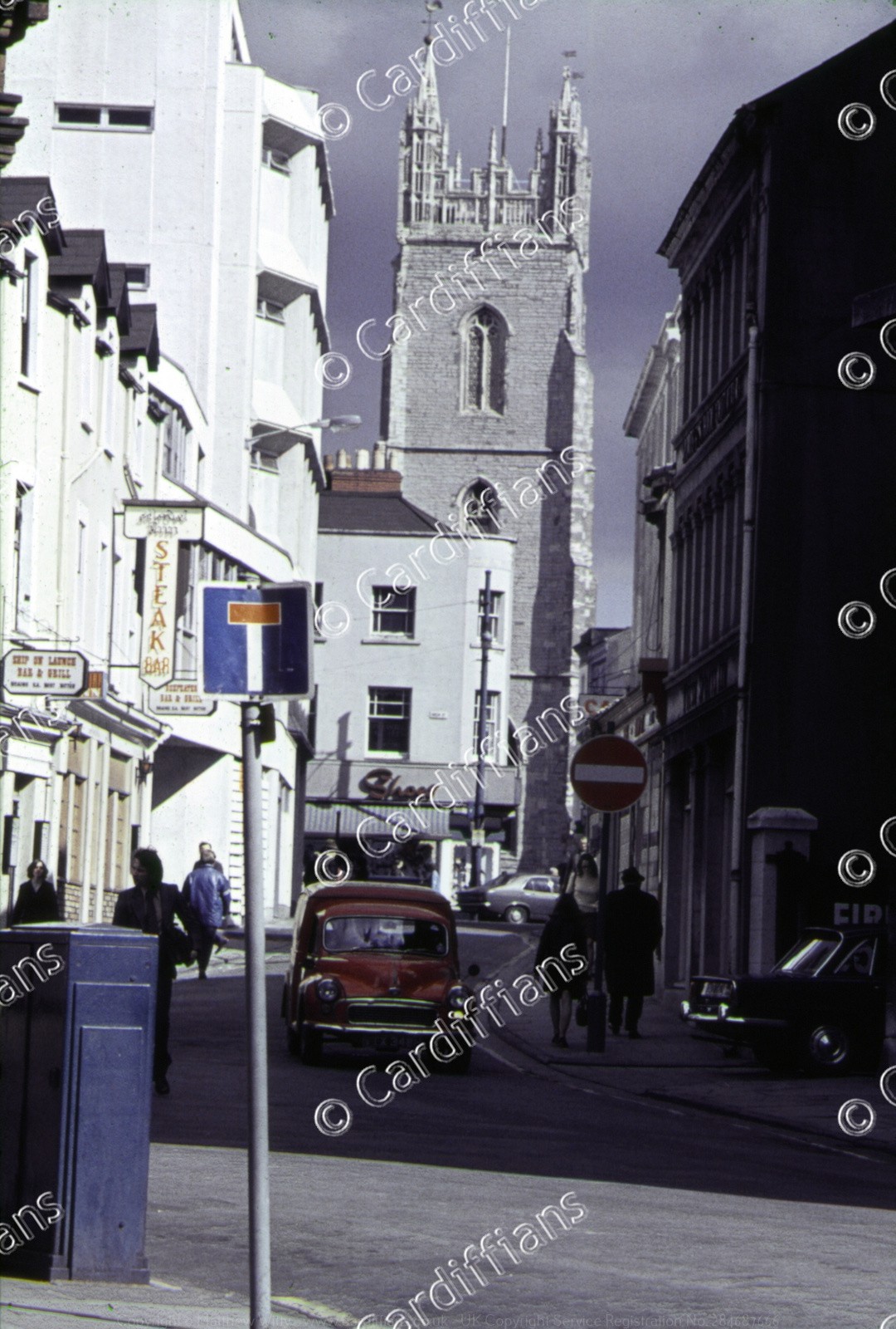
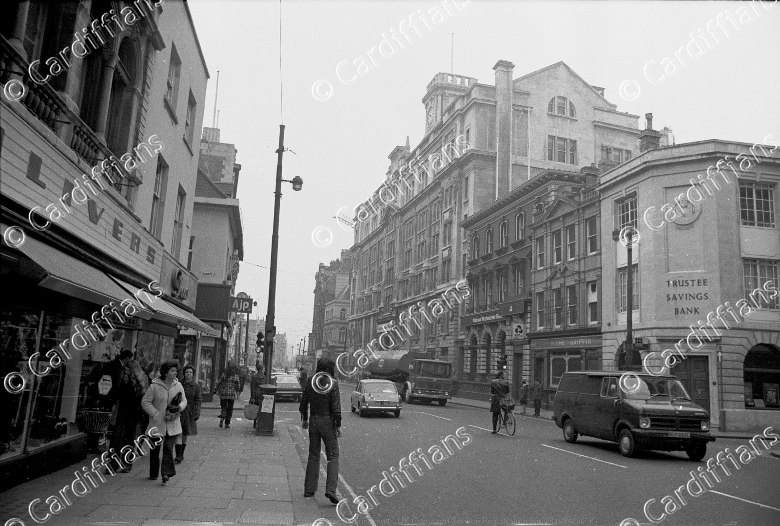
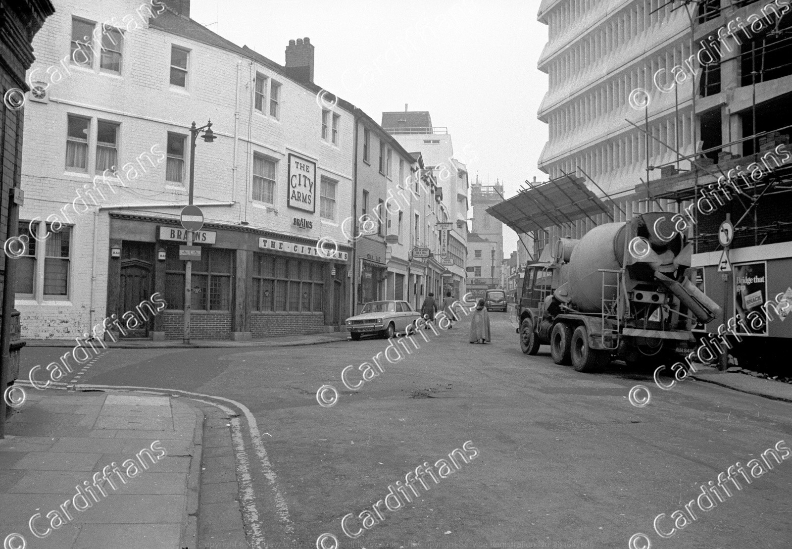
 (1978) St John Street
 (1979) Construction of St Davids Hall, The Hayes
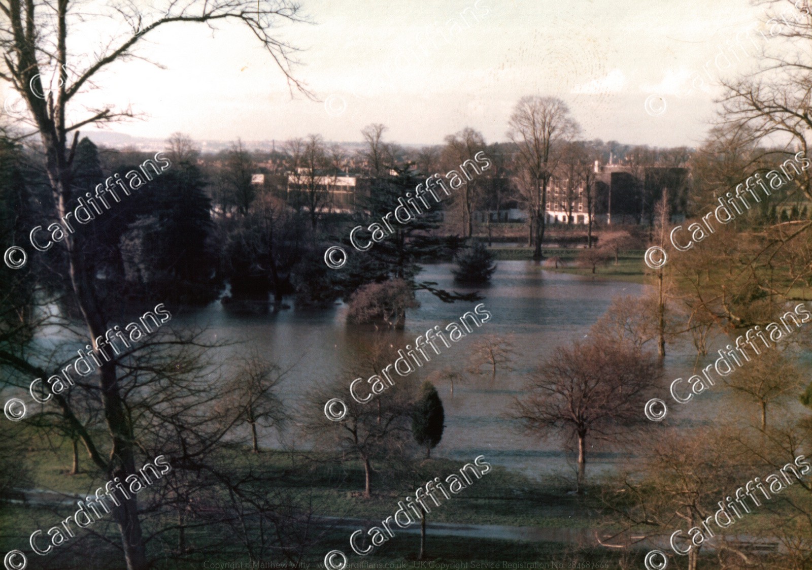 (1980) Bute Park (flooded) with National Sports Centre Wales in background, view from roof of Welsh College of Music and Drama
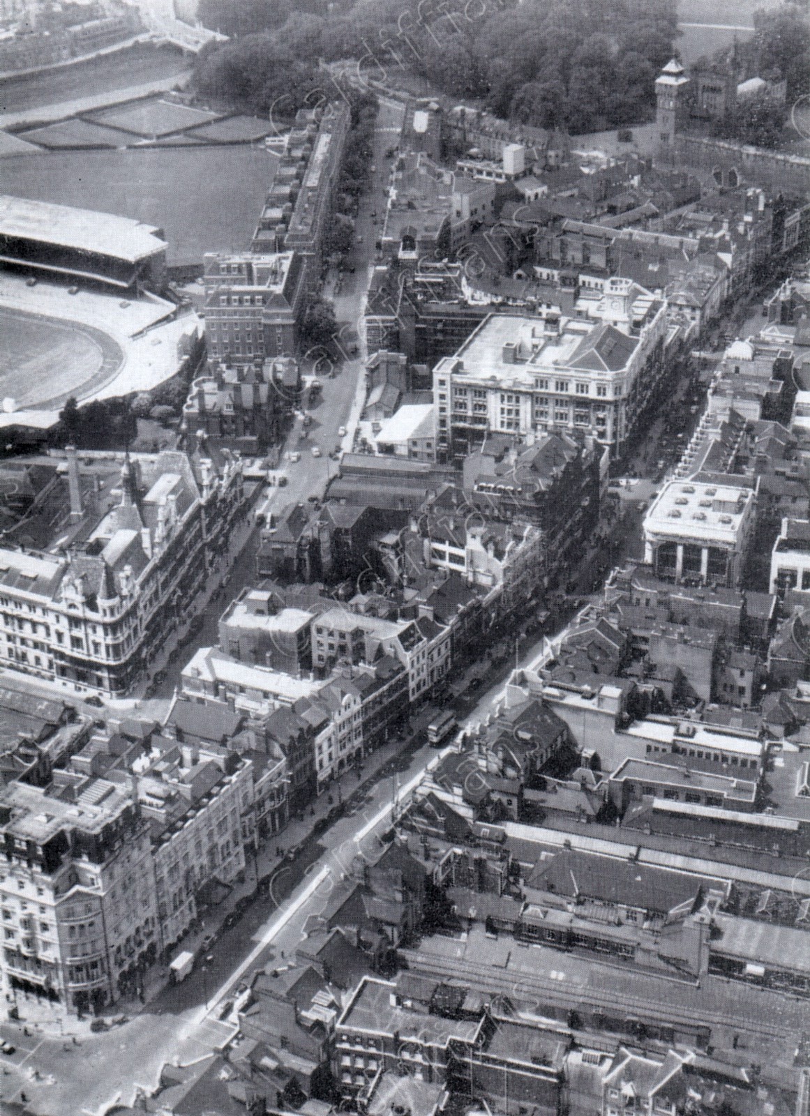
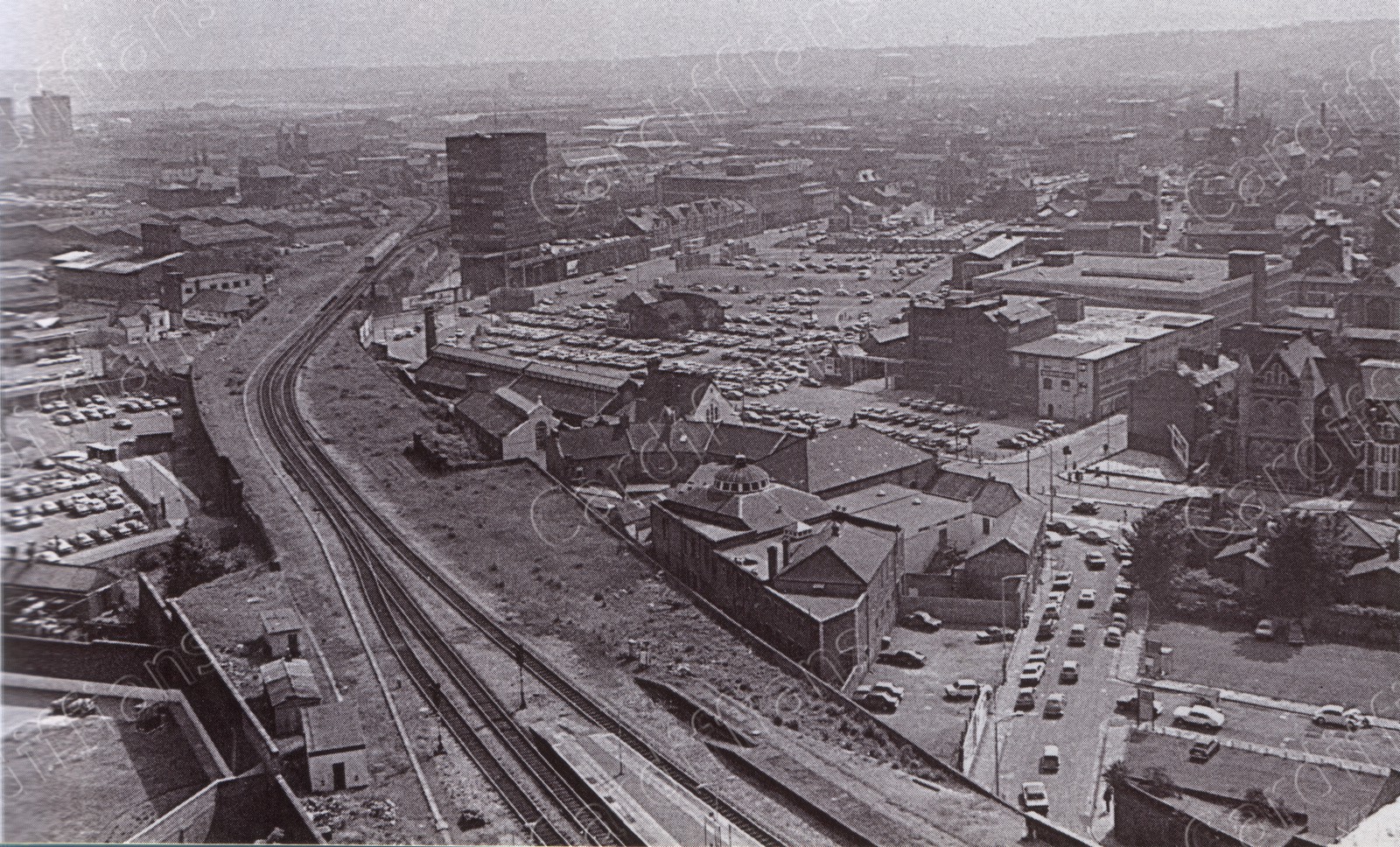 (1980) Guildford Crescent and Queen Street Station railway line, aerial view
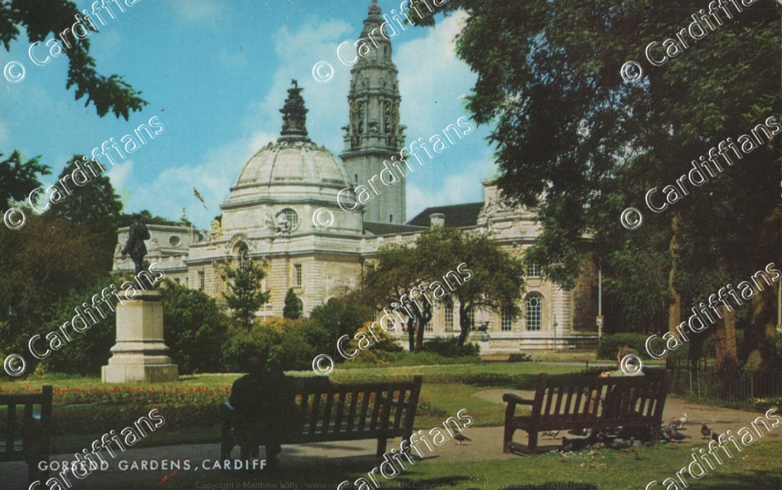 (1980s) Gorsedd Gardens, City Hall
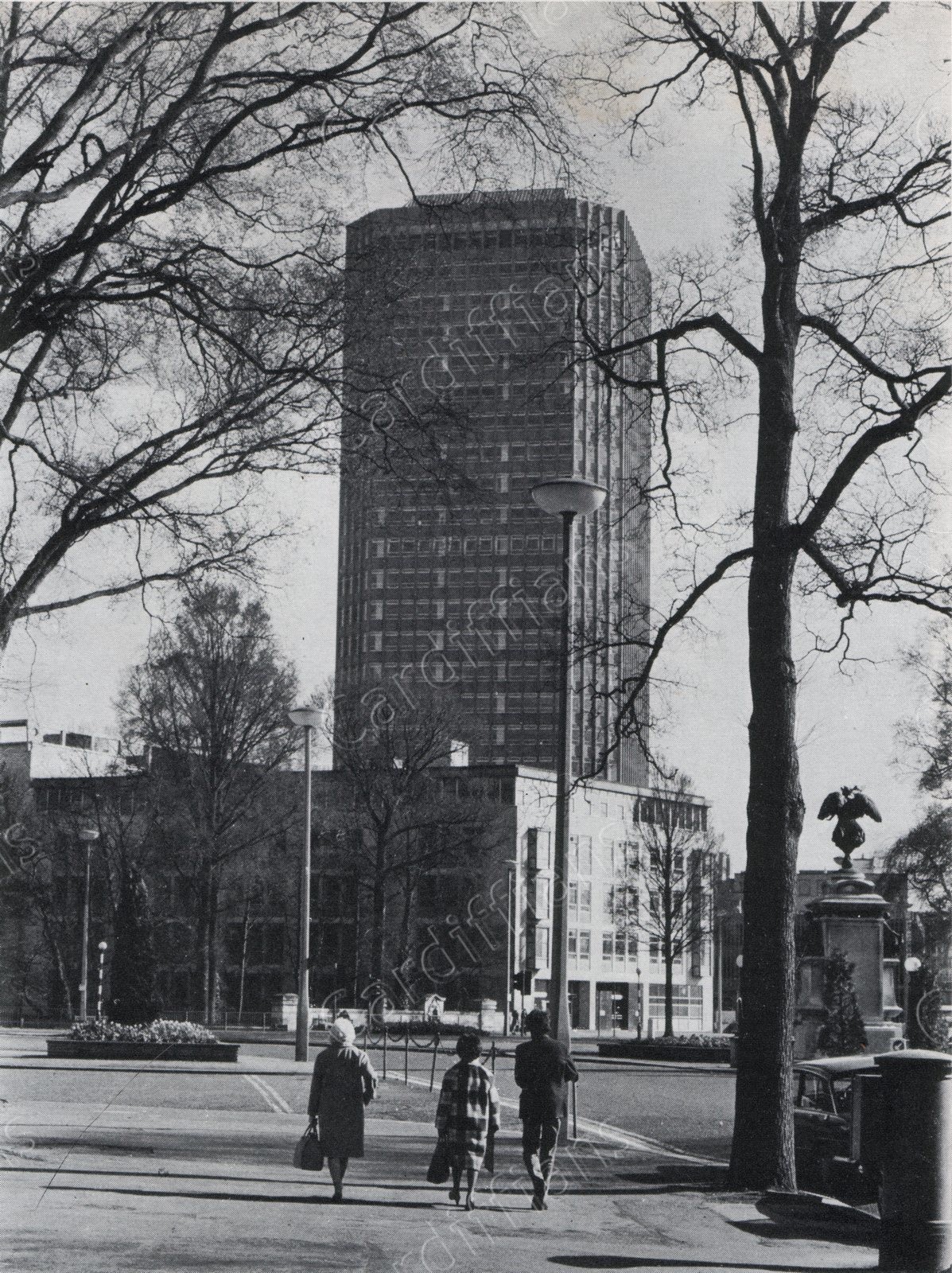
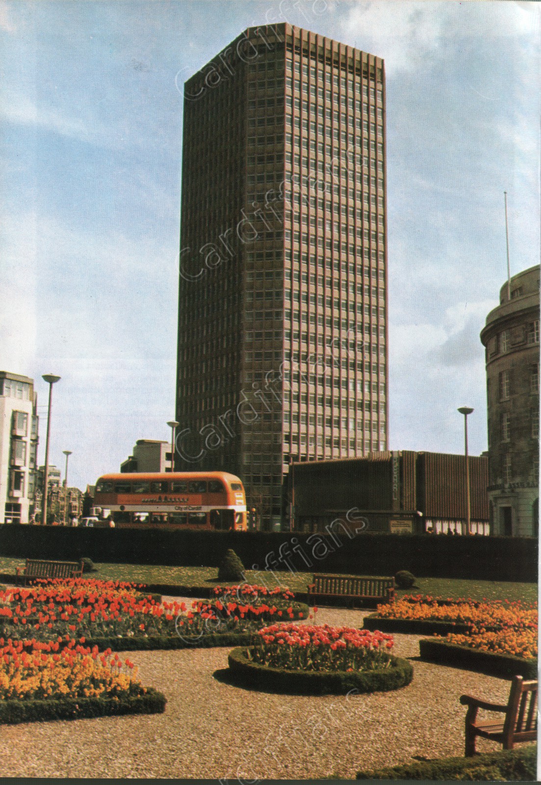 (1980s) Pearl Assurance (now Capital) Tower
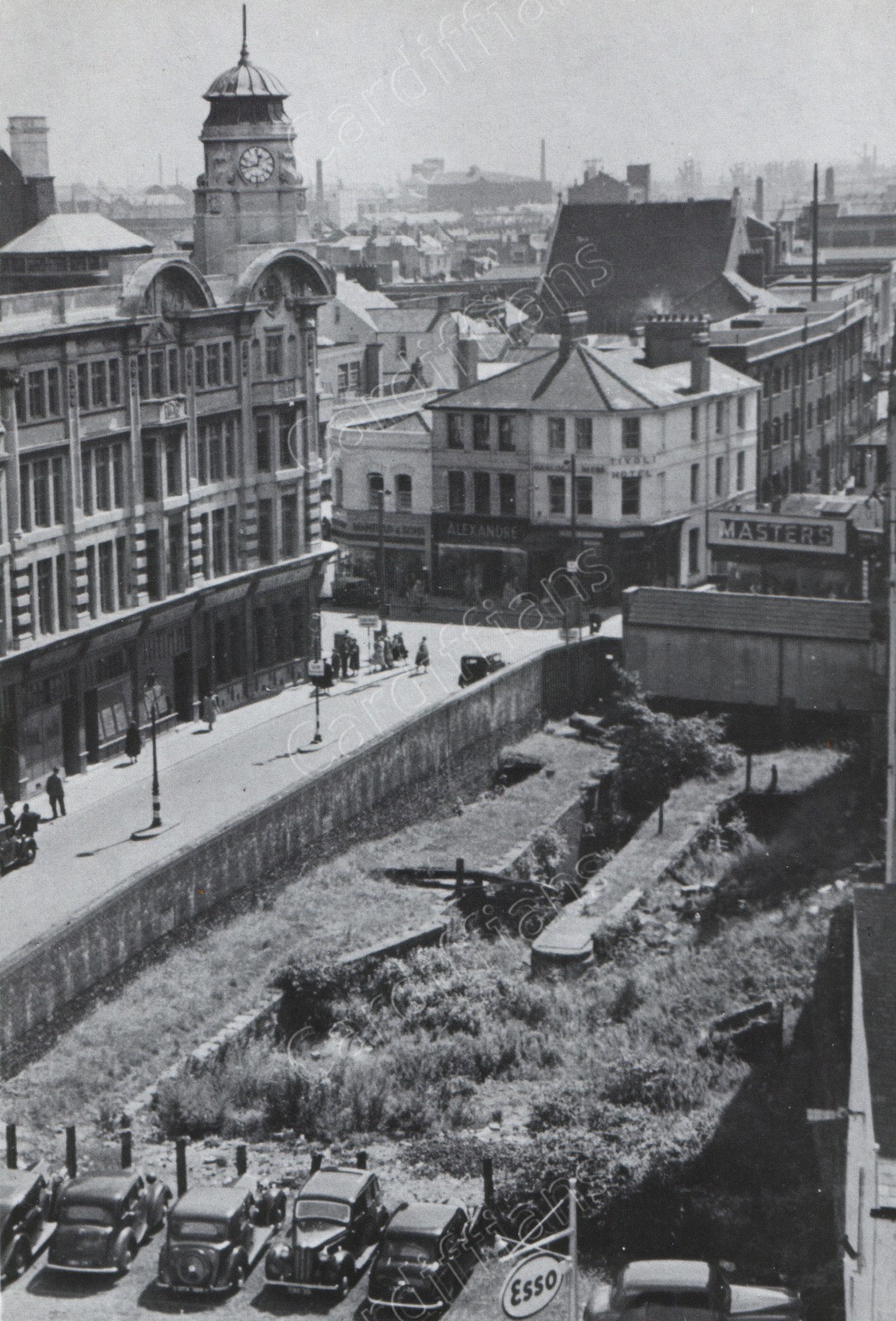
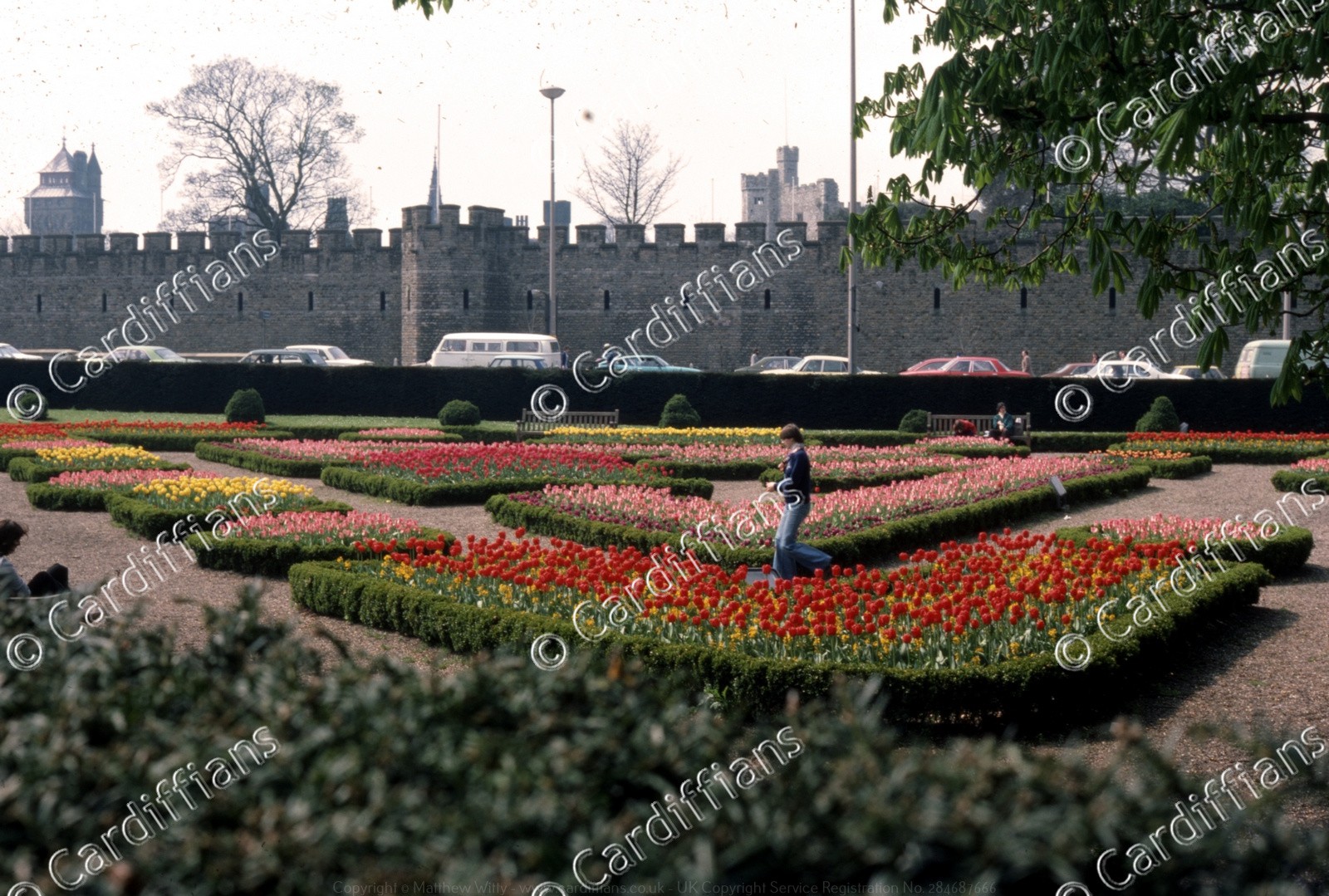
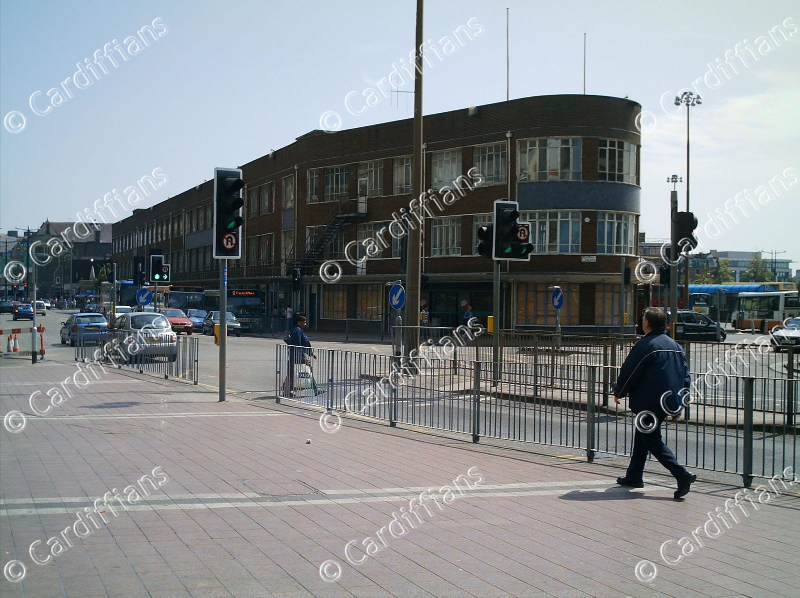
 (1980s) View of Queen Street from the Castle Wall (Refuge Assurance Company in background) NEW
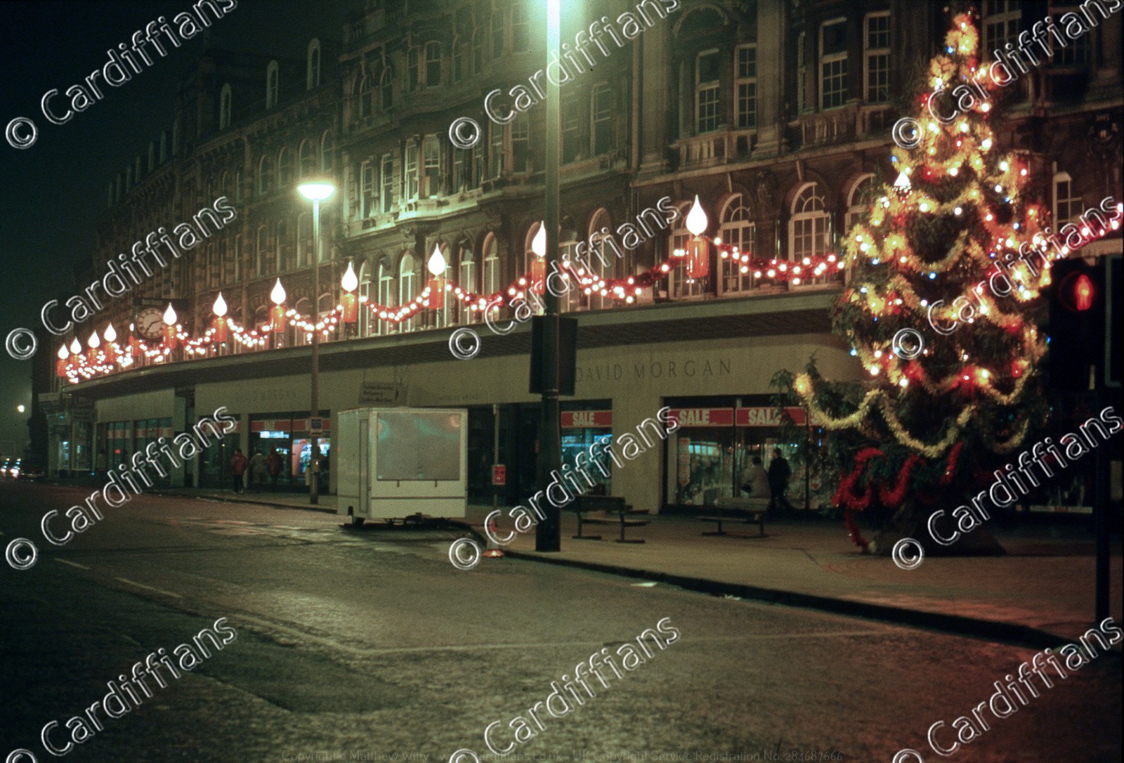 (1981) David Morgans Christmas Tree, The Hayes
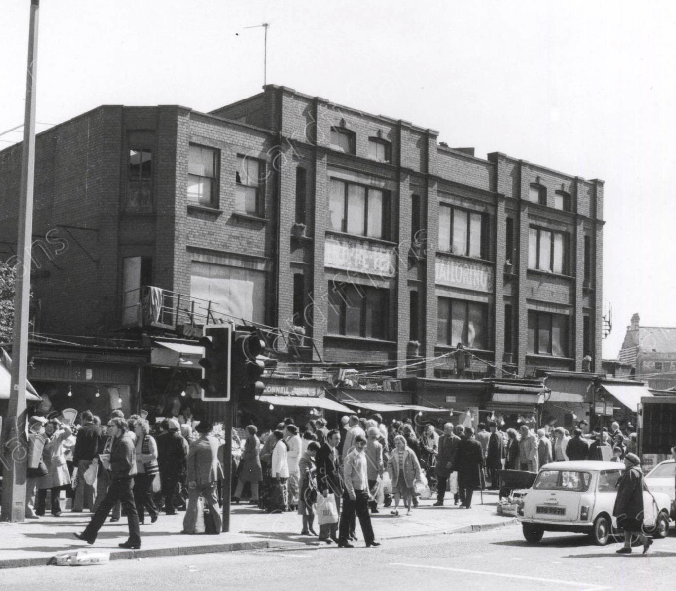 (1981) Mill Lane Market - Trippe Tex Tailoring warehouse, later became the Moon Club
 (1981) New Street - The building to the left is the back of Trippe Tex Tailoring warehouse (later the Moon Club)
 (1981) Queen Street Christmas Tree
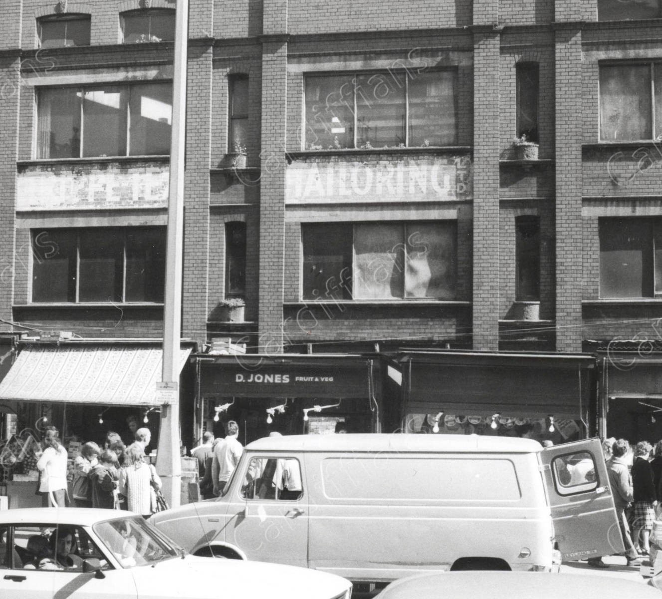 (1981) Tripp Tex Tailoring warehouse (later became the Moon Club). Demolished 1981
 (1982) Golden Cross
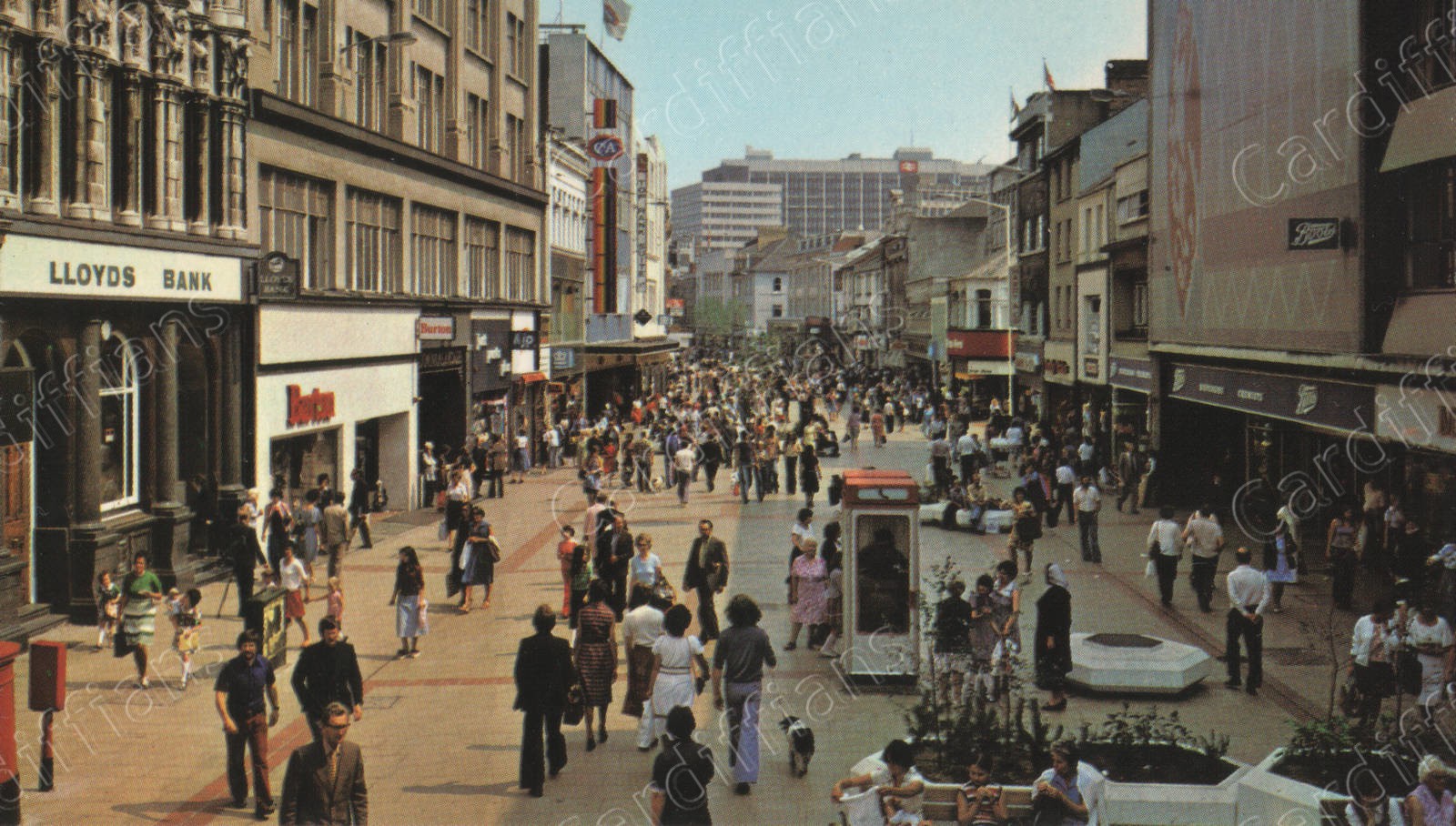 (1985) Queen Street (Lloyds Bank and Boots)
 (1985) Queen Street (Marments)
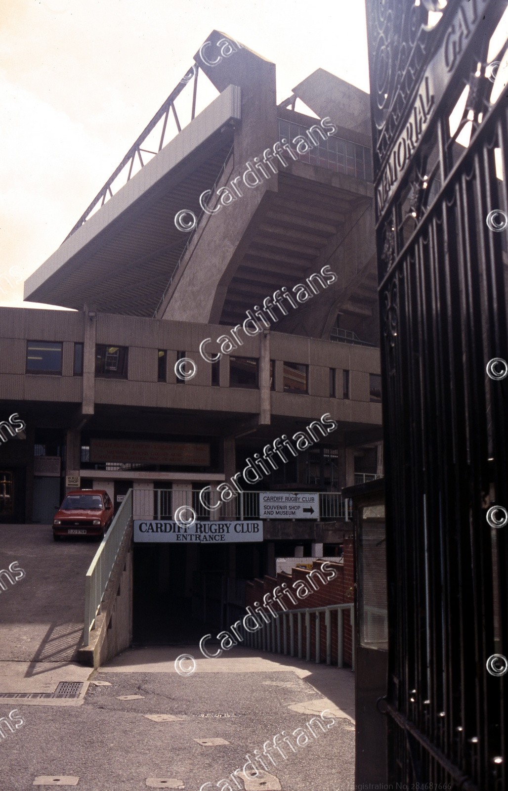 (1990) Cardiff Arms Park (National Stadium) Rugby Ground - Club Entrance
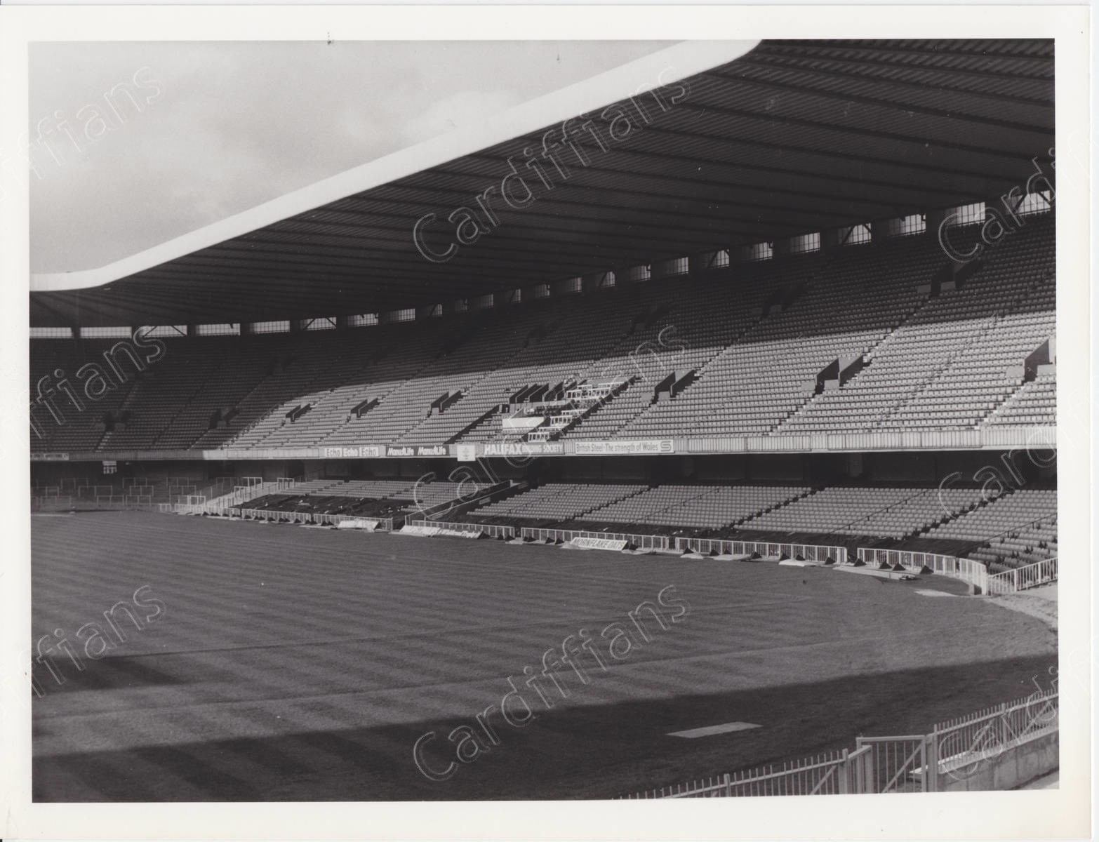
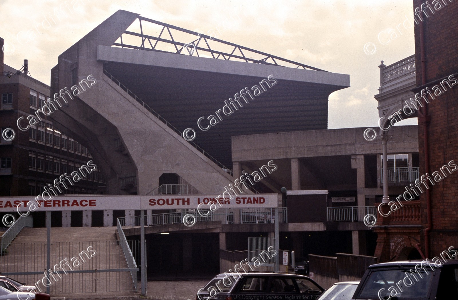 (1990) Cardiff Arms Park (National Stadium) Rugby Ground - South Lower Stand
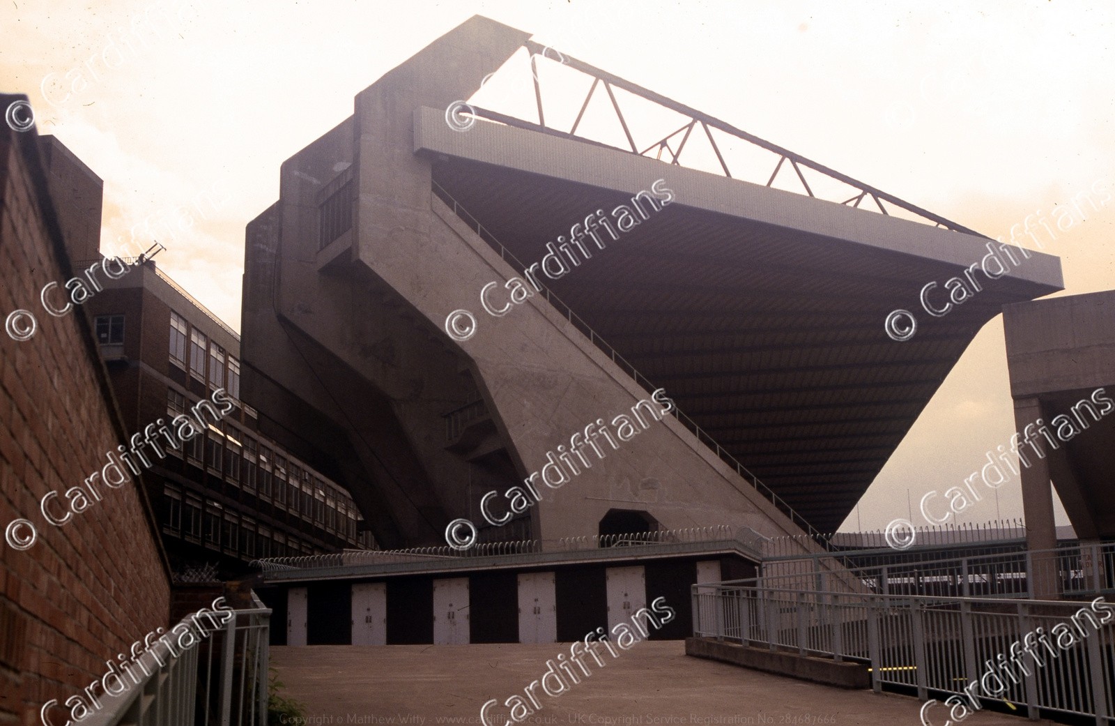 (1990) Cardiff Arms Park (National Stadium) Rugby Ground - View from Westgate Street
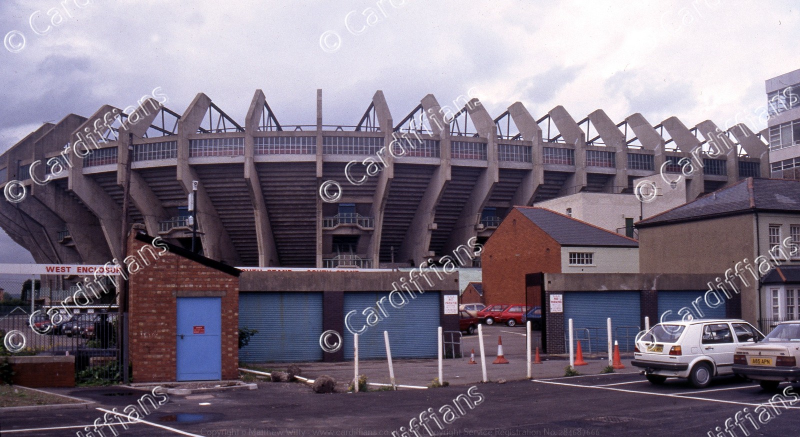 (1990) Cardiff Arms Park (National Stadium) Rugby Ground - West Enclosure
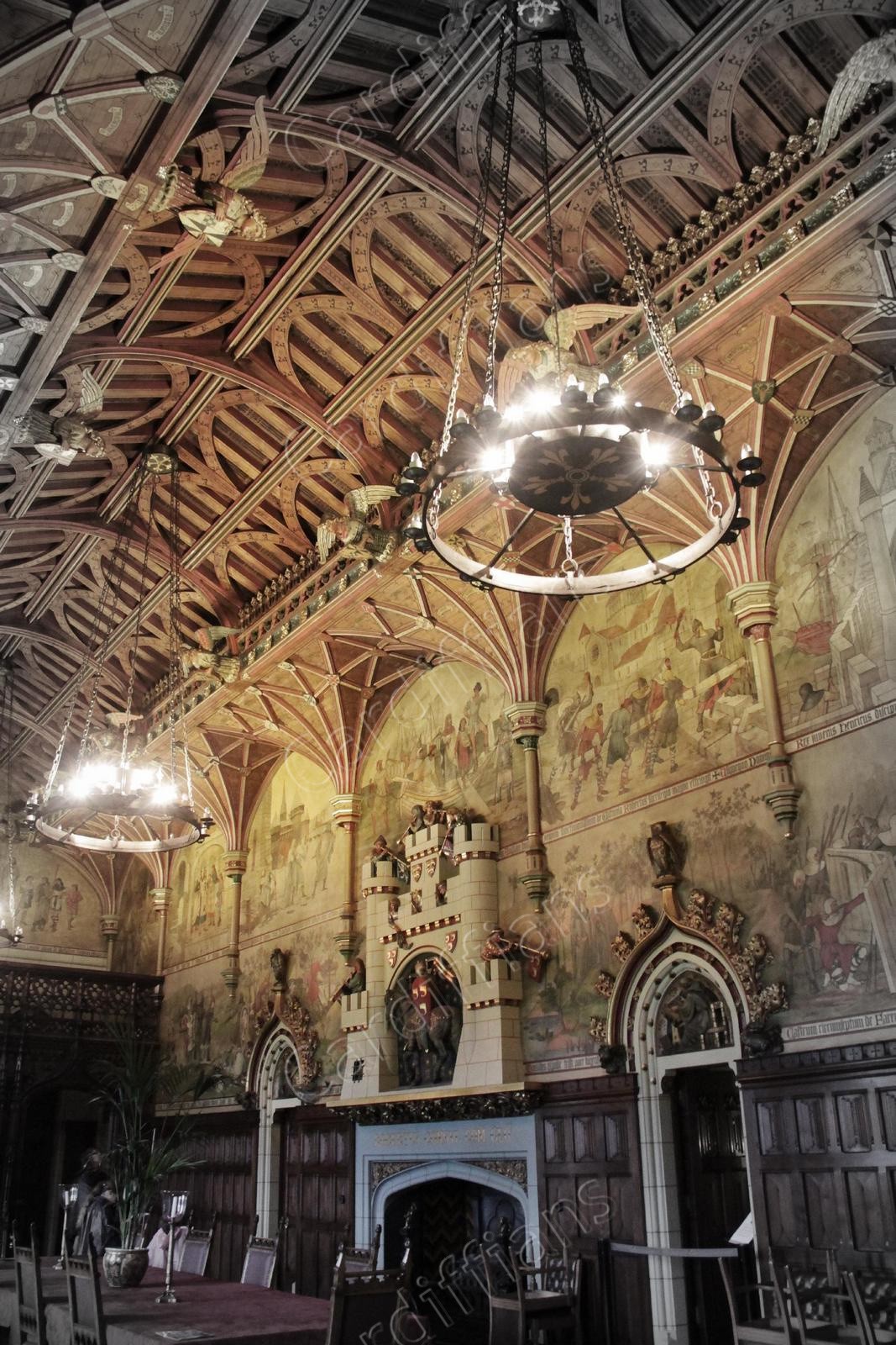
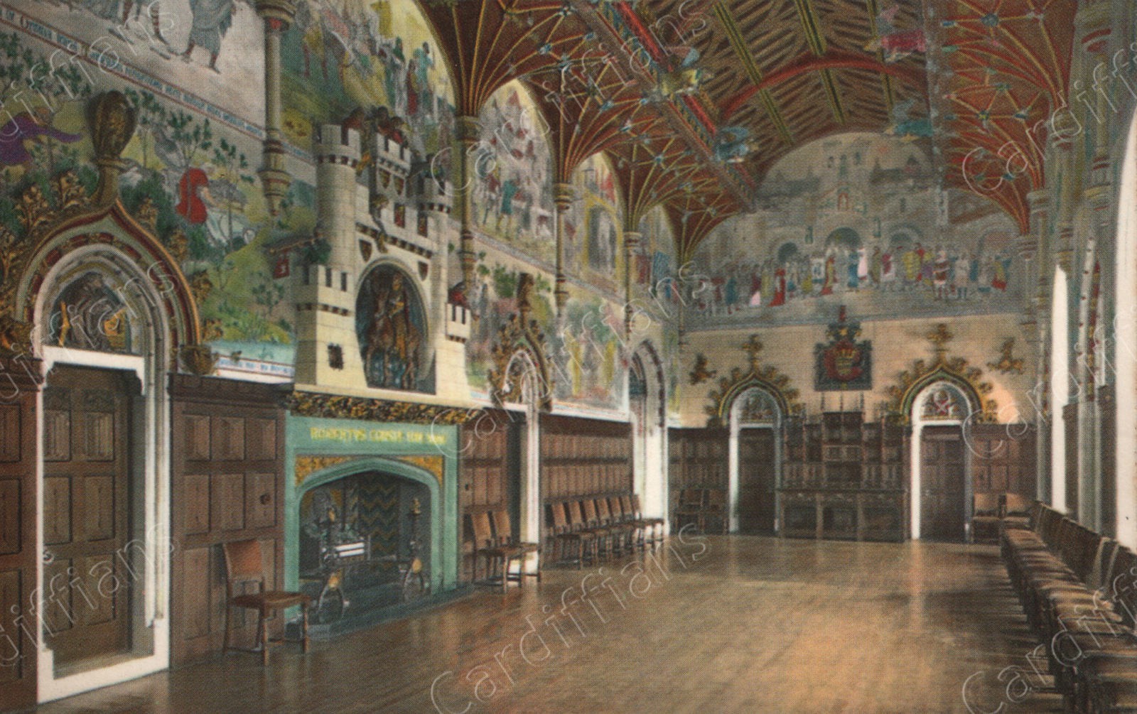 (1992) Cardiff Castle, Banqueting Hall
 (1999) Cardiff Castle Clock Tower - Before the animal wall was redesigned to incorporate a driveway NEW
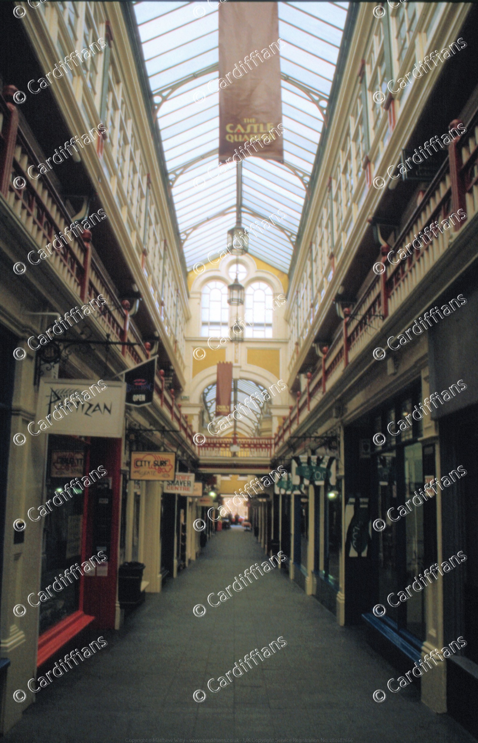 (1999) Castle Arcade (Partizan, City Surf) NEW
 (1999) Castle Grounds - View from the Norman Keep NEW
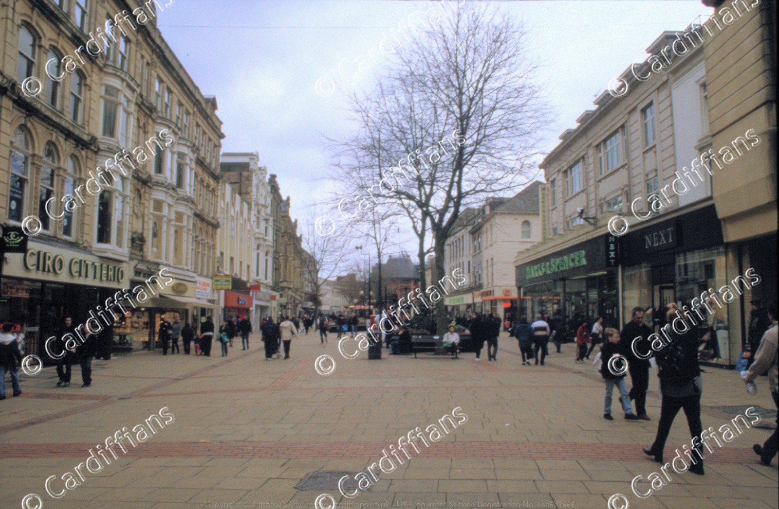 (1999) Queen Street (near Marks and Spencer) NEW
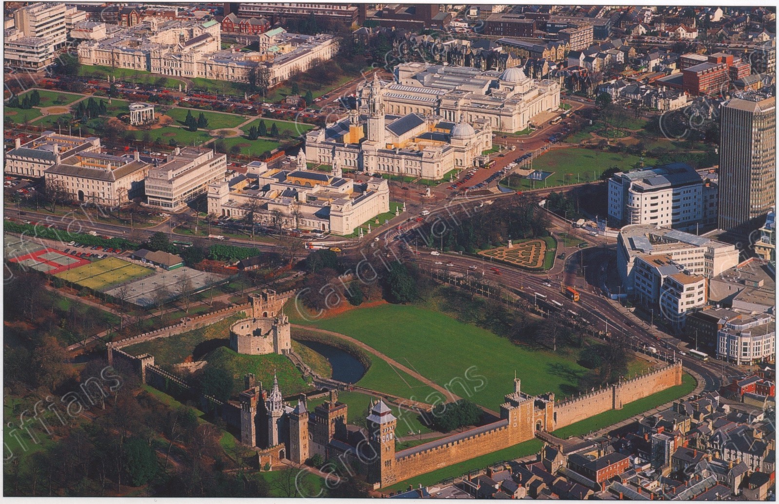 (2001) Aerial view of Cardiff Castle and Civic Centre
 (2003) Cardiff Castle
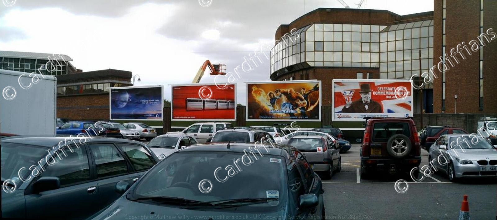 (2005) Billboard Display, Rear of CIA
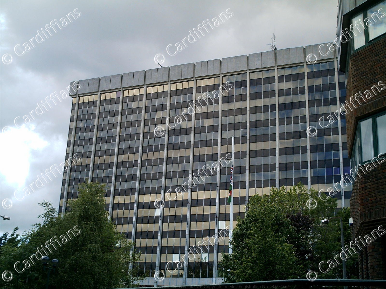 (2005) Brunel House, Knox Road
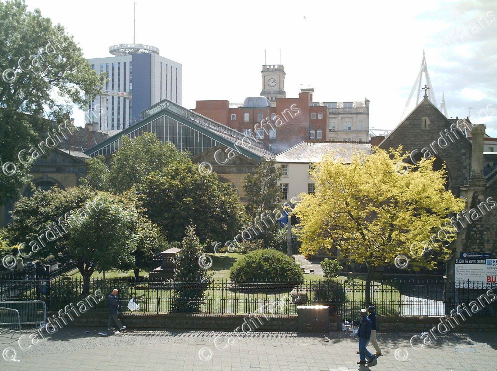 (2005) Central Market and St Johns Church Graveyard
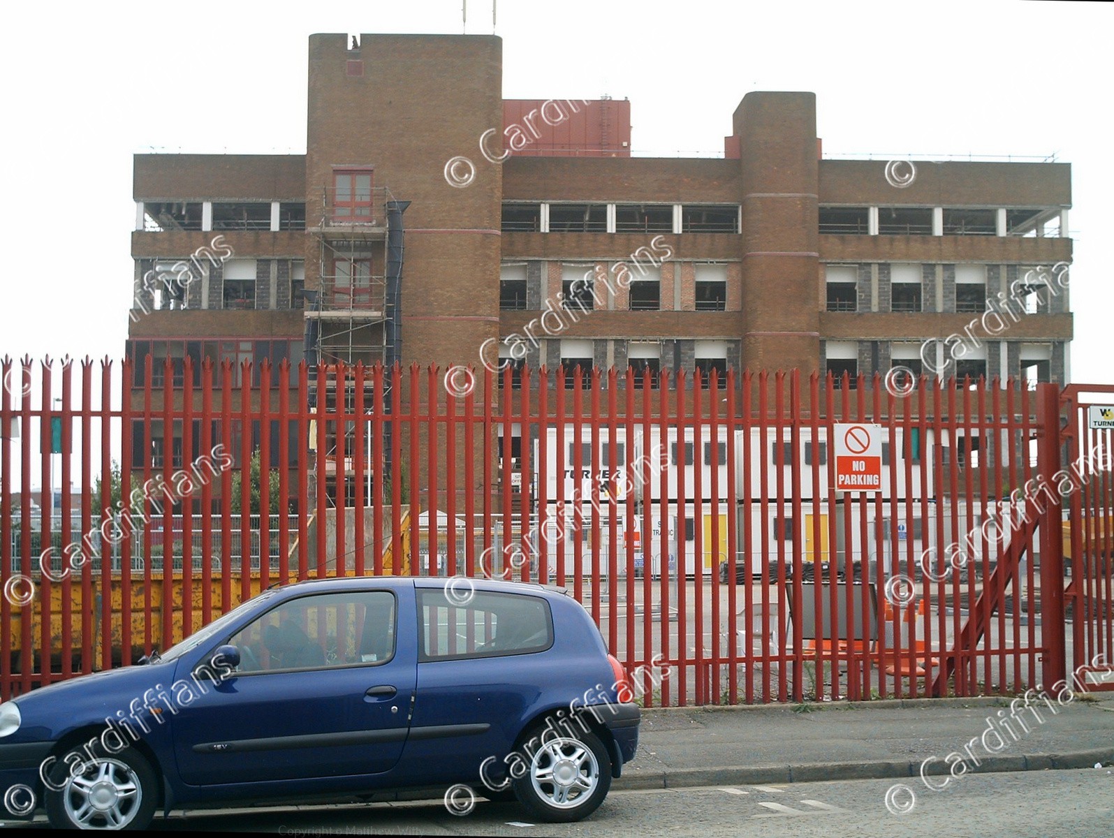
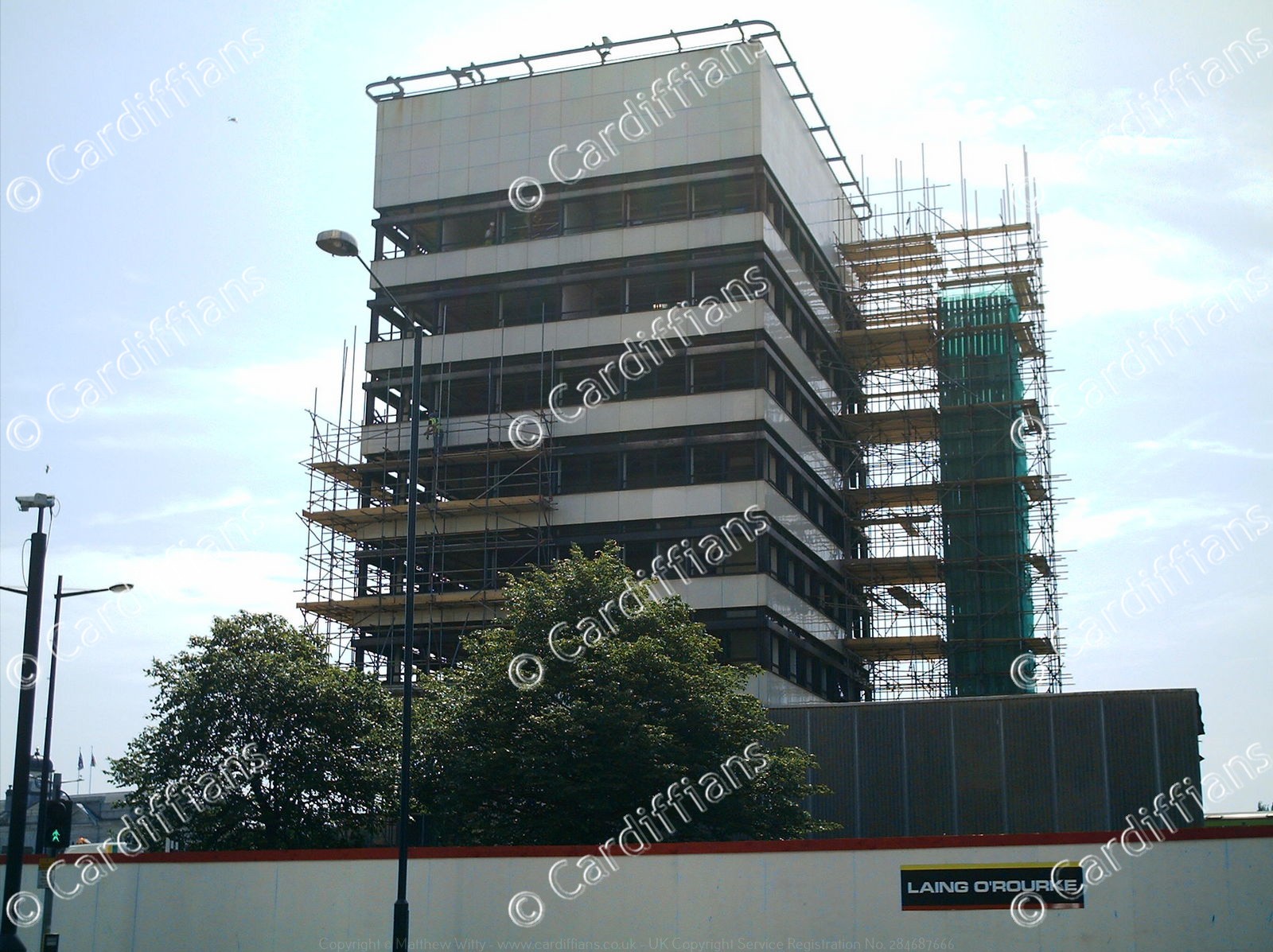 (2005) City Planning Offices prior to being demolished, Central Station
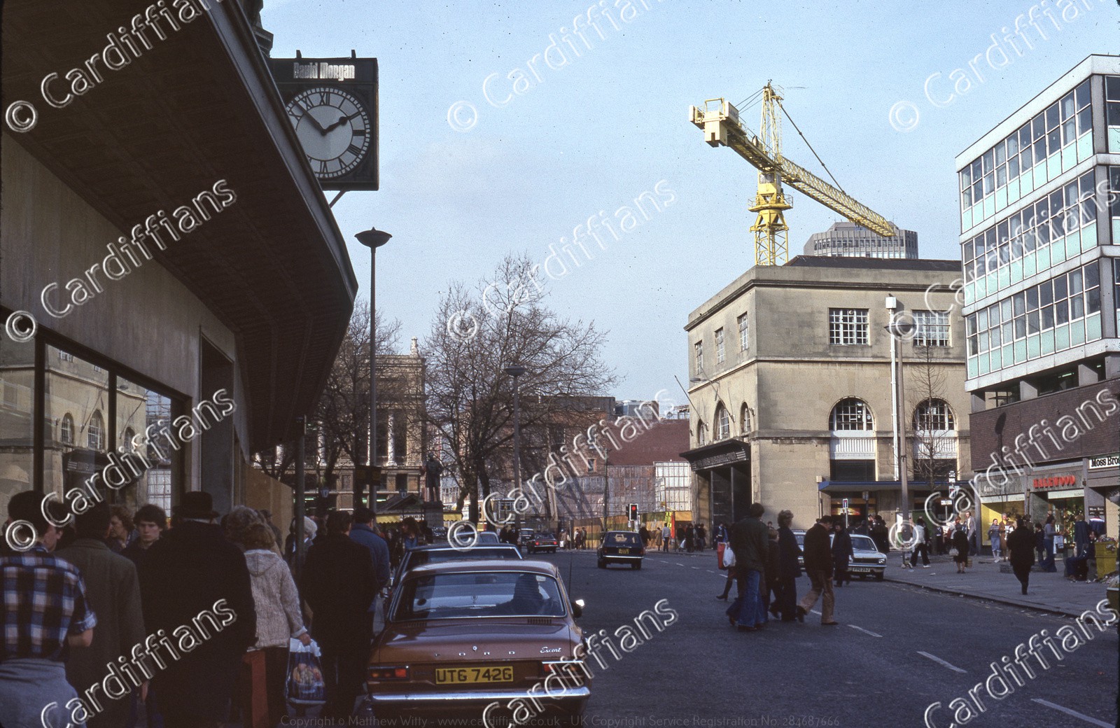
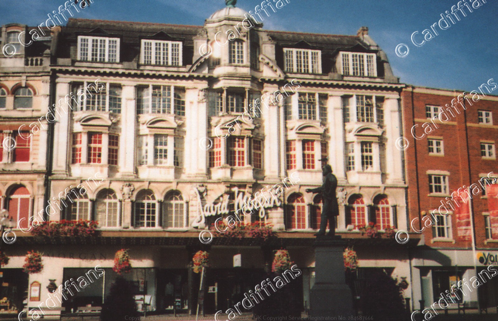 (2005) David Morgan Department Store
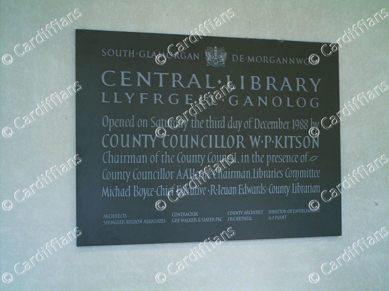 (2005) Dedication Plaque for Cardiff Central Library
 (2005) High Street
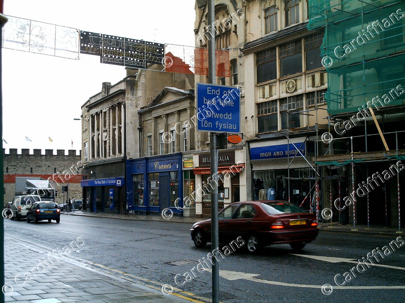
 (2005) Wood Street
 (2006) BT building in Sandon Street being renovated (for University of South Wales)
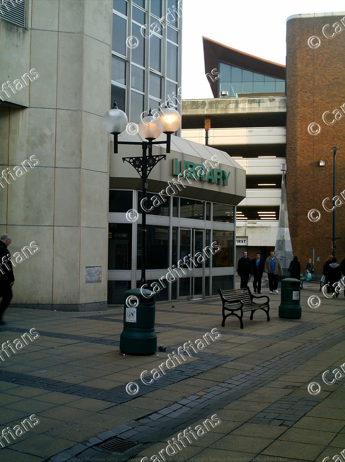 (2006) Central Library
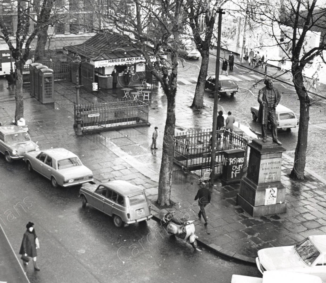
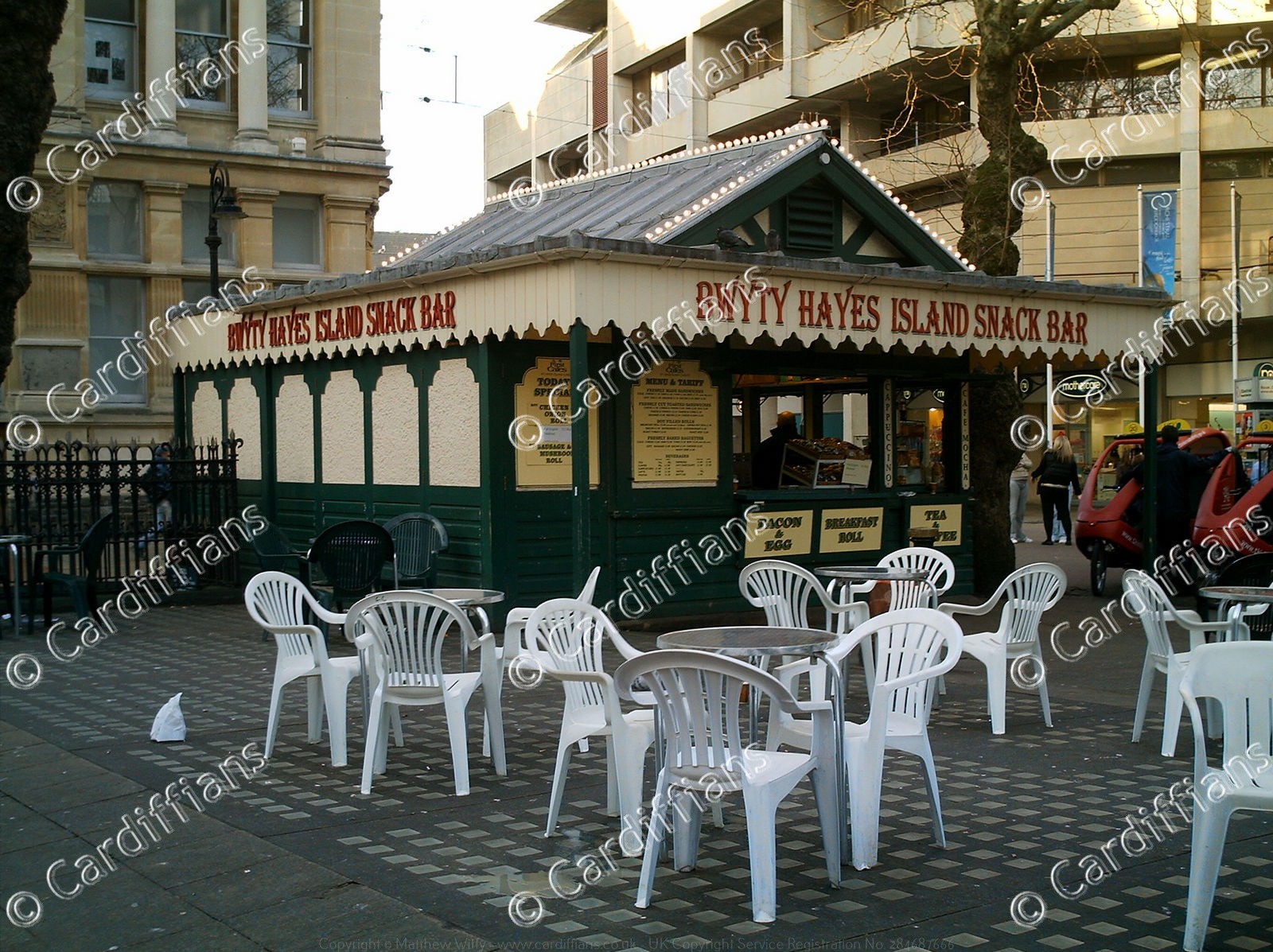 (2006) Hayes Island Snack Bar
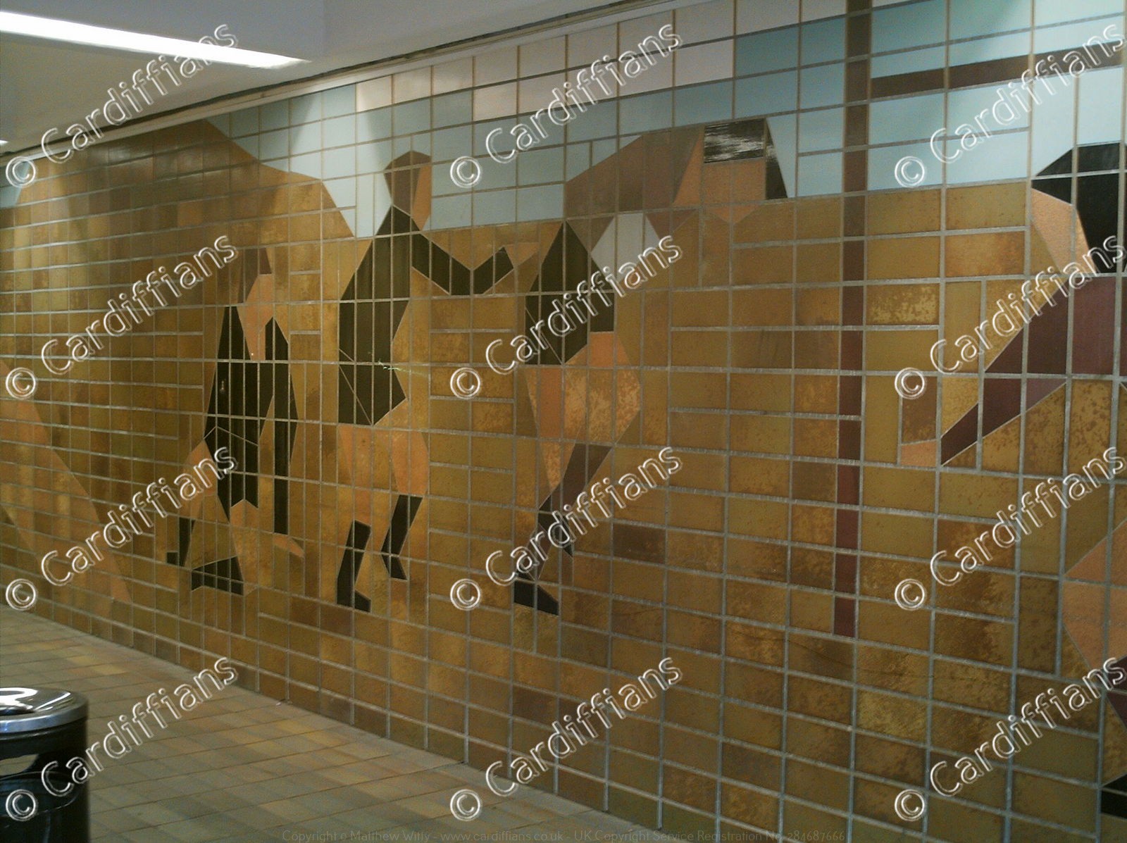
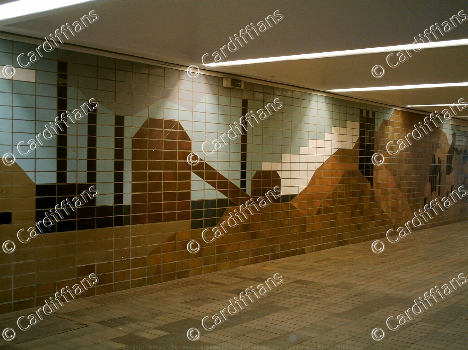
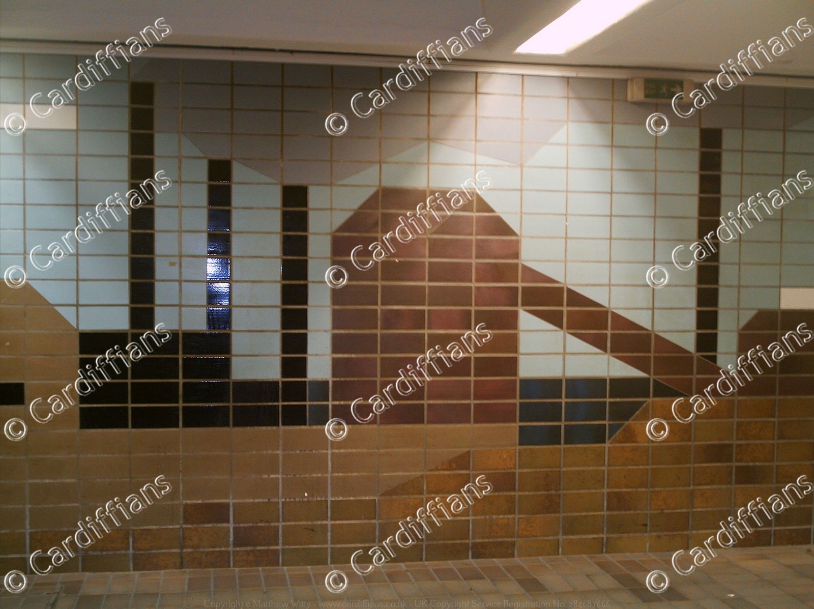
 (2006) North Road subway, and the old lock workings from the days of the Glamorganshire Canal
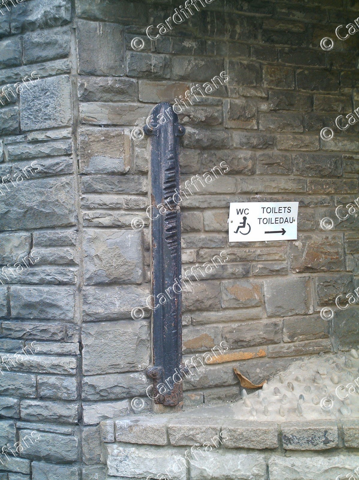 (2006) North Road subway, and the post which has been worn away by ropes used to pull canal boats through
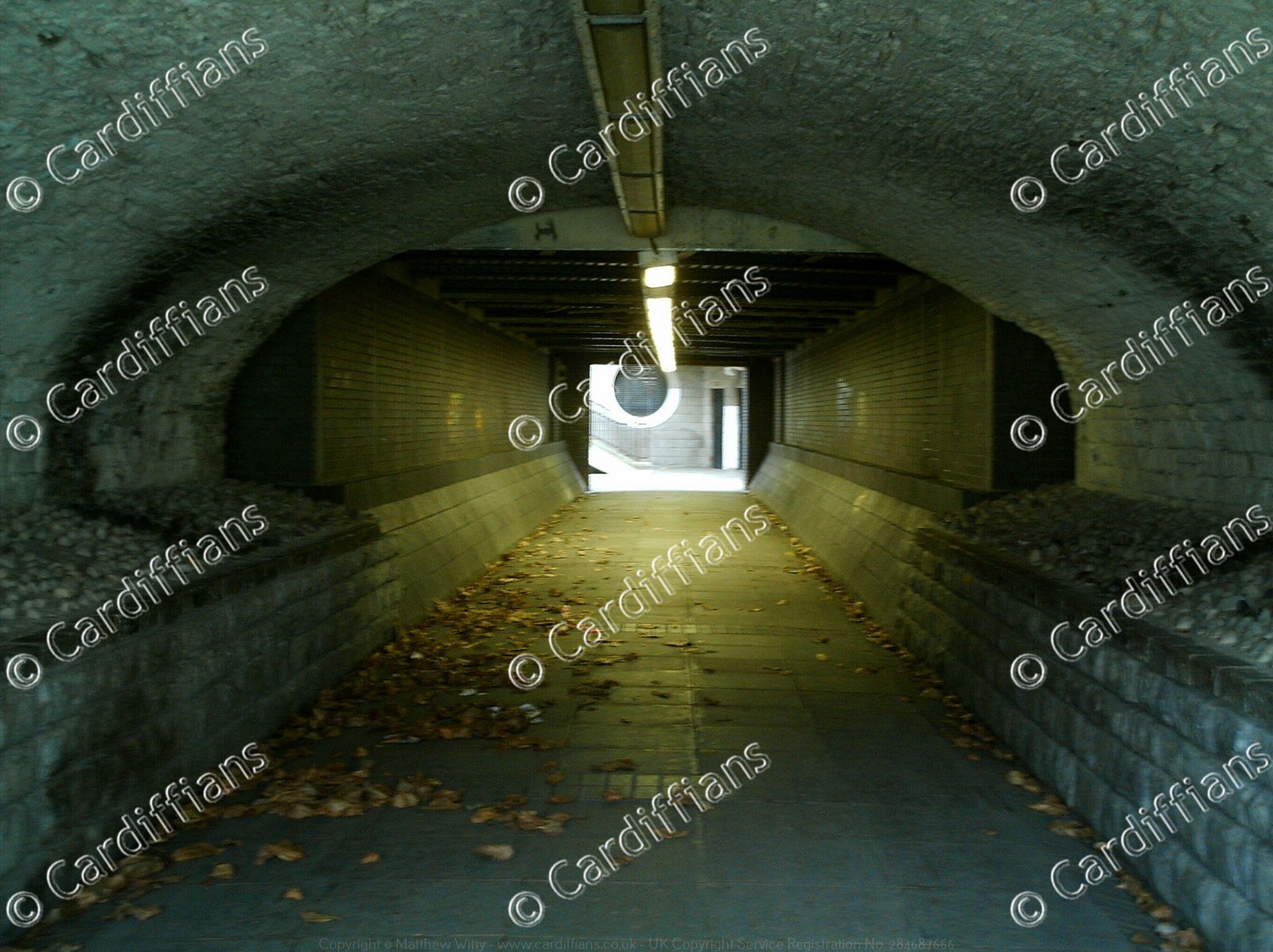 (2006) North Road subway, previously the old Glamorganshire Canal tunnel
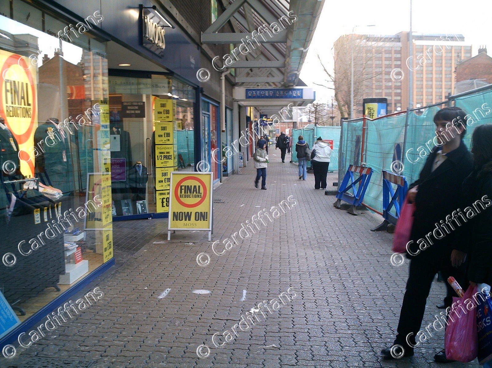 (2006) Oxford Arcade (01)
 (2006) Oxford Arcade (02)
 (2006) Oxford Arcade (03)
 (2006) Oxford Arcade (04)
 (2006) Oxford Arcade (05)
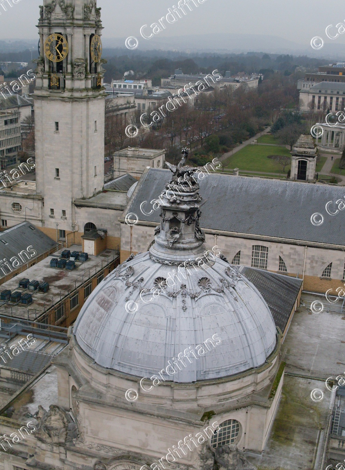 (2008) City Hall Dome (Note the Ornate Dragon at the top) - view from the Admiral Eye Big Wheel
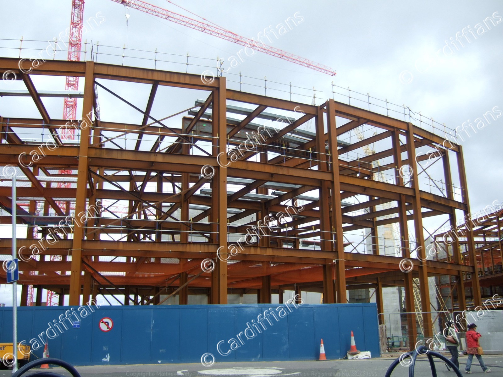
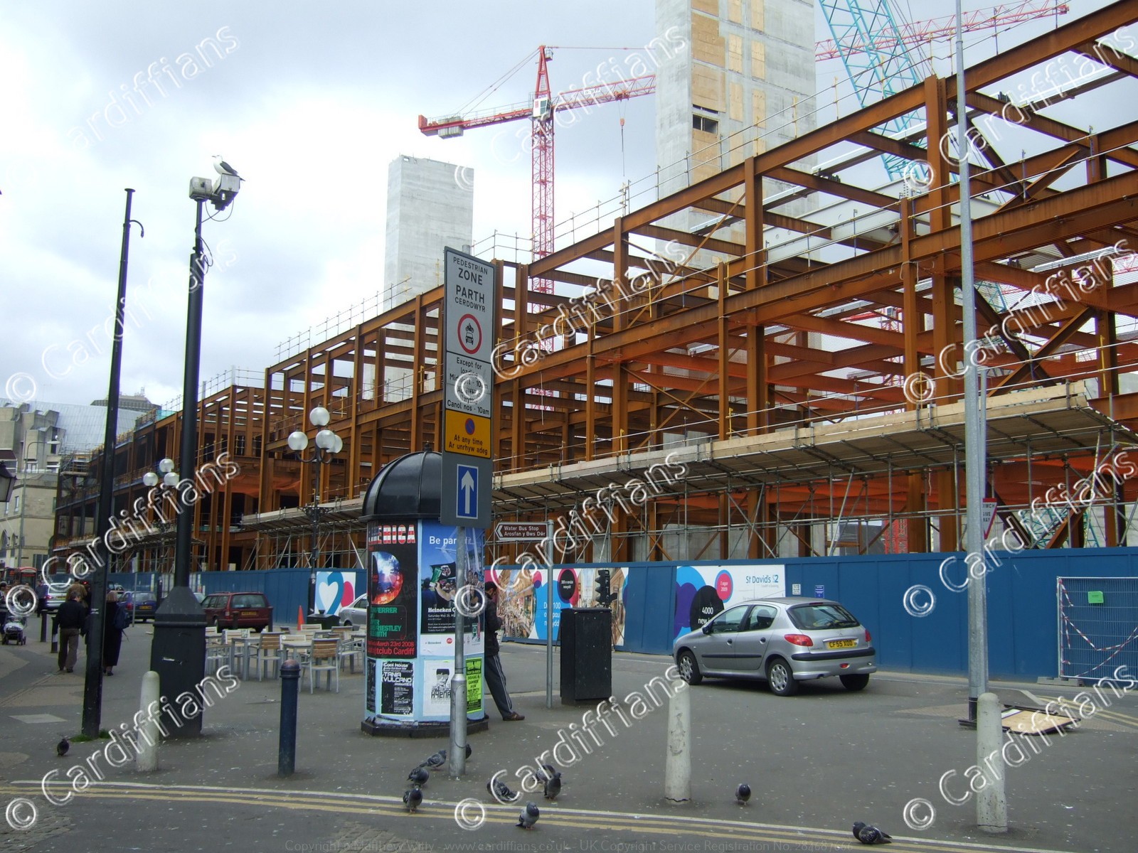
 (2008) St David's 2 Construction (01)
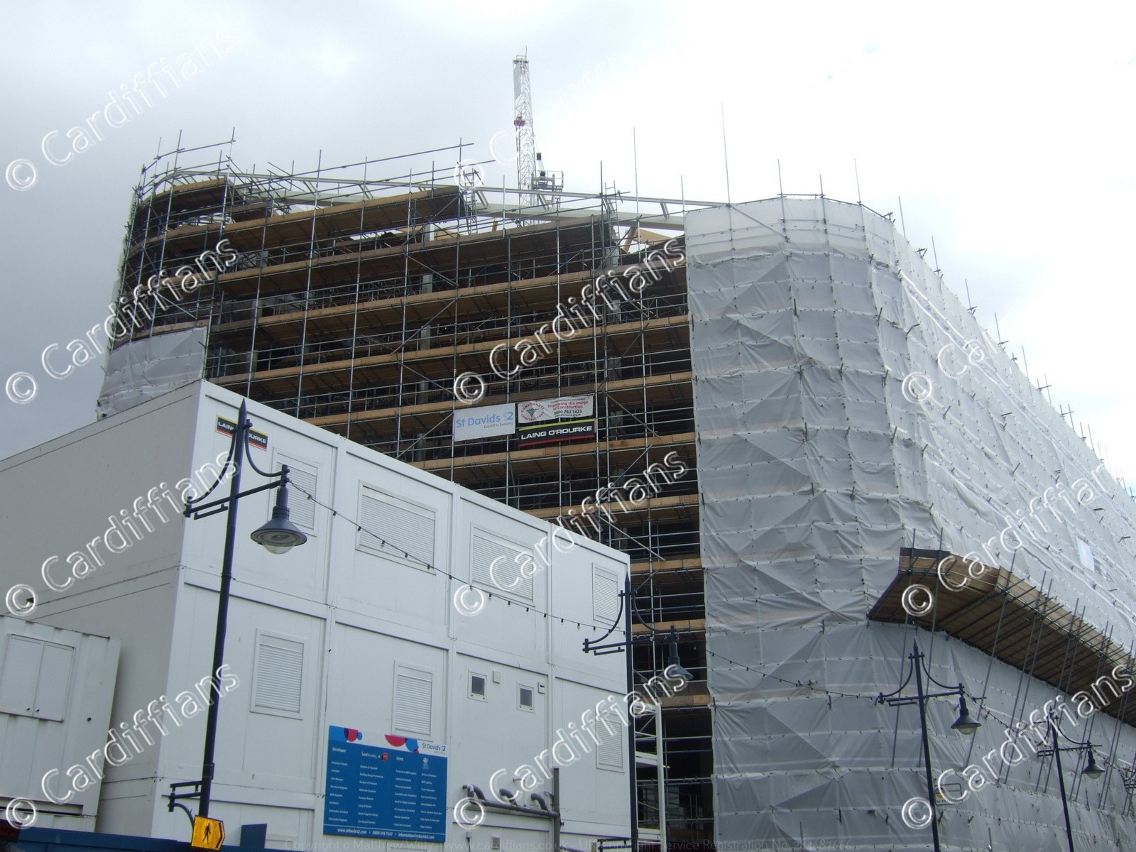
 (2008) St David's 2 Construction (02)
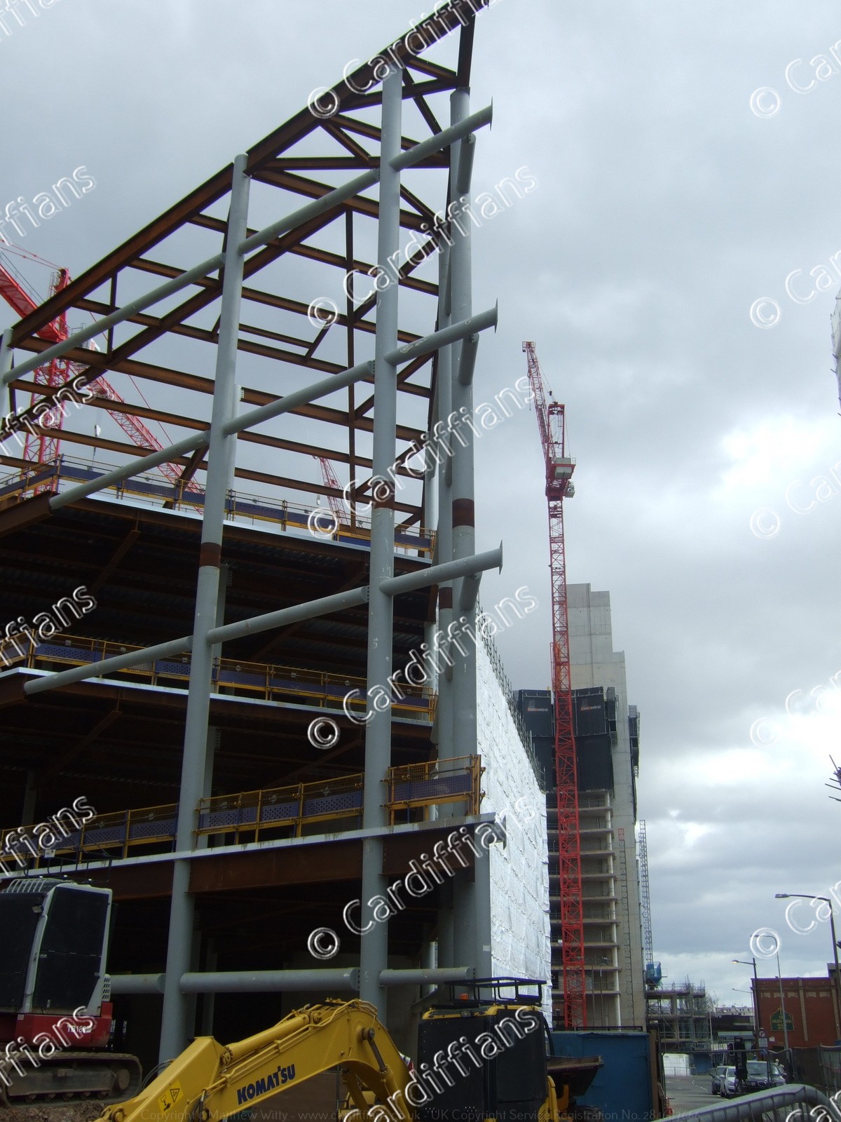
 (2008) St David's 2 Construction (03)
 (2008) St David's 2 Construction (04)
 (2008) St David's 2 Construction (05)
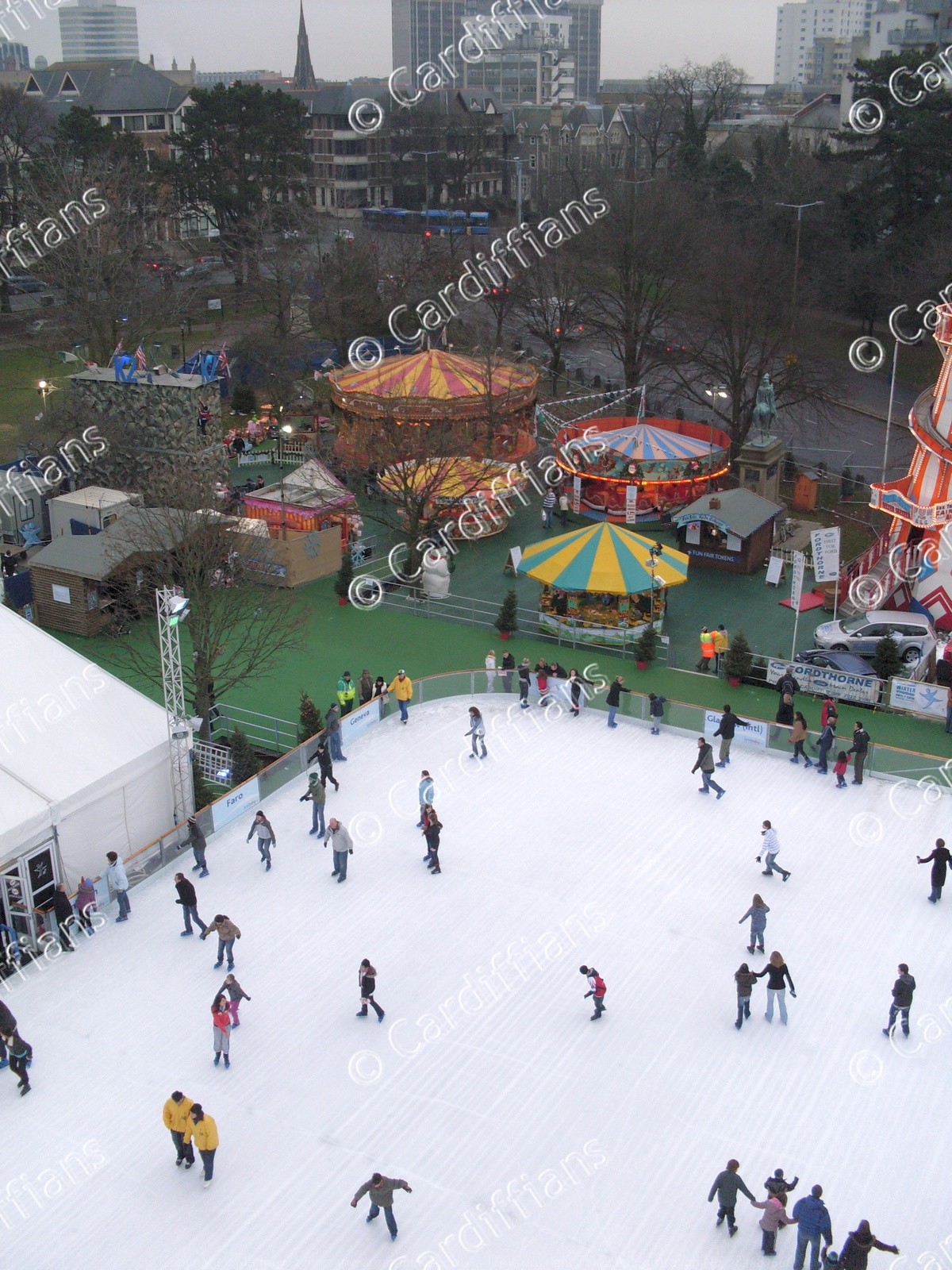 (2008) Winter Wonderland Outdoor Ice Rink - View from the Admiral Eye Big Wheel
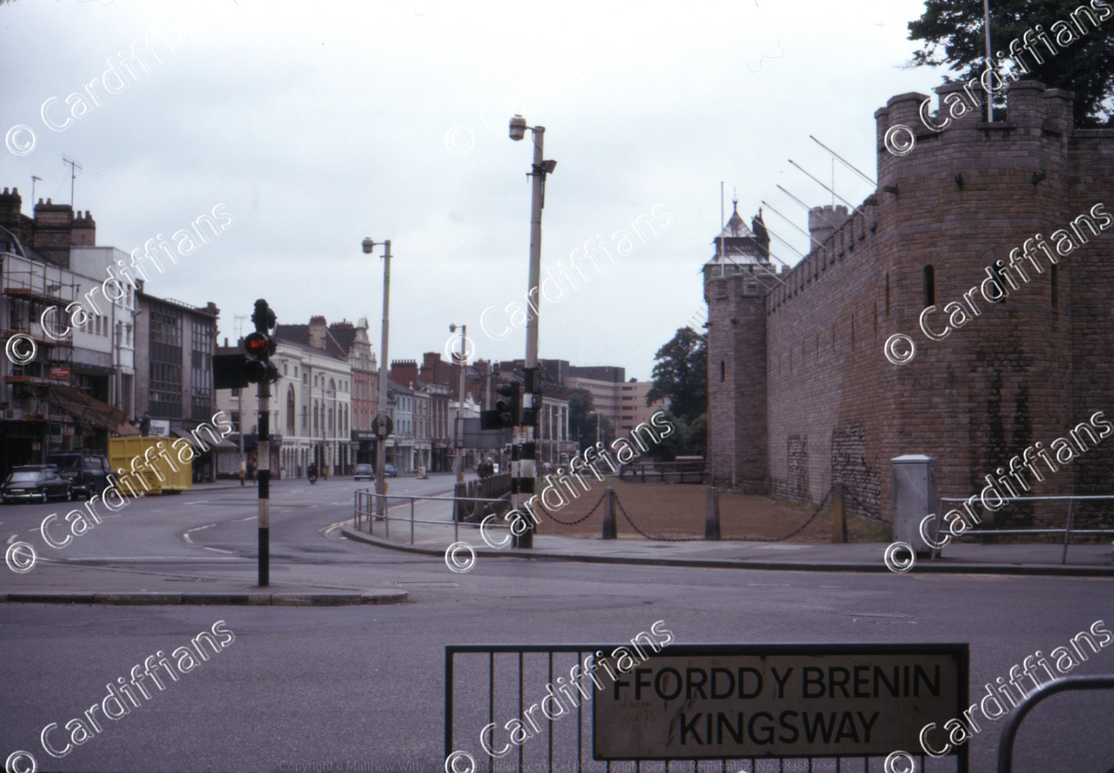
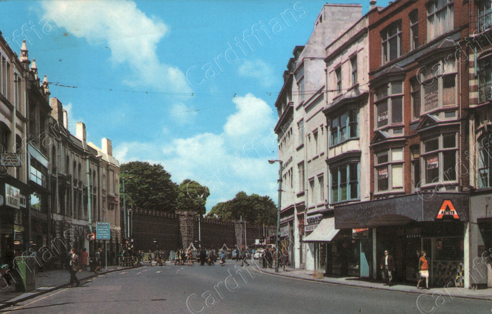
 (2010) Cardiff Town Wall (Just off Kingsway) (1)
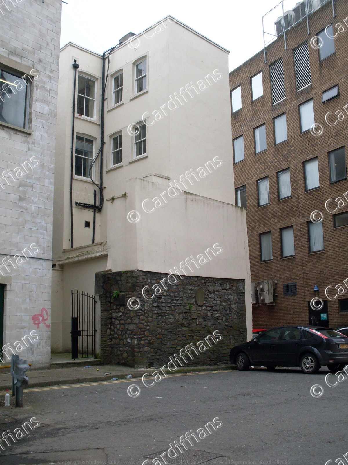 (2010) Cardiff Town Wall (Just off Kingsway) (2)
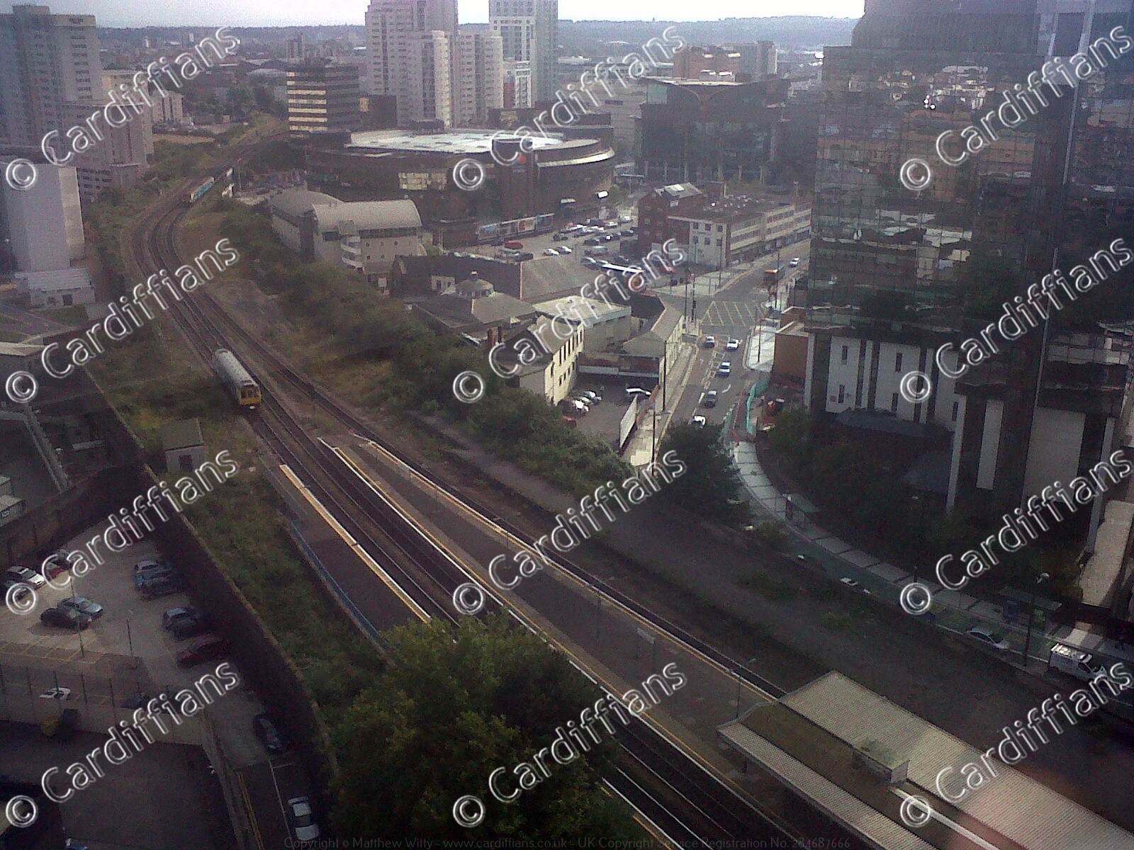 (2011) Guildford Crescent and Queen Street Station railway line, aerial view
 (2013) Cardiff Castle, Inside the Walls
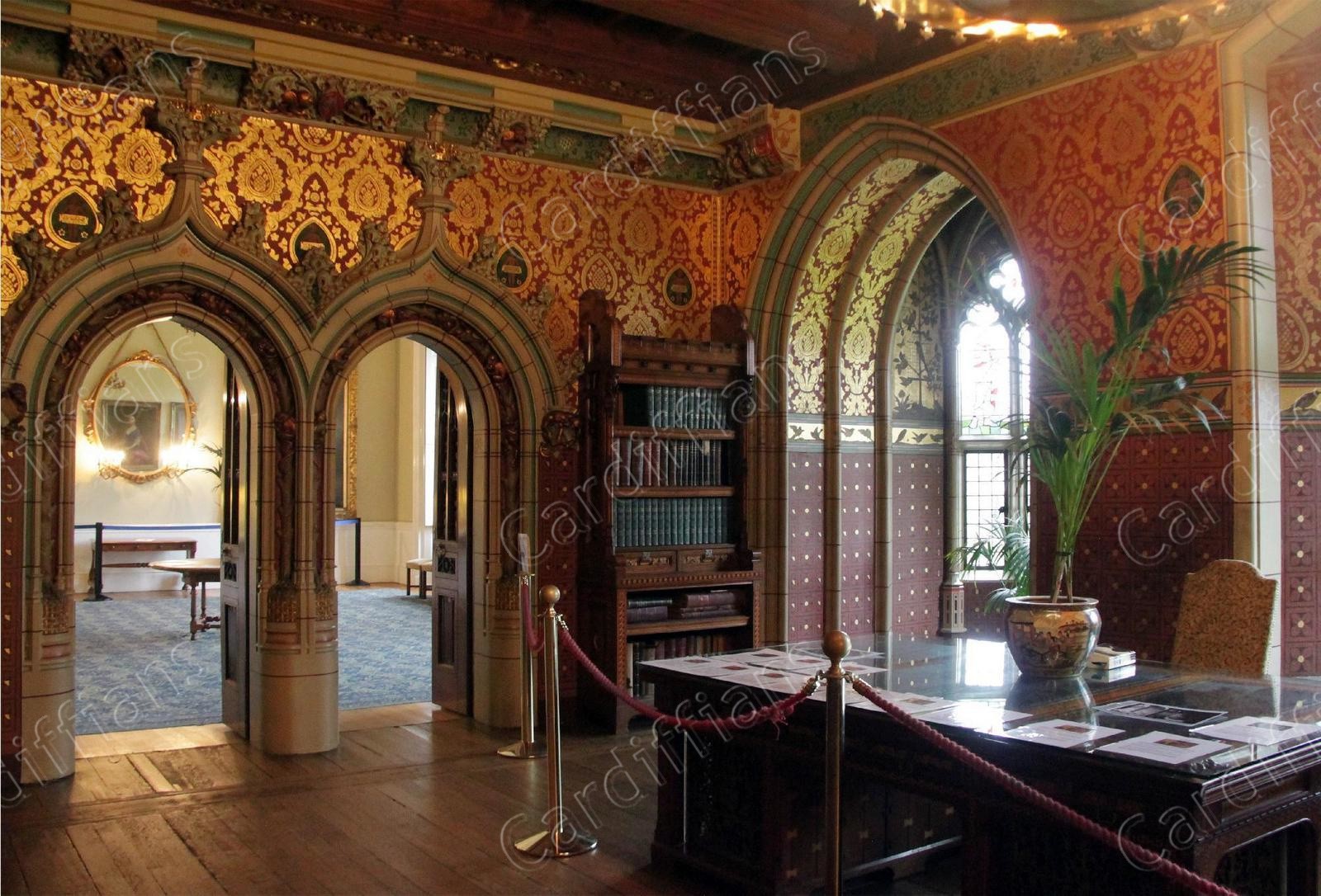
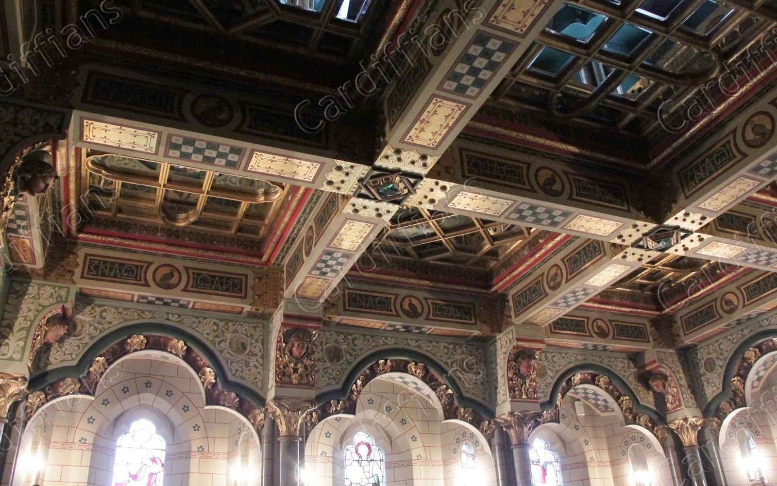
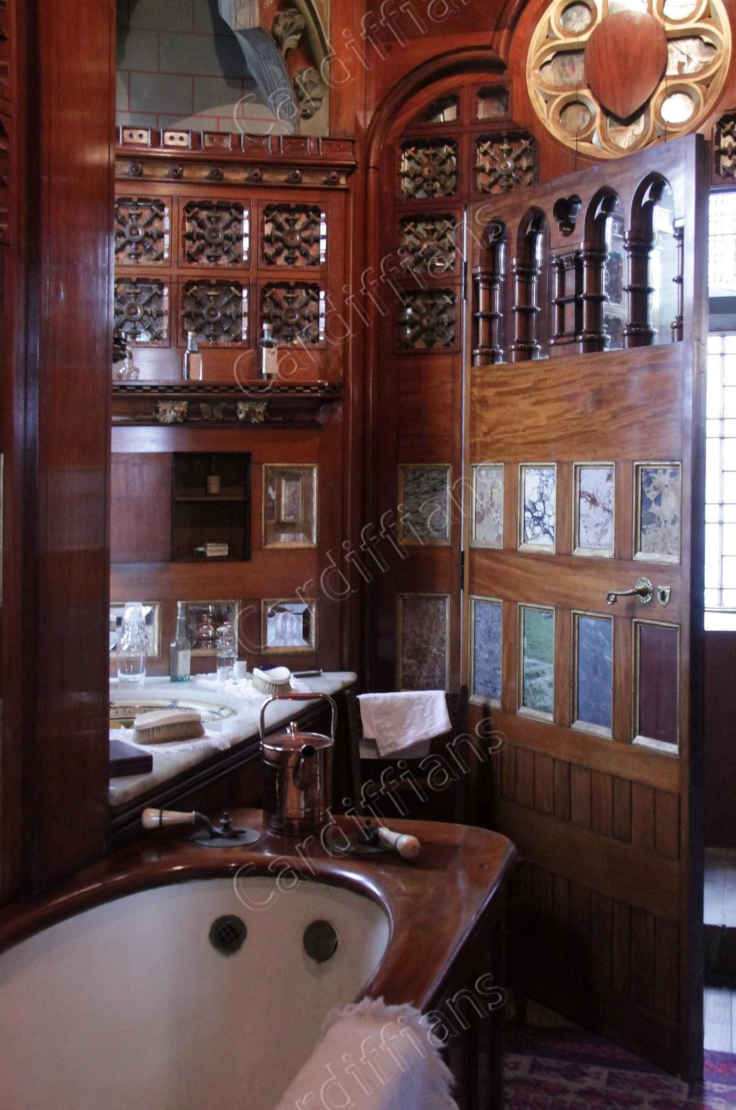
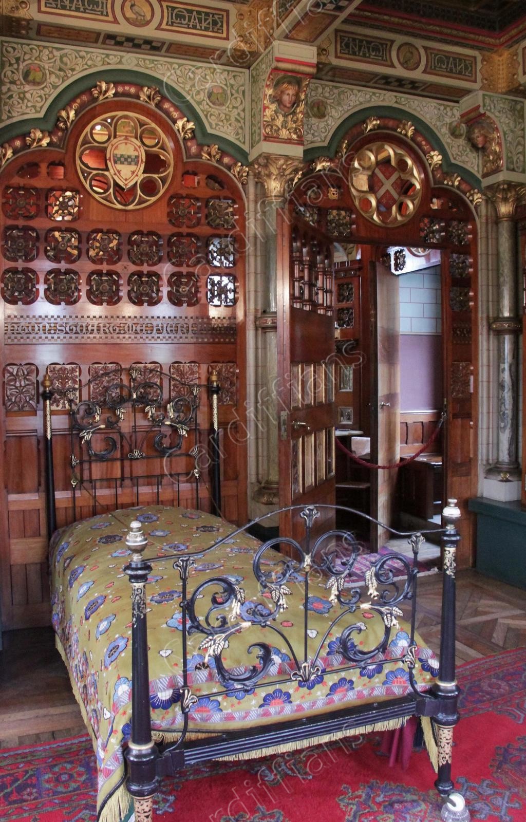
 (2013) Cardiff Castle, Interior (01)
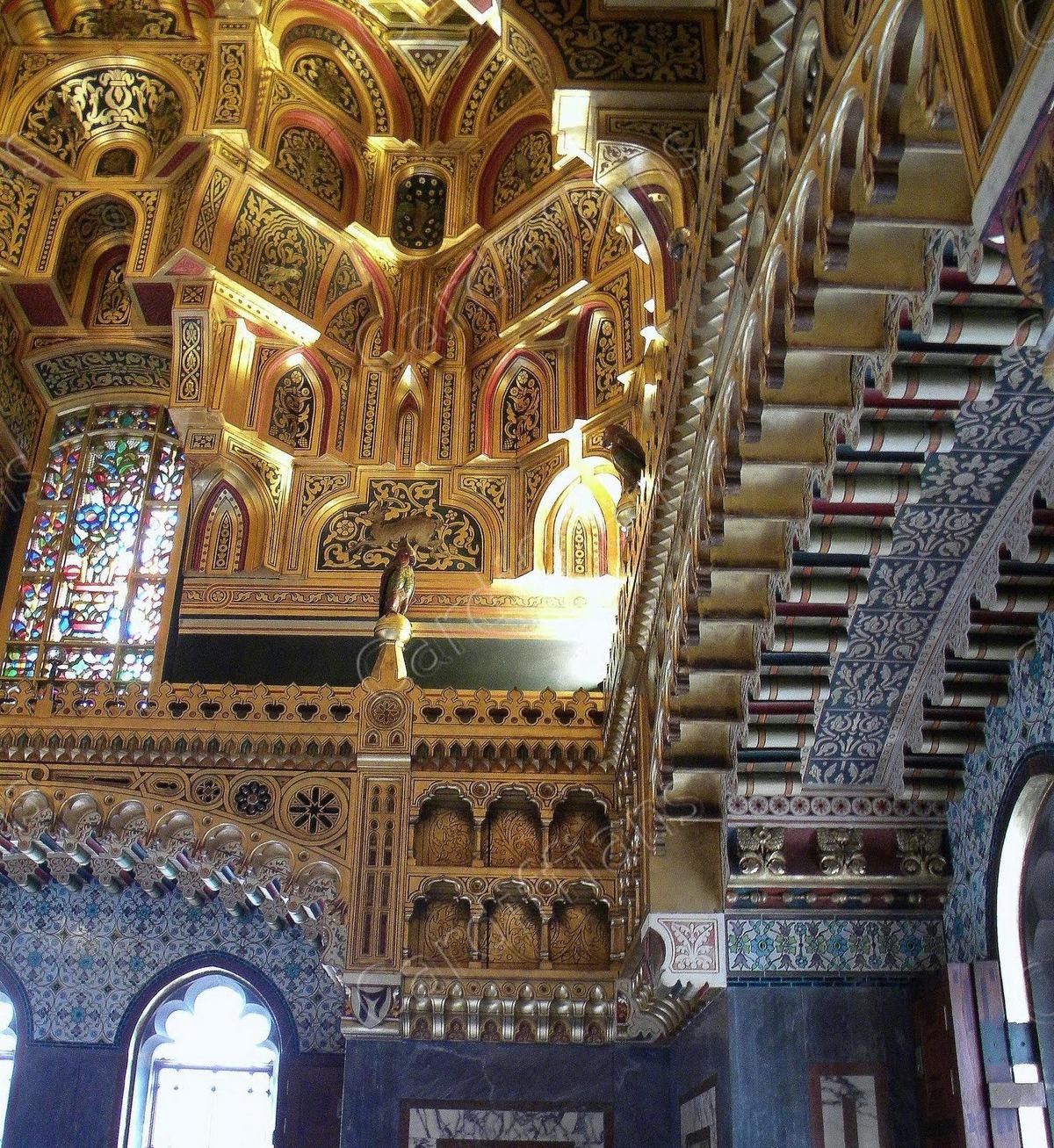 (2013) Cardiff Castle, Interior (02)
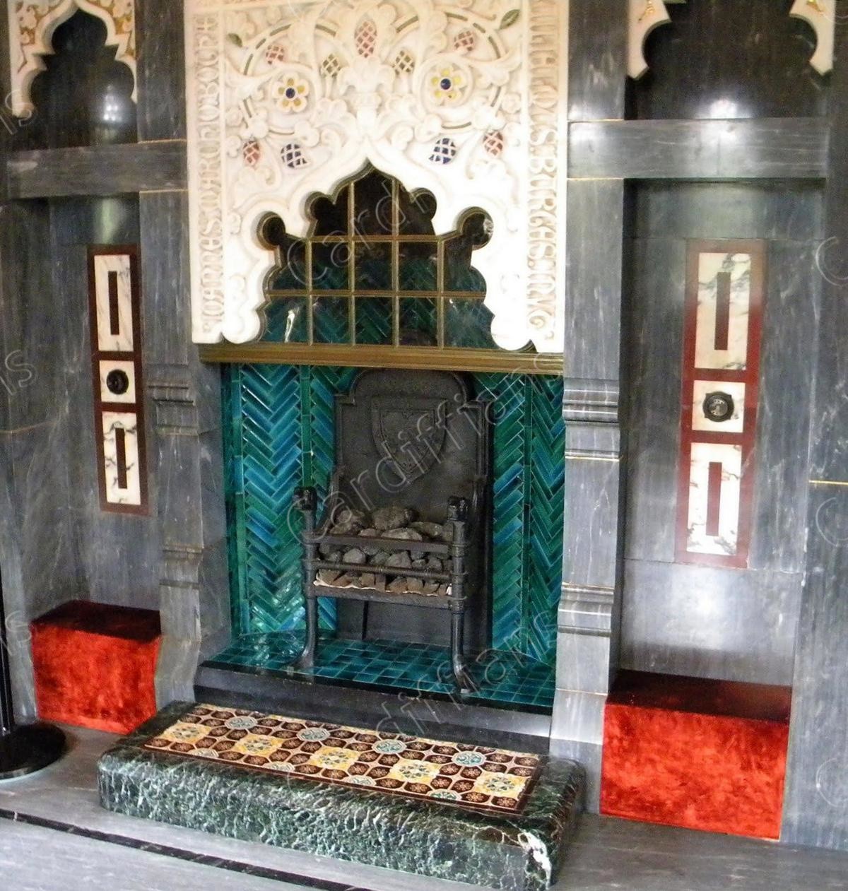 (2013) Cardiff Castle, Interior (03)
 (2013) Cardiff Castle, Interior (04)
 (2013) Cardiff Castle, Interior (05)
 (2013) Cardiff Castle, Interior (06)
 (2013) Cardiff Castle, Interior (07)
 (2013) Cardiff Castle, Interior (08)
 (2013) Cardiff Castle, Interior (09)
PAGE UPDATE HISTORY
03 November 2025 (5 new images added, coding updates)
06 April 2024 (Coding updates)
15 March 2024 (30 new images added, 8 old images removed, all images upgraded from 1280 to 1600 pixels wide in resolution, copyright logo prominence increased, coding updates,)
18 September 2018 (25 new images added, 2 old images removed, 5 images moved to Transport Gallery, title corrections, coding updates)
24 December 2014 (Site rebuilt and new design launched)
July 2005 (Page Created)