THE HISTORY OF CARDIFF'S SUBURBS
TROWBRIDGE
CONTENTS
Tap or click to open / closeLow-lying Farmland
Trowbridge was until 1938, part of the parish of Rumney, in the former county of Monmouthshire.
It is one of Cardiff's newest suburbs, and includes part of St. Mellons in its boundaries.
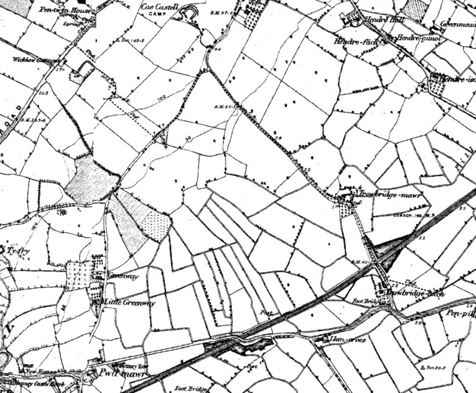
Source: OS
Trowbridge was a large tract of low-lying land, across which ran the main railway line to Bristol.
Apart from a few farms scattered across the district, Trowbridge does not seem to have any historical significance with regards to the development of the City.
Great Flood of 1606
The area, along with most of Cardiff, was decimated by a flood in the early 17th century. Trowbridge, being at near sea level, was one of the worst areas hit.
Those who returned to farm the land, found that the sea water had contaminated the earth. It took over 5 years for the rains to dilute and wash away, all of the salt left behind.
At Peterstone Wentloog to the east of St. Mellons, a memorial plaque on the outside of the St. Peter's Church commemorates The Great Flood, January 20th, 1606.
Housing and Commercial Developments
By the mid 1960's the post-war housing estate in Rumney was extended to the east, taking in the land owned by the farms of Trowbridge Mawr and Trowbridge Bach (Greater and Little Trowbridge respectively).
The farms were located on either side of the railway, with Trowbridge Bach now the site of the Wentloog Environmental Centre.
Other areas in the district were used for light industry and commerce. The Spring Meadow Business Park, the Wentloog Industrial Park and the Freight Liner Depot are all based on former farmland in Trowbridge.
The small shopping centre and surrounding Trowbridge Flats, were typical of the architecture of the 1960's.
Economically Deprived
Residents felt cut off in the high rise buildings, and the atmosphere provided a catalyst for the escalation of anti-social behaviour in the 1990's.
By 1998, the area was listed as one of the most economically deprived wards in South Wales.
Efforts have been made to enhance the environment, by improving street lighting, installing CCTV cameras and demolishing some of the worst buildings, including the afore-mentioned shopping centre.
However, the positive aspects of the area are frequently forgotten. To the north is Rumney Hill, with houses commanding a spectacular view of the whole suburb right down to the Bristol Channel.
Coleg Glan Hafren Tertiary College, based in Trowbridge Road, was demolished in 2016 to make way for the brand new Eastern High school and facilities for Cardiff and Vale College.[REF]
Fortunately, there are still many large recreation grounds and parks for residents to enjoy. Traffic density is low, and the area is well served by public transport. With little effort, it's possible to cycle through the wide open streets to St Mellons and beyond.
PAGE UPDATE HISTORY
02 April 2024 (Content and coding updates)
30 December 2014 (Coding updates)
June 2010 (Page Created)